

Surf Forecasts:

Jailbreaks surf forecast from 3 Aug 2026:
- Most powerful swell: Wednesday 5 Aug, 5PM (local time) - 4ft (1.2m), 18s period, SSW swell with 861 kJ wave energy.
Best Forecast Surf Conditions for Jailbreaks this week:
The most powerful waves expected at Jailbreaks in the next 16 days are 1.2m 18s and forecast to arrive on Wednesday (Aug 05) at 5PM. Winds are predicted to be cross-offshore at the time the swell arrives. The largest open ocean swell (not directed at the beach) is 1.5m 9s period and expected on Monday (Aug 03) at 11PM.
| Wave Type | Time (+05) & Date | Wave Height & Period |
|---|---|---|
| Next good surf (1 star+) | - | - |
| Best Surf | - | - |
| Most Powerful | 5PM (Wed 5th Aug) | 4ft (1.2m) 18s |
Table - best surf conditions forecast for Jailbreaks over the next 16 days.
The Lowdown
Alright, surfers, Rusty here. Let's be straight with you: looking at this 16-day window, it’s a real mixed bag. We've got some very average days to wade through before things start to show a bit of fire, and we've got a long-range standout that has got me properly excited.
Right off the bat, the start is slow. Monday the 3rd and the 4th are basically a write-off. There's some swell in the water around 4ft and 4ft from the SSW, but a 25 km/h cross-shore WNW wind is going to make a mess of things. The energy at Jailbreaks is weak-to-moderate (768) on Monday, but it's just not doing us any favors. There's a longer period swell in there, but the wind and chop kill it. It’s a blank run for a few days, so don't get too keen.
Things do settle a little through the middle of the week, but the surf is nothing to write home about. From the 5th through to the 9th, the wind backs off to a cross-offshore, which will clean things up, and you're looking at waves in the 3ft to 5ft range. The swell direction swings around from S to SSE with shorter periods, mostly in that 10-11 second range. It's onshore, but the energy is moderate (643-961), so there are ridable waves, but nothing with any real push. The 8th has a touch more size at 5ft, but it’s still just a semi-clean, average Saturday. This is a good chance to work on your pop-up, not to score a gem.
The following week, from the 10th to the 16th, the size drops back but the clean conditions persist. We're looking at waves in the 2ft to 5ft zone. There's an interesting blip on the 10th with a long 20-21 second period SSW swell, but the size is marginal at best (2ft to 3ft). The energy is moderate but the lack of height means it's asking a lot of the break. From the 12th onwards, the swell settles into a consistent 5ft SSE short-period pulse. The good news is winds get lighter, dropping to 15 km/h, and the surface gets super clean. The 15th sees light 10 km/h winds and clean 4ft to 4ft waves, and the 16th sees a proper offshore SSW wind at 10 km/h with clean 3ft to 3ft surf. It’s not big, but it’s the most user-friendly it’s been all week, good for the longboard.
Now, for the real standout, you need to look to the second week. Keep your eye on Monday the 18th. This is the one. Overnight, the energy just lights up. The combined energy rockets to a strong 2263. We’re looking at a solid 6ft SSW swell with a lovely 19-second period, all from the optimum S direction for Jailbreaks. This is proper groundswell energy. The wind will be a light 15 km/h cross-offshore, keeping it clean.
Jailbreaks is a reef break, and with a swell like that from the south at that long period, it's going to be a proper, powerful beast. This is not a day for beginners, with the swell way over 5ft. This is a day for the experienced crew. The long period groundswell will mean some set waves with real push, and you'll want to know the place well. It’s promising, but long-range forecasts can shift, so treat it with respect for now.
The day before, on the 17th, looks like a nice warm-up. Clean 2ft to 3ft swell with a long 20-21 second period on light winds. A great sign of things to come.
So, the plan? Get through the next week and a half doing maintenance on your shortboard. The ocean will be clean, but the waves will be small. Then, when you see the charts for the 18th, be ready to roll. It’s the best thing on offer by a long shot. The water is sitting at a normal 85° for this time of year, so the usual summer boardies are all you need.
Keep it salty.
Rusty
Short Range ForecastModerate rain (total 15mm), heaviest on Tue night. Warm (max 28°C on Mon afternoon, min 27°C on Mon afternoon). Wind will be generally light. | Days 5-7 Weather SummaryModerate rain (total 12mm), heaviest on Sun morning. Warm (max 28°C on Thu afternoon, min 27°C on Thu night). Mainly fresh winds. | |||||||||||||||||||
Mon 3 | Tuesday 4 | Wednesday 5 | Thursday 6 | Friday 7 | Saturday 8 | Sunday 9 | ||||||||||||||
PM | Night | AM | PM | Night | AM | PM | Night | AM | PM | Night | AM | PM | Night | AM | PM | Night | AM | PM | Night | |
Swell Height Map |  | 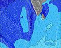 | 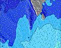 | 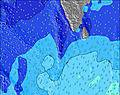 | 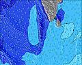 |  |  | |||||||||||||
Wave Height (m) Direction Period (s) | SSW 17 | SSW 16 | SSW 16 | SSW 15 | SW 15 | SSW 19 | SSW 18 | SSW 17 | S 16 | SSE 10 | SSE 10 | SSE 11 | S 11 | S 11 | S 11 | S 10 | S 10 | S 10 | S 10 | SSE 10 |
Wave Graph | ||||||||||||||||||||
657 | 604 | 662 | 612 | 323 | 627 | 861 | 647 | 246 | 318 | 282 | 460 | 466 | 543 | 599 | 470 | 467 | 477 | 477 | 407 | |
Wind (km/h) | ||||||||||||||||||||
Wind State on-shore cross-onshore cross-shore cross-offshore off-shore glassy | cross | cross | cross | cross | cross | cross | cross-off | cross-off | cross-off | cross-off | cross-off | cross-off | cross-off | cross-off | cross-off | cross-off | cross-off | cross-off | cross-off | cross-off |
High Tide | 3:30PM0.89m | 4:15AM0.79m | 3:50PM0.83m | 4:59AM0.77m | 4:09PM0.77m | 5:55AM0.72m | 4:24PM0.70m | 7:21AM0.68m | 4:26PM0.63m | 9:43AM0.69m | 11:21AM0.76m | 9:03PM0.48m | ||||||||
Low Tide | 9:54PM0.13m | 9:53AM0.31m | 10:23PM0.12m | 10:28AM0.39m | 10:56PM0.12m | 11:09AM0.48m | 11:37PM0.14m | 12:11PM0.56m | 00:38AM0.18m | 2:24AM0.20m | 7:08PM0.48m | 4:18AM0.18m | ||||||||
— | — | 6:01 | — | — | 6:01 | — | — | 6:01 | — | — | 6:01 | — | — | 6:01 | — | — | 6:01 | — | — | |
6:20 | — | — | 6:20 | — | — | 6:20 | — | — | 6:20 | — | — | 6:20 | — | — | 6:19 | — | — | 6:19 | — | |
mm | — | 4 | 1 | — | 7 | 1 | — | 2 | — | 2 | 1 | — | 1 | 1 | — | — | 4 | 3 | — | — |
Temp °C | 28 | 27 | 27 | 28 | 27 | 28 | 28 | 28 | 28 | 28 | 27 | 27 | 28 | 28 | 27 | 28 | 28 | 28 | 28 | 28 |
Feels °C | 29 | 28 | 28 | 29 | 28 | 28 | 27 | 28 | 29 | 28 | 27 | 28 | 28 | 28 | 28 | 28 | 29 | 29 | 29 | 29 |
Swell 1 Height (m) Direction Period (s) | WNW 9 | WNW 9 | SSW 16 | SSW 15 | SW 15 | SSW 15 | SSW 18 | SSW 17 | S 9 | SSE 10 | SSE 10 | SSE 11 | S 11 | S 11 | S 11 | S 10 | S 10 | S 10 | S 10 | SSE 10 |
313 | 286 | 662 | 612 | 314 | 428 | 861 | 647 | 217 | 318 | 282 | 460 | 466 | 543 | 599 | 470 | 467 | 477 | 477 | 407 | |
Swell 2 Height (m) Direction Period (s) | SSW 17 | SSW 16 | SSE 8 | SSE 8 | S 17 | SSW 19 | S 10 | S 10 | S 16 | SW 16 | WNW 8 | WNW 8 | WNW 8 | WNW 8 | NW 9 | NW 8 | NW 8 | NW 10 | NW 10 | NW 9 |
657 | 604 | 75 | 67 | 204 | 627 | 100 | 192 | 246 | 196 | 117 | 98 | 126 | 106 | 115 | 98 | 86 | 167 | 138 | 125 | |
Swell 3 Height (m) Direction Period (s) | SSE 8 | SSE 8 | SE 9 | E 9 | S 21 | S 9 | WNW 10 | S 18 | SW 16 | S 16 | SSW 14 | S 18 | S 17 | S 18 | S 17 | S 17 | S 16 | S 18 | S 17 | S 16 |
111 | 108 | 3 | 2 | 323 | 39 | 42 | 304 | 201 | 129 | 138 | 229 | 291 | 158 | 138 | 135 | 77 | 154 | 153 | 124 | |
Wind waves Height (m) Direction Period (s) | WNW 3 | — | WNW 8 | WNW 8 | NW 8 | WNW 8 | WNW 8 | WNW 8 | WNW 8 | WNW 8 | — | W 8 | — | — | — | — | — | — | — | — |
3 | — | 309 | 294 | 288 | 254 | 220 | 199 | 170 | 196 | — | 21 | — | — | — | — | — | — | — | — | |
Nearest Offshore or Glassy | ||||||||||||||||||||
Distance (km) | 254 | 7 | 244 | 7 | 254 | 254 | 254 | 254 | 954 | 954 | 959 | 282 | 2731 | 959 | 954 | 1175 | 959 | 959 | 959 | 670 |
Best forecast wave conditions in North Male Atoll | ||||||||||||||||||||
Best forecast wave conditions in Maldives | ||||||||||||||||||||
Header Global | ||||||||||||||||||||
- Map Icons:
 Break
Break Live Wave Height (m)
 Live Wind Speed (km/h)
 Surf Rating (10 Max)
 Ocean Swells (m)
- Wind Speed (km/h)
Latest Updates


FREE! Surf-Forecast.com widget for your website
The surf report / weather widget below is available to embed on third party websites free of charge and provides a summary of our Jailbreaks surf forecast. Simply grab the html code snippet that we provide and paste it into your own site. You can choose your preferred language and metric/imperial units for the surf forecast feed to suit users of your site. Click here to get the code.
Information about the Jailbreaks Surf forecast
The above surf forecast table for Jailbreaks provides essential information for determining whether the surfing conditions will be good over the next 16 days. A general guide to surfing at Jailbreaks can be found by selecting the local surf guide option on the grey menu. Our Jailbreaks surf forecast is unique since it includes wave energy (power) that defines the real feel of the surf rather than just the height or the period. If you surf the same spot (Jailbreaks) regularly then make a mental note of the wave energy from the surf forecast table each time you go. Very soon you may start to choose your surf days based on the wave energy alone combined with our forecast of favourable offshore wind conditions. Our star ratings will help here and of course you will also find the usual wave height and period predictions on our surf forecasts as well as a full break down of the swell components under our advanced users option (to reveal that, click the little Einstein character under the tide times).
Further information to help with frequently asked questions about our surf forecast for Jailbreaks may be found under the help tab on the top menu and also by moving your mouse over the question marks on the surf forecast table itself. Please always bear in mind that the forecast is for near-shore open water and local factors at each surf break influence the actual breaking wave height, such as the beach / reef profile, water depths offshore and shelter.
Are you planning a holiday in North Male Atoll? If you are looking for accommodation near Jailbreaks, camping, hotels and holiday cottages in North Male Atoll, consider staying in Male which is 40 km (25 miles) away.
 Nearest