

Surf Forecasts:

San Pancho (San Francisco) surf forecast from 3 Aug 2026:
- Best quality surf: Thursday 6 Aug, 9AM (local time) - 2.5ft (0.7m), 13s period, SW swell with cross-offshore winds.
- Most powerful swell: Saturday 8 Aug, 6AM (local time) - 3ft (0.9m), 16s period, SW swell with 371 kJ wave energy.
- Next surfable swell (1★+): Monday 3 Aug, 9PM (local time) - 1.5ft (0.5m), 13s period with SW swell.
Best Forecast Surf Conditions for San Pancho (San Francisco) this week:
The surf forecast for San Pancho (San Francisco) over the next 16 days: The first swell (rated 1 star or higher) is forecast to arrive on Monday (Aug 03) at 9PM. The primary swell is predicted to be 0.5m and 13s period with a secondary swell of 0.4m and 16s. The wind is predicted to be glassy as the swell arrives.
The most powerful waves expected at San Pancho (San Francisco) in the next 16 days are 0.9m 16s and forecast to arrive on Saturday (Aug 08) at 6AM. Winds are predicted to be cross-offshore at the time the swell arrives.
| Wave Type | Time (CST) & Date | Wave Height & Period |
|---|---|---|
| Next good surf (1 star+) | 9PM (Mon 3rd Aug) | 1.5ft (0.5m) 13s |
| Best Surf | 9AM (Thu 6th Aug) | 2.5ft (0.7m) 13s |
| Most Powerful | 6AM (Sat 8th Aug) | 3ft (0.9m) 16s |
Table - best surf conditions forecast for San Pancho (San Francisco) over the next 16 days.
The Lowdown
Alright, folks, Rusty here. Let’s break down the next couple of weeks.
It’s a quiet stretch, no doubt. The surf is mostly small, and the real magic is in the mornings when the wind behaves. The afternoons? Forget about ’em – they’re nearly all junk. The water is sitting around 89°F, which is a touch warmer than usual for this time of year, so you’ll be fine in just boardshorts or a spring suit.
The first real standout is Thursday morning, August 6th at San Pancho (San Francisco). We’ve got a clean 2ft swell from the SW, with a light cross-offshore breeze. The energy is moderate (238), and it’s glassy enough that you’ll be able to pick off those little runners clean. It’s a reef, so watch your fins, but it’s a fun, clean session for the intermediate crew.
Then Friday morning, August 7th is another one to circle. The swell nudges up to 3ft from the SW, but the real story is the period stretching to 18 seconds – that’s proper groundswell. It’s still clean with a cross-off wind, and the combined energy jumps to moderate (404). This reef will handle that long period nicely, and the waves will have some real shape. Not huge, but quality.
The morning of Tuesday, August 11th has a bit more grunt – 2ft with an 18-second period and glassy conditions, with energy hitting 518. That’s a good sign for a lined-up reef session. Expect some nice, clean sets.
The Saturday morning, August 15th swell lifts to 3ft from the SW, with a 16-second period, and a cross-off wind keeps it tidy. The energy is moderate (498). That’s the biggest swell in the window, but it’s still a small wave. For a beginner, that’s fine; for an expert, it’s a fun little cruiser.
The Sunday morning, August 16th is another clean, offshore morning with 3ft and 15-second period – a solid, repeatable option.
Overall, the standout is Friday morning August 7th for the quality, and Saturday morning August 15th for the size. Don’t waste your time on the afternoons – they’re blown out or onshore nearly every day. The crowds at San Pancho can pop up sometimes, so get there early for the cleanest waves.
Rusty.
Short Range ForecastLight rain (total 3mm), mostly falling on Tue morning. Warm (max 30°C on Mon afternoon, min 27°C on Tue night). Wind will be generally light. | Days 4-6 Weather SummaryHeavy rain (total 43mm), heaviest during Sat night. Warm (max 30°C on Thu afternoon, min 24°C on Sat night). Wind will be generally light. | ||||||||||||||||||||
Monday 3 | Tuesday 4 | Wednesday 5 | Thursday 6 | Friday 7 | Saturday 8 | Sunday 9 | |||||||||||||||
AM | PM | Night | AM | PM | Night | AM | PM | Night | AM | PM | Night | AM | PM | Night | AM | PM | Night | AM | PM | Night | |
Swell Height Map |  |  |  | 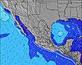 | 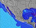 | 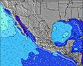 | 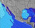 | ||||||||||||||
Wave Height (m) Direction Period (s) | SW 13 | SW 13 | SW 16 | SW 16 | SW 15 | WSW 15 | SW 14 | SW 14 | SW 14 | SW 13 | SW 13 | SW 18 | SW 18 | SW 17 | SW 16 | SW 16 | SW 15 | SW 15 | SW 14 | SW 14 | SW 13 |
Wave Graph | |||||||||||||||||||||
79 | 80 | 77 | 72 | 71 | 84 | 103 | 100 | 95 | 176 | 140 | 166 | 249 | 362 | 264 | 367 | 276 | 217 | 211 | 200 | 178 | |
Wind (km/h) | |||||||||||||||||||||
Wind State on-shore cross-onshore cross-shore cross-offshore off-shore glassy | glassy | on | glassy | glassy | on | glassy | glassy | cross-on | cross-off | cross-off | cross-on | glassy | cross-off | on | cross | glassy | on | off | glassy | cross-on | cross-off |
High Tide | 12:02PM1.34m | 00:05AM1.11m | 12:32PM1.34m | 1:14AM0.94m | 1:13PM1.33m | 2:20PM1.30m | 4:11PM1.31m | 8:44AM1.11m | 5:46PM1.38m | 8:53AM1.20m | 6:53PM1.49m | ||||||||||
Low Tide | 6:19PM0.59m | 5:53AM0.59m | 7:24PM0.60m | 6:07AM0.73m | 9:14PM0.58m | 11:35PM0.45m | 00:49AM0.28m | 12:12PM1.04m | 1:38AM0.13m | 1:19PM0.94m | 2:19AM0.02m | ||||||||||
6:35 | — | — | 6:35 | — | — | 6:37 | — | — | 6:37 | — | — | 6:37 | — | — | 6:37 | — | — | 6:37 | — | — | |
— | 7:38 | — | — | 7:37 | — | — | 7:37 | — | — | 7:37 | — | — | 7:36 | — | — | 7:36 | — | — | 7:35 | — | |
mm | — | — | — | 1 | 1 | — | — | — | 1 | — | — | 3 | — | 1 | 7 | — | — | 32 | — | — | — |
Temp °C | 29 | 30 | 29 | 30 | 29 | 29 | 29 | 30 | 29 | 29 | 30 | 29 | 29 | 30 | 29 | 29 | 29 | 28 | 29 | 29 | 28 |
Feels °C | 32 | 34 | 34 | 34 | 32 | 34 | 33 | 34 | 34 | 33 | 34 | 34 | 34 | 33 | 34 | 33 | 33 | 32 | 32 | 31 | 32 |
Swell 1 Height (m) Direction Period (s) | SW 13 | SW 13 | SW 12 | SW 12 | SW 12 | WSW 15 | SW 14 | SW 14 | SW 14 | SW 13 | SW 13 | SW 13 | SW 12 | SW 17 | SW 16 | SW 16 | SW 15 | SW 15 | SW 14 | SW 14 | SW 13 |
79 | 80 | 77 | 72 | 71 | 84 | 103 | 100 | 95 | 176 | 140 | 134 | 151 | 362 | 264 | 367 | 276 | 217 | 211 | 200 | 178 | |
Swell 2 Height (m) Direction Period (s) | WNW 5 | SW 16 | SW 16 | SW 16 | SW 15 | SSW 12 | SW 12 | SW 11 | SW 11 | SW 20 | SW 18 | SW 18 | SW 18 | SW 12 | SW 12 | SW 12 | SW 12 | SW 11 | SW 11 | SW 22 | SW 21 |
9 | 41 | 66 | 64 | 56 | 56 | 34 | 32 | 32 | 60 | 113 | 166 | 249 | 95 | 114 | 87 | 69 | 43 | 18 | 73 | 72 | |
Swell 3 Height (m) Direction Period (s) | W 8 | W 8 | W 5 | WNW 5 | W 7 | WNW 5 | WNW 5 | S 9 | SW 20 | WNW 4 | W 6 | NW 4 | W 15 | S 13 | — | W 13 | SW 23 | SW 24 | W 4 | WNW 5 | WNW 5 |
11 | 10 | 4 | 5 | 4 | 5 | 2 | 6 | 60 | 2 | 1 | 1 | 4 | 3 | — | 4 | 21 | 22 | 2 | 2 | 2 | |
Wind waves Height (m) Direction Period (s) | — | W 5 | — | — | WNW 5 | — | — | WNW 5 | — | — | WNW 4 | — | — | — | — | — | WNW 4 | — | — | — | — |
— | 4 | — | — | 10 | — | — | 2 | — | — | 2 | — | — | — | — | — | 2 | — | — | — | — | |
Nearest Offshore or Glassy | |||||||||||||||||||||
Distance (km) | 17 | 490 | 17 | 17 | 17 | 4 | 4 | 31 | 4 | 4 | 17 | 17 | 4 | 17 | 17 | 4 | 17 | 4 | 4 | 17 | 4 |
Best forecast wave conditions in Nayarit | |||||||||||||||||||||
Best forecast wave conditions in Mexico | |||||||||||||||||||||
Header Global | |||||||||||||||||||||
- Map Icons:
 Break
Break Live Wave Height (m)
 Live Wind Speed (km/h)
 Surf Rating (10 Max)
 Ocean Swells (m)
- Wind Speed (km/h)
Latest Updates


FREE! Surf-Forecast.com widget for your website
The surf report / weather widget below is available to embed on third party websites free of charge and provides a summary of our San Pancho (San Francisco) surf forecast. Simply grab the html code snippet that we provide and paste it into your own site. You can choose your preferred language and metric/imperial units for the surf forecast feed to suit users of your site. Click here to get the code.
Information about the San Pancho (San Francisco) Surf forecast
The above surf forecast table for San Pancho (San Francisco) provides essential information for determining whether the surfing conditions will be good over the next 16 days. A general guide to surfing at San Pancho (San Francisco) can be found by selecting the local surf guide option on the grey menu. Our San Pancho (San Francisco) surf forecast is unique since it includes wave energy (power) that defines the real feel of the surf rather than just the height or the period. If you surf the same spot (San Pancho (San Francisco)) regularly then make a mental note of the wave energy from the surf forecast table each time you go. Very soon you may start to choose your surf days based on the wave energy alone combined with our forecast of favourable offshore wind conditions. Our star ratings will help here and of course you will also find the usual wave height and period predictions on our surf forecasts as well as a full break down of the swell components under our advanced users option (to reveal that, click the little Einstein character under the tide times).
Further information to help with frequently asked questions about our surf forecast for San Pancho (San Francisco) may be found under the help tab on the top menu and also by moving your mouse over the question marks on the surf forecast table itself. Please always bear in mind that the forecast is for near-shore open water and local factors at each surf break influence the actual breaking wave height, such as the beach / reef profile, water depths offshore and shelter.
San Pancho (San Francisco) is 32 km (20 miles) from the city of Ixtapa. If you plan a holiday in Nayarit, look for hotels and other accommodation in Ixtapa. Ixtapa has rooms for a wide range of budgets as well as car hire and transport links.
 Nearest