

Surf Forecasts:

Reve Havn surf forecast from 3 Aug 2026:
- Most powerful swell: Friday 7 Aug, 5AM (local time) - 6ft (1.8m), 7s period, W swell with 352 kJ wave energy.
Best Forecast Surf Conditions for Reve Havn this week:
The most powerful waves expected at Reve Havn in the next 16 days are 1.8m 7s and forecast to arrive on Friday (Aug 07) at 5AM. Winds are predicted to be cross-onshore at the time the swell arrives. The largest open ocean swell (not directed at the beach) is 0.9m 6s period and expected on Wednesday (Aug 05) at 5AM.
| Wave Type | Time (CEST) & Date | Wave Height & Period |
|---|---|---|
| Next good surf (1 star+) | - | - |
| Best Surf | - | - |
| Most Powerful | 5AM (Fri 7th Aug) | 6ft (1.8m) 7s |
Table - best surf conditions forecast for Reve Havn over the next 16 days.
The Lowdown
Alright, let’s put it in feet and miles. The outlook for Reve Havn over the next 16 days is a real test of patience. We’re looking at a long, dry spell before anything worthwhile shows up.
The first part of the forecast is a big fat zero. From Monday, August 3rd, all the way through Saturday, August 15th, every single report says “poor surf conditions.” The swell is tiny, mostly under 2 feet, with energy readings well under 50 (48, 38, 13 at the worst). The wind is almost always cross-onshore or choppy. There’s a little bump on Thursday, August 6th – swell around 5 ft, energy up to 177 – but it’s a short-period, messy swell with onshore winds. That’s a no-go for clean surfing. Then another bump on Sunday, August 9th, with 4 ft swell and 121 energy, but again, it’s cross-onshore and lumpy. The water temperature is about average for the season.
Finally, on Sunday, August 16th, things change. The morning goes glassy, with 3 ft of SW swell and 86 energy. It’s small, clean, and surfable – the first real opportunity. The afternoon picks up a bit: 4 ft from the WSW, clean conditions with a cross-off wind, energy up to 121. This is your best bet. The swell period is short, around 6 seconds, so it’s not the best shape, but it’s ridable. Crowds are sometimes a thing here, but on a day like this, you might have it fairly quiet.
Monday, August 17th, has a little more size (4 ft to 5 ft), but the wind turns cross-shore and then onshore, and conditions go back to ordinary. The last day, Tuesday, August 18th, has a big energy spike – 509 from a 5 ft W swell, 8-second period – but that’s with a moderate cross-onshore wind and chop. That’s a powerful, messy setup, more suited for kiting than clean surfing.
The standout is Sunday, August 16th. That’s the day to target. The glassy morning gives you a shot at small, clean waves, and the afternoon offers a bit more size but still clean. That’s your window.
Rusty.
Short Range ForecastLight rain (total 3mm), mostly falling on Sun night. Very mild (max 17°C on Tue afternoon, min 12°C on Mon morning). Wind will be generally light. | Days 5-7 Weather SummaryModerate rain (total 11mm), heaviest on Thu morning. Very mild (max 16°C on Wed night, min 12°C on Fri night). Mainly fresh winds. | ||||||||||||||||||
Monday 3 | Tuesday 4 | Wednesday 5 | Thursday 6 | Friday 7 | Saturday 8 | ||||||||||||||
Night | AM | PM | Night | AM | PM | Night | AM | PM | Night | AM | PM | Night | AM | PM | Night | AM | PM | Night | |
Swell Height Map | 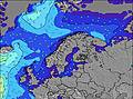 | 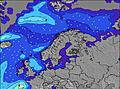 | 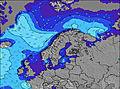 | 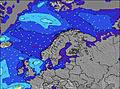 | 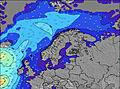 | 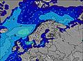 | 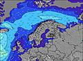 | ||||||||||||
Wave Height (m) Direction Period (s) | NW 7 | NW 9 | NW 9 | NW 8 | NW 8 | NW 8 | NW 7 | NW 7 | NW 7 | S 7 | SSW 7 | SSW 7 | W 7 | WNW 6 | WNW 6 | WSW 5 | NNW 6 | WNW 9 | WNW 9 |
Wave Graph | |||||||||||||||||||
126 | 192 | 145 | 107 | 46 | 35 | 18 | 11 | 11 | 73 | 171 | 264 | 239 | 165 | 113 | 28 | 6 | 16 | 15 | |
Wind (km/h) | |||||||||||||||||||
Wind State on-shore cross-onshore cross-shore cross-offshore off-shore glassy | on | on | cross-on | cross | cross | cross | off | cross-off | cross | cross-off | cross | on | cross-on | cross-on | cross-on | cross-on | cross-on | cross-on | cross-on |
High Tide | 2:16AM0.35m | 2:38PM0.29m | 2:50AM0.34m | 3:13PM0.28m | 3:24AM0.32m | 3:49PM0.27m | 4:01AM0.30m | 4:28PM0.26m | 4:45AM0.28m | 5:17PM0.24m | 5:49AM0.25m | 6:37PM0.23m | |||||||
Low Tide | 8:02AM0.02m | 7:58PM0.03m | 8:36AM0.02m | 8:36PM0.04m | 9:15AM0.03m | 9:20PM0.05m | 10:00AM0.05m | 10:10PM0.06m | 10:54AM0.07m | 11:15PM0.08m | 12:02PM0.09m | 00:41AM0.10m | |||||||
— | 5:28 | — | — | 5:31 | — | — | 5:33 | — | — | 5:35 | — | — | 5:37 | — | — | 5:39 | — | — | |
9:59 | — | — | 9:57 | — | — | 9:54 | — | — | 9:52 | — | — | 9:50 | — | — | 9:46 | — | — | 9:45 | |
mm | 1 | — | — | — | — | — | — | — | 2 | 4 | 6 | 1 | — | — | — | — | — | — | — |
Temp °C | 13 | 13 | 14 | 13 | 15 | 17 | 17 | 17 | 16 | 16 | 15 | 15 | 14 | 13 | 14 | 13 | 13 | 13 | 13 |
Feels °C | 9 | 11 | 11 | 9 | 12 | 14 | 16 | 14 | 13 | 15 | 12 | 12 | 11 | 8 | 9 | 8 | 9 | 9 | 8 |
Swell 1 Height (m) Direction Period (s) | NW 7 | NW 9 | NW 9 | NW 8 | NW 8 | NW 8 | NW 5 | NW 7 | NW 7 | NW 7 | SSW 7 | SSW 7 | SSW 7 | SSW 7 | SSW 7 | WSW 5 | W 4 | WNW 9 | WNW 9 |
126 | 192 | 145 | 107 | 46 | 35 | 6 | 11 | 11 | 11 | 171 | 264 | 104 | 17 | 9 | 28 | 4 | 16 | 15 | |
Swell 2 Height (m) Direction Period (s) | SW 5 | W 8 | SW 4 | SW 4 | W 7 | W 9 | NW 7 | W 9 | W 7 | — | NNW 6 | NW 6 | — | W 10 | W 10 | NNW 6 | NNW 6 | SSW 5 | S 5 |
8 | 46 | 3 | 1 | 1 | 2 | 18 | 2 | 1 | — | 4 | 1 | — | 2 | 2 | 14 | 6 | 2 | 2 | |
Swell 3 Height (m) Direction Period (s) | WNW 9 | SW 5 | W 8 | — | S 6 | S 5 | SSE 6 | — | W 7 | — | W 10 | W 11 | — | — | — | W 10 | SSW 5 | SW 4 | SW 4 |
8 | 3 | 1 | — | 1 | 1 | 7 | — | 1 | — | 2 | 2 | — | — | — | 7 | 2 | 1 | 1 | |
Wind waves Height (m) Direction Period (s) | — | — | NNW 2 | — | — | — | SE 5 | S 4 | S 5 | S 7 | — | — | W 7 | WNW 6 | WNW 6 | — | — | NW 3 | NW 4 |
— | — | 1 | — | — | — | 29 | 21 | 12 | 73 | — | — | 239 | 165 | 113 | — | — | 8 | 7 | |
Nearest Offshore or Glassy | |||||||||||||||||||
Distance (km) | 344 | 3 | 514 | 263 | 1 | 594 | 562 | 484 | 458 | 454 | 1001 | 563 | 562 | 248 | 248 | 248 | 248 | 458 | 515 |
Best forecast wave conditions in South and West Norway | |||||||||||||||||||
Best forecast wave conditions in Norway | |||||||||||||||||||
Header Global | |||||||||||||||||||
- Map Icons:
 Break
Break Live Wave Height (m)
 Live Wind Speed (km/h)
 Surf Rating (10 Max)
 Ocean Swells (m)
- Wind Speed (km/h)
Latest Updates


FREE! Surf-Forecast.com widget for your website
The surf report / weather widget below is available to embed on third party websites free of charge and provides a summary of our Reve Havn surf forecast. Simply grab the html code snippet that we provide and paste it into your own site. You can choose your preferred language and metric/imperial units for the surf forecast feed to suit users of your site. Click here to get the code.
Information about the Reve Havn Surf forecast
The above surf forecast table for Reve Havn provides essential information for determining whether the surfing conditions will be good over the next 16 days. A general guide to surfing at Reve Havn can be found by selecting the local surf guide option on the grey menu. Our Reve Havn surf forecast is unique since it includes wave energy (power) that defines the real feel of the surf rather than just the height or the period. If you surf the same spot (Reve Havn) regularly then make a mental note of the wave energy from the surf forecast table each time you go. Very soon you may start to choose your surf days based on the wave energy alone combined with our forecast of favourable offshore wind conditions. Our star ratings will help here and of course you will also find the usual wave height and period predictions on our surf forecasts as well as a full break down of the swell components under our advanced users option (to reveal that, click the little Einstein character under the tide times).
Further information to help with frequently asked questions about our surf forecast for Reve Havn may be found under the help tab on the top menu and also by moving your mouse over the question marks on the surf forecast table itself. Please always bear in mind that the forecast is for near-shore open water and local factors at each surf break influence the actual breaking wave height, such as the beach / reef profile, water depths offshore and shelter.
Are you planning a holiday in South and West Norway? If you are looking for accommodation near Reve Havn, camping, hotels and holiday cottages in South and West Norway, consider staying in Sandnes which is 12 km (7 miles) away. Other places in and around South and West Norway where you can find information about places to rent, and car hire include Tananger which is 13 km (8 miles) away, Stavanger, Randaberg and Tau.
 Nearest