

Surf Forecasts:

Port Waikato-The Reef surf forecast from 4 Jul 2026:
- Best quality surf: Monday 6 Jul, 9AM (local time) - 15ft (4.5m), 10s period, NW swell with cross-shore winds.
- Most powerful swell: Friday 10 Jul, 12PM (local time) - 10ft (3.0m), 17s period, SW swell with 5,794 kJ wave energy.
- Next surfable swell (1★+): Sunday 5 Jul, 6PM (local time) - 3ft (0.9m), 16s period with WSW swell.
Best Forecast Surf Conditions for Port Waikato-The Reef this week:
The surf forecast for Port Waikato-The Reef over the next 16 days: The first swell (rated 1 star or higher) is forecast to arrive on Sunday (Jul 05) at 6PM. The primary swell is predicted to be 0.9m and 16s period with a secondary swell of 1.3m and 9s. The wind is predicted to be cross-offshore as the swell arrives.
The most powerful waves expected at Port Waikato-The Reef in the next 16 days are 3.0m 17s and forecast to arrive on Friday (Jul 10) at 12PM. Winds are predicted to be cross-offshore at the time the swell arrives. The largest open ocean swell (not directed at the beach) is 2.1m 7s period and expected on Monday (Jul 06) at 6AM.
| Wave Type | Time (NZST) & Date | Wave Height & Period |
|---|---|---|
| Next good surf (1 star+) | 6PM (Sun 5th Jul) | 3ft (0.9m) 16s |
| Best Surf | 9AM (Mon 6th Jul) | 15ft (4.5m) 10s |
| Most Powerful | 12PM (Fri 10th Jul) | 10ft (3.0m) 17s |
Table - best surf conditions forecast for Port Waikato-The Reef over the next 16 days.
Updates in hr min s Forecast update imminent
Right then, let’s have a look at what’s coming up for Port Waikato-The Reef. This is a tricky reef set-up that doesn’t fire all that often, so when it does, you want to be on it.
The next few days are a mixed bag, but there’s a standout window coming early next week that’s got my attention. The water temp is about average for the time of year, nothing unusual there.
Starting off on Sunday the 5th, it’s pretty ordinary. We’ve got a 7ft swell from the WNW with a 10-second period, but the wind is cross-onshore and the wave energy is moderate at 1251. It’s marginal, not worth getting excited about. That afternoon drops right off.
Monday the 6th sees a big jump. Morning brings a 15ft NW swell, 10-second period, and cross-shore wind. The energy is very strong at 5691, but honestly, that’s way too big for this break—15ft on a reef is expert-only, and the wind isn’t helping. Not a day for the average surfer.
Now, Tuesday the 7th is where it gets interesting. The morning has a clean 10ft swell from the WSW with a long 15-second period, and the wind is offshore from the ESE at 12 mph. The energy is strong at 3728, and the conditions are excellent for experienced surfers. That afternoon holds similar quality with 8ft and clean offshore wind. This is the standout of the whole period—the combination of solid groundswell, offshore wind, and the reef handling that long period makes for some real quality waves. The break is inconsistent, but when it’s on like this, it’s worth the wait.
Thursday the 9th is another good day. Morning is glassy with 8ft SW swell at 11 seconds, energy at 2059. That afternoon cleans up with 10ft and a 16-second period—very long period groundswell (3992 energy), and only a slight breeze. That long period will make the reef shine, but watch the sets.
Friday the 10th stays solid with 10ft SW swell, cross-off wind, and very strong energy (7298 in the afternoon). It’s clean but the size is pushing into expert territory.
The following week, from the 12th to the 14th, the surf drops a bit. Sunday the 12th morning is glassy with 6ft SW swell at 16 seconds—nice, clean conditions but the energy is moderate. Monday the 13th morning is also glassy with 5ft, but it’s getting smaller.
Then from the 14th onwards, it goes wild again. Tuesday the 14th afternoon sees 16ft WSW swell with fresh cross-onshore wind—that’s poor, lumpy, and messy. The 15th has 15ft and 19-second period groundswell with energy at a massive 21918, but it’s just too big for paddle surfing. This setup looks more interesting for kite surfing than paddle surfing.
The 16th to the 19th is all big, powerful swell between 12ft and 20ft, mostly from the WSW, with periods from 13 to 16 seconds. The winds are mostly cross or cross-onshore, and the energy is very strong. It’s intimidating stuff—only for the most experienced, and even then, conditions are far from perfect.
Finally, Monday the 20th offers a nice reset. Morning brings 7ft WSW swell at 12 seconds with glassy conditions (energy 1454). It’s clean and a much friendlier size.
The real standout here is Tuesday the 7th and Thursday the 9th—clean offshore or glassy winds, solid groundswell, and the reef working its magic. The later week is just too big and messy for most.
Rusty
Short Range ForecastHeavy rain (total 29mm), heaviest during Sun night. Very mild (max 15°C on Sun morning, min 9°C on Mon night). Winds increasing (light winds from the NW on Sun morning, fresh winds from the N by Sun night). | Days 5-7 Weather SummaryLight rain (total 7mm), mostly falling on Wed night. Very mild (max 14°C on Fri morning, min 10°C on Tue night). Wind will be generally light. | ||||||||||||||||||||
Sunday 5 | Monday 6 | Tuesday 7 | Wednesday 8 | Thursday 9 | Friday 10 | Sat 11 | |||||||||||||||
Night | AM | PM | Night | AM | PM | Night | AM | PM | Night | AM | PM | Night | AM | PM | Night | AM | PM | Night | AM | PM | |
Swell Height Map |  |  |  |  |  |  |  | 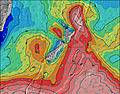 | |||||||||||||
Wave Height (m) Direction Period (s) | WNW 10 | WNW 10 | WSW 17 | W 10 | NW 10 | NW 11 | WSW 16 | WSW 15 | WSW 15 | SW 14 | SW 14 | SW 13 | SW 13 | SW 11 | SW 16 | SW 14 | SW 12 | SW 17 | SW 16 | WSW 15 | SW 14 |
Wave Graph | |||||||||||||||||||||
734 | 821 | 459 | 653 | 3733 | 2878 | 4327 | 3590 | 2960 | 2056 | 1663 | 2528 | 936 | 1493 | 3903 | 2844 | 2436 | 5435 | 1591 | 1206 | 1031 | |
Wind (km/h) | |||||||||||||||||||||
Wind State on-shore cross-onshore cross-shore cross-offshore off-shore glassy | cross | cross-on | cross-on | cross-off | cross | cross | cross-off | off | off | cross-off | cross-off | cross | cross-on | glassy | cross-off | glassy | cross-off | cross-off | cross-off | cross-off | cross |
High Tide | 00:37AM3.51m | 1:01PM3.28m | 1:16AM3.43m | 1:44PM3.20m | 2:00AM3.34m | 2:31PM3.13m | 2:48AM3.25m | 3:22PM3.08m | 3:43AM3.18m | 4:24PM3.06m | 4:47AM3.15m | 5:41PM3.12m | 6:02AM3.18m | ||||||||
Low Tide | 6:58AM0.88m | 7:11PM0.90m | 7:40AM0.90m | 7:55PM0.98m | 8:24AM0.93m | 8:44PM1.06m | 9:12AM0.97m | 9:38PM1.13m | 10:06AM1.01m | 10:41PM1.16m | 11:13AM1.03m | 11:58PM1.12m | 12:32PM0.96m | ||||||||
— | 7:35 | — | — | 7:35 | — | — | 7:35 | — | — | 7:35 | — | — | 7:35 | — | — | 7:33 | — | — | 7:33 | — | |
— | — | 5:15 | — | — | 5:15 | — | — | 5:15 | — | — | 5:16 | — | — | 5:16 | — | — | 5:17 | — | — | 5:19 | |
mm | 6 | — | 2 | 19 | — | — | — | — | 2 | 1 | — | — | 5 | 1 | — | — | — | — | — | — | — |
Temp °C | 13 | 15 | 14 | 12 | 13 | 13 | 10 | 11 | 13 | 11 | 13 | 13 | 12 | 12 | 13 | 12 | 14 | 13 | 12 | 12 | 12 |
Feels °C | 8 | 13 | 11 | 9 | 9 | 9 | 6 | 6 | 8 | 7 | 8 | 8 | 9 | 11 | 12 | 11 | 10 | 8 | 7 | 8 | 8 |
Swell 1 Height (m) Direction Period (s) | WNW 10 | WNW 10 | WNW 9 | W 10 | WSW 14 | NW 11 | WSW 16 | WSW 15 | WSW 15 | SW 14 | SW 14 | WSW 19 | SW 13 | SW 11 | SW 16 | SW 14 | WSW 18 | WSW 17 | SW 16 | WSW 15 | SW 14 |
734 | 821 | 397 | 643 | 1958 | 2878 | 4327 | 3590 | 2960 | 2056 | 1663 | 37 | 936 | 1493 | 3903 | 2844 | 897 | 1863 | 1591 | 1206 | 1031 | |
Swell 2 Height (m) Direction Period (s) | WSW 16 | WSW 18 | WSW 17 | WSW 15 | — | WSW 14 | NW 10 | NW 8 | NW 8 | NW 8 | W 21 | — | WSW 18 | WSW 16 | WSW 21 | WSW 19 | — | — | — | SW 21 | WSW 19 |
53 | 352 | 459 | 653 | — | 1987 | 681 | 138 | 54 | 10 | 9 | — | 211 | 545 | 89 | 428 | — | — | — | 18 | 210 | |
Swell 3 Height (m) Direction Period (s) | WSW 20 | WSW 14 | W 11 | — | — | WSW 18 | — | — | — | — | — | — | — | SW 23 | — | — | — | — | — | — | — |
75 | 78 | 62 | — | — | 1106 | — | — | — | — | — | — | — | 21 | — | — | — | — | — | — | — | |
Wind waves Height (m) Direction Period (s) | NNE 4 | — | — | NE 3 | NW 10 | — | E 3 | ESE 4 | SE 4 | SE 3 | — | SW 13 | SSW 8 | — | — | — | SW 12 | SW 17 | SSW 7 | SSW 6 | SSW 6 |
50 | — | — | 3 | 3733 | — | 8 | 14 | 20 | 6 | — | 2528 | 508 | — | — | — | 2436 | 5435 | 358 | 227 | 106 | |
Nearest Offshore or Glassy | |||||||||||||||||||||
Distance (km) | 279 | 88 | 88 | 173 | 54 | 106 | 43 | 0 | 0 | 0 | 87 | 102 | 48 | 0 | 0 | 0 | 48 | 106 | 102 | 102 | 102 |
Best forecast wave conditions in Raglan and West Waikato | |||||||||||||||||||||
Best forecast wave conditions in New Zealand | |||||||||||||||||||||
Header Global | |||||||||||||||||||||
- Map Icons:
 Break
Break Live Wave Height (m)
 Live Wind Speed (km/h)
 Surf Rating (10 Max)
 Ocean Swells (m)
- Wind Speed (km/h)


FREE! Surf-Forecast.com widget for your website
The surf report / weather widget below is available to embed on third party websites free of charge and provides a summary of our Port Waikato-The Reef surf forecast. Simply grab the html code snippet that we provide and paste it into your own site. You can choose your preferred language and metric/imperial units for the surf forecast feed to suit users of your site. Click here to get the code.
Information about the Port Waikato-The Reef Surf forecast
The above surf forecast table for Port Waikato-The Reef provides essential information for determining whether the surfing conditions will be good over the next 16 days. A general guide to surfing at Port Waikato-The Reef can be found by selecting the local surf guide option on the grey menu. Our Port Waikato-The Reef surf forecast is unique since it includes wave energy (power) that defines the real feel of the surf rather than just the height or the period. If you surf the same spot (Port Waikato-The Reef) regularly then make a mental note of the wave energy from the surf forecast table each time you go. Very soon you may start to choose your surf days based on the wave energy alone combined with our forecast of favourable offshore wind conditions. Our star ratings will help here and of course you will also find the usual wave height and period predictions on our surf forecasts as well as a full break down of the swell components under our advanced users option (to reveal that, click the little Einstein character under the tide times).
Further information to help with frequently asked questions about our surf forecast for Port Waikato-The Reef may be found under the help tab on the top menu and also by moving your mouse over the question marks on the surf forecast table itself. Please always bear in mind that the forecast is for near-shore open water and local factors at each surf break influence the actual breaking wave height, such as the beach / reef profile, water depths offshore and shelter.
Port Waikato-The Reef is 31 km (19 miles) from the city of Pukekohe East. If you plan a holiday in Raglan and West Waikato, look for hotels and other accommodation in Pukekohe East. Pukekohe East has rooms for a wide range of budgets as well as car hire and transport links.
 Nearest