

Surf Forecasts:

Playa Chahue surf forecast from 9 Jul 2026:
- Best quality surf: Saturday 11 Jul, 12AM (local time) - 4.5ft (1.3m), 17s period, SSW swell with offshore winds.
- Most powerful swell: Saturday 11 Jul, 12AM (local time) - 4.5ft (1.3m), 17s period, SSW swell with 1,020 kJ wave energy.
- Next surfable swell (1★+): Thursday 9 Jul, 9AM (local time) - 4.5ft (1.3m), 15s period with SSW swell.
Best Forecast Surf Conditions for Playa Chahue this week:
The surf forecast for Playa Chahue over the next 16 days: The first swell (rated 1 star or higher) is forecast to arrive on Thursday (Jul 09) at 9AM. The primary swell is predicted to be 1.3m and 15s period with a secondary swell of 0.4m and 7s. The wind is predicted to be glassy as the swell arrives.
The most powerful waves expected at Playa Chahue in the next 16 days are 1.3m 17s and forecast to arrive on Saturday (Jul 11) at 12AM. Winds are predicted to be offshore at the time the swell arrives. The largest open ocean swell (not directed at the beach) is 1.7m 6s period and expected on Tuesday (Jul 14) at 6PM.
| Wave Type | Time (CST) & Date | Wave Height & Period |
|---|---|---|
| Next good surf (1 star+) | 9AM (Thu 9th Jul) | 4.5ft (1.3m) 15s |
| Best Surf | 12AM (Sat 11th Jul) | 4.5ft (1.3m) 17s |
| Most Powerful | 12AM (Sat 11th Jul) | 4.5ft (1.3m) 17s |
Table - best surf conditions forecast for Playa Chahue over the next 16 days.
G’day, Rusty here. We’ve got a solid 16-day window ahead for Playa Chahue, with a promising start and a few standout sessions if you time it right. The first real action kicks off on Thursday morning, July 9th, with clean lines and glassy conditions.
The week starts with a nice, consistent SSW groundswell running at 4 ft, with a period of 15 seconds—plenty of energy in the water (combined energy reading 875). Thursday morning is the pick of the early days: offshore ESE breeze at 5 km/h, glassy surface, and the swell is right on the money. This is a classic setup for this beach, and the water temp is about average for the time of year, so it’s comfortable. The afternoon turns rubbish with onshore wind, so forget that.
Friday morning, July 10th, is another glassy beauty—zero wind, same 4 ft SSW swell at 15 seconds (656 energy). It’s a touch smaller but still very clean. Saturday morning, July 11th, follows suit: 4 ft, 15 seconds, SSW, with a light offshore puff (5 km/h SW) and glassy conditions. Energy is up to 853, so there’s a bit more punch. These three mornings are the real standouts in the first week—clean, well-shaped, and just right for intermediates.
Then Sunday afternoon, July 12th, surprises with a glassy spell and 3 ft SSW swell (15 seconds, 700 energy), but the real game-changer hits Monday morning, July 13th. We get a jump in size to 6 ft from the SE, but it’s short-period at 8 seconds. The energy is cranking at 1098, and it’s glassy with a slight NE breeze. This one’s for experienced surfers only—over 5 ft and punchy, with long gaps between sets. Tuesday afternoon, July 14th, is another expert-only call: 6 ft from the S, 12 seconds, with 1199 energy and glassy conditions. Both of these are big, powerful, and clean.
The second week is quieter, with smaller swells but still plenty of clean windows. Thursday morning, July 16th, is a write-off with onshore wind, but Friday morning, July 17th, has a glassy 2 ft SSW swell (12 seconds, 292 energy)—a small but fun session. Saturday morning, July 18th, is also glassy with 2 ft SW swell, but the period jumps to 18 seconds (very long period), which is best for the points and reefs, not so much a beach break. It’s worth a look if you’re patient.
The real gem in the second week is Sunday morning, July 19th: dead calm, 3 ft SW swell at 18 seconds (very long period), with 747 energy. It’s small but glassy and clean. Monday morning, July 20th, and Tuesday morning, July 21st, are also glassy with 3 ft to 3 ft SW swell, good for a cruisy paddle. Crowds are possible here—sometimes busy—so get in early.
Overall, the best on offer is Thursday morning, July 9th, and Saturday morning, July 11th, for that perfect mix of clean, consistent, and just the right size for intermediates. For the experts, Monday morning, July 13th, is the standout. The long-range stuff is promising but less certain—just keep an eye on the sky.
Rusty.
Short Range ForecastLight rain (total 6mm), mostly falling on Fri night. Warm (max 32°C on Thu morning, min 27°C on Wed night). Wind will be generally light. | Days 5-7 Weather SummaryModerate rain (total 11mm), heaviest on Mon afternoon. Warm (max 31°C on Tue morning, min 25°C on Mon night). Wind will be generally light. | ||||||||||||||||||||
Thursday 9 | Friday 10 | Saturday 11 | Sunday 12 | Monday 13 | Tuesday 14 | Wed 15 | |||||||||||||||
Night | AM | PM | Night | AM | PM | Night | AM | PM | Night | AM | PM | Night | AM | PM | Night | AM | PM | Night | AM | PM | |
Swell Height Map |  |  |  |  | 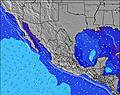 | 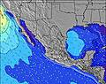 | 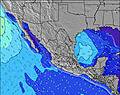 | 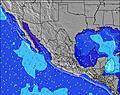 | |||||||||||||
Wave Height (m) Direction Period (s) | SSW 16 | SSW 15 | SSW 15 | SSW 15 | SSW 15 | SSW 15 | SSW 17 | SSW 15 | SSW 16 | SSW 15 | SSW 14 | SSW 15 | SSW 14 | SSW 14 | SE 8 | SSE 10 | SSE 8 | S 12 | SSW 9 | SSW 14 | SSW 13 |
Wave Graph | |||||||||||||||||||||
1067 | 815 | 683 | 674 | 576 | 683 | 1020 | 784 | 859 | 372 | 602 | 405 | 487 | 392 | 698 | 741 | 284 | 841 | 189 | 384 | 257 | |
Wind (km/h) | |||||||||||||||||||||
Wind State on-shore cross-onshore cross-shore cross-offshore off-shore glassy | cross-off | glassy | on | cross-off | glassy | cross-on | off | glassy | cross-on | cross-off | cross | glassy | off | glassy | cross-on | cross | glassy | glassy | cross-on | glassy | cross-on |
High Tide | 9:16AM1.21m | 9:15PM0.86m | 10:11AM1.25m | 10:13PM0.83m | 11:10AM1.29m | 11:17PM0.84m | 12:11PM1.32m | 00:24AM0.87m | 1:12PM1.34m | 1:31AM0.92m | 2:11PM1.35m | 2:36AM1.00m | 3:08PM1.35m | ||||||||
Low Tide | 2:29AM0.12m | 3:42PM0.29m | 3:18AM0.10m | 4:44PM0.27m | 4:15AM0.08m | 5:48PM0.24m | 5:18AM0.06m | 6:50PM0.19m | 6:25AM0.04m | 7:50PM0.14m | 7:32AM0.03m | 8:46PM0.08m | 8:37AM0.02m | ||||||||
— | 5:58 | — | — | 5:58 | — | — | 5:58 | — | — | 6:00 | — | — | 6:00 | — | — | 6:00 | — | — | 6:01 | — | |
— | — | 7:00 | — | — | 7:00 | — | — | 7:00 | — | — | 7:00 | — | — | 6:59 | — | — | 6:59 | — | — | 6:59 | |
mm | 1 | — | — | 1 | — | 2 | 2 | — | — | — | — | 2 | 4 | 1 | 4 | — | — | — | 6 | — | 4 |
Temp °C | 27 | 32 | 32 | 29 | 32 | 32 | 28 | 31 | 32 | 28 | 30 | 30 | 27 | 30 | 28 | 27 | 31 | 30 | 29 | 30 | 29 |
Feels °C | 30 | 35 | 34 | 33 | 35 | 35 | 32 | 33 | 34 | 32 | 33 | 34 | 32 | 30 | 31 | 29 | 33 | 34 | 32 | 32 | 33 |
Swell 1 Height (m) Direction Period (s) | SSW 16 | SSW 15 | SSW 15 | SSW 15 | SSW 15 | SSW 15 | SSW 17 | SSW 15 | SSW 16 | SSW 15 | SSW 14 | SSW 15 | SE 8 | SE 8 | SSE 8 | SSE 10 | SSE 8 | S 12 | SSW 9 | SSW 14 | SSW 13 |
1067 | 815 | 683 | 674 | 576 | 683 | 1020 | 784 | 859 | 372 | 602 | 405 | 182 | 304 | 493 | 741 | 284 | 841 | 189 | 384 | 257 | |
Swell 2 Height (m) Direction Period (s) | ESE 8 | ESE 7 | S 11 | S 11 | S 9 | S 10 | S 10 | S 9 | S 9 | SSW 13 | S 8 | SSW 12 | SSW 14 | SSW 14 | SSW 13 | SSW 13 | SSW 12 | SW 18 | SW 13 | SSW 8 | SW 16 |
38 | 18 | 37 | 85 | 63 | 65 | 68 | 60 | 78 | 269 | 36 | 129 | 487 | 347 | 282 | 198 | 271 | 252 | 180 | 81 | 208 | |
Swell 3 Height (m) Direction Period (s) | S 8 | SSE 11 | E 6 | ESE 8 | ESE 7 | ESE 7 | ESE 8 | ESE 7 | ESE 6 | S 9 | ESE 7 | SSW 21 | SW 21 | S 18 | SW 19 | S 16 | SSW 16 | S 15 | E 6 | E 7 | E 6 |
23 | 42 | 7 | 25 | 17 | 5 | 24 | 9 | 7 | 36 | 18 | 42 | 117 | 55 | 184 | 132 | 179 | 106 | 23 | 33 | 20 | |
Wind waves Height (m) Direction Period (s) | — | — | — | — | — | — | — | — | — | — | ENE 5 | ESE 6 | — | SE 8 | SE 8 | — | — | ENE 6 | — | — | SSW 8 |
— | — | — | — | — | — | — | — | — | — | 10 | 124 | — | 392 | 698 | — | — | 111 | — | — | 123 | |
Nearest Offshore or Glassy | |||||||||||||||||||||
Distance (km) | 0 | 0 | 85 | 0 | 0 | 85 | 0 | 0 | 85 | 0 | 10 | 0 | 0 | 0 | 734 | 50 | 0 | 0 | 50 | 0 | 50 |
Best forecast wave conditions in Oaxaca | |||||||||||||||||||||
Best forecast wave conditions in Mexico | |||||||||||||||||||||
Header Global | |||||||||||||||||||||
- Map Icons:
 Break
Break Live Wave Height (m)
 Live Wind Speed (km/h)
 Surf Rating (10 Max)
 Ocean Swells (m)
- Wind Speed (km/h)


FREE! Surf-Forecast.com widget for your website
The surf report / weather widget below is available to embed on third party websites free of charge and provides a summary of our Playa Chahue surf forecast. Simply grab the html code snippet that we provide and paste it into your own site. You can choose your preferred language and metric/imperial units for the surf forecast feed to suit users of your site. Click here to get the code.
Information about the Playa Chahue Surf forecast
The above surf forecast table for Playa Chahue provides essential information for determining whether the surfing conditions will be good over the next 16 days. A general guide to surfing at Playa Chahue can be found by selecting the local surf guide option on the grey menu. Our Playa Chahue surf forecast is unique since it includes wave energy (power) that defines the real feel of the surf rather than just the height or the period. If you surf the same spot (Playa Chahue) regularly then make a mental note of the wave energy from the surf forecast table each time you go. Very soon you may start to choose your surf days based on the wave energy alone combined with our forecast of favourable offshore wind conditions. Our star ratings will help here and of course you will also find the usual wave height and period predictions on our surf forecasts as well as a full break down of the swell components under our advanced users option (to reveal that, click the little Einstein character under the tide times).
Further information to help with frequently asked questions about our surf forecast for Playa Chahue may be found under the help tab on the top menu and also by moving your mouse over the question marks on the surf forecast table itself. Please always bear in mind that the forecast is for near-shore open water and local factors at each surf break influence the actual breaking wave height, such as the beach / reef profile, water depths offshore and shelter.
Are you planning a holiday in Oaxaca? If you are looking for accommodation near Playa Chahue, camping, hotels and holiday cottages in Oaxaca, consider staying in Miahuatlan de Porfirio Diaz which is 84 km (52 miles) away.
 Nearest