

Surf Forecasts:

Mizata surf forecast from 18 Jul 2026:
- Best quality surf: Friday 24 Jul, 9AM (local time) - 3ft (0.9m), 24s period, SSW swell with glassy winds.
- Most powerful swell: Friday 24 Jul, 9AM (local time) - 3ft (0.9m), 24s period, SSW swell with 866 kJ wave energy.
- Next surfable swell (1★+): Friday 17 Jul, 9PM (local time) - 3ft (0.9m), 12s period with SSW swell.
Best Forecast Surf Conditions for Mizata this week:
The surf forecast for Mizata over the next 16 days: The first swell (rated 1 star or higher) is forecast to arrive on Friday (Jul 17) at 9PM. The primary swell is predicted to be 0.9m and 12s period with a secondary swell of 0.6m and 7s. The wind is predicted to be offshore as the swell arrives.
The most powerful waves expected at Mizata in the next 16 days are 0.9m 24s and forecast to arrive on Friday (Jul 24) at 9AM. Winds are predicted to be glassy at the time the swell arrives. The largest open ocean swell (not directed at the beach) is 0.4m 3s period and expected on Saturday (Jul 18) at 6AM.
| Wave Type | Time (CST) & Date | Wave Height & Period |
|---|---|---|
| Next good surf (1 star+) | 9PM (Fri 17th Jul) | 3ft (0.9m) 12s |
| Best Surf | 9AM (Fri 24th Jul) | 3ft (0.9m) 24s |
| Most Powerful | 9AM (Fri 24th Jul) | 3ft (0.9m) 24s |
Table - best surf conditions forecast for Mizata over the next 16 days.
The Lowdown
Alright folks, Rusty here with a good look at what’s shaping up for the Mizata region over the next couple of weeks. We’ve got a solid run of surf on offer, but patience is the name of the game for the first few days—small, clean waves that’ll suit the longboard and the beginners.
Right out of the gate, Friday morning, July 17, we’ve got a clean 3ft SSW swell, period of 14 seconds, with a light cross-offshore breeze from the NE. The water is a warm 85°, which is right about average for this time of year. Combined energy is moderate (395). It’s not big but it’s tidy—great for getting a feel for the point.
Saturday and Sunday mornings follow a similar pattern through the 18th and 19th: continued 3ft to 2ft SSW swell. Saturday stays clean under a NE cross-off, but the real treat comes Sunday morning, July 19, when the wind goes glassy from the SSE, and the period jumps to 19 seconds. That long-period groundswell energy will wrap nicely around the point at Mizata, offering up clean, lined-up waves. Combined energy is still moderate (429). This is a good window for cruisy, fun waves.
Then we roll into Monday morning, July 20. This is when things get interesting. The swell holds at 2.5ft from the SSW, but the period is 16 seconds and the combined energy bumps up to 504—moderate but punchy. What makes Monday the first standout is the glassy conditions from an ESE breeze. This is about as good as it gets for the size—clean, long-period lines reeling down the point. Conditions are excellent.
Tuesday and Wednesday mornings on the 21st and 22nd offer more of the same in terms of clean conditions, though the swell drops slightly to 2.3ft and the energy dips. Still fun, but Monday was the highlight of the first week.
Now, after a bit of a lull on Thursday morning, July 23, with weak 1.5ft swell and energy down to 102, we hit a real standout window starting Friday morning, July 24. This is where the swell kicks into gear. We get a 3ft SSW groundswell with a very long 24-second period. That long period means these waves will have serious push and shape, perfect for the point at Mizata. The combined energy jumps to 1009—solid moderate-to-strong. Best of all? Glassy conditions with a light SW breeze. This is the best morning of the entire run so far. It’s not huge, but that period makes every wave count. Get on it.
Saturday morning, July 25, the swell builds a touch more to 3.5ft from the SSW, with a 21-second period. Combined energy now hits 1452—strong. Glassy conditions again from the SSE. This is another prime morning. By Sunday the 26th, it’s up to 4ft with 19-second period, still glassy on the morning, energy at 1239. But by now the size is starting to creep up, so it’s less for beginners and more for the intermediate crowd.
Monday morning, July 27, the swell reaches 5ft, period at 18 seconds, combined energy strong at 1599. Glassy conditions from the east. This is a serious morning for experienced surfers. The point at Mizata will handle this size well with that long-period groundswell, offering long, well-shaped rides. The crowds are sometimes an issue here, but on a Monday morning, you might have some room.
Tuesday morning, July 28, holds at 5ft SSW, 18-second period, and energy stays high at 1675, but the wind turns cross-on from the SE. It’s still surfable—better for the more experienced—but not as clean as Monday.
Wednesday morning, July 29, gives us another glassy morning with 5ft SSW, 16-second period, and energy at 1116. Another excellent option for experienced surfers, with clean conditions from a calm NNE breeze.
After that, the swell fades through the end of July and into August. Thursday the 30th and Friday the 31st offer clean, smaller waves in the 3.5ft to 4ft range, glassy mornings, but the energy drops off. Good for the longboard or a fun morning session, but not a standout. Saturday, August 1, stays small and clean, and the window closes out with small, weak surf from there.
So, the two true standouts: Monday morning, July 20, for the clean, glassy long-period 2.5ft SSW swell, and Friday morning, July 24, for the 3ft, 24-second groundswell also under glassy conditions. Those are the mornings to circle on the calendar. The swell stays solid through the end of the month, but those two days offer the best combo of size, period, and wind.
Stay stoked.
Short Range ForecastLight rain (total 3mm), mostly falling on Sun night. Warm (max 31°C on Fri morning, min 26°C on Sat night). Wind will be generally light. | Days 4-6 Weather SummaryMostly dry. Warm (max 30°C on Mon afternoon, min 26°C on Mon night). Wind will be generally light. | ||||||||||||||||||||
Friday 17 | Saturday 18 | Sunday 19 | Monday 20 | Tuesday 21 | Wednesday 22 | Thursday 23 | |||||||||||||||
AM | PM | Night | AM | PM | Night | AM | PM | Night | AM | PM | Night | AM | PM | Night | AM | PM | Night | AM | PM | Night | |
Swell Height Map |  |  |  | 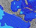 | 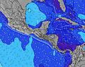 | 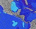 | 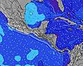 | ||||||||||||||
Wave Height (m) Direction Period (s) | SSW 14 | SSW 14 | SSW 13 | SSW 13 | SSW 13 | SSW 13 | SSW 19 | SSW 18 | SW 17 | SSW 16 | SSW 16 | SW 16 | SW 15 | SW 15 | SSW 13 | SW 13 | SW 13 | SW 12 | SW 12 | SW 26 | SW 18 |
Wave Graph | |||||||||||||||||||||
297 | 325 | 231 | 242 | 195 | 195 | 233 | 204 | 309 | 334 | 326 | 349 | 322 | 220 | 229 | 180 | 144 | 73 | 73 | 171 | 94 | |
Wind (km/h) | |||||||||||||||||||||
Wind State on-shore cross-onshore cross-shore cross-offshore off-shore glassy | cross-off | on | off | cross-off | cross-on | cross-off | glassy | cross-on | cross-off | glassy | cross-on | off | glassy | cross-on | glassy | cross-off | on | off | glassy | on | off |
High Tide | 4:56PM2.11m | 5:30AM2.10m | 5:45PM2.01m | 6:19AM2.08m | 6:34PM1.89m | 7:06AM2.02m | 7:22PM1.76m | 7:54AM1.94m | 8:12PM1.63m | 8:42AM1.84m | 9:05PM1.52m | 9:33AM1.76m | 10:02PM1.43m | ||||||||
Low Tide | 10:48AM0.12m | 11:14PM-0.01m | 11:40AM0.16m | 00:00AM0.06m | 12:32PM0.23m | 00:45AM0.16m | 1:23PM0.32m | 1:31AM0.28m | 2:15PM0.40m | 2:18AM0.39m | 3:10PM0.48m | 3:07AM0.50m | 4:07PM0.53m | ||||||||
5:39 | — | — | 5:39 | — | — | 5:39 | — | — | 5:39 | — | — | 5:39 | — | — | 5:41 | — | — | 5:41 | — | — | |
— | 6:30 | — | — | 6:29 | — | — | 6:29 | — | — | 6:29 | — | — | 6:29 | — | — | 6:29 | — | — | 6:29 | — | |
mm | — | — | — | — | — | — | — | — | 3 | — | — | — | — | — | — | — | — | — | — | — | — |
Temp °C | 31 | 31 | 28 | 31 | 31 | 28 | 30 | 30 | 29 | 29 | 30 | 27 | 30 | 30 | 28 | 30 | 30 | 27 | 30 | 30 | 27 |
Feels °C | 33 | 34 | 30 | 32 | 32 | 31 | 31 | 32 | 33 | 32 | 33 | 30 | 30 | 31 | 30 | 30 | 31 | 30 | 30 | 32 | 30 |
Swell 1 Height (m) Direction Period (s) | SSW 14 | SSW 14 | SSW 13 | SSW 13 | SSW 13 | SSW 13 | SSW 13 | SSW 12 | SW 17 | SSW 16 | SSW 16 | SW 16 | SW 15 | SW 15 | SSW 13 | SW 13 | SW 13 | SW 12 | SW 12 | SSE 8 | SSE 8 |
297 | 325 | 231 | 242 | 195 | 195 | 181 | 157 | 309 | 334 | 326 | 349 | 322 | 220 | 229 | 180 | 144 | 73 | 73 | 92 | 94 | |
Swell 2 Height (m) Direction Period (s) | SE 8 | SE 7 | SE 7 | SSW 18 | SSW 19 | SSW 19 | SSW 19 | SSW 18 | SSW 12 | S 12 | SSW 11 | SSW 8 | SSW 7 | SSW 7 | SW 7 | SSW 12 | SE 8 | SE 6 | SE 8 | SW 13 | SSW 13 |
51 | 23 | 24 | 120 | 139 | 145 | 233 | 204 | 109 | 132 | 158 | 73 | 62 | 43 | 23 | 46 | 28 | 14 | 18 | 80 | 68 | |
Swell 3 Height (m) Direction Period (s) | SSW 11 | SSW 20 | SW 10 | SE 6 | SSE 7 | SSE 7 | SE 8 | SSE 7 | SSE 7 | SSW 14 | S 13 | S 13 | S 12 | SSW 12 | SE 7 | SSW 7 | SSW 12 | SSW 11 | WSW 8 | SW 26 | SW 18 |
47 | 38 | 25 | 6 | 20 | 19 | 15 | 40 | 29 | 38 | 56 | 54 | 80 | 50 | 13 | 9 | 45 | 40 | 11 | 171 | 80 | |
Wind waves Height (m) Direction Period (s) | — | — | — | NE 3 | — | WNW 8 | — | — | — | — | — | — | — | — | — | E 6 | — | — | NE 3 | — | — |
— | — | — | 2 | — | 6 | — | — | — | — | — | — | — | — | — | 7 | — | — | 1 | — | — | |
Nearest Offshore or Glassy | |||||||||||||||||||||
Distance (km) | 0 | 19 | 0 | 0 | 518 | 0 | 0 | 176 | 0 | 0 | 176 | 0 | 0 | 175 | 0 | 0 | 254 | 0 | 0 | 518 | 0 |
Best forecast wave conditions in El-Salvador - Costa del Balsamo | |||||||||||||||||||||
Best forecast wave conditions in El Salvador | |||||||||||||||||||||
Header Global | |||||||||||||||||||||
- Map Icons:
 Break
Break Live Wave Height (m)
 Live Wind Speed (km/h)
 Surf Rating (10 Max)
 Ocean Swells (m)
- Wind Speed (km/h)


FREE! Surf-Forecast.com widget for your website
The surf report / weather widget below is available to embed on third party websites free of charge and provides a summary of our Mizata surf forecast. Simply grab the html code snippet that we provide and paste it into your own site. You can choose your preferred language and metric/imperial units for the surf forecast feed to suit users of your site. Click here to get the code.
Information about the Mizata Surf forecast
The above surf forecast table for Mizata provides essential information for determining whether the surfing conditions will be good over the next 16 days. A general guide to surfing at Mizata can be found by selecting the local surf guide option on the grey menu. Our Mizata surf forecast is unique since it includes wave energy (power) that defines the real feel of the surf rather than just the height or the period. If you surf the same spot (Mizata) regularly then make a mental note of the wave energy from the surf forecast table each time you go. Very soon you may start to choose your surf days based on the wave energy alone combined with our forecast of favourable offshore wind conditions. Our star ratings will help here and of course you will also find the usual wave height and period predictions on our surf forecasts as well as a full break down of the swell components under our advanced users option (to reveal that, click the little Einstein character under the tide times).
Further information to help with frequently asked questions about our surf forecast for Mizata may be found under the help tab on the top menu and also by moving your mouse over the question marks on the surf forecast table itself. Please always bear in mind that the forecast is for near-shore open water and local factors at each surf break influence the actual breaking wave height, such as the beach / reef profile, water depths offshore and shelter.
Mizata is 16 km (10 miles) from the city of Acajutla. If you plan a holiday in El-Salvador - Costa del Balsamo, look for hotels and other accommodation in Acajutla. Acajutla has rooms for a wide range of budgets as well as car hire and transport links.
 Nearest