

Surf Forecasts:

Playa Caletas surf forecast from 16 Jul 2026:
- Best quality surf: Saturday 18 Jul, 3AM (local time) - 3.5ft (1.1m), 13s period, SSW swell with cross-offshore winds.
- Most powerful swell: Sunday 19 Jul, 12AM (local time) - 3.5ft (1.1m), 13s period, SSW swell with 437 kJ wave energy.
- Next surfable swell (1★+): Thursday 16 Jul, 6PM (local time) - 3.5ft (1.1m), 14s period with SSW swell.
Best Forecast Surf Conditions for Playa Caletas this week:
The surf forecast for Playa Caletas over the next 16 days: The first swell (rated 1 star or higher) is forecast to arrive on Thursday (Jul 16) at 6PM. The primary swell is predicted to be 1.1m and 14s period with a secondary swell of 0.1m and 20s. The wind is predicted to be glassy as the swell arrives.
The most powerful waves expected at Playa Caletas in the next 16 days are 1.1m 13s and forecast to arrive on Sunday (Jul 19) at 12AM. Winds are predicted to be offshore at the time the swell arrives. The largest open ocean swell (not directed at the beach) is 1.0m 14s period and expected on Sunday (Jul 19) at 9AM.
| Wave Type | Time (CST) & Date | Wave Height & Period |
|---|---|---|
| Next good surf (1 star+) | 6PM (Thu 16th Jul) | 3.5ft (1.1m) 14s |
| Best Surf | 3AM (Sat 18th Jul) | 3.5ft (1.1m) 13s |
| Most Powerful | 12AM (Sun 19th Jul) | 3.5ft (1.1m) 13s |
Table - best surf conditions forecast for Playa Caletas over the next 16 days.
The Lowdown
G’day, Rusty here. Looks like we’ve got a slow start at Playa Caletas, a reef setup that’s fairly consistent and best with a WNW swell direction. The water’s sitting at 87°, a touch warmer than normal for this time of year. Don’t get too excited just yet – the first few sessions are small, but the real juice builds as we head into the end of the month.
Thursday the 16th is a glassy little morning with a 2ft SW swell and a 12-second period, combined energy of 248 (moderate). It’s clean, but pretty small. Friday the 17th is a step up: morning offshore winds from the NNE, 3ft SSW swell at 14 seconds, and energy jumping to 493 (moderate). Clean and fun. Saturday the 18th is smaller again, 3ft, and the afternoon gets onshore sloppy. Sunday the 19th is a glassy morning with a 2ft SW swell, but check the period – 19 seconds! That’s a long-period groundswell, and for a reef, that’s a proper treat. Energy is 219 (moderate), but it’s a small wave. Still, glassy and long-period makes for some silky rides.
Monday the 20th is where it starts to get interesting. Morning offshore from the NE, 2ft SW swell at 16 seconds, and energy hits 511 (moderate to strong). The forecast says “very good” and that’s spot on – clean, long lines. Tuesday the 21st holds with clean cross-off winds, 3ft SW swell at 15 seconds, energy 301 (moderate). Wednesday the 22nd stays glassy with 2ft SW, 13 seconds. A solid run of small but clean days.
Thursday the 23rd is a bit ordinary in the morning, but the afternoon has a 1ft SW swell with a massive 26-second period – energy 319 (moderate). That’s a very long-period groundswell, and on a reef, it’ll be lined up but super fat. A novelty wave.
Now, the standout. Friday the 24th morning: ENE offshore at 6 mph, 2ft SW swell, 24-second period, and energy 674 (strong). This is the best of the first week – clean, super long-period, and plenty of energy. The afternoon gets trashed by 16 mph cross-offshore winds, so get in early.
The second week has a monster pulse. Saturday the 25th and Sunday the 26th are messy with strong cross-shore winds, but Sunday the 26th morning is glassy with 4ft SW swell at 19 seconds, energy 1048 (very strong). That’s a proper swell, but it’s only for experienced surfers – over 5ft, and with that period, it’ll be powerful and walled-up on the reef. Monday the 27th morning is the best of the whole run: glassy, 5ft SW swell at 19 seconds, energy 1391 (very strong). This is expert territory. Clean, heavy, and lined up. Tuesday the 28th morning is similar – 5ft SW, 18 seconds, energy 1457 (very strong), glassy. Unreal.
After that, it fades. Wednesday the 29th morning is still very good, 4ft SW at 16 seconds, energy 820 (strong), glassy. Thursday the 30th morning is okay, 3ft SW, 14 seconds, glassy. Friday the 31st morning is a small, glassy end to the run, 2ft SW.
Overall, the best on offer is Monday the 27th and Tuesday the 28th mornings – glassy, 5ft SW groundswell with very strong energy. That’s a proper reef session for the crew that knows what they’re doing. The earlier week is clean but small, and the long-range standouts are promising but less certain. Crowds? Playa Caletas can get busy sometimes, but with these conditions, it’ll be worth the company.
Rusty.
Short Range ForecastModerate rain (total 10mm), heaviest on Thu afternoon. Warm (max 31°C on Thu morning, min 25°C on Thu night). Wind will be generally light. | Days 4-6 Weather SummaryModerate rain (total 17mm), heaviest on Mon afternoon. Warm (max 30°C on Sun morning, min 25°C on Sun night). Wind will be generally light. | ||||||||||||||||||||
Thursday 16 | Friday 17 | Saturday 18 | Sunday 19 | Monday 20 | Tuesday 21 | Wednesday 22 | |||||||||||||||
AM | PM | Night | AM | PM | Night | AM | PM | Night | AM | PM | Night | AM | PM | Night | AM | PM | Night | AM | PM | Night | |
Swell Height Map |  |  |  | 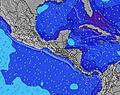 | 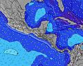 |  | 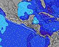 | ||||||||||||||
Wave Height (m) Direction Period (s) | SW 12 | SSW 13 | SSW 12 | SSW 14 | SSW 13 | SSW 13 | SSW 12 | SSW 12 | SSW 13 | SW 19 | SW 18 | SSW 12 | SW 16 | SW 16 | SW 15 | SW 15 | SW 14 | SW 13 | SW 13 | SW 13 | SW 12 |
Wave Graph | |||||||||||||||||||||
157 | 331 | 167 | 356 | 372 | 336 | 164 | 164 | 437 | 219 | 194 | 260 | 257 | 361 | 309 | 301 | 248 | 250 | 173 | 101 | 92 | |
Wind (km/h) | |||||||||||||||||||||
Wind State on-shore cross-onshore cross-shore cross-offshore off-shore glassy | glassy | on | off | off | on | cross-off | off | on | off | glassy | on | off | off | glassy | cross-off | cross-off | cross-off | off | glassy | glassy | glassy |
High Tide | 4:05PM2.62m | 4:40AM2.60m | 4:55PM2.56m | 5:28AM2.60m | 5:43PM2.45m | 6:15AM2.54m | 6:31PM2.31m | 7:01AM2.44m | 7:20PM2.15m | 7:48AM2.31m | 8:11PM1.99m | 8:37AM2.18m | 9:07PM1.86m | ||||||||
Low Tide | 9:56AM0.16m | 10:22PM-0.05m | 10:48AM0.16m | 11:09PM0.01m | 11:38AM0.21m | 11:56PM0.11m | 12:28PM0.30m | 00:41AM0.26m | 1:18PM0.40m | 1:28AM0.42m | 2:10PM0.51m | 2:16AM0.57m | 3:04PM0.60m | ||||||||
5:26 | — | — | 5:28 | — | — | 5:28 | — | — | 5:28 | — | — | 5:28 | — | — | 5:28 | — | — | 5:28 | — | — | |
— | 6:06 | — | — | 6:06 | — | — | 6:06 | — | — | 6:05 | — | — | 6:05 | — | — | 6:05 | — | — | 6:05 | — | |
mm | — | 6 | 1 | — | 1 | — | — | 1 | 1 | — | 2 | — | 1 | 6 | — | 2 | 6 | — | — | 4 | 1 |
Temp °C | 31 | 29 | 28 | 30 | 30 | 27 | 31 | 29 | 27 | 30 | 28 | 27 | 29 | 28 | 25 | 29 | 27 | 25 | 28 | 28 | 26 |
Feels °C | 34 | 33 | 33 | 34 | 34 | 31 | 34 | 32 | 31 | 33 | 32 | 31 | 33 | 33 | 29 | 33 | 31 | 28 | 32 | 32 | 30 |
Swell 1 Height (m) Direction Period (s) | SW 12 | SSW 13 | SSW 12 | SSW 14 | SSW 13 | SSW 13 | SSW 12 | SSW 12 | SSW 13 | S 14 | S 12 | SSW 12 | SSW 13 | S 12 | SW 15 | SW 15 | SW 14 | SSW 7 | SSW 7 | SSW 7 | SSW 7 |
157 | 331 | 164 | 356 | 372 | 336 | 164 | 164 | 437 | 377 | 304 | 260 | 215 | 187 | 309 | 301 | 248 | 72 | 65 | 67 | 89 | |
Swell 2 Height (m) Direction Period (s) | S 13 | SW 16 | SSW 15 | SW 15 | SW 15 | SSW 7 | S 14 | S 14 | SW 19 | S 7 | SSW 6 | SSW 6 | SW 16 | SW 16 | SSW 7 | S 7 | S 7 | SW 13 | SW 13 | SW 13 | SW 12 |
90 | 40 | 167 | 75 | 75 | 15 | 203 | 198 | 94 | 32 | 41 | 41 | 257 | 361 | 57 | 43 | 44 | 250 | 173 | 101 | 92 | |
Swell 3 Height (m) Direction Period (s) | SW 16 | SW 20 | SW 15 | SW 19 | SW 20 | S 16 | S 6 | S 6 | S 16 | SW 19 | SW 18 | SW 18 | SSW 7 | SSW 7 | S 12 | S 12 | S 12 | S 12 | S 11 | SSW 11 | SSW 11 |
91 | 15 | 106 | 57 | 63 | 81 | 12 | 20 | 46 | 219 | 194 | 152 | 34 | 34 | 184 | 132 | 101 | 101 | 62 | 40 | 39 | |
Wind waves Height (m) Direction Period (s) | — | — | — | NNW 7 | — | — | NNW 6 | — | — | — | — | — | NNW 7 | — | — | — | — | — | — | — | — |
— | — | — | 5 | — | — | 8 | — | — | — | — | — | 5 | — | — | — | — | — | — | — | — | |
Nearest Offshore or Glassy | |||||||||||||||||||||
Distance (km) | 0 | 24 | 0 | 0 | 19 | 0 | 0 | 78 | 0 | 0 | 19 | 0 | 0 | 0 | 0 | 0 | 0 | 0 | 0 | 0 | 0 |
Best forecast wave conditions in Golfo de Nicoya | |||||||||||||||||||||
Best forecast wave conditions in Costa Rica | |||||||||||||||||||||
Header Global | |||||||||||||||||||||
- Map Icons:
 Break
Break Live Wave Height (m)
 Live Wind Speed (km/h)
 Surf Rating (10 Max)
 Ocean Swells (m)
- Wind Speed (km/h)


FREE! Surf-Forecast.com widget for your website
The surf report / weather widget below is available to embed on third party websites free of charge and provides a summary of our Playa Caletas surf forecast. Simply grab the html code snippet that we provide and paste it into your own site. You can choose your preferred language and metric/imperial units for the surf forecast feed to suit users of your site. Click here to get the code.
Information about the Playa Caletas Surf forecast
The above surf forecast table for Playa Caletas provides essential information for determining whether the surfing conditions will be good over the next 16 days. A general guide to surfing at Playa Caletas can be found by selecting the local surf guide option on the grey menu. Our Playa Caletas surf forecast is unique since it includes wave energy (power) that defines the real feel of the surf rather than just the height or the period. If you surf the same spot (Playa Caletas) regularly then make a mental note of the wave energy from the surf forecast table each time you go. Very soon you may start to choose your surf days based on the wave energy alone combined with our forecast of favourable offshore wind conditions. Our star ratings will help here and of course you will also find the usual wave height and period predictions on our surf forecasts as well as a full break down of the swell components under our advanced users option (to reveal that, click the little Einstein character under the tide times).
Further information to help with frequently asked questions about our surf forecast for Playa Caletas may be found under the help tab on the top menu and also by moving your mouse over the question marks on the surf forecast table itself. Please always bear in mind that the forecast is for near-shore open water and local factors at each surf break influence the actual breaking wave height, such as the beach / reef profile, water depths offshore and shelter.
Playa Caletas is 49 km (30 miles) from Nicoya. If you plan a holiday in Golfo de Nicoya, look for hotels and other accommodation in Nicoya. Nicoya has rooms for a wide range of budgets as well as car hire and transport links.
 Nearest