

Surf Forecasts:

Punta Barigona surf forecast from 13 Jul 2026:
- Best quality surf: Saturday 18 Jul, 12AM (local time) - 3.5ft (1.1m), 13s period, SSW swell with glassy winds.
- Most powerful swell: Sunday 19 Jul, 3AM (local time) - 4ft (1.2m), 13s period, SSW swell with 523 kJ wave energy.
- Next surfable swell (1★+): Monday 13 Jul, 9PM (local time) - 2ft (0.6m), 15s period with S swell.
Best Forecast Surf Conditions for Punta Barigona this week:
The surf forecast for Punta Barigona over the next 16 days: The first swell (rated 1 star or higher) is forecast to arrive on Monday (Jul 13) at 9PM. The primary swell is predicted to be 0.6m and 15s period with a secondary swell of 0.6m and 12s. The wind is predicted to be glassy as the swell arrives.
The most powerful waves expected at Punta Barigona in the next 16 days are 1.2m 13s and forecast to arrive on Sunday (Jul 19) at 3AM. Winds are predicted to be cross-offshore at the time the swell arrives. The largest open ocean swell (not directed at the beach) is 0.2m 8s period and expected on Monday (Jul 20) at 9AM.
| Wave Type | Time (CST) & Date | Wave Height & Period |
|---|---|---|
| Next good surf (1 star+) | 9PM (Mon 13th Jul) | 2ft (0.6m) 15s |
| Best Surf | 12AM (Sat 18th Jul) | 3.5ft (1.1m) 13s |
| Most Powerful | 3AM (Sun 19th Jul) | 4ft (1.2m) 13s |
Table - best surf conditions forecast for Punta Barigona over the next 16 days.
The Lowdown
G'day, Rusty here. We've got a solid run of surf on the cards for Punta Barigona, with clean conditions and consistent SSW groundswell lining up nicely. The water is a touch warmer than normal at 87°, which is always a bonus.
The first real standout hits on Monday morning, July 13th. We're looking at a clean 3 ft SSW groundswell with a 13-second period, and light offshore ENE breeze at 6 mph. The energy is moderate (391), and the conditions are set to be glassy and clean. This is a great session for intermediates, with the point offering up some nice lines.
The pattern holds through the week, with the best windows being the mornings. Tuesday morning, July 14th brings a similar 3 ft SSW swell at 14 seconds, with light offshore NE wind. Wednesday morning, July 15th is a little smaller at 3 ft, but the NNE breeze at 3 mph has it cross-off and clean. Thursday morning, July 16th is a cracker – glassy conditions with the same 3 ft SSW swell, just a slight air moving. Friday morning, July 17th repeats the formula: 3 ft SSW swell, cross-off NNE breeze.
The energy picks up noticeably for Sunday morning, July 19th. The swell bumps to 4 ft from the SSW at 14 seconds, and the combined energy jumps to 642 (moderate to strong). With a light cross-off NNE breeze, the waves will have more push and shape. This is one of the best on offer.
Then Monday morning, July 20th is another standout. Glassy conditions again, with a 3 ft SW groundswell at a very long 16-second period. The energy is strong (624). That long period will really groove down the point, giving you some long, lined-up waves. Crowds are possible here, so get in early.
The rhythm continues through the second week, but energy drops off. Wednesday morning, July 22nd is clean with a 2 ft SW swell and offshore NE wind. Thursday morning, July 23rd is glassy but tiny, with only 1 ft and weak energy (120) – still surfable, but very ordinary.
After a bit of a messy period on the 24th, the forecast gets interesting again. Saturday morning, July 25th is a promising call: a 2 ft SW swell but with a very long 21-second period and clean cross-off E wind. The energy is moderate (306). That long period is for the point, not the beach.
The run home is strong. Sunday morning, July 26th has a clean 2 ft SW swell at 19 seconds, and Sunday afternoon turns glassy with a 3 ft SW swell at 19 seconds and strong energy (618). Monday morning, July 27th is glassy with a 3 ft SW swell at 18 seconds (686 energy), and Tuesday morning, July 28th is also glassy with a 3 ft SW swell at 16 seconds (593 energy). These last three mornings are the true standouts of the second week – clean, glassy, and solid groundswell energy. Mark the calendar for July 26th, 27th, and 28th.
No kite surfing talk here – the point is all about paddle surfing, and it's looking good.
Rusty.
Short Range ForecastModerate rain (total 12mm), heaviest on Mon night. Warm (max 29°C on Mon morning, min 26°C on Tue night). Wind will be generally light. | Days 4-6 Weather SummaryModerate rain (total 16mm), heaviest on Sat night. Warm (max 29°C on Thu morning, min 26°C on Thu night). Wind will be generally light. | ||||||||||||||||||||
Monday 13 | Tuesday 14 | Wednesday 15 | Thursday 16 | Friday 17 | Saturday 18 | Sunday 19 | |||||||||||||||
AM | PM | Night | AM | PM | Night | AM | PM | Night | AM | PM | Night | AM | PM | Night | AM | PM | Night | AM | PM | Night | |
Swell Height Map |  |  |  | 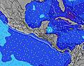 | 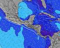 | 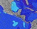 | 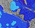 | ||||||||||||||
Wave Height (m) Direction Period (s) | SSW 13 | SSW 13 | S 15 | SSW 14 | SSW 14 | SSW 13 | SSW 13 | SW 16 | SW 16 | SSW 13 | SSW 13 | SSW 12 | SSW 12 | SSW 13 | SSW 13 | S 14 | S 14 | SSW 13 | SSW 14 | S 12 | S 12 |
Wave Graph | |||||||||||||||||||||
225 | 229 | 215 | 371 | 269 | 181 | 246 | 196 | 163 | 261 | 331 | 163 | 271 | 372 | 402 | 203 | 195 | 437 | 507 | 304 | 319 | |
Wind (km/h) | |||||||||||||||||||||
Wind State on-shore cross-onshore cross-shore cross-offshore off-shore glassy | off | cross | glassy | off | on | cross-off | cross-off | cross-on | cross | glassy | cross-on | cross-off | cross-off | cross-on | glassy | cross-off | cross-on | cross | cross-off | cross-on | cross-off |
High Tide | 1:26PM2.63m | 2:08AM2.41m | 2:24PM2.71m | 3:03AM2.56m | 3:18PM2.75m | 3:55AM2.67m | 4:09PM2.74m | 4:44AM2.73m | 4:59PM2.68m | 5:32AM2.73m | 5:48PM2.57m | 6:19AM2.67m | 6:36PM2.42m | ||||||||
Low Tide | 7:54PM0.13m | 8:09AM0.30m | 8:48PM0.03m | 9:06AM0.21m | 9:38PM-0.04m | 10:00AM0.17m | 10:27PM-0.04m | 10:52AM0.18m | 11:14PM0.01m | 11:43AM0.23m | 00:00AM0.13m | 12:33PM0.32m | 00:46AM0.28m | ||||||||
5:26 | — | — | 5:26 | — | — | 5:26 | — | — | 5:26 | — | — | 5:28 | — | — | 5:28 | — | — | 5:28 | — | — | |
— | 6:05 | — | — | 6:05 | — | — | 6:05 | — | — | 6:05 | — | — | 6:05 | — | — | 6:05 | — | — | 6:05 | — | |
mm | — | 2 | 5 | 1 | 1 | 2 | — | 1 | — | — | 2 | 2 | — | 3 | — | — | 3 | 6 | — | 3 | 5 |
Temp °C | 29 | 29 | 27 | 29 | 29 | 27 | 29 | 29 | 27 | 29 | 29 | 28 | 29 | 29 | 28 | 29 | 28 | 27 | 29 | 28 | 28 |
Feels °C | 32 | 32 | 32 | 33 | 32 | 30 | 33 | 32 | 30 | 33 | 32 | 33 | 32 | 33 | 32 | 33 | 31 | 31 | 33 | 31 | 33 |
Swell 1 Height (m) Direction Period (s) | SSW 13 | SSW 13 | S 15 | SSW 14 | SSW 14 | SSW 13 | SSW 13 | SSW 12 | SSW 12 | SSW 13 | SSW 13 | SSW 12 | SSW 12 | SSW 13 | SSW 13 | SSW 12 | SSW 12 | SSW 13 | SSW 14 | S 12 | S 12 |
225 | 229 | 215 | 371 | 269 | 181 | 246 | 113 | 113 | 261 | 331 | 161 | 271 | 372 | 402 | 164 | 164 | 437 | 507 | 304 | 319 | |
Swell 2 Height (m) Direction Period (s) | S 7 | S 16 | SSW 12 | SSE 8 | SW 13 | SW 13 | SW 15 | SW 16 | SW 16 | SW 16 | SW 16 | SSW 14 | SW 15 | SW 15 | S 6 | S 14 | S 14 | S 16 | SW 19 | SW 18 | SSW 6 |
32 | 186 | 83 | 19 | 87 | 88 | 54 | 196 | 163 | 91 | 41 | 163 | 75 | 54 | 21 | 203 | 195 | 46 | 123 | 194 | 44 | |
Swell 3 Height (m) Direction Period (s) | S 16 | S 6 | S 7 | SW 13 | SW 18 | SW 18 | S 7 | S 16 | S 15 | S 8 | SW 21 | SW 15 | SW 19 | SW 20 | S 16 | S 6 | S 6 | SW 19 | SSW 6 | S 6 | SW 18 |
134 | 20 | 27 | 45 | 111 | 154 | 16 | 174 | 119 | 11 | 17 | 75 | 58 | 62 | 81 | 20 | 20 | 95 | 12 | 19 | 194 | |
Wind waves Height (m) Direction Period (s) | — | — | — | — | WSW 6 | W 5 | — | — | — | — | — | — | — | — | — | — | — | — | — | — | — |
— | — | — | — | 3 | 5 | — | — | — | — | — | — | — | — | — | — | — | — | — | — | — | |
Nearest Offshore or Glassy | |||||||||||||||||||||
Distance (km) | 0 | 2 | 0 | 0 | 57 | 0 | 0 | 44 | 16 | 0 | 104 | 0 | 0 | 4 | 0 | 0 | 82 | 2 | 0 | 40 | 0 |
Best forecast wave conditions in Golfo de Nicoya | |||||||||||||||||||||
Best forecast wave conditions in Costa Rica | |||||||||||||||||||||
Header Global | |||||||||||||||||||||
- Map Icons:
 Break
Break Live Wave Height (m)
 Live Wind Speed (km/h)
 Surf Rating (10 Max)
 Ocean Swells (m)
- Wind Speed (km/h)


FREE! Surf-Forecast.com widget for your website
The surf report / weather widget below is available to embed on third party websites free of charge and provides a summary of our Punta Barigona surf forecast. Simply grab the html code snippet that we provide and paste it into your own site. You can choose your preferred language and metric/imperial units for the surf forecast feed to suit users of your site. Click here to get the code.
Information about the Punta Barigona Surf forecast
The above surf forecast table for Punta Barigona provides essential information for determining whether the surfing conditions will be good over the next 16 days. A general guide to surfing at Punta Barigona can be found by selecting the local surf guide option on the grey menu. Our Punta Barigona surf forecast is unique since it includes wave energy (power) that defines the real feel of the surf rather than just the height or the period. If you surf the same spot (Punta Barigona) regularly then make a mental note of the wave energy from the surf forecast table each time you go. Very soon you may start to choose your surf days based on the wave energy alone combined with our forecast of favourable offshore wind conditions. Our star ratings will help here and of course you will also find the usual wave height and period predictions on our surf forecasts as well as a full break down of the swell components under our advanced users option (to reveal that, click the little Einstein character under the tide times).
Further information to help with frequently asked questions about our surf forecast for Punta Barigona may be found under the help tab on the top menu and also by moving your mouse over the question marks on the surf forecast table itself. Please always bear in mind that the forecast is for near-shore open water and local factors at each surf break influence the actual breaking wave height, such as the beach / reef profile, water depths offshore and shelter.
Punta Barigona is 53 km (33 miles) from Puntarenas. If you plan a holiday in Golfo de Nicoya, look for hotels and other accommodation in Puntarenas. Puntarenas has rooms for a wide range of budgets as well as car hire and transport links.
 Nearest