

Surf Forecasts:

Nordseeklinik Westerland (Sylt) surf forecast from 3 Aug 2026:
- Most powerful swell: Thursday 6 Aug, 2PM (local time) - 6ft (1.9m), 7s period, W swell with 397 kJ wave energy.
Best Forecast Surf Conditions for Nordseeklinik Westerland (Sylt) this week:
The most powerful waves expected at Nordseeklinik Westerland (Sylt) in the next 16 days are 1.9m 7s and forecast to arrive on Thursday (Aug 06) at 2PM. Winds are predicted to be cross-onshore at the time the swell arrives. The largest open ocean swell (not directed at the beach) is 0.9m 4s period and expected on Wednesday (Aug 05) at 8AM.
| Wave Type | Time (CEST) & Date | Wave Height & Period |
|---|---|---|
| Next good surf (1 star+) | - | - |
| Best Surf | - | - |
| Most Powerful | 2PM (Thu 6th Aug) | 6ft (1.9m) 7s |
Table - best surf conditions forecast for Nordseeklinik Westerland (Sylt) over the next 16 days.
The Lowdown
Alright, let’s cut through it. Nordseeklinik Westerland (Sylt) is looking pretty flat and messy for most of the next couple of weeks. The combined swell energy is weak to moderate at best, with most days under 100 and only a couple pushing into the 100–200 range. Water temp is around 65°, which is pretty normal for this time of year.
The first real chance to get wet doesn’t roll in until Tuesday, 11 August. Before that, we’ve got a long stretch of poor surf – from Monday 3rd right through to Monday 10th, it’s all tiny swell, onshore wind, and messy conditions. Even when the swell bumps up to 4 to 6 ft from the WSW and W around Wednesday 5th and Thursday 6th, the wind is cross or cross-on with fresh to strong breezes, making it lumpy and ugly. That’s more of a kite-surfing day than a paddle day.
Then from Saturday 8th through Monday 10th, it drops to tiny 2 to 2 ft slop with onshore wind. Not worth a second look.
Finally, on Tuesday morning, 11 August, we get a proper window. Swell is 5 ft from the NW, period 7 seconds, and the wind swings offshore from the SE – clean and glassy. Combined energy hits 204 (moderate). It’s a beginner-friendly break, fairly consistent, but expect crowds sometimes – it’s Sylt, after all.
After that, Wednesday 12th onward drops off again – small swell, onshore or cross-onshore wind, and very little energy. By the weekend of 15th–16th August, we’re down to 0.3 ft to 1 ft. Basically flat.
So the standout is that Tuesday morning session on 11 August. Clean, enough push for a fun little wave, and the wind’s on your side. The rest of this 16-day run is a write-off.
Rusty.
Short Range ForecastLight rain (total 2mm), mostly falling on Tue night. Warm (max 27°C on Tue night, min 17°C on Thu morning). Winds increasing (light winds from the NE on Mon afternoon, strong winds from the WSW by Thu morning). | Days 5-7 Weather SummaryLight rain (total 2mm), mostly falling on Thu afternoon. Very mild (max 18°C on Sat night, min 15°C on Fri morning). Winds decreasing (strong winds from the WSW on Thu afternoon, light winds from the SW by Sat night). | |||||||||||||||||||
Mon 3 | Tuesday 4 | Wednesday 5 | Thursday 6 | Friday 7 | Saturday 8 | Sunday 9 | ||||||||||||||
PM | Night | AM | PM | Night | AM | PM | Night | AM | PM | Night | AM | PM | Night | AM | PM | Night | AM | PM | Night | |
Swell Height Map | 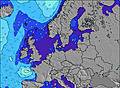 | 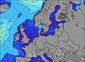 | 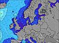 | 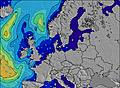 | 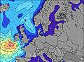 | 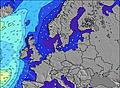 | 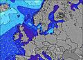 | |||||||||||||
Wave Height (m) Direction Period (s) | NW 7 | NW 9 | NW 8 | NW 8 | NNW 8 | SW 5 | WSW 6 | WSW 6 | WSW 7 | W 7 | WNW 6 | WNW 6 | WNW 7 | NW 6 | NW 6 | NW 5 | W 5 | W 5 | W 4 | WNW 6 |
Wave Graph | ||||||||||||||||||||
13 | 27 | 11 | 10 | 6 | 87 | 141 | 82 | 290 | 269 | 195 | 169 | 125 | 34 | 16 | 9 | 14 | 13 | 26 | 52 | |
Wind (km/h) | ||||||||||||||||||||
Wind State on-shore cross-onshore cross-shore cross-offshore off-shore glassy | cross | cross-off | off | cross-off | cross-off | cross | cross | cross | cross | cross-on | on | on | cross-on | cross-on | cross-on | cross | cross | cross-on | on | on |
High Tide | 5:50PM2.56m | 6:15AM2.20m | 6:23PM2.55m | 6:48AM2.21m | 7:00PM2.55m | 7:27AM2.22m | 7:43PM2.50m | 8:13AM2.19m | 8:38PM2.38m | 9:11AM2.14m | 9:46PM2.23m | 10:27AM2.10m | 11:15PM2.14m | |||||||
Low Tide | 00:07AM0.52m | 12:13PM0.57m | 00:40AM0.51m | 12:50PM0.57m | 1:19AM0.56m | 1:33PM0.63m | 2:04AM0.67m | 2:23PM0.76m | 2:59AM0.82m | 3:27PM0.88m | 4:11AM0.94m | 4:59PM0.91m | ||||||||
— | — | 5:39 | — | — | 5:41 | — | — | 5:43 | — | — | 5:45 | — | — | 5:47 | — | — | 5:48 | — | — | |
— | 9:25 | — | — | 9:23 | — | — | 9:22 | — | — | 9:20 | — | — | 9:17 | — | — | 9:15 | — | — | 9:14 | |
mm | — | — | — | — | 2 | — | — | — | — | 2 | — | — | — | — | — | — | — | — | — | — |
Temp °C | 24 | 22 | 19 | 25 | 27 | 20 | 19 | 19 | 17 | 17 | 16 | 15 | 15 | 16 | 16 | 17 | 18 | 18 | 17 | 16 |
Feels °C | 21 | 17 | 14 | 24 | 27 | 15 | 15 | 15 | 10 | 10 | 10 | 9 | 9 | 12 | 13 | 14 | 16 | 14 | 14 | 13 |
Swell 1 Height (m) Direction Period (s) | NW 7 | NW 9 | NW 8 | NW 8 | NNW 8 | NW 8 | NW 7 | NW 7 | — | — | — | — | — | NW 6 | NW 6 | NW 5 | W 5 | SSW 4 | — | — |
13 | 27 | 11 | 10 | 6 | 2 | 2 | 2 | — | — | — | — | — | 34 | 16 | 9 | 14 | 11 | — | — | |
Swell 2 Height (m) Direction Period (s) | W 5 | NW 9 | — | — | — | — | — | — | — | — | — | — | — | — | — | — | — | W 5 | — | — |
2 | 3 | — | — | — | — | — | — | — | — | — | — | — | — | — | — | — | 13 | — | — | |
Swell 3 Height (m) Direction Period (s) | — | — | — | — | — | — | — | — | — | — | — | — | — | — | — | — | — | NW 7 | — | — |
— | — | — | — | — | — | — | — | — | — | — | — | — | — | — | — | — | 2 | — | — | |
Wind waves Height (m) Direction Period (s) | — | E 3 | SE 3 | SSE 4 | SE 3 | SW 5 | WSW 6 | WSW 6 | WSW 7 | W 7 | WNW 6 | WNW 6 | WNW 7 | SW 5 | WSW 4 | SW 4 | S 3 | WSW 5 | W 4 | WNW 6 |
— | 5 | 7 | 7 | 7 | 87 | 141 | 82 | 290 | 269 | 195 | 169 | 125 | 5 | 3 | 4 | 5 | 3 | 26 | 52 | |
Nearest Offshore or Glassy | ||||||||||||||||||||
Distance (km) | 819 | 122 | 460 | 503 | 593 | 554 | 634 | 370 | 991 | 566 | 557 | 502 | 502 | 156 | 554 | 822 | 1073 | 689 | 915 | 801 |
Best forecast wave conditions in Nordsee (North Sea) | ||||||||||||||||||||
Best forecast wave conditions in Germany | ||||||||||||||||||||
Header Global | ||||||||||||||||||||
- Map Icons:
 Break
Break Live Wave Height (m)
 Live Wind Speed (km/h)
 Surf Rating (10 Max)
 Ocean Swells (m)
- Wind Speed (km/h)
Latest Updates


FREE! Surf-Forecast.com widget for your website
The surf report / weather widget below is available to embed on third party websites free of charge and provides a summary of our Nordseeklinik Westerland (Sylt) surf forecast. Simply grab the html code snippet that we provide and paste it into your own site. You can choose your preferred language and metric/imperial units for the surf forecast feed to suit users of your site. Click here to get the code.
Information about the Nordseeklinik Westerland (Sylt) Surf forecast
The above surf forecast table for Nordseeklinik Westerland (Sylt) provides essential information for determining whether the surfing conditions will be good over the next 16 days. A general guide to surfing at Nordseeklinik Westerland (Sylt) can be found by selecting the local surf guide option on the grey menu. Our Nordseeklinik Westerland (Sylt) surf forecast is unique since it includes wave energy (power) that defines the real feel of the surf rather than just the height or the period. If you surf the same spot (Nordseeklinik Westerland (Sylt)) regularly then make a mental note of the wave energy from the surf forecast table each time you go. Very soon you may start to choose your surf days based on the wave energy alone combined with our forecast of favourable offshore wind conditions. Our star ratings will help here and of course you will also find the usual wave height and period predictions on our surf forecasts as well as a full break down of the swell components under our advanced users option (to reveal that, click the little Einstein character under the tide times).
Further information to help with frequently asked questions about our surf forecast for Nordseeklinik Westerland (Sylt) may be found under the help tab on the top menu and also by moving your mouse over the question marks on the surf forecast table itself. Please always bear in mind that the forecast is for near-shore open water and local factors at each surf break influence the actual breaking wave height, such as the beach / reef profile, water depths offshore and shelter.
Are you planning a holiday in Nordsee (North Sea)? If you are looking for accommodation near Nordseeklinik Westerland (Sylt), camping, hotels and holiday cottages in Nordsee (North Sea), consider staying in Sylt-Ost which is 9 km (6 miles) away. Other places in and around Nordsee (North Sea) where you can find information about places to rent, and car hire include Sherrebek which is 35 km (22 miles) away, Esbjerg, Blaavand and Abenra.
 Nearest