

Surf Forecasts:

Norderney surf forecast from 3 Aug 2026:
- Best quality surf: Friday 7 Aug, 11PM (local time) - 2.5ft (0.8m), 7s period, NNW swell with cross-offshore winds.
- Most powerful swell: Friday 7 Aug, 8AM (local time) - 4.5ft (1.3m), 8s period, NW swell with 201 kJ wave energy.
- Next surfable swell (1★+): Friday 7 Aug, 11PM (local time) - 2.5ft (0.8m), 7s period with NNW swell.
Best Forecast Surf Conditions for Norderney this week:
The surf forecast for Norderney over the next 16 days: The first swell (rated 1 star or higher) is forecast to arrive on Friday (Aug 07) at 11PM. The primary swell is predicted to be 0.8m and 7s period. The wind is predicted to be cross-offshore as the swell arrives.
The most powerful waves expected at Norderney in the next 16 days are 1.3m 8s and forecast to arrive on Friday (Aug 07) at 8AM. Winds are predicted to be cross-onshore at the time the swell arrives. The largest open ocean swell (not directed at the beach) is 0.9m 4s period and expected on Wednesday (Aug 05) at 8AM.
| Wave Type | Time (CEST) & Date | Wave Height & Period |
|---|---|---|
| Next good surf (1 star+) | 11PM (Fri 7th Aug) | 2.5ft (0.8m) 7s |
| Best Surf | 11PM (Fri 7th Aug) | 2.5ft (0.8m) 7s |
| Most Powerful | 8AM (Fri 7th Aug) | 4.5ft (1.3m) 8s |
Table - best surf conditions forecast for Norderney over the next 16 days.
The Lowdown
Alright, this is Rusty. Let's talk about what's on the table for Norderney over the next couple of weeks.
Look, I gotta be straight with you. The next 16 days are looking pretty grim for any decent paddle surfing. The forecast is showing a real dry spell. We’re looking at a gap of about 16 days with no real surf on offer. The combined wave energy stays weak, mostly in the single or low double digits, and the swell heights are tiny. The only time we see a spike in energy is around Wednesday afternoon, August 5th, and Thursday afternoon, August 6th, with combined energy hitting 119 and 160, but that's coming with strong, messy winds. On Wednesday afternoon, it's a 4.3ft swell from the west with a short 6-second period, but it's getting torn up by a 25 mph cross-shore wind. Thursday afternoon is a bit bigger at 5ft from the west, also with a 6-second period, but again, 28 mph winds making it a complete mess. That’s not surf, that’s a washing machine. For the most part, the wind is either cross-shore or onshore, and the swell is weak and short-period. The few times it gets clean, the swell is just too small, like 1ft or 1.3ft.
The one spot we have to work with is Norderney itself. It's a fairly consistent beach break, but with this kind of forecast, even that won't help. The water temp is about 66.7°, which is a touch warmer than normal for this time of year, but that's little comfort when there's no waves. The optimum swell direction is from the NNW, and we do see some small pulses from that direction, but they are all under 1.6ft and often with onshore wind. This setup, with the stronger, choppier swells, looks way more interesting for kite surfing than for paddle surfing. Honestly, it's one of those blank runs that happens more often than we'd like here. Forecasts can change, but for now, I'd keep the board in the car.
Short Range ForecastLight rain (total 7mm), mostly falling on Tue night. Warm (max 28°C on Tue afternoon, min 18°C on Mon night). Winds increasing (calm on Tue afternoon, strong winds from the W by Wed afternoon). | Days 5-7 Weather SummarySome drizzle, heaviest during Thu night. Warm (max 20°C on Sat night, min 15°C on Sat morning). Winds decreasing (strong winds from the W on Thu afternoon, light winds from the NW by Sat afternoon). | |||||||||||||||||||
Mon 3 | Tuesday 4 | Wednesday 5 | Thursday 6 | Friday 7 | Saturday 8 | Sunday 9 | ||||||||||||||
PM | Night | AM | PM | Night | AM | PM | Night | AM | PM | Night | AM | PM | Night | AM | PM | Night | AM | PM | Night | |
Swell Height Map | 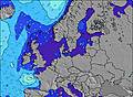 | 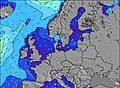 | 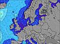 | 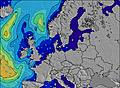 | 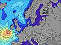 | 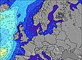 | 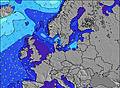 | |||||||||||||
Wave Height (m) Direction Period (s) | ENE 4 | E 4 | NNW 9 | NNW 8 | NNW 8 | NNW 8 | W 6 | NNW 7 | W 4 | WNW 6 | NW 6 | NW 8 | NNW 7 | NW 7 | NNW 7 | NNW 6 | NNW 6 | N 9 | W 4 | NW 5 |
Wave Graph | ||||||||||||||||||||
18 | 14 | 26 | 14 | 6 | 6 | 94 | 5 | 40 | 131 | 75 | 173 | 86 | 50 | 25 | 13 | 3 | 2 | 6 | 14 | |
Wind (km/h) | ||||||||||||||||||||
Wind State on-shore cross-onshore cross-shore cross-offshore off-shore glassy | cross | cross | off | cross | off | cross-off | cross | cross-off | cross-off | cross | cross-on | cross-on | cross-on | cross-off | cross-off | on | off | cross-on | on | cross-on |
High Tide | 3:09PM2.91m | 3:35AM2.55m | 3:46PM2.88m | 4:13AM2.52m | 4:27PM2.79m | 4:56AM2.46m | 5:17PM2.66m | 5:52AM2.39m | 6:24PM2.51m | 7:02AM2.35m | 7:39PM2.42m | 8:13AM2.39m | 8:54PM2.40m | |||||||
Low Tide | 9:37PM0.15m | 9:42AM0.23m | 10:13PM0.19m | 10:19AM0.27m | 10:54PM0.28m | 11:03AM0.35m | 11:43PM0.40m | 12:02PM0.46m | 00:45AM0.53m | 1:17PM0.54m | 1:55AM0.60m | 2:34PM0.53m | 3:09AM0.59m | |||||||
— | — | 5:48 | — | — | 5:50 | — | — | 5:52 | — | — | 5:54 | — | — | 5:56 | — | — | 5:58 | — | — | |
— | 9:24 | — | — | 9:22 | — | — | 9:21 | — | — | 9:19 | — | — | 9:17 | — | — | 9:15 | — | — | 9:14 | |
mm | — | 1 | — | — | 6 | — | — | — | — | — | 1 | — | — | — | — | — | — | — | — | — |
Temp °C | 25 | 24 | 23 | 28 | 23 | 21 | 20 | 20 | 18 | 18 | 17 | 16 | 16 | 17 | 16 | 19 | 20 | 19 | 19 | 18 |
Feels °C | 19 | 19 | 22 | 25 | 20 | 17 | 14 | 16 | 12 | 11 | 13 | 10 | 12 | 16 | 15 | 17 | 17 | 17 | 18 | 17 |
Swell 1 Height (m) Direction Period (s) | NNW 8 | NNW 8 | NNW 9 | NNW 8 | NNW 8 | NNW 8 | NNW 8 | NNW 7 | NW 9 | — | — | — | NNW 7 | NW 7 | NNW 7 | NNW 6 | NNW 6 | N 6 | — | NW 5 |
12 | 12 | 26 | 14 | 6 | 6 | 6 | 5 | 13 | — | — | — | 86 | 50 | 25 | 13 | 3 | 1 | — | 14 | |
Swell 2 Height (m) Direction Period (s) | — | — | NE 4 | — | — | — | — | — | N 7 | — | — | — | — | — | WNW 4 | — | WNW 5 | N 9 | — | — |
— | — | 1 | — | — | — | — | — | 1 | — | — | — | — | — | 2 | — | 3 | 2 | — | — | |
Swell 3 Height (m) Direction Period (s) | — | — | — | — | — | — | — | — | — | — | — | — | — | — | — | — | — | — | — | — |
— | — | — | — | — | — | — | — | — | — | — | — | — | — | — | — | — | — | — | — | |
Wind waves Height (m) Direction Period (s) | ENE 4 | E 4 | SE 3 | ENE 3 | WSW 3 | WSW 5 | W 6 | W 5 | W 4 | WNW 6 | NW 6 | NW 8 | — | — | — | — | SSE 3 | SW 3 | W 4 | — |
18 | 14 | 1 | 3 | 3 | 37 | 94 | 34 | 40 | 131 | 75 | 173 | — | — | — | — | 3 | 6 | 6 | — | |
Nearest Offshore or Glassy | ||||||||||||||||||||
Distance (km) | 809 | 265 | 575 | 387 | 535 | 471 | 603 | 223 | 1003 | 499 | 485 | 383 | 383 | 0 | 471 | 876 | 953 | 701 | 806 | 768 |
Best forecast wave conditions in Nordsee (North Sea) | ||||||||||||||||||||
Best forecast wave conditions in Germany | ||||||||||||||||||||
Header Global | ||||||||||||||||||||
- Map Icons:
 Break
Break Live Wave Height (m)
 Live Wind Speed (km/h)
 Surf Rating (10 Max)
 Ocean Swells (m)
- Wind Speed (km/h)
Latest Updates


FREE! Surf-Forecast.com widget for your website
The surf report / weather widget below is available to embed on third party websites free of charge and provides a summary of our Norderney surf forecast. Simply grab the html code snippet that we provide and paste it into your own site. You can choose your preferred language and metric/imperial units for the surf forecast feed to suit users of your site. Click here to get the code.
Information about the Norderney Surf forecast
The above surf forecast table for Norderney provides essential information for determining whether the surfing conditions will be good over the next 16 days. A general guide to surfing at Norderney can be found by selecting the local surf guide option on the grey menu. Our Norderney surf forecast is unique since it includes wave energy (power) that defines the real feel of the surf rather than just the height or the period. If you surf the same spot (Norderney) regularly then make a mental note of the wave energy from the surf forecast table each time you go. Very soon you may start to choose your surf days based on the wave energy alone combined with our forecast of favourable offshore wind conditions. Our star ratings will help here and of course you will also find the usual wave height and period predictions on our surf forecasts as well as a full break down of the swell components under our advanced users option (to reveal that, click the little Einstein character under the tide times).
Further information to help with frequently asked questions about our surf forecast for Norderney may be found under the help tab on the top menu and also by moving your mouse over the question marks on the surf forecast table itself. Please always bear in mind that the forecast is for near-shore open water and local factors at each surf break influence the actual breaking wave height, such as the beach / reef profile, water depths offshore and shelter.
Norderney is 14 km (9 miles) from Norden. If you plan a holiday in Nordsee (North Sea), look for hotels and other accommodation in Norden. Norden has rooms for a wide range of budgets as well as car hire and transport links.
 Nearest