

Surf Forecasts:

Nipussi (Nyang-Nyang) surf forecast from 2 Aug 2026:
- Best quality surf: Friday 7 Aug, 7PM (local time) - 8ft (2.5m), 17s period, SSW swell with offshore winds.
- Most powerful swell: Friday 7 Aug, 7PM (local time) - 8ft (2.5m), 17s period, SSW swell with 3,627 kJ wave energy.
- Next surfable swell (1★+): Monday 3 Aug, 4AM (local time) - 5.5ft (1.7m), 15s period with SSW swell.
Best Forecast Surf Conditions for Nipussi (Nyang-Nyang) this week:
The surf forecast for Nipussi (Nyang-Nyang) over the next 16 days: The first swell (rated 1 star or higher) is forecast to arrive on Monday (Aug 03) at 4AM. The primary swell is predicted to be 1.7m and 15s period with a secondary swell of 0.8m and 8s. The wind is predicted to be glassy as the swell arrives.
The most powerful waves expected at Nipussi (Nyang-Nyang) in the next 16 days are 2.5m 17s and forecast to arrive on Friday (Aug 07) at 7PM. Winds are predicted to be offshore at the time the swell arrives. The largest open ocean swell (not directed at the beach) is 2.0m 7s period and expected on Thursday (Aug 06) at 1PM.
| Wave Type | Time (WIB) & Date | Wave Height & Period |
|---|---|---|
| Next good surf (1 star+) | 4AM (Mon 3rd Aug) | 5.5ft (1.7m) 15s |
| Best Surf | 7PM (Fri 7th Aug) | 8ft (2.5m) 17s |
| Most Powerful | 7PM (Fri 7th Aug) | 8ft (2.5m) 17s |
Table - best surf conditions forecast for Nipussi (Nyang-Nyang) over the next 16 days.
The Lowdown
Alright, mates, Rusty here. Let’s get into it. The ocean’s been stirring and this stretch ahead has some real firepower if you know where to look. It’s not all perfect, but the next week has some proper windows, and the long-range stuff is starting to show its teeth, though we’ll be playing it by ear that far out.
First, let’s talk about the main event, Nipussi (Nipussi (Nyang-Nyang)) . This reef setup is the only game in town on the radar, and it’s exposed and ready to handle the south-southwest groundswell that’s lining up. The water’s sitting at about 85°F, which is pretty much spot-on for this time of year, nothing weird going on there.
The opening act on Sunday afternoon is a bit of a letdown, just 4ft of swell with a light onshore breeze. You’d be scratching for a wave. Don't waste your energy on that.
But hold on to your boards, because Monday morning kicks off a proper run. It’s glassy, with a light westerly wind, and the swell jumps up to 6ft, coming from the SSW with a 15-second period. That’s some proper groundswell energy, and the combined energy reading is up there (1240). This is when the reef starts doing its job. Monday afternoon holds up too, cross-off breeze and clean conditions, but it’s the next day that gets the heart pumping.
Tuesday is the one. Morning has a clean 4ft, but the afternoon is where it’s at: 6ft of SSW swell at 16 seconds, light offshore wind, glassy conditions, and the energy jumps to 1949. This is a high-quality window for experienced surfers. The reef will be shaping those lines perfectly.
Wednesday is more of the same, good solid surf at 6ft in the morning with a cross-off breeze, and though the afternoon drops a bit in size to 4ft, it's still clean with a long 19-second period. This one’s all about the long waits between sets, but the paddle out is easier for it.
Now, look out for Thursday. This is where it starts to get serious. The morning brings 7ft with a strong offshore NNW breeze at 25 km/h. The energy is pumping at 2655. This is powerful, expert-level surf. It's a step up, and the afternoon keeps that size and energy, holding at 7ft and 2635. The wind stays offshore and clean. This is raw power.
Friday pushes it even more. The morning is 8ft, but the conditions are a bit iffy tide-wise. The afternoon, though, is the standout of the whole run: 8ft of SSW swell with a 17-second period, clean offshore winds, and the energy reading hits 3669. This is big, clean, and pushing hard. This is the pick of the week, no doubt.
Saturday is still solid, with the wave height hanging around 7ft with light offshore winds and clean conditions, but the energy drops slightly. It’s still a fantastic day for experts.
From Sunday onwards, the wind starts to turn against us, swinging to the east and southeast, becoming cross-onshore and then fully onshore. The swell stays solid, but the quality takes a hit. The days from the 9th to the 13th are largely a write-off for quality surf. It's still big on the 11th, over 7ft, but with a strong onshore wind it’s going to be messy. The setup looks more interesting for kite surfing than paddle surfing, if you’re into that.
There’s a glimmer of hope around the 14th and 15th, but the winds are still onshore, and the energy, while strong, isn't translating to clean waves. The swell is big on the 15th, over 7ft, but it's just not breaking well.
So, here’s the long and short of it. The first week is where the magic is. Don't miss Tuesday afternoon or Friday afternoon at Nipussi. That’s world-class stuff. The second week is a waiting game, and honestly, it’s too far out to trust the details. What I can say is that it tends not to stay poor for long around here, and the swell isn’t going away. It might just take a bit of patience. But for now, get your board ready, that Friday swell is the one.
-Rusty
Short Range ForecastHeavy rain (total 70mm), heaviest during Sun night. Warm (max 29°C on Wed afternoon, min 24°C on Mon afternoon). Wind will be generally light. | Days 4-6 Weather SummaryHeavy rain (total 66mm), heaviest during Thu morning. Warm (max 29°C on Fri afternoon, min 25°C on Wed night). Winds decreasing (fresh winds from the N on Wed night, light winds from the NW by Sat afternoon). | ||||||||||||||||||||
Monday 3 | Tuesday 4 | Wednesday 5 | Thursday 6 | Friday 7 | Saturday 8 | Sunday 9 | |||||||||||||||
AM | PM | Night | AM | PM | Night | AM | PM | Night | AM | PM | Night | AM | PM | Night | AM | PM | Night | AM | PM | Night | |
Swell Height Map |  |  |  | 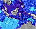 | 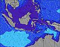 | 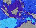 | 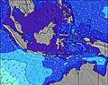 | ||||||||||||||
Wave Height (m) Direction Period (s) | SSW 15 | SSW 14 | SSW 14 | SSW 16 | SSW 16 | SSW 15 | SSW 15 | SSW 19 | SSW 18 | SSW 17 | SSW 16 | SSW 16 | SSW 18 | SSW 17 | SSW 16 | SSW 16 | SSW 16 | SSW 15 | SSW 16 | SSW 16 | SSW 15 |
Wave Graph | |||||||||||||||||||||
1145 | 996 | 643 | 915 | 1586 | 1393 | 1292 | 1077 | 2715 | 2630 | 2107 | 1851 | 3328 | 3520 | 3213 | 2716 | 2338 | 1882 | 2002 | 2054 | 1641 | |
Wind (km/h) | |||||||||||||||||||||
Wind State on-shore cross-onshore cross-shore cross-offshore off-shore glassy | cross-off | cross-off | off | cross-off | off | off | off | cross-off | off | off | cross-off | off | off | off | off | off | off | cross-on | cross-on | on | on |
High Tide | 8:47AM1.05m | 9:26PM1.00m | 9:17AM0.97m | 10:03PM1.01m | 9:51AM0.87m | 10:49PM1.01m | 10:33AM0.76m | 11:48PM1.00m | 11:33AM0.64m | 1:06AM1.00m | 1:19PM0.56m | 2:34AM1.03m | 3:15PM0.56m | 3:50AM1.10m | |||||||
Low Tide | 3:06PM0.05m | 3:22AM0.20m | 3:37PM0.07m | 4:09AM0.24m | 4:12PM0.10m | 5:04AM0.29m | 4:52PM0.14m | 6:14AM0.33m | 5:43PM0.18m | 7:49AM0.34m | 6:52PM0.22m | 9:36AM0.29m | 8:18PM0.23m | ||||||||
6:28 | — | — | 6:28 | — | — | 6:26 | — | — | 6:26 | — | — | 6:26 | — | — | 6:26 | — | — | 6:26 | — | — | |
— | 6:30 | — | — | 6:30 | — | — | 6:30 | — | — | 6:30 | — | — | 6:30 | — | — | 6:30 | — | — | 6:29 | — | |
mm | 6 | 7 | 7 | 2 | 10 | 11 | 3 | 5 | 23 | 18 | 13 | 5 | — | — | 2 | 2 | 3 | 1 | 1 | 1 | 3 |
Temp °C | 27 | 25 | 26 | 28 | 28 | 27 | 28 | 29 | 27 | 27 | 26 | 26 | 28 | 29 | 27 | 29 | 28 | 27 | 27 | 28 | 27 |
Feels °C | 31 | 26 | 29 | 30 | 31 | 28 | 30 | 31 | 29 | 28 | 27 | 27 | 28 | 29 | 28 | 31 | 32 | 32 | 30 | 31 | 31 |
Swell 1 Height (m) Direction Period (s) | SSW 15 | SSW 14 | SSW 14 | SSW 16 | SSW 16 | SSW 15 | SSW 15 | SSW 15 | SSW 18 | SSW 17 | SSW 16 | SSW 16 | SSW 18 | SSW 17 | SSW 16 | SSW 16 | SSW 16 | SSW 15 | SSW 16 | SSW 16 | SSW 15 |
1145 | 996 | 643 | 915 | 1586 | 1393 | 1292 | 949 | 2715 | 2630 | 2107 | 1851 | 3328 | 3520 | 3213 | 2716 | 2338 | 1882 | 2002 | 2054 | 1641 | |
Swell 2 Height (m) Direction Period (s) | SSE 8 | S 7 | SSW 17 | WNW 11 | WNW 10 | WNW 10 | WNW 10 | SSW 19 | WNW 10 | WNW 10 | SSE 11 | W 9 | W 9 | W 8 | W 7 | W 7 | WNW 9 | SSE 7 | W 7 | W 7 | W 7 |
75 | 66 | 622 | 302 | 324 | 373 | 260 | 1077 | 169 | 140 | 22 | 332 | 162 | 72 | 68 | 47 | 106 | 74 | 27 | 27 | 28 | |
Swell 3 Height (m) Direction Period (s) | WNW 9 | S 18 | S 7 | SSW 13 | SSE 6 | S 16 | SSW 21 | WNW 10 | WNW 10 | S 12 | — | SSW 20 | W 8 | — | WNW 8 | WNW 9 | W 7 | WNW 9 | WNW 9 | WNW 9 | WNW 9 |
17 | 160 | 46 | 427 | 8 | 20 | 353 | 209 | 98 | 11 | — | 634 | 72 | — | 22 | 15 | 22 | 90 | 33 | 34 | 35 | |
Wind waves Height (m) Direction Period (s) | — | WNW 9 | NNW 4 | N 4 | N 4 | NNW 4 | N 4 | N 4 | N 5 | N 6 | NW 11 | N 5 | N 5 | NW 8 | N 4 | NNE 4 | — | — | — | — | — |
— | 8 | 10 | 12 | 11 | 19 | 13 | 13 | 46 | 243 | 1403 | 42 | 34 | 147 | 15 | 16 | — | — | — | — | — | |
Nearest Offshore or Glassy | |||||||||||||||||||||
Distance (km) | 0 | 91 | 0 | 0 | 0 | 0 | 0 | 1 | 11 | 0 | 2 | 0 | 11 | 11 | 0 | 0 | 0 | 2 | 2 | 2 | 2 |
Best forecast wave conditions in Mentawi Islands | |||||||||||||||||||||
Best forecast wave conditions in Indonesia | |||||||||||||||||||||
Header Global | |||||||||||||||||||||
- Map Icons:
 Break
Break Live Wave Height (m)
 Live Wind Speed (km/h)
 Surf Rating (10 Max)
 Ocean Swells (m)
- Wind Speed (km/h)
Latest Updates


FREE! Surf-Forecast.com widget for your website
The surf report / weather widget below is available to embed on third party websites free of charge and provides a summary of our Nipussi (Nyang-Nyang) surf forecast. Simply grab the html code snippet that we provide and paste it into your own site. You can choose your preferred language and metric/imperial units for the surf forecast feed to suit users of your site. Click here to get the code.
Information about the Nipussi (Nyang-Nyang) Surf forecast
The above surf forecast table for Nipussi (Nyang-Nyang) provides essential information for determining whether the surfing conditions will be good over the next 16 days. A general guide to surfing at Nipussi (Nyang-Nyang) can be found by selecting the local surf guide option on the grey menu. Our Nipussi (Nyang-Nyang) surf forecast is unique since it includes wave energy (power) that defines the real feel of the surf rather than just the height or the period. If you surf the same spot (Nipussi (Nyang-Nyang)) regularly then make a mental note of the wave energy from the surf forecast table each time you go. Very soon you may start to choose your surf days based on the wave energy alone combined with our forecast of favourable offshore wind conditions. Our star ratings will help here and of course you will also find the usual wave height and period predictions on our surf forecasts as well as a full break down of the swell components under our advanced users option (to reveal that, click the little Einstein character under the tide times).
Further information to help with frequently asked questions about our surf forecast for Nipussi (Nyang-Nyang) may be found under the help tab on the top menu and also by moving your mouse over the question marks on the surf forecast table itself. Please always bear in mind that the forecast is for near-shore open water and local factors at each surf break influence the actual breaking wave height, such as the beach / reef profile, water depths offshore and shelter.
Are you planning a holiday in Mentawi Islands? If you are looking for accommodation near Nipussi, camping, hotels and holiday cottages in Mentawi Islands, consider staying in Padang which is 154 km (96 miles) away.
 Nearest