

Surf Forecasts:

How big are the waves at Bruny Island - Neck Bay today (03 Aug):
- Morning surf: Morning surf (03 Aug, local time) - 5ft (1.6m), 14s period with SW swell.
- Afternoon surf: Afternoon surf (03 Aug, local time) - 4.5ft (1.4m), 13s period with SW swell.
- Evening surf: Evening surf (03 Aug, local time) - 4.5ft (1.3m), 13s period with SW swell.
The current surf forecast for Bruny Island - Neck Bay at 1PM is: 1.4m 13s primary swell from a Southwest direction and 0.3m 14s secondary swell from a Southeast direction (forecast issued at 09:00am August 03). An open ocean swell of 0.8m 4s is not directed at the surf break. The wind direction is predicted to be cross-offshore.
| Time (AEST) & Date | Wave Height | Wave Period |
|---|---|---|
| Morning (03 Aug) | 5ft (1.6m) | 14s |
| Afternoon (03 Aug) | 4.5ft (1.4m) | 13s |
| Evening (03 Aug) | 4.5ft (1.3m) | 13s |
Table - waves today at Bruny Island - Neck Bay. (Swell directed towards the surf break)
Short Range ForecastLight rain (total 2mm), mostly falling on Tue afternoon. Very mild (max 12°C on Mon afternoon, min 8°C on Mon night). Wind will be generally light. | ||||||||||||||||||||||
Monday 3 | Tuesday 4 | Wednesday 5 | ||||||||||||||||||||
7 AM | 10 AM | 1 PM | 4 PM | 7 PM | 10 PM | 1 AM | 4 AM | 7 AM | 10 AM | 1 PM | 4 PM | 7 PM | 10 PM | 1 AM | 4 AM | 7 AM | 10 AM | 1 PM | 4 PM | 7 PM | 10 PM | |
Swell Height Map |  |  |  | 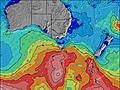 |  |  | 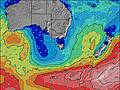 |  | ||||||||||||||
Wave Height (m) Direction Period (s) | SSW 14 | SW 13 | SW 13 | SW 13 | SW 13 | SW 13 | SW 13 | SW 13 | SW 12 | SW 12 | SW 12 | SW 12 | SW 12 | SW 12 | SE 8 | SSW 20 | ESE 8 | SW 14 | SW 14 | SW 13 | SW 13 | SW 13 |
Wave Graph | ||||||||||||||||||||||
1080 | 880 | 711 | 509 | 642 | 560 | 501 | 424 | 398 | 379 | 319 | 403 | 187 | 278 | 216 | 346 | 202 | 336 | 368 | 352 | 386 | 369 | |
Wind (km/h) | ||||||||||||||||||||||
Wind State on-shore cross-onshore cross-shore cross-offshore off-shore glassy | cross-off | cross-off | cross-off | glassy | glassy | cross-off | cross-off | cross-off | cross-off | cross-off | cross | cross | cross | cross-off | cross-off | cross | cross-off | cross-off | cross | cross | cross | cross-off |
High Tide | 10:32AM0.83m | 9:50PM0.86m | 11:08AM0.91m | 11:11PM0.78m | 11:48AM1.00m | |||||||||||||||||
Low Tide | 4:04PM0.52m | 4:26AM0.32m | 5:27PM0.44m | 5:06AM0.38m | 6:43PM0.32m | |||||||||||||||||
7:20 | — | — | — | — | — | — | — | 7:20 | — | — | — | — | — | — | — | 7:18 | — | — | — | — | — | |
— | — | — | 5:12 | — | — | — | — | — | — | — | 5:13 | — | — | — | — | — | — | — | 5:14 | — | — | |
mm | — | — | — | — | — | — | — | — | — | — | — | 1 | 1 | — | — | — | — | — | — | — | — | — |
Temp °C | 9 | 10 | 11 | 12 | 11 | 10 | 9 | 9 | 8 | 9 | 11 | 11 | 11 | 11 | 10 | 11 | 10 | 10 | 11 | 12 | 11 | 10 |
Feels °C | 4 | 4 | 6 | 10 | 9 | 8 | 5 | 5 | 3 | 4 | 6 | 6 | 7 | 7 | 6 | 9 | 8 | 7 | 8 | 8 | 6 | 5 |
Swell 1 Height (m) Direction Period (s) | SSW 14 | SW 13 | SW 13 | SW 13 | SW 13 | SW 13 | SW 13 | SW 13 | SW 12 | SW 12 | SW 12 | SE 8 | SE 8 | SE 8 | SE 8 | ESE 8 | ESE 8 | ESE 8 | ESE 8 | SW 13 | SW 13 | SW 13 |
1080 | 880 | 711 | 509 | 642 | 560 | 501 | 424 | 398 | 379 | 319 | 211 | 187 | 208 | 216 | 184 | 202 | 157 | 128 | 352 | 386 | 369 | |
Swell 2 Height (m) Direction Period (s) | SW 18 | SE 14 | SE 14 | SW 17 | SSW 18 | SSW 18 | SW 17 | SSW 16 | SSW 16 | SE 6 | SE 7 | SSW 15 | SW 12 | SW 12 | SW 12 | S 9 | S 9 | SW 14 | SW 14 | ESE 8 | ESE 8 | ESE 8 |
109 | 31 | 29 | 232 | 178 | 204 | 145 | 175 | 147 | 26 | 71 | 142 | 164 | 278 | 210 | 79 | 99 | 336 | 368 | 125 | 127 | 125 | |
Swell 3 Height (m) Direction Period (s) | SSE 14 | SE 10 | E 17 | NE 4 | NE 6 | ENE 6 | E 5 | E 5 | ESE 5 | SW 16 | SW 15 | SSW 21 | SW 14 | SSW 21 | S 9 | SSW 20 | SW 14 | S 6 | S 8 | S 8 | S 8 | SSW 18 |
20 | 4 | 6 | 11 | 9 | 7 | 4 | 4 | 5 | 67 | 110 | 85 | 102 | 171 | 64 | 346 | 147 | 29 | 92 | 88 | 66 | 124 | |
Wind waves Height (m) Direction Period (s) | NE 4 | NNE 4 | NNE 4 | NE 6 | — | — | — | SW 2 | SW 4 | WSW 4 | WSW 4 | SW 12 | SW 4 | — | — | — | — | — | — | — | SW 3 | S 8 |
22 | 29 | 21 | 47 | — | — | — | 2 | 12 | 22 | 16 | 403 | 12 | — | — | — | — | — | — | — | 2 | 108 | |
Nearest Offshore or Glassy | ||||||||||||||||||||||
Distance (km) | 26 | 20 | 20 | 20 | 20 | 20 | 22 | 29 | 29 | 29 | 232 | 69 | 69 | 43 | 22 | 20 | 22 | 22 | 120 | 127 | 175 | 91 |
Best forecast wave conditions in East Coast of Tasmania | ||||||||||||||||||||||
Best forecast wave conditions in Australia | ||||||||||||||||||||||
Header Global | ||||||||||||||||||||||
- Map Icons:
 Break
Break Live Wave Height (m)
 Live Wind Speed (km/h)
 Surf Rating (10 Max)
 Ocean Swells (m)
- Wind Speed (km/h)
Latest Updates


FREE! Surf-Forecast.com widget for your website
The surf report / weather widget below is available to embed on third party websites free of charge and provides a summary of our Bruny Island - Neck Bay surf forecast. Simply grab the html code snippet that we provide and paste it into your own site. You can choose your preferred language and metric/imperial units for the surf forecast feed to suit users of your site. Click here to get the code.
 Nearest