

Surf Forecasts:

La Salina surf forecast from 3 Aug 2026:
- Best quality surf: Saturday 8 Aug, 5AM (local time) - 3ft (0.9m), 18s period, SSW swell with glassy winds.
- Most powerful swell: Saturday 8 Aug, 8PM (local time) - 3.5ft (1.0m), 16s period, SSW swell with 487 kJ wave energy.
- Next surfable swell (1★+): Wednesday 5 Aug, 5AM (local time) - 2ft (0.6m), 14s period with SW swell.
Best Forecast Surf Conditions for La Salina this week:
The surf forecast for La Salina over the next 16 days: The first swell (rated 1 star or higher) is forecast to arrive on Wednesday (Aug 05) at 5AM. The primary swell is predicted to be 0.6m and 14s period with a secondary swell of 0.7m and 5s. The wind is predicted to be glassy as the swell arrives.
The most powerful waves expected at La Salina in the next 16 days are 1.0m 16s and forecast to arrive on Saturday (Aug 08) at 8PM. Winds are predicted to be glassy at the time the swell arrives.
| Wave Type | Time (PDT) & Date | Wave Height & Period |
|---|---|---|
| Next good surf (1 star+) | 5AM (Wed 5th Aug) | 2ft (0.6m) 14s |
| Best Surf | 5AM (Sat 8th Aug) | 3ft (0.9m) 18s |
| Most Powerful | 8PM (Sat 8th Aug) | 3.5ft (1.0m) 16s |
Table - best surf conditions forecast for La Salina over the next 16 days.
The Lowdown
Alright folks, Rusty here. Let's have a look at what's on the menu for La Salina over the next couple of weeks.
Right off the bat, it's a bit of a slow start. The first few days are looking pretty flat with weak, small pulses. The water's a touch warmer than usual for this time of year, sitting at 71.1°. We've got a consistent, exposed beach break setup that's usually reliable, but the swell energy is just not there to get things going properly.
The first real glimmer of hope comes in on the morning of Friday the 7th of August. We see a jump in the combined swell energy to 509, which is moderate, with a 2.3ft swell from the SSW. The period is a solid 19 seconds, which is a very long-period groundswell. That's going to mean some real power and shape, but at a beach break, it might be a bit too straight and closed out. Still, the wind is light and offshore from the W, so it could be clean. The morning of Saturday the 8th also has a similar setup, with a 2.9ft SSW swell at 16 seconds and energy at 500, but the wind is cross-onshore, which will mess up the surface. For a consistent spot like this, it's a case of pick your moment.
The standout for the whole period, and it's a bit of a stretch, is the Friday the 7th morning session. With that long period and clean offshore wind, it's the best combination of quality and conditions we've got. The swell is small, so it's fine for all levels.
After that, it's a pretty grim run. The swell stays small, the wind is mostly onshore or cross-onshore, and the energy is weak to moderate. The closest thing to another option is the afternoon of Friday the 14th of August, where the swell pushes to 3.6ft from the SW with a period of 18 seconds and energy hits 854. That's a lot more power, but the wind is onshore, which will make it a choppy, blown-out mess. It's a beach break, so with that much swell and onshore wind, it's going to be a battle. Might be one for the kite surfers, not for paddle surfing.
Honestly, this is a lean spell. If you're keen, keep your eyes on the 7th of August morning, but don't hold your breath for much else.
Short Range ForecastMostly dry. Warm (max 24°C on Mon morning, min 20°C on Mon night). Wind will be generally light. | Days 5-7 Weather SummaryMostly dry. Warm (max 24°C on Thu afternoon, min 20°C on Fri night). Wind will be generally light. | |||||||||||||||||||
Sun 2 | Monday 3 | Tuesday 4 | Wednesday 5 | Thursday 6 | Friday 7 | Saturday 8 | ||||||||||||||
PM | Night | AM | PM | Night | AM | PM | Night | AM | PM | Night | AM | PM | Night | AM | PM | Night | AM | PM | Night | |
Swell Height Map |  |  |  | 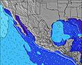 | 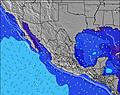 | 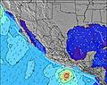 | 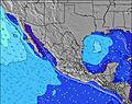 | |||||||||||||
Wave Height (m) Direction Period (s) | SW 13 | WNW 9 | WNW 9 | WNW 9 | WNW 9 | SW 15 | SW 15 | SW 14 | SW 14 | SW 14 | SW 14 | SW 13 | SW 21 | SW 13 | SSW 19 | SSW 18 | SSW 18 | SSW 16 | SSW 16 | SSW 16 |
Wave Graph | ||||||||||||||||||||
85 | 116 | 116 | 127 | 125 | 143 | 136 | 132 | 162 | 125 | 114 | 111 | 138 | 136 | 329 | 209 | 438 | 302 | 366 | 441 | |
Wind (km/h) | ||||||||||||||||||||
Wind State on-shore cross-onshore cross-shore cross-offshore off-shore glassy | on | cross-on | on | on | cross-on | on | on | cross-on | on | on | cross-on | on | on | on | on | on | on | cross-on | on | cross-off |
High Tide | 11:48PM1.69m | 12:47PM1.79m | 00:37AM1.48m | 1:26PM1.84m | 1:52AM1.27m | 2:18PM1.89m | 4:08AM1.15m | 3:26PM1.94m | 6:41AM1.21m | 4:43PM2.03m | 7:44AM1.33m | 5:54PM2.16m | ||||||||
Low Tide | 6:03PM0.89m | 6:10AM0.60m | 7:03PM0.87m | 6:36AM0.75m | 8:23PM0.83m | 7:05AM0.90m | 10:04PM0.73m | 7:48AM1.05m | 11:38PM0.55m | 9:20AM1.17m | 00:45AM0.34m | 11:13AM1.19m | 1:37AM0.15m | |||||||
— | — | 6:03 | — | — | 6:03 | — | — | 6:05 | — | — | 6:05 | — | — | 6:05 | — | — | 6:07 | — | — | |
7:44 | — | — | 7:43 | — | — | 7:42 | — | — | 7:40 | — | — | 7:39 | — | — | 7:38 | — | — | 7:37 | — | |
mm | — | — | — | — | — | — | — | — | — | — | — | — | — | — | — | — | — | — | — | — |
Temp °C | 23 | 21 | 24 | 24 | 21 | 23 | 24 | 21 | 23 | 23 | 21 | 23 | 24 | 22 | 24 | 24 | 22 | 24 | 24 | 21 |
Feels °C | 24 | 23 | 25 | 24 | 23 | 24 | 24 | 22 | 24 | 24 | 22 | 24 | 25 | 23 | 25 | 24 | 23 | 25 | 24 | 23 |
Swell 1 Height (m) Direction Period (s) | WNW 7 | WNW 9 | WNW 9 | WNW 9 | WNW 9 | SW 15 | SW 15 | WNW 9 | WNW 5 | SW 14 | SW 14 | SW 13 | SW 13 | SW 13 | SW 13 | SW 13 | SSW 18 | SSW 16 | SSW 16 | SSW 16 |
78 | 116 | 116 | 116 | 119 | 143 | 136 | 62 | 23 | 125 | 114 | 111 | 138 | 136 | 172 | 130 | 438 | 302 | 366 | 441 | |
Swell 2 Height (m) Direction Period (s) | S 12 | SW 13 | SW 13 | SW 13 | SSW 12 | SW 12 | SW 12 | SW 14 | SW 14 | SW 12 | S 12 | SSW 11 | WNW 5 | SSW 18 | SSW 19 | SSW 18 | S 14 | SW 12 | SW 12 | SW 12 |
73 | 79 | 79 | 80 | 83 | 36 | 36 | 132 | 162 | 34 | 25 | 25 | 16 | 126 | 329 | 209 | 98 | 69 | 114 | 68 | |
Swell 3 Height (m) Direction Period (s) | SW 13 | SSW 12 | SW 16 | SW 16 | SW 16 | SSW 13 | S 10 | SSW 13 | SSW 12 | S 9 | SSW 20 | SSW 20 | SW 21 | WNW 5 | WNW 5 | WNW 5 | SW 12 | WNW 5 | WNW 14 | SSW 9 |
85 | 44 | 93 | 127 | 125 | 35 | 19 | 90 | 28 | 7 | 37 | 38 | 110 | 11 | 8 | 8 | 49 | 4 | 20 | 16 | |
Wind waves Height (m) Direction Period (s) | — | — | — | — | — | WNW 9 | WNW 9 | — | — | WNW 6 | WNW 5 | WNW 5 | — | — | — | — | — | — | — | — |
— | — | — | — | — | 92 | 92 | — | — | 24 | 21 | 15 | — | — | — | — | — | — | — | — | |
Nearest Offshore or Glassy | ||||||||||||||||||||
Distance (km) | 29 | 29 | 29 | 29 | 29 | 78 | 29 | 8 | 29 | 29 | 8 | 78 | 29 | 29 | 242 | 29 | 7 | 241 | 29 | 0 |
Best forecast wave conditions in Baja Norte | ||||||||||||||||||||
Best forecast wave conditions in Mexico | ||||||||||||||||||||
Header Global | ||||||||||||||||||||
- Map Icons:
 Break
Break Live Wave Height (m)
 Live Wind Speed (km/h)
 Surf Rating (10 Max)
 Ocean Swells (m)
- Wind Speed (km/h)
Latest Updates


FREE! Surf-Forecast.com widget for your website
The surf report / weather widget below is available to embed on third party websites free of charge and provides a summary of our La Salina surf forecast. Simply grab the html code snippet that we provide and paste it into your own site. You can choose your preferred language and metric/imperial units for the surf forecast feed to suit users of your site. Click here to get the code.
Information about the La Salina Surf forecast
The above surf forecast table for La Salina provides essential information for determining whether the surfing conditions will be good over the next 16 days. A general guide to surfing at La Salina can be found by selecting the local surf guide option on the grey menu. Our La Salina surf forecast is unique since it includes wave energy (power) that defines the real feel of the surf rather than just the height or the period. If you surf the same spot (La Salina) regularly then make a mental note of the wave energy from the surf forecast table each time you go. Very soon you may start to choose your surf days based on the wave energy alone combined with our forecast of favourable offshore wind conditions. Our star ratings will help here and of course you will also find the usual wave height and period predictions on our surf forecasts as well as a full break down of the swell components under our advanced users option (to reveal that, click the little Einstein character under the tide times).
Further information to help with frequently asked questions about our surf forecast for La Salina may be found under the help tab on the top menu and also by moving your mouse over the question marks on the surf forecast table itself. Please always bear in mind that the forecast is for near-shore open water and local factors at each surf break influence the actual breaking wave height, such as the beach / reef profile, water depths offshore and shelter.
La Salina is 31 km (19 miles) from the city of Ensenada. If you plan a holiday in Baja Norte, look for hotels and other accommodation in Ensenada. Ensenada has rooms for a wide range of budgets as well as car hire and transport links.
 Nearest