

Surf Forecasts:

Koroni Right surf forecast from 14 Jul 2026:
- Most powerful swell: Tuesday 14 Jul, 9PM (local time) - 0.5ft (0.1m), 4s period, SE swell with 1 kJ wave energy.
Best Forecast Surf Conditions for Koroni Right this week:
The most powerful waves expected at Koroni Right in the next 16 days are 0.1m 4s and forecast to arrive on Tuesday (Jul 14) at 9PM. Winds are predicted to be cross-offshore at the time the swell arrives. The largest open ocean swell (not directed at the beach) is 1.2m 6s period and expected on Tuesday (Jul 21) at 9PM.
| Wave Type | Time (EEST) & Date | Wave Height & Period |
|---|---|---|
| Next good surf (1 star+) | - | - |
| Best Surf | - | - |
| Most Powerful | 9PM (Tue 14th Jul) | 0.5ft (0.1m) 4s |
Table - best surf conditions forecast for Koroni Right over the next 16 days.
The Lowdown
Alright folks, Rusty here. Gotta be straight with you on this one. Looking at the whole 16-day window, it's a tough stretch for Koroni Right. The numbers just aren't there.
We're starting from now, and for the first ten days or so, there's absolutely nothing to get excited about. The wave energy is sitting at zero (0) and the swell charts are a blank line. The conditions are often glassy and clean, with that offshore wind from the NW popping up a few times, but without any swell it's just a flat lake. It's a real bummer, because the water is warm, sitting at 80°, which is much warmer than usual for this time of year.
The first tiny flicker of hope shows up on Friday the 24th of July in the afternoon. We're talking a tiny little 1ft swell from the southwest, with a period of just 2 seconds. That's not even a wave, that's a ripple. The energy is a measly 1. That's a no-go. The wind is cross-off and clean, but there's just nothing to ride.
After that, it's back to the same story. Plenty of clean, offshore winds through the mornings and afternoons, especially from the 22nd onwards, but the swell remains completely absent right through to the end of the outlook on the 29th of July.
So, the honest truth? There are no standouts, no best days, nothing to recommend. This is a classic flat spell for the area. Koroni Right is an inconsistent spot, and this run is a blank one. It's a good time to tune up your gear or chase a different coast. Forecasts can change, but right now, we're staring at a long gap with no surf on offer for the entire 16-day period.
Rusty.
Short Range ForecastMostly dry. Warm (max 30°C on Thu afternoon, min 25°C on Tue night). Wind will be generally light. | Days 5-7 Weather SummaryMostly dry. Warm (max 31°C on Sat afternoon, min 26°C on Sun night). Wind will be generally light. | ||||||||||||||||||||
Tue 14 | Wednesday 15 | Thursday 16 | Friday 17 | Saturday 18 | Sunday 19 | Monday 20 | |||||||||||||||
PM | Night | AM | PM | Night | AM | PM | Night | AM | PM | Night | AM | PM | Night | AM | PM | Night | AM | PM | Night | AM | |
Swell Height Map | 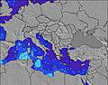 | 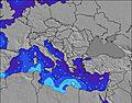 | 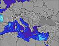 | 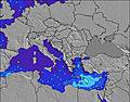 | 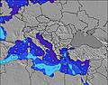 | 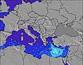 | 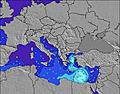 | 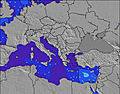 | |||||||||||||
Wave Height (m) Direction Period (s) | WNW 6 | WNW 6 | W 5 | WSW 2 | WNW 3 | WNW 3 | W 2 | W 5 | W 5 | W 5 | W 4 | NW 5 | WNW 5 | WSW 3 | — | — | W 6 | W 5 | WSW 5 | WSW 4 | WNW 5 |
Wave Graph | |||||||||||||||||||||
0 | 0 | 0 | 0 | 0 | 0 | 0 | 0 | 0 | 0 | 0 | 0 | 0 | 0 | 0 | 0 | 0 | 0 | 0 | 0 | 0 | |
Wind (km/h) | |||||||||||||||||||||
Wind State on-shore cross-onshore cross-shore cross-offshore off-shore glassy | cross | off | glassy | cross-off | cross-off | glassy | cross-off | cross-off | glassy | cross | off | cross-off | cross-off | cross-off | glassy | cross | off | glassy | cross | off | glassy |
High Tide | 4:20PM0.13m | 5:23AM0.09m | 5:00PM0.12m | 6:05AM0.09m | 5:38PM0.12m | 6:46AM0.09m | 6:14PM0.11m | 7:28AM0.09m | 6:52PM0.10m | 8:12AM0.09m | 7:27PM0.08m | 9:04AM0.09m | 8:03PM0.07m | 10:03AM0.09m | |||||||
Low Tide | 11:16PM-0.00m | 10:55AM0.03m | 11:54PM-0.00m | 11:40AM0.03m | 00:30AM-0.00m | 12:25PM0.03m | 1:05AM0.00m | 1:10PM0.04m | 1:37AM0.01m | 2:01PM0.04m | 2:10AM0.02m | 3:01PM0.05m | 2:48AM0.03m | ||||||||
— | — | 6:24 | — | — | 6:24 | — | — | 6:24 | — | — | 6:26 | — | — | 6:26 | — | — | 6:28 | — | — | 6:28 | |
8:51 | — | — | 8:51 | — | — | 8:51 | — | — | 8:50 | — | — | 8:49 | — | — | 8:49 | — | — | 8:47 | — | 8:47 | |
mm | — | — | — | — | — | — | — | — | — | — | — | — | — | — | — | — | — | — | — | — | — |
Temp °C | 28 | 26 | 27 | 29 | 27 | 29 | 30 | 29 | 29 | 28 | 29 | 29 | 31 | 29 | 28 | 30 | 28 | 27 | 28 | 27 | 27 |
Feels °C | 27 | 27 | 28 | 29 | 29 | 30 | 29 | 31 | 30 | 28 | 31 | 29 | 30 | 31 | 31 | 31 | 31 | 30 | 31 | 31 | 30 |
Swell 1 Height (m) Direction Period (s) | WNW 6 | W 5 | W 5 | — | — | WNW 3 | — | W 5 | W 5 | W 5 | W 4 | — | WNW 5 | WSW 3 | — | — | W 6 | W 5 | WSW 5 | WSW 4 | SW 4 |
3 | 4 | 2 | — | — | 1 | — | 4 | 4 | 2 | 1 | — | 2 | 1 | — | — | 2 | 8 | 7 | 3 | 4 | |
Swell 2 Height (m) Direction Period (s) | — | — | — | — | — | — | — | — | — | — | W 6 | NW 5 | — | — | — | — | — | — | — | NW 6 | WNW 5 |
— | — | — | — | — | — | — | — | — | — | 1 | 1 | — | — | — | — | — | — | — | 1 | 2 | |
Swell 3 Height (m) Direction Period (s) | — | — | — | — | — | — | — | E 6 | — | — | W 7 | — | — | — | — | — | — | — | — | SSW 3 | W 7 |
— | — | — | — | — | — | — | 1 | — | — | 1 | — | — | — | — | — | — | — | — | 1 | 1 | |
Wind waves Height (m) Direction Period (s) | WSW 3 | WNW 6 | — | WSW 2 | WNW 3 | — | W 2 | WNW 3 | — | — | — | — | WSW 2 | — | — | — | W 3 | — | — | — | WNW 5 |
2 | 6 | — | 1 | 1 | — | 1 | 2 | — | — | — | — | 1 | — | — | — | 2 | — | — | — | 10 | |
Nearest Offshore or Glassy | |||||||||||||||||||||
Distance (km) | 2618 | 1268 | 957 | 2615 | 355 | 1268 | 2647 | 1286 | 2395 | 2643 | 227 | 2256 | 2647 | 205 | 957 | 2367 | 875 | 875 | 2167 | 925 | 991 |
Best forecast wave conditions in Pelloponisos | |||||||||||||||||||||
Best forecast wave conditions in Greece | |||||||||||||||||||||
Header Global | |||||||||||||||||||||
- Map Icons:
 Break
Break Live Wave Height (m)
 Live Wind Speed (km/h)
 Surf Rating (10 Max)
 Ocean Swells (m)
- Wind Speed (km/h)


FREE! Surf-Forecast.com widget for your website
The surf report / weather widget below is available to embed on third party websites free of charge and provides a summary of our Koroni Right surf forecast. Simply grab the html code snippet that we provide and paste it into your own site. You can choose your preferred language and metric/imperial units for the surf forecast feed to suit users of your site. Click here to get the code.
Information about the Koroni Right Surf forecast
The above surf forecast table for Koroni Right provides essential information for determining whether the surfing conditions will be good over the next 16 days. A general guide to surfing at Koroni Right can be found by selecting the local surf guide option on the grey menu. Our Koroni Right surf forecast is unique since it includes wave energy (power) that defines the real feel of the surf rather than just the height or the period. If you surf the same spot (Koroni Right) regularly then make a mental note of the wave energy from the surf forecast table each time you go. Very soon you may start to choose your surf days based on the wave energy alone combined with our forecast of favourable offshore wind conditions. Our star ratings will help here and of course you will also find the usual wave height and period predictions on our surf forecasts as well as a full break down of the swell components under our advanced users option (to reveal that, click the little Einstein character under the tide times).
Further information to help with frequently asked questions about our surf forecast for Koroni Right may be found under the help tab on the top menu and also by moving your mouse over the question marks on the surf forecast table itself. Please always bear in mind that the forecast is for near-shore open water and local factors at each surf break influence the actual breaking wave height, such as the beach / reef profile, water depths offshore and shelter.
 Nearest