

Surf Forecasts:

Danger surf forecast from 28 Jul 2026:
- Best quality surf: Thursday 30 Jul, 12AM (local time) - 2ft (0.6m), 6s period, WNW swell with glassy winds.
- Most powerful swell: Thursday 30 Jul, 6AM (local time) - 3ft (0.9m), 7s period, WNW swell with 96 kJ wave energy.
- Next surfable swell (1★+): Thursday 30 Jul, 12AM (local time) - 2ft (0.6m), 6s period with WNW swell.
Best Forecast Surf Conditions for Danger this week:
The surf forecast for Danger over the next 16 days: The first swell (rated 1 star or higher) is forecast to arrive on Thursday (Jul 30) at 12AM. The primary swell is predicted to be 0.6m and 6s period with a secondary swell of 0.4m and 8s. The wind is predicted to be glassy as the swell arrives.
The most powerful waves expected at Danger in the next 16 days are 0.9m 7s and forecast to arrive on Thursday (Jul 30) at 6AM. Winds are predicted to be glassy at the time the swell arrives. The largest open ocean swell (not directed at the beach) is 0.3m 4s period and expected on Saturday (Aug 01) at 12AM.
| Wave Type | Time (IDT) & Date | Wave Height & Period |
|---|---|---|
| Next good surf (1 star+) | 12AM (Thu 30th Jul) | 2ft (0.6m) 6s |
| Best Surf | 12AM (Thu 30th Jul) | 2ft (0.6m) 6s |
| Most Powerful | 6AM (Thu 30th Jul) | 3ft (0.9m) 7s |
Table - best surf conditions forecast for Danger over the next 16 days.
The Lowdown
Alright, grab a coffee, 'cause this one's a bummer. I'm Rusty, and we've got a long stretch of nothing on our hands.
There's a massive gap at the start with no real surf. From Tuesday, July 28th, all the way through to the morning of Friday, August 7th, it's a dead zone. Nearly a week and a half of flat, weak, and messy conditions. The swell is tiny, the wind is all wrong, and it's a solid zero across the board. It's the kind of run that makes you want to take up golf.
The first time you might even think about paddling out is on the morning of Friday, August 7th. The spot is Danger, a breakwater. It's inconsistent, so don't hold your breath. The morning brings a tiny 3ft swell from the WNW, with a period of 7 seconds. The combined energy is a weak 57, so it's barely a breath of air. The one saving grace? The wind is glassy. That's the only reason I'm mentioning it. You'll find clean, tiny little waves, but you'll need a longboard or a foamie. Water temp is 84°, which is a touch warmer than normal for this time of year.
After that, we're back to the flatness. The glassy conditions show up again on the morning of Saturday, August 8th, and Sunday, August 9th, but the swell is gone. By Sunday morning, we're looking at a pathetic 1ft swell. The combined energy is almost zero. It's a skim board flat spell.
The only other thing to keep an eye on is much later, on the morning of Wednesday, August 12th. The swell finally picks up to 3ft from the WNW, with a period of 8 seconds. The combined energy jumps to a moderate 110, which is the most we've seen in the whole forecast. The wind is from the SSW at 12 mph, creating a cross-shore chop. It won't be clean, but it'll be the biggest and most powerful surf of the entire 16-day run. It's still small, but it's a step up.
So, here's the rundown: the morning of Friday, August 7th is your best bet for a clean, glassy, tiny wave. The morning of Wednesday, August 12th is your best bet if you want a bit more push and power, even if it's a bit choppy. For everything else, it's a no-go. It's a bleak outlook, but that's the way it goes sometimes.
Rusty.
Short Range ForecastMostly dry. Warm (max 30°C on Thu morning, min 25°C on Tue night). Wind will be generally light. | Days 4-6 Weather SummaryMostly dry. Warm (max 31°C on Fri afternoon, min 27°C on Fri night). Wind will be generally light. | ||||||||||||||||||||
Tuesday 28 | Wednesday 29 | Thursday 30 | Friday 31 | Saturday 1 | Sunday 2 | Monday 3 | |||||||||||||||
AM | PM | Night | AM | PM | Night | AM | PM | Night | AM | PM | Night | AM | PM | Night | AM | PM | Night | AM | PM | Night | |
Swell Height Map | 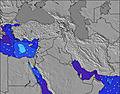 | 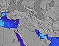 | 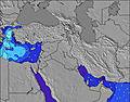 | 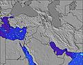 | 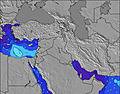 | 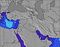 | 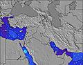 | ||||||||||||||
Wave Height (m) Direction Period (s) | WNW 7 | WNW 6 | WNW 6 | WNW 6 | W 6 | WNW 7 | NW 7 | WNW 7 | WNW 9 | NW 8 | NW 8 | WNW 7 | WNW 7 | WNW 7 | WNW 7 | NW 7 | NW 6 | NW 5 | NW 5 | WNW 5 | NW 5 |
Wave Graph | |||||||||||||||||||||
29 | 34 | 20 | 12 | 22 | 68 | 77 | 42 | 52 | 65 | 64 | 48 | 36 | 36 | 31 | 21 | 19 | 18 | 22 | 16 | 32 | |
Wind (km/h) | |||||||||||||||||||||
Wind State on-shore cross-onshore cross-shore cross-offshore off-shore glassy | cross-on | on | cross | cross | on | glassy | cross-on | cross-on | glassy | cross-on | on | cross | cross-on | cross-on | cross | on | cross-on | cross | on | cross-on | cross-on |
High Tide | 10:25AM0.37m | 11:07PM0.31m | 10:56AM0.39m | 11:33PM0.32m | 11:25AM0.40m | 11:59PM0.33m | 11:55AM0.40m | 00:26AM0.34m | 12:24PM0.39m | 00:54AM0.34m | 12:55PM0.37m | 1:24AM0.34m | 1:29PM0.34m | 1:58AM0.33m | |||||||
Low Tide | 5:00PM0.03m | 4:45AM0.08m | 5:27PM0.01m | 5:15AM0.07m | 5:53PM0.01m | 5:45AM0.06m | 6:20PM0.01m | 6:16AM0.06m | 6:46PM0.02m | 6:49AM0.06m | 7:14PM0.03m | 7:25AM0.07m | 7:43PM0.06m | ||||||||
5:52 | — | — | 5:52 | — | — | 5:54 | — | — | 5:54 | — | — | 5:54 | — | — | 5:56 | — | — | 5:56 | — | — | |
— | 7:40 | — | — | 7:39 | — | — | 7:39 | — | — | 7:38 | — | — | 7:37 | — | — | 7:37 | — | — | 7:37 | — | |
mm | — | — | — | — | — | — | — | — | — | — | — | — | — | — | — | — | — | — | — | — | — |
Temp °C | 29 | 29 | 27 | 28 | 29 | 28 | 30 | 30 | 29 | 30 | 31 | 29 | 31 | 31 | 29 | 30 | 31 | 29 | 31 | 31 | 29 |
Feels °C | 28 | 28 | 29 | 28 | 30 | 32 | 31 | 30 | 32 | 31 | 31 | 31 | 31 | 31 | 31 | 31 | 31 | 32 | 33 | 31 | 31 |
Swell 1 Height (m) Direction Period (s) | WNW 7 | — | WNW 6 | WNW 6 | — | WNW 7 | NW 7 | WNW 7 | WNW 9 | NW 8 | NW 8 | WNW 7 | WNW 7 | — | WNW 7 | NW 7 | N 5 | NW 5 | NW 5 | NNW 6 | NW 5 |
29 | — | 20 | 12 | — | 68 | 77 | 42 | 52 | 65 | 64 | 48 | 36 | — | 31 | 21 | 1 | 18 | 22 | 13 | 32 | |
Swell 2 Height (m) Direction Period (s) | — | — | W 7 | — | — | — | — | NW 7 | — | WNW 10 | — | N 4 | N 3 | — | — | — | — | WNW 6 | — | — | — |
— | — | 1 | — | — | — | — | 2 | — | 10 | — | 2 | 1 | — | — | — | — | 4 | — | — | — | |
Swell 3 Height (m) Direction Period (s) | — | — | — | — | — | — | — | — | — | — | — | — | — | — | — | — | — | — | — | — | — |
— | — | — | — | — | — | — | — | — | — | — | — | — | — | — | — | — | — | — | — | — | |
Wind waves Height (m) Direction Period (s) | — | WNW 6 | — | — | W 6 | — | — | — | — | — | — | — | — | WNW 7 | — | — | NW 6 | — | — | WNW 5 | — |
— | 34 | — | — | 22 | — | — | — | — | — | — | — | — | 36 | — | — | 19 | — | — | 16 | — | |
Nearest Offshore or Glassy | |||||||||||||||||||||
Distance (km) | 1513 | 2224 | 2755 | 369 | 3599 | 0 | 20 | 1324 | 0 | 2224 | 2224 | 3 | 2224 | 2224 | 934 | 1324 | 1324 | 2040 | 2224 | 2224 | 2224 |
Best forecast wave conditions in Tel Aviv and South | |||||||||||||||||||||
Best forecast wave conditions in Israel | |||||||||||||||||||||
Header Global | |||||||||||||||||||||
- Map Icons:
 Break
Break Live Wave Height (m)
 Live Wind Speed (km/h)
 Surf Rating (10 Max)
 Ocean Swells (m)
- Wind Speed (km/h)


FREE! Surf-Forecast.com widget for your website
The surf report / weather widget below is available to embed on third party websites free of charge and provides a summary of our Danger surf forecast. Simply grab the html code snippet that we provide and paste it into your own site. You can choose your preferred language and metric/imperial units for the surf forecast feed to suit users of your site. Click here to get the code.
Information about the Danger Surf forecast
The above surf forecast table for Danger provides essential information for determining whether the surfing conditions will be good over the next 16 days. A general guide to surfing at Danger can be found by selecting the local surf guide option on the grey menu. Our Danger surf forecast is unique since it includes wave energy (power) that defines the real feel of the surf rather than just the height or the period. If you surf the same spot (Danger) regularly then make a mental note of the wave energy from the surf forecast table each time you go. Very soon you may start to choose your surf days based on the wave energy alone combined with our forecast of favourable offshore wind conditions. Our star ratings will help here and of course you will also find the usual wave height and period predictions on our surf forecasts as well as a full break down of the swell components under our advanced users option (to reveal that, click the little Einstein character under the tide times).
Further information to help with frequently asked questions about our surf forecast for Danger may be found under the help tab on the top menu and also by moving your mouse over the question marks on the surf forecast table itself. Please always bear in mind that the forecast is for near-shore open water and local factors at each surf break influence the actual breaking wave height, such as the beach / reef profile, water depths offshore and shelter.
Danger is 4 km (2 miles) from the city of Tel Aviv. If you plan a holiday in Tel Aviv and South, look for hotels and other accommodation in Tel Aviv. Tel Aviv has rooms for a wide range of budgets as well as car hire and transport links.
 Nearest