

Surf Forecasts:

Agios Ioannis surf forecast from 3 Aug 2026:
- Best quality surf: Monday 10 Aug, 9AM (local time) - 2.5ft (0.8m), 6s period, ENE swell with glassy winds.
- Most powerful swell: Monday 10 Aug, 9AM (local time) - 2.5ft (0.8m), 6s period, ENE swell with 42 kJ wave energy.
- Next surfable swell (1★+): Monday 10 Aug, 9AM (local time) - 2.5ft (0.8m), 6s period with ENE swell.
Best Forecast Surf Conditions for Agios Ioannis this week:
The surf forecast for Agios Ioannis over the next 16 days: The first swell (rated 1 star or higher) is forecast to arrive on Monday (Aug 10) at 9AM. The primary swell is predicted to be 0.8m and 6s period. The wind is predicted to be glassy as the swell arrives.
The most powerful waves expected at Agios Ioannis in the next 16 days are 0.8m 6s and forecast to arrive on Monday (Aug 10) at 9AM. Winds are predicted to be glassy at the time the swell arrives. The largest open ocean swell (not directed at the beach) is 0.2m 2s period and expected on Tuesday (Aug 04) at 12PM.
| Wave Type | Time (EEST) & Date | Wave Height & Period |
|---|---|---|
| Next good surf (1 star+) | 9AM (Mon 10th Aug) | 2.5ft (0.8m) 6s |
| Best Surf | 9AM (Mon 10th Aug) | 2.5ft (0.8m) 6s |
| Most Powerful | 9AM (Mon 10th Aug) | 2.5ft (0.8m) 6s |
Table - best surf conditions forecast for Agios Ioannis over the next 16 days.
The Lowdown
Alright folks, Rusty here. Let’s have a look at what’s on the cards for Agios Ioannis over the next couple of weeks. I’ll be straight with you – it’s a slow start. Real slow.
We’re looking at a pretty quiet period kicking off from Monday the 3rd of August. For the first week, there’s just nothing doing. The swell is tiny, barely a ripple, with wave heights hanging around 0.7ft to 2ft and periods under 8 seconds. That’s flat spell territory, and the combined energy is sitting in the weak range (3 to 12). The water is a touch warmer than normal at 80°, so it’s comfortable for a swim, but there’s no surf to speak of. We’ve got a few glassy mornings here and there, but without any swell, it’s just a pretty lake. This quiet run stretches from Monday the 3rd right through to Sunday the 9th of August. A full week of nothing.
Things start to stir a little on Monday the 10th of August. The morning shows a little bump of 3ft from the ENE at 6 seconds, with a combined energy of 42. It’s glassy, and while the waves are surfable, they’re very ordinary. The afternoon sees a bit of cross-onshore wind, which doesn’t help. This small-scale stuff continues through the middle of the week, with heights staying under 3ft and energy levels low. Not worth getting excited about.
Now, here’s where it gets interesting. The real standout window opens up on Monday the 17th of August. Monday morning is the pick of the entire forecast. We’ve got a clean 6ft swell from the NNW, with a period of 6 seconds, and the combined energy jumps to 224 – that’s moderate, solid energy. The wind is glassy, dead calm, which means those waves will be clean as a whistle. This is a proper point break setup, and with the swell coming from the NNW, it’s matching the optimum direction for Agios Ioannis. It’s not a huge swell, but it’s enough to get your heart pumping. For a point break, that’s a sweet spot. The only downer is that it’s inconsistent, so you’ll be waiting for sets, but when they come, they’ll be worth it. Crowds are possible at this spot, so get there early if you want a piece.
Tuesday the 18th of August is still worth a look. The morning offers 5ft from the NNW with a cross-offshore breeze, which will keep things clean. Energy is down to 98, but it’s still surfable. The afternoon glass off brings 3ft, which is a fun size for a point break.
So, to sum it up: the first week is a write-off. The second week starts slow, but the real action is on Monday the 17th of August. That’s your best bet. It’s a bit of a wait, but when it arrives, it’ll be worth it. Keep your eyes on the horizon.
Rusty.
Short Range ForecastMostly dry. Warm (max 32°C on Wed afternoon, min 27°C on Mon morning). Wind will be generally light. | Days 4-6 Weather SummaryMostly dry. Warm (max 34°C on Sat night, min 27°C on Thu night). Wind will be generally light. | ||||||||||||||||||||
Monday 3 | Tuesday 4 | Wednesday 5 | Thursday 6 | Friday 7 | Saturday 8 | Sunday 9 | |||||||||||||||
AM | PM | Night | AM | PM | Night | AM | PM | Night | AM | PM | Night | AM | PM | Night | AM | PM | Night | AM | PM | Night | |
Swell Height Map | 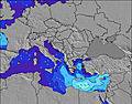 | 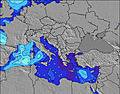 | 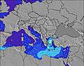 | 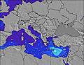 | 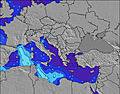 | 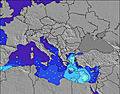 | 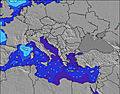 | ||||||||||||||
Wave Height (m) Direction Period (s) | ENE 4 | ENE 5 | ENE 4 | — | — | — | NNW 3 | ENE 3 | NE 4 | ENE 4 | E 5 | ENE 3 | ENE 4 | ENE 3 | ENE 4 | NE 3 | ENE 3 | — | NNW 3 | N 3 | ENE 4 |
Wave Graph | |||||||||||||||||||||
2 | 4 | 2 | 0 | 0 | 0 | 1 | 1 | 15 | 6 | 12 | 3 | 2 | 1 | 2 | 2 | 1 | 0 | 3 | 1 | 3 | |
Wind (km/h) | |||||||||||||||||||||
Wind State on-shore cross-onshore cross-shore cross-offshore off-shore glassy | glassy | cross-on | glassy | cross | glassy | cross-off | cross | glassy | cross | glassy | glassy | glassy | glassy | cross-on | cross | cross-off | glassy | cross | cross | glassy | on |
High Tide | 7:54PM0.26m | 8:32AM0.27m | 8:33PM0.23m | 9:10AM0.26m | 9:25PM0.19m | 10:02AM0.24m | 11:07PM0.17m | 11:28AM0.23m | 2:29AM0.17m | 1:27PM0.23m | 3:43AM0.20m | 2:49PM0.25m | 4:23AM0.23m | ||||||||
Low Tide | 2:02PM0.07m | 2:05AM0.04m | 2:45PM0.08m | 2:36AM0.07m | 3:41PM0.09m | 3:11AM0.10m | 5:11PM0.11m | 4:07AM0.13m | 7:31PM0.10m | 6:45AM0.15m | 9:00PM0.07m | 8:44AM0.14m | 9:51PM0.04m | ||||||||
6:28 | — | — | 6:28 | — | — | 6:30 | — | — | 6:30 | — | — | 6:31 | — | — | 6:31 | — | — | 6:33 | — | — | |
— | 8:37 | — | — | 8:37 | — | — | 8:36 | — | — | 8:35 | — | — | 8:32 | — | — | 8:31 | — | — | 8:30 | — | |
mm | — | — | — | — | — | — | — | — | — | — | — | — | — | — | — | — | — | — | — | — | — |
Temp °C | 27 | 29 | 30 | 27 | 29 | 31 | 28 | 32 | 32 | 29 | 32 | 32 | 29 | 32 | 32 | 30 | 32 | 34 | 30 | 34 | 34 |
Feels °C | 28 | 29 | 28 | 27 | 29 | 30 | 28 | 32 | 31 | 30 | 31 | 31 | 31 | 32 | 31 | 30 | 30 | 32 | 31 | 34 | 34 |
Swell 1 Height (m) Direction Period (s) | ENE 4 | ENE 5 | ENE 4 | — | — | — | — | ENE 3 | ENE 4 | ENE 4 | E 5 | ENE 4 | ENE 4 | ENE 3 | ENE 4 | NE 3 | ENE 3 | — | — | N 3 | ENE 4 |
2 | 4 | 2 | — | — | — | — | 1 | 10 | 6 | 12 | 2 | 2 | 1 | 2 | 2 | 1 | — | — | 1 | 3 | |
Swell 2 Height (m) Direction Period (s) | E 6 | — | — | — | — | — | — | NNW 3 | NNE 4 | N 4 | — | — | — | — | — | — | — | — | — | — | — |
1 | — | — | — | — | — | — | 1 | 4 | 1 | — | — | — | — | — | — | — | — | — | — | — | |
Swell 3 Height (m) Direction Period (s) | — | — | — | — | — | — | — | — | — | — | — | — | — | — | — | — | — | — | — | — | — |
— | — | — | — | — | — | — | — | — | — | — | — | — | — | — | — | — | — | — | — | — | |
Wind waves Height (m) Direction Period (s) | — | — | — | — | — | — | NNW 3 | — | NE 4 | — | — | ENE 3 | — | — | — | — | — | — | NNW 3 | — | — |
— | — | — | — | — | — | 1 | — | 15 | — | — | 3 | — | — | — | — | — | — | 3 | — | — | |
Nearest Offshore or Glassy | |||||||||||||||||||||
Distance (km) | 2106 | 2295 | 2088 | 2088 | 2324 | 2093 | 2093 | 2302 | 2089 | 2089 | 2192 | 1097 | 1241 | 2192 | 1241 | 1231 | 2727 | 1288 | 1289 | 2370 | 1097 |
Best forecast wave conditions in Aegean Sea | |||||||||||||||||||||
Best forecast wave conditions in Greece | |||||||||||||||||||||
Header Global | |||||||||||||||||||||
- Map Icons:
 Break
Break Live Wave Height (m)
 Live Wind Speed (km/h)
 Surf Rating (10 Max)
 Ocean Swells (m)
- Wind Speed (km/h)
Latest Updates


FREE! Surf-Forecast.com widget for your website
The surf report / weather widget below is available to embed on third party websites free of charge and provides a summary of our Agios Ioannis surf forecast. Simply grab the html code snippet that we provide and paste it into your own site. You can choose your preferred language and metric/imperial units for the surf forecast feed to suit users of your site. Click here to get the code.
Information about the Agios Ioannis Surf forecast
The above surf forecast table for Agios Ioannis provides essential information for determining whether the surfing conditions will be good over the next 16 days. A general guide to surfing at Agios Ioannis can be found by selecting the local surf guide option on the grey menu. Our Agios Ioannis surf forecast is unique since it includes wave energy (power) that defines the real feel of the surf rather than just the height or the period. If you surf the same spot (Agios Ioannis) regularly then make a mental note of the wave energy from the surf forecast table each time you go. Very soon you may start to choose your surf days based on the wave energy alone combined with our forecast of favourable offshore wind conditions. Our star ratings will help here and of course you will also find the usual wave height and period predictions on our surf forecasts as well as a full break down of the swell components under our advanced users option (to reveal that, click the little Einstein character under the tide times).
Further information to help with frequently asked questions about our surf forecast for Agios Ioannis may be found under the help tab on the top menu and also by moving your mouse over the question marks on the surf forecast table itself. Please always bear in mind that the forecast is for near-shore open water and local factors at each surf break influence the actual breaking wave height, such as the beach / reef profile, water depths offshore and shelter.
Agios Ioannis is 19 km (12 miles) from the city of Volos. If you plan a holiday in Aegean Sea, look for hotels and other accommodation in Volos. Volos has rooms for a wide range of budgets as well as car hire and transport links.
 Nearest