

Surf Forecasts:

Kamakura surf forecast from 3 Aug 2026:
- Best quality surf: Thursday 6 Aug, 12PM (local time) - 7ft (2.2m), 14s period, S swell with cross-offshore winds.
- Most powerful swell: Wednesday 5 Aug, 12PM (local time) - 8ft (2.5m), 16s period, SSE swell with 3,460 kJ wave energy.
- Next surfable swell (1★+): Thursday 6 Aug, 12PM (local time) - 7ft (2.2m), 14s period with S swell.
Best Forecast Surf Conditions for Kamakura this week:
The surf forecast for Kamakura over the next 16 days: The first swell (rated 1 star or higher) is forecast to arrive on Thursday (Aug 06) at 12PM. The primary swell is predicted to be 2.2m and 14s period with a secondary swell of 0.6m and 10s. The wind is predicted to be cross-offshore as the swell arrives.
The most powerful waves expected at Kamakura in the next 16 days are 2.5m 16s and forecast to arrive on Wednesday (Aug 05) at 12PM. Winds are predicted to be cross-offshore at the time the swell arrives. The largest open ocean swell (not directed at the beach) is 1.0m 4s period and expected on Wednesday (Aug 05) at 9AM.
| Wave Type | Time (JST) & Date | Wave Height & Period |
|---|---|---|
| Next good surf (1 star+) | 12PM (Thu 6th Aug) | 7ft (2.2m) 14s |
| Best Surf | 12PM (Thu 6th Aug) | 7ft (2.2m) 14s |
| Most Powerful | 12PM (Wed 5th Aug) | 8ft (2.5m) 16s |
Table - best surf conditions forecast for Kamakura over the next 16 days.
The Lowdown
Alright folks, Rusty here. Let’s get into it. We’ve got a window of surf coming up for Kamakura, but it’s a slow start and a bit of a mixed bag. The first few days are pretty ordinary, but there’s a standout session that looks worth circling on the calendar.
Looking at the whole 16-day run, the good stuff kicks off on Monday the 3rd of August, but that first day is a write-off. The swell is small at 3ft from the SE, with a long 16-second period, and the combined energy is weak (449). The wind is a cross-off from the NNE at 30 km/h, which keeps it clean, but the waves are just poor. Forget it.
Tuesday the 4th of August shows a bump in size. The morning sees 5ft SE swell with a very long 17-second period, and the afternoon pushes up to 6ft from the SE. The energy is building (1094 and 1495), but the conditions are still described as marginal. The wind is a cross-off, so it’s rideable but not special.
The real standout lands on Wednesday the 5th of August. This is the one to aim for. Both morning and afternoon have a solid 8ft swell from the SSE, with a 16-second period. The energy is strong (3278 and 3253). The wind is the key here: Wednesday morning it’s a clean offshore from the NNE at 30 km/h, and the afternoon is a cross-off from the NE at 20 km/h. The morning session is the pick, with that fresh offshore wind making for clean, firing lines. This is excellent, experienced surfer territory, as that 8ft is getting big. The water temperature is 83°, which is a touch warmer than normal for this time of year.
Thursday the 6th of August holds size at 8ft, but the wind switches to a cross-on from the SE in the afternoon, making it choppy and poor. The morning is okay with a cross-off, but the quality drops.
Friday the 7th of August is interesting. The morning is 8ft from the S with a cross-off, but the afternoon is the pick: 7ft from the S with a classic offshore wind from the N at 20 km/h. The energy is still strong (2276), and the description says "excellent surf conditions for experienced surfers." This is a solid second option behind Wednesday.
After that, the weekend (August 8th and 9th) drops off. The swell fades to 6ft and then 4ft, with wind becoming onshore or cross-shore. The surf is marginal.
The second week is a real letdown. From Monday the 10th of August onwards, the swell drops below 3ft and the energy is weak. A few days have offshore winds, but the waves are just too small. By August 14th, we’re looking at 2ft and glassy conditions, but it’s just ordinary. There’s a slight bump on August 16th with 5ft SSE swell, but the energy is still moderate (567) and it’s only rated as marginal. The rest of the run is flat and poor.
The Bottom Line: Wednesday the 5th of August is the big day. Get on it early for the cleanest offshore conditions. Friday the 7th of August in the afternoon is a close second. After that, it’s a long gap of poor surf until the window closes.
Rusty out.
Short Range ForecastLight rain (total 3mm), mostly falling on Wed night. Warm (max 30°C on Thu morning, min 22°C on Mon night). Winds decreasing (fresh winds from the NE on Mon afternoon, light winds from the ENE by Thu morning). | Days 5-7 Weather SummaryHeavy rain (total 20mm), heaviest during Fri night. Warm (max 30°C on Thu afternoon, min 25°C on Sat night). Wind will be generally light. | |||||||||||||||||||
Mon 3 | Tuesday 4 | Wednesday 5 | Thursday 6 | Friday 7 | Saturday 8 | Sunday 9 | ||||||||||||||
PM | Night | AM | PM | Night | AM | PM | Night | AM | PM | Night | AM | PM | Night | AM | PM | Night | AM | PM | Night | |
Swell Height Map |  |  |  | 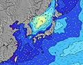 | 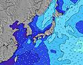 | 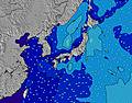 | 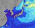 | |||||||||||||
Wave Height (m) Direction Period (s) | SE 16 | SE 17 | SE 17 | SE 16 | SE 16 | SSE 16 | SSE 16 | SSE 14 | SSE 14 | S 15 | S 15 | S 15 | S 15 | SSW 15 | SSW 14 | SSW 14 | SSW 14 | SSW 14 | SSW 14 | SSW 15 |
Wave Graph | ||||||||||||||||||||
448 | 671 | 1094 | 1492 | 2107 | 3278 | 3253 | 2445 | 1956 | 2228 | 2246 | 2437 | 2016 | 1576 | 1533 | 1061 | 943 | 702 | 586 | 581 | |
Wind (km/h) | ||||||||||||||||||||
Wind State on-shore cross-onshore cross-shore cross-offshore off-shore glassy | cross-off | cross-off | cross-off | cross-off | cross-off | off | cross-off | cross-off | cross-off | cross-on | cross-off | cross-off | off | cross | cross | on | cross-off | cross-off | cross | cross-off |
High Tide | 7:41PM1.46m | 7:48AM1.28m | 8:05PM1.45m | 8:47AM1.18m | 8:32PM1.43m | 10:11AM1.09m | 9:05PM1.40m | 12:46PM1.07m | 9:50PM1.36m | 3:26PM1.19m | 11:06PM1.33m | 4:05PM1.31m | 00:48AM1.35m | |||||||
Low Tide | 1:55AM0.55m | 1:43PM0.55m | 2:41AM0.50m | 2:13PM0.72m | 3:38AM0.47m | 2:45PM0.88m | 4:53AM0.43m | 3:23PM1.05m | 6:23AM0.36m | 5:46PM1.18m | 7:47AM0.25m | 8:17PM1.17m | ||||||||
— | — | 4:52 | — | — | 4:52 | — | — | 4:52 | — | — | 4:54 | — | — | 4:54 | — | — | 4:54 | — | — | |
6:44 | — | — | 6:43 | — | — | 6:42 | — | — | 6:40 | — | — | 6:39 | — | — | 6:38 | — | — | 6:37 | — | |
mm | — | — | — | — | — | — | — | 2 | 1 | — | 1 | 3 | 2 | 10 | 3 | — | — | 1 | — | — |
Temp °C | 26 | 23 | 25 | 26 | 24 | 25 | 28 | 27 | 30 | 30 | 26 | 28 | 29 | 27 | 29 | 29 | 26 | 28 | 30 | 25 |
Feels °C | 24 | 20 | 21 | 23 | 22 | 23 | 28 | 28 | 32 | 31 | 28 | 30 | 31 | 29 | 31 | 30 | 28 | 29 | 31 | 23 |
Swell 1 Height (m) Direction Period (s) | SE 16 | SE 17 | SE 17 | SE 16 | SE 16 | SSE 16 | SSE 16 | SSE 14 | SSE 14 | S 15 | S 15 | S 15 | S 15 | SSW 15 | SSW 14 | SSW 14 | SSW 14 | SSW 14 | SSW 14 | SSW 15 |
448 | 671 | 1094 | 1492 | 2107 | 3278 | 3253 | 2445 | 1956 | 2228 | 2246 | 2437 | 2016 | 1576 | 1533 | 1061 | 943 | 702 | 586 | 581 | |
Swell 2 Height (m) Direction Period (s) | S 8 | E 14 | NNE 14 | E 13 | — | — | — | — | — | ESE 10 | ESE 10 | SE 9 | SE 9 | SE 9 | SE 9 | SE 8 | SE 9 | SE 9 | SE 9 | SE 9 |
1 | 4 | 18 | 3 | — | — | — | — | — | 106 | 151 | 335 | 260 | 343 | 393 | 100 | 83 | 83 | 64 | 38 | |
Swell 3 Height (m) Direction Period (s) | — | — | — | — | — | — | — | — | — | — | — | — | — | — | — | ESE 12 | ESE 12 | ESE 12 | ESE 12 | ESE 14 |
— | — | — | — | — | — | — | — | — | — | — | — | — | — | — | 14 | 28 | 15 | 15 | 18 | |
Wind waves Height (m) Direction Period (s) | NE 3 | NE 3 | NNE 3 | — | — | NNE 4 | — | — | — | — | — | — | — | — | SE 8 | — | — | — | — | ENE 3 |
5 | 6 | 8 | — | — | 34 | — | — | — | — | — | — | — | — | 227 | — | — | — | — | 2 | |
Nearest Offshore or Glassy | ||||||||||||||||||||
Distance (km) | 551 | 490 | 145 | 40 | 490 | 488 | 2 | 2 | 2 | 54 | 2 | 2 | 0 | 54 | 2 | 54 | 0 | 3 | 2 | 1028 |
Best forecast wave conditions in Kanagawa | ||||||||||||||||||||
Best forecast wave conditions in Japan | ||||||||||||||||||||
Header Global | ||||||||||||||||||||
- Map Icons:
 Break
Break Live Wave Height (m)
 Live Wind Speed (km/h)
 Surf Rating (10 Max)
 Ocean Swells (m)
- Wind Speed (km/h)
Latest Updates


FREE! Surf-Forecast.com widget for your website
The surf report / weather widget below is available to embed on third party websites free of charge and provides a summary of our Kamakura surf forecast. Simply grab the html code snippet that we provide and paste it into your own site. You can choose your preferred language and metric/imperial units for the surf forecast feed to suit users of your site. Click here to get the code.
Information about the Kamakura Surf forecast
The above surf forecast table for Kamakura provides essential information for determining whether the surfing conditions will be good over the next 16 days. A general guide to surfing at Kamakura can be found by selecting the local surf guide option on the grey menu. Our Kamakura surf forecast is unique since it includes wave energy (power) that defines the real feel of the surf rather than just the height or the period. If you surf the same spot (Kamakura) regularly then make a mental note of the wave energy from the surf forecast table each time you go. Very soon you may start to choose your surf days based on the wave energy alone combined with our forecast of favourable offshore wind conditions. Our star ratings will help here and of course you will also find the usual wave height and period predictions on our surf forecasts as well as a full break down of the swell components under our advanced users option (to reveal that, click the little Einstein character under the tide times).
Further information to help with frequently asked questions about our surf forecast for Kamakura may be found under the help tab on the top menu and also by moving your mouse over the question marks on the surf forecast table itself. Please always bear in mind that the forecast is for near-shore open water and local factors at each surf break influence the actual breaking wave height, such as the beach / reef profile, water depths offshore and shelter.
Kamakura is 2 km (1 miles) from the city of Kamakura. If you plan a holiday in Kanagawa, look for hotels and other accommodation in Kamakura. Kamakura has rooms for a wide range of budgets as well as car hire and transport links.
 Nearest