

Surf Forecasts:

How big are the waves at Hookipa today (30 Jul):
- Morning surf: Morning surf (30 Jul, local time) - 5ft (1.6m), 8s period with E swell.
- Afternoon surf: Afternoon surf (30 Jul, local time) - 5ft (1.6m), 8s period with E swell.
- Evening surf: Evening surf (30 Jul, local time) - 5.5ft (1.7m), 8s period with E swell.
The current surf forecast for Hookipa at 8PM is: 1.7m 8s primary swell from a East direction and 0.5m 16s secondary swell from a East direction, 0.3m 10s secondary swell from a North direction (forecast issued at 01:00pm July 30). The wind direction is predicted to be cross-shore.
| Time (HST) & Date | Wave Height | Wave Period |
|---|---|---|
| Morning (30 Jul) | 5ft (1.6m) | 8s |
| Afternoon (30 Jul) | 5ft (1.6m) | 8s |
| Evening (30 Jul) | 5.5ft (1.7m) | 8s |
Table - waves today at Hookipa. (Swell directed towards the surf break)
Short Range ForecastMostly dry. Warm (max 28°C on Thu afternoon, min 24°C on Fri night). Mainly fresh winds. | |||||||||||||||||||||
Thu 30 | Friday 31 | Saturday 1 | |||||||||||||||||||
11 AM | 2 PM | 5 PM | 8 PM | 11 PM | 2 AM | 5 AM | 8 AM | 11 AM | 2 PM | 5 PM | 8 PM | 11 PM | 2 AM | 5 AM | 8 AM | 11 AM | 2 PM | 5 PM | 8 PM | 11 PM | |
Swell Height Map |  |  |  |  |  |  | 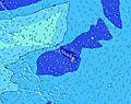 |  | |||||||||||||
Wave Height (m) Direction Period (s) | E 8 | E 8 | E 8 | E 8 | E 8 | E 8 | E 8 | E 8 | E 8 | E 8 | E 8 | E 8 | E 8 | E 8 | E 8 | ENE 8 | E 8 | E 8 | ENE 8 | ENE 8 | ENE 8 |
Wave Graph | |||||||||||||||||||||
266 | 299 | 294 | 328 | 337 | 377 | 421 | 432 | 443 | 491 | 507 | 507 | 579 | 684 | 701 | 730 | 736 | 754 | 721 | 737 | 737 | |
Wind (km/h) | |||||||||||||||||||||
Wind State on-shore cross-onshore cross-shore cross-offshore off-shore glassy | cross | cross | cross | cross | cross | cross | cross | cross | cross | cross | cross | cross | cross | cross | cross | cross | cross | cross | cross | cross | cross |
High Tide | 3:43PM0.92m | 3:07AM0.57m | 4:04PM0.89m | 3:50AM0.59m | 4:24PM0.86m | ||||||||||||||||
Low Tide | 8:33AM0.08m | 10:14PM0.31m | 9:05AM0.12m | 10:36PM0.29m | 9:38AM0.18m | 10:59PM0.25m | |||||||||||||||
— | — | — | — | — | — | 5:58 | — | — | — | — | — | — | — | 5:58 | — | — | — | — | — | — | |
— | — | 7:04 | — | — | — | — | — | — | — | 7:04 | — | — | — | — | — | — | — | 7:02 | — | — | |
mm | — | — | — | — | — | — | — | — | — | — | — | — | — | — | — | — | — | — | — | — | — |
Temp °C | 28 | 28 | 27 | 26 | 26 | 25 | 25 | 26 | 27 | 27 | 27 | 25 | 25 | 24 | 24 | 25 | 26 | 26 | 26 | 25 | 25 |
Feels °C | 28 | 28 | 27 | 26 | 27 | 25 | 25 | 25 | 26 | 25 | 25 | 23 | 23 | 21 | 21 | 23 | 24 | 24 | 25 | 23 | 23 |
Swell 1 Height (m) Direction Period (s) | E 19 | N 6 | E 18 | E 16 | E 16 | E 16 | E 15 | E 15 | E 16 | E 16 | E 15 | E 15 | E 15 | E 14 | E 14 | E 14 | E 14 | E 14 | E 14 | E 14 | E 14 |
28 | 12 | 152 | 132 | 183 | 252 | 222 | 216 | 382 | 382 | 286 | 275 | 267 | 264 | 334 | 260 | 249 | 253 | 257 | 260 | 249 | |
Swell 2 Height (m) Direction Period (s) | N 10 | E 17 | N 10 | N 10 | N 9 | N 9 | N 9 | N 9 | N 9 | N 9 | N 8 | N 8 | N 8 | N 8 | N 8 | N 8 | N 8 | N 8 | N 8 | N 11 | N 10 |
7 | 53 | 7 | 16 | 15 | 15 | 14 | 14 | 14 | 13 | 12 | 12 | 12 | 12 | 11 | 10 | 5 | 5 | 5 | 9 | 19 | |
Swell 3 Height (m) Direction Period (s) | W 18 | N 10 | W 18 | W 18 | W 18 | W 17 | W 16 | W 16 | W 16 | W 16 | W 16 | W 16 | SW 16 | W 16 | W 15 | W 15 | W 15 | N 11 | N 11 | W 14 | W 14 |
6 | 7 | 6 | 6 | 6 | 6 | 5 | 20 | 5 | 5 | 5 | 5 | 10 | 5 | 5 | 5 | 4 | 3 | 9 | 4 | 4 | |
Wind waves Height (m) Direction Period (s) | E 8 | E 8 | E 8 | E 8 | E 8 | E 8 | E 8 | E 8 | E 8 | E 8 | E 8 | E 8 | E 8 | E 8 | E 8 | ENE 8 | E 8 | E 8 | ENE 8 | ENE 8 | ENE 8 |
266 | 299 | 294 | 328 | 337 | 377 | 421 | 432 | 443 | 491 | 507 | 507 | 579 | 684 | 701 | 730 | 736 | 754 | 721 | 737 | 737 | |
Nearest Offshore or Glassy | |||||||||||||||||||||
Distance (km) | 33 | 33 | 22 | 22 | 22 | 22 | 22 | 22 | 22 | 22 | 24 | 24 | 24 | 24 | 24 | 24 | 22 | 22 | 22 | 24 | 24 |
Best forecast wave conditions in Maui | |||||||||||||||||||||
Best forecast wave conditions in United States | |||||||||||||||||||||
Header Global | |||||||||||||||||||||
- Map Icons:
 Break
Break Live Wave Height (m)
 Live Wind Speed (km/h)
 Surf Rating (10 Max)
 Ocean Swells (m)
- Wind Speed (km/h)
Latest Updates


FREE! Surf-Forecast.com widget for your website
The surf report / weather widget below is available to embed on third party websites free of charge and provides a summary of our Hookipa surf forecast. Simply grab the html code snippet that we provide and paste it into your own site. You can choose your preferred language and metric/imperial units for the surf forecast feed to suit users of your site. Click here to get the code.
 Nearest