

Surf Forecasts:

El Tizate surf forecast from 31 Jul 2026:
- Best quality surf: Saturday 1 Aug, 9PM (local time) - 1.5ft (0.5m), 14s period, SW swell with glassy winds.
- Most powerful swell: Saturday 1 Aug, 3PM (local time) - 1.5ft (0.5m), 14s period, SW swell with 99 kJ wave energy.
- Next surfable swell (1★+): Saturday 1 Aug, 9PM (local time) - 1.5ft (0.5m), 14s period with SW swell.
Best Forecast Surf Conditions for El Tizate this week:
The surf forecast for El Tizate over the next 16 days: The first swell (rated 1 star or higher) is forecast to arrive on Saturday (Aug 01) at 9PM. The primary swell is predicted to be 0.5m and 14s period with a secondary swell of 0.3m and 8s. Another secondary swell of 0.2m and 3s is also forecast. The wind is predicted to be glassy as the swell arrives.
The most powerful waves expected at El Tizate in the next 16 days are 0.5m 14s and forecast to arrive on Saturday (Aug 01) at 3PM. Winds are predicted to be cross-onshore at the time the swell arrives. The largest open ocean swell (not directed at the beach) is 0.6m 13s period and expected on Friday (Jul 31) at 12PM.
| Wave Type | Time (CST) & Date | Wave Height & Period |
|---|---|---|
| Next good surf (1 star+) | 9PM (Sat 1st Aug) | 1.5ft (0.5m) 14s |
| Best Surf | 9PM (Sat 1st Aug) | 1.5ft (0.5m) 14s |
| Most Powerful | 3PM (Sat 1st Aug) | 1.5ft (0.5m) 14s |
Table - best surf conditions forecast for El Tizate over the next 16 days.
The Lowdown
Alright, Rusty here. Let’s have a look at what’s cookin’.
To be straight with you, the next couple of weeks aren’t going to have you racing for your board. This is a tough stretch for surf at El Tizate. We’re looking at a long dry spell with nothing worth paddling out for right through the end of July and nearly all the way into the second week of August. There’s a big gap of days with no real recommendations at all. The surf is tiny and weak, and the energy just isn’t there.
From Friday the 31st of July right through to Wednesday the 5th of August, it’s all poor surf conditions. Swell heights are hovering around 1ft to 2ft, and the wave energy is laughably low – mostly between 21 and 135 (combined energy of all swells directed here). Winds are often glassy or light, but with nothing to work with, it doesn’t matter. The water temperature is about average for this time of year, nothing to write home about.
The first faint glimmer of something surfable shows up on Thursday morning the 6th of August. We’ve got 2ft from the SW, with a period of 13 seconds – that’s a groundswell, which is nice, and the combined energy climbs to 106 (moderate wave energy). The wind is glassy from the NE, so the surface will be clean. Still, the conditions are only described as “surfable but very ordinary.” It’s not a standout, just the best of a bad bunch. Then it goes back to poor again.
Things get a little more interesting around Wednesday the 12th of August. The morning shows 2ft from the SW, period 17 seconds – that’s a long-period groundswell, and combined energy jumps to 257 (strong wave energy). Wind is glassy from the NNE, so it’ll be clean. Again, it’s only “surfable but very ordinary,” but on this run, that’s as good as it gets. The swell is small, so it’s not going to fire, but the long period means better shaped waves and longer waits between sets. Best for a point break or reef setup, but El Tizate is sheltered and inconsistent – so don’t expect much.
Thursday the 13th of August morning is similar: 2ft, SW, 16-second period, glassy, combined energy of 225 (strong wave energy). Again, surfable but not great. Friday the 14th of August morning drops back to 2ft with 14 seconds and combined energy of 105, and it’s glassy again. That’s the last little blip before it all fades away.
Honestly, if you’re desperate for a paddle, Thursday the 6th of August morning and Wednesday the 12th of August morning are your only real chances. But don’t expect much – it’s small, inconsistent, and just barely surfable. The rest of the window is a write-off. This area tends to go quiet like this, so it’s not a huge surprise.
Rusty.
Short Range ForecastModerate rain (total 17mm), heaviest on Thu night. Warm (max 34°C on Fri morning, min 25°C on Thu night). Wind will be generally light. | Days 5-7 Weather SummaryHeavy rain (total 26mm), heaviest during Mon afternoon. Warm (max 32°C on Tue morning, min 25°C on Sun night). Wind will be generally light. | ||||||||||||||||||
Friday 31 | Saturday 1 | Sunday 2 | Monday 3 | Tuesday 4 | Wednesday 5 | ||||||||||||||
Night | AM | PM | Night | AM | PM | Night | AM | PM | Night | AM | PM | Night | AM | PM | Night | AM | PM | Night | |
Swell Height Map |  |  |  |  | 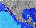 | 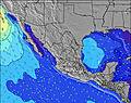 | 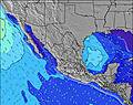 | ||||||||||||
Wave Height (m) Direction Period (s) | WSW 10 | W 9 | W 9 | SW 16 | WSW 8 | SW 14 | SW 14 | SW 13 | SW 13 | SW 13 | W 8 | W 5 | WSW 16 | WSW 16 | SW 15 | SW 15 | SW 14 | SW 14 | SW 13 |
Wave Graph | |||||||||||||||||||
75 | 45 | 41 | 40 | 23 | 99 | 91 | 87 | 85 | 59 | 11 | 15 | 25 | 24 | 56 | 54 | 74 | 29 | 46 | |
Wind (km/h) | |||||||||||||||||||
Wind State on-shore cross-onshore cross-shore cross-offshore off-shore glassy | glassy | glassy | on | glassy | glassy | cross-on | glassy | glassy | on | glassy | glassy | on | glassy | glassy | glassy | glassy | glassy | on | cross-off |
High Tide | 9:28PM1.26m | 10:36AM0.96m | 9:58PM1.24m | 10:58AM1.02m | 10:30PM1.18m | 11:22AM1.08m | 11:04PM1.09m | 11:50AM1.13m | 11:43PM0.95m | 12:25PM1.16m | 00:39AM0.78m | 1:14PM1.15m | |||||||
Low Tide | 4:18AM0.00m | 3:53PM0.40m | 4:39AM0.08m | 4:29PM0.41m | 5:00AM0.20m | 5:10PM0.45m | 5:21AM0.33m | 6:02PM0.50m | 5:38AM0.47m | 7:20PM0.55m | 5:44AM0.59m | 10:00PM0.53m | |||||||
— | 6:35 | — | — | 6:35 | — | — | 6:35 | — | — | 6:35 | — | — | 6:35 | — | — | 6:35 | — | — | |
— | — | 7:38 | — | — | 7:38 | — | — | 7:37 | — | — | 7:37 | — | — | 7:37 | — | — | 7:36 | — | |
mm | 6 | — | 4 | 3 | — | — | — | 1 | 3 | 3 | 1 | 8 | 2 | 1 | 4 | 1 | 1 | 5 | 10 |
Temp °C | 27 | 34 | 33 | 27 | 34 | 33 | 27 | 33 | 31 | 27 | 31 | 29 | 27 | 32 | 30 | 27 | 31 | 31 | 27 |
Feels °C | 33 | 38 | 38 | 33 | 37 | 36 | 33 | 37 | 36 | 33 | 36 | 34 | 33 | 37 | 36 | 33 | 36 | 36 | 33 |
Swell 1 Height (m) Direction Period (s) | SSW 14 | SSW 13 | SSW 13 | SSW 13 | SSW 14 | SW 14 | SW 14 | SW 13 | SW 13 | SW 13 | WNW 5 | SW 12 | WNW 5 | WNW 5 | SW 15 | SW 15 | SW 14 | SW 14 | SW 14 |
175 | 158 | 114 | 95 | 134 | 99 | 91 | 87 | 85 | 59 | 10 | 39 | 8 | 8 | 56 | 54 | 74 | 29 | 51 | |
Swell 2 Height (m) Direction Period (s) | WSW 10 | W 9 | W 9 | WSW 9 | WSW 8 | W 8 | WNW 8 | W 8 | W 9 | WNW 5 | SW 12 | W 7 | SW 12 | SW 12 | SW 12 | SW 12 | W 5 | SSW 11 | SW 13 |
75 | 45 | 41 | 25 | 23 | 21 | 20 | 11 | 24 | 8 | 40 | 10 | 37 | 36 | 36 | 35 | 2 | 12 | 46 | |
Swell 3 Height (m) Direction Period (s) | WNW 5 | WNW 5 | WNW 5 | SW 16 | NW 5 | SW 20 | SSW 11 | WNW 3 | SW 18 | W 8 | W 8 | SSW 14 | WSW 16 | WSW 16 | W 6 | WNW 5 | SSW 11 | SSW 15 | SSW 20 |
2 | 3 | 3 | 40 | 1 | 15 | 12 | 1 | 12 | 21 | 11 | 20 | 25 | 24 | 3 | 5 | 12 | 21 | 37 | |
Wind waves Height (m) Direction Period (s) | — | — | — | — | — | — | — | — | WNW 4 | — | — | W 5 | — | — | WNW 5 | — | — | — | — |
— | — | — | — | — | — | — | — | 3 | — | — | 15 | — | — | 8 | — | — | — | — | |
Nearest Offshore or Glassy | |||||||||||||||||||
Distance (km) | 22 | 25 | 27 | 22 | 25 | 1169 | 0 | 22 | 31 | 22 | 22 | 22 | 22 | 22 | 27 | 22 | 22 | 22 | 22 |
Best forecast wave conditions in Nayarit | |||||||||||||||||||
Best forecast wave conditions in Mexico | |||||||||||||||||||
Header Global | |||||||||||||||||||
- Map Icons:
 Break
Break Live Wave Height (m)
 Live Wind Speed (km/h)
 Surf Rating (10 Max)
 Ocean Swells (m)
- Wind Speed (km/h)
Latest Updates


FREE! Surf-Forecast.com widget for your website
The surf report / weather widget below is available to embed on third party websites free of charge and provides a summary of our El Tizate surf forecast. Simply grab the html code snippet that we provide and paste it into your own site. You can choose your preferred language and metric/imperial units for the surf forecast feed to suit users of your site. Click here to get the code.
Information about the El Tizate Surf forecast
The above surf forecast table for El Tizate provides essential information for determining whether the surfing conditions will be good over the next 16 days. A general guide to surfing at El Tizate can be found by selecting the local surf guide option on the grey menu. Our El Tizate surf forecast is unique since it includes wave energy (power) that defines the real feel of the surf rather than just the height or the period. If you surf the same spot (El Tizate) regularly then make a mental note of the wave energy from the surf forecast table each time you go. Very soon you may start to choose your surf days based on the wave energy alone combined with our forecast of favourable offshore wind conditions. Our star ratings will help here and of course you will also find the usual wave height and period predictions on our surf forecasts as well as a full break down of the swell components under our advanced users option (to reveal that, click the little Einstein character under the tide times).
Further information to help with frequently asked questions about our surf forecast for El Tizate may be found under the help tab on the top menu and also by moving your mouse over the question marks on the surf forecast table itself. Please always bear in mind that the forecast is for near-shore open water and local factors at each surf break influence the actual breaking wave height, such as the beach / reef profile, water depths offshore and shelter.
El Tizate is 1 km (1 miles) from Puerto Vallarta. If you plan a holiday in Nayarit, look for hotels and other accommodation in Puerto Vallarta. Puerto Vallarta has rooms for a wide range of budgets as well as car hire and transport links.
 Nearest