

Surf Forecasts:

El Playon surf forecast from 3 Aug 2026:
Best Forecast Surf Conditions for El Playon this week:
The largest open ocean swell (not directed at the beach) is 1.5m 7s period and expected on Friday (Aug 07) at 5PM.
The Lowdown
Right, folks, Rusty here. Let’s have a look at what’s on the cards for El Playon.
Well, I’ve got to be straight with you – the outlook for the next 16 days is a real bummer. There’s not a single wave on offer in the entire forecast window. The combined energy of all swells directed here is a flat zero (0) right through from the 2nd of August all the way to the 17th. That’s a solid 16-day stretch with nothing to ride. The water is sitting at a warm 83°, which is just about normal for this time of year, but that’s the only good news.
El Playon (El Playon) is a sheltered beach and breakwater set-up, and it’s a consistent spot normally, so a blank run like this is a bit of a surprise. But the numbers don’t lie – no swell height, no period, no energy. The wind is all over the place, mostly cross-onshore or onshore, with a few glassy mornings on the 4th and 14th of August, but without any swell, that’s just a flat, glassy lake. It’s a beginner-friendly break, but even beginners need something to push them.
Don’t get too down, though. Places like this that are usually consistent tend not to stay flat for long, and forecasts can change. For now, though, if you want to get wet, you’re better off with a set of fins and a snorkel.
Rusty.
Short Range ForecastModerate rain (total 10mm), heaviest on Mon afternoon. Warm (max 31°C on Tue morning, min 25°C on Tue night). Wind will be generally light. | Days 5-7 Weather SummaryModerate rain (total 11mm), heaviest on Wed night. Warm (max 30°C on Wed afternoon, min 25°C on Wed night). Wind will be generally light. | |||||||||||||||||||
Sun 2 | Monday 3 | Tuesday 4 | Wednesday 5 | Thursday 6 | Friday 7 | Saturday 8 | ||||||||||||||
PM | Night | AM | PM | Night | AM | PM | Night | AM | PM | Night | AM | PM | Night | AM | PM | Night | AM | PM | Night | |
Swell Height Map |  |  |  | 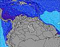 | 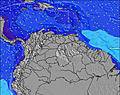 | 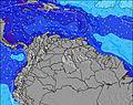 | 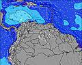 | |||||||||||||
Wave Height (m) Direction Period (s) | NE 7 | NE 6 | NE 6 | NE 7 | NE 7 | NE 7 | NE 7 | NE 7 | NE 7 | NE 7 | NE 7 | NE 7 | NE 7 | NE 7 | NE 8 | NE 7 | NE 7 | NE 7 | NE 6 | NE 7 |
Wave Graph | ||||||||||||||||||||
0 | 0 | 0 | 0 | 0 | 0 | 0 | 0 | 0 | 0 | 0 | 0 | 0 | 0 | 0 | 0 | 0 | 0 | 0 | 0 | |
Wind (km/h) | ||||||||||||||||||||
Wind State on-shore cross-onshore cross-shore cross-offshore off-shore glassy | cross-on | off | on | cross-on | off | glassy | cross-on | off | cross-on | cross-on | off | cross-on | cross-on | off | on | cross-on | glassy | on | cross-on | cross-off |
High Tide | 5:42PM0.27m | 1:46AM0.25m | 6:05PM0.31m | 00:54AM0.21m | 5:39AM0.20m | 6:35PM0.34m | 6:59AM0.15m | 7:11PM0.37m | 8:08AM0.11m | 7:51PM0.40m | 9:17AM0.09m | 8:36PM0.42m | 9:22PM0.44m | |||||||
Low Tide | 9:41PM0.22m | 9:51AM0.13m | 11:12PM0.20m | 10:04AM0.12m | 4:23AM0.14m | 10:23AM0.11m | 4:57AM0.08m | 10:43AM0.09m | 5:32AM0.04m | 6:09AM0.01m | ||||||||||
— | — | 6:20 | — | — | 6:20 | — | — | 6:20 | — | — | 6:20 | — | — | 6:20 | — | — | 6:20 | — | — | |
6:53 | — | — | 6:53 | — | — | 6:52 | — | — | 6:52 | — | — | 6:52 | — | — | 6:52 | — | — | 6:52 | — | |
mm | — | 1 | — | 3 | 2 | — | 1 | 3 | — | 2 | 3 | — | 3 | 3 | — | — | — | — | — | 3 |
Temp °C | 29 | 27 | 30 | 30 | 27 | 31 | 31 | 27 | 30 | 30 | 26 | 30 | 28 | 26 | 29 | 28 | 26 | 28 | 28 | 26 |
Feels °C | 30 | 31 | 33 | 33 | 31 | 35 | 33 | 31 | 33 | 32 | 28 | 33 | 31 | 29 | 32 | 30 | 29 | 31 | 29 | 30 |
Swell 1 Height (m) Direction Period (s) | NE 7 | NE 6 | NE 6 | NE 7 | NE 7 | NE 7 | NE 7 | NE 7 | NE 7 | NE 7 | NE 7 | NE 7 | NE 7 | NE 7 | NE 8 | NE 7 | NE 7 | NE 7 | NE 6 | NE 7 |
88 | 91 | 60 | 77 | 109 | 97 | 109 | 102 | 77 | 85 | 114 | 93 | 121 | 167 | 143 | 235 | 153 | 73 | 108 | 97 | |
Swell 2 Height (m) Direction Period (s) | — | — | — | — | — | — | — | — | — | — | — | — | — | — | — | — | — | — | — | — |
— | — | — | — | — | — | — | — | — | — | — | — | — | — | — | — | — | — | — | — | |
Swell 3 Height (m) Direction Period (s) | — | — | — | — | — | — | — | — | — | — | — | — | — | — | — | — | — | — | — | — |
— | — | — | — | — | — | — | — | — | — | — | — | — | — | — | — | — | — | — | — | |
Wind waves Height (m) Direction Period (s) | — | — | — | — | — | — | — | — | — | — | — | — | — | — | — | — | — | — | — | — |
— | — | — | — | — | — | — | — | — | — | — | — | — | — | — | — | — | — | — | — | |
Nearest Offshore or Glassy | ||||||||||||||||||||
Distance (km) | 87 | 1 | 87 | 87 | 1 | 1 | 87 | 1 | 87 | 87 | 1 | 87 | 87 | 1 | 87 | 87 | 1 | 87 | 709 | 1 |
Best forecast wave conditions in Zona del Centro | ||||||||||||||||||||
Best forecast wave conditions in Venezuela | ||||||||||||||||||||
Header Global | ||||||||||||||||||||
- Map Icons:
 Break
Break Live Wave Height (m)
 Live Wind Speed (km/h)
 Surf Rating (10 Max)
 Ocean Swells (m)
- Wind Speed (km/h)
Latest Updates


FREE! Surf-Forecast.com widget for your website
The surf report / weather widget below is available to embed on third party websites free of charge and provides a summary of our El Playon surf forecast. Simply grab the html code snippet that we provide and paste it into your own site. You can choose your preferred language and metric/imperial units for the surf forecast feed to suit users of your site. Click here to get the code.
Information about the El Playon Surf forecast
The above surf forecast table for El Playon provides essential information for determining whether the surfing conditions will be good over the next 16 days. A general guide to surfing at El Playon can be found by selecting the local surf guide option on the grey menu. Our El Playon surf forecast is unique since it includes wave energy (power) that defines the real feel of the surf rather than just the height or the period. If you surf the same spot (El Playon) regularly then make a mental note of the wave energy from the surf forecast table each time you go. Very soon you may start to choose your surf days based on the wave energy alone combined with our forecast of favourable offshore wind conditions. Our star ratings will help here and of course you will also find the usual wave height and period predictions on our surf forecasts as well as a full break down of the swell components under our advanced users option (to reveal that, click the little Einstein character under the tide times).
Further information to help with frequently asked questions about our surf forecast for El Playon may be found under the help tab on the top menu and also by moving your mouse over the question marks on the surf forecast table itself. Please always bear in mind that the forecast is for near-shore open water and local factors at each surf break influence the actual breaking wave height, such as the beach / reef profile, water depths offshore and shelter.
El Playon is 22 km (14 miles) from Mariara. If you plan a holiday in Zona del Centro, look for hotels and other accommodation in Mariara. Mariara has rooms for a wide range of budgets as well as car hire and transport links.
 Nearest