

Surf Forecasts:

81st Street surf forecast from 3 Aug 2026:
- Best quality surf: Monday 3 Aug, 2PM (local time) - 4ft (1.2m), 7s period, SSE swell with cross-offshore winds.
- Most powerful swell: Monday 3 Aug, 5PM (local time) - 5ft (1.5m), 7s period, SSE swell with 228 kJ wave energy.
- Next surfable swell (1★+): Monday 3 Aug, 2PM (local time) - 4ft (1.2m), 7s period with SSE swell.
Best Forecast Surf Conditions for 81st Street this week:
The surf forecast for 81st Street over the next 16 days: The first swell (rated 1 star or higher) is forecast to arrive on Monday (Aug 03) at 2PM. The primary swell is predicted to be 1.2m and 7s period. The wind is predicted to be cross-offshore as the swell arrives.
The most powerful waves expected at 81st Street in the next 16 days are 1.5m 7s and forecast to arrive on Monday (Aug 03) at 5PM. Winds are predicted to be cross-offshore at the time the swell arrives. The largest open ocean swell (not directed at the beach) is 1.1m 5s period and expected on Thursday (Aug 06) at 8PM.
| Wave Type | Time (EDT) & Date | Wave Height & Period |
|---|---|---|
| Next good surf (1 star+) | 2PM (Mon 3rd Aug) | 4ft (1.2m) 7s |
| Best Surf | 2PM (Mon 3rd Aug) | 4ft (1.2m) 7s |
| Most Powerful | 5PM (Mon 3rd Aug) | 5ft (1.5m) 7s |
Table - best surf conditions forecast for 81st Street over the next 16 days.
The Lowdown
Alright, Rusty here. Let’s break it down. This forecast is a lean one. There’s really only one window that’s worth wetting a wetsuit, and it’s right at the start.
Monday August 3rd morning is the pick of the whole 16 days. Swell is running about 5ft from the SSE, with a moderate offshore breeze cleaning things up. The period is short at 7 seconds, but for a spot like 81st Street, which is beginner-friendly, it’s a solid shot. Combined swell energy is moderate at 429. Water temp is 78°, totally normal for the season.
That afternoon the wind shifts south at 15 mph and brings a risk of thunderstorms, so quality nose-dives. From Tuesday August 4th on, the surf shrinks fast. We go into a long, flat spell. For over a week, wave heights barely hit 2ft, and the combined energy often drops under 100. The wind is mostly cross or cross-off, but with almost no swell, it’s just a lake. The period stays short, under 8 seconds, with no power.
There’s one half-hearted chance on Monday August 17th morning. A tiny 3ft ENE swell with glassy conditions. It’s small and weak, with energy at 81, but if you’re on a longboard and get out early, it might be worth a paddle. The wind goes cross in the afternoon and ruins it.
Bottom line: Monday August 3rd morning is your only real call. Grab it. After that, the forecast is mostly flat and frustrating until a slim, glassy chance on the 17th. It’s a quiet stretch, but that’s how it goes sometimes.
Rusty.
Short Range ForecastModerate rain (total 13mm), heaviest on Mon afternoon. Warm (max 30°C on Mon afternoon, min 24°C on Tue night). Wind will be generally light. | Days 4-6 Weather SummaryMostly dry. Warm (max 34°C on Sat afternoon, min 25°C on Thu morning). Wind will be generally light. | ||||||||||||||||||||
Monday 3 | Tuesday 4 | Wednesday 5 | Thursday 6 | Friday 7 | Saturday 8 | Sunday 9 | |||||||||||||||
AM | PM | Night | AM | PM | Night | AM | PM | Night | AM | PM | Night | AM | PM | Night | AM | PM | Night | AM | PM | Night | |
Swell Height Map |  | 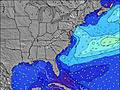 | 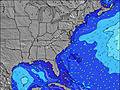 | 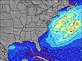 |  | 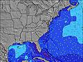 | 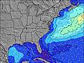 | ||||||||||||||
Wave Height (m) Direction Period (s) | SSE 7 | SSE 7 | SSE 7 | SE 7 | SE 7 | SSE 6 | SE 7 | SSE 6 | E 10 | ESE 6 | SSE 5 | E 11 | SE 7 | SE 7 | SE 7 | SE 8 | SSE 8 | SSE 6 | SE 7 | SSE 7 | E 11 |
Wave Graph | |||||||||||||||||||||
268 | 228 | 93 | 52 | 49 | 51 | 21 | 51 | 2 | 17 | 52 | 3 | 11 | 13 | 14 | 60 | 51 | 34 | 12 | 18 | 2 | |
Wind (km/h) | |||||||||||||||||||||
Wind State on-shore cross-onshore cross-shore cross-offshore off-shore glassy | off | cross-off | cross-off | cross-on | cross-off | cross-off | cross-off | cross-off | cross-off | cross-off | cross | cross-off | off | cross | cross-off | off | cross-off | off | off | cross-off | cross-off |
High Tide | 12:15PM0.96m | 00:29AM0.86m | 1:01PM0.97m | 1:19AM0.81m | 1:55PM0.98m | 2:16AM0.77m | 2:56PM0.98m | 3:21AM0.74m | 4:04PM0.99m | 4:32AM0.74m | 5:14PM1.01m | 5:43AM0.77m | 6:21PM1.05m | ||||||||
Low Tide | 6:12PM0.14m | 6:17AM0.07m | 7:07PM0.16m | 7:03AM0.08m | 8:08PM0.17m | 7:58AM0.09m | 9:16PM0.18m | 9:02AM0.09m | 10:27PM0.16m | 10:11AM0.08m | 11:35PM0.12m | 11:21AM0.05m | 00:36AM0.06m | ||||||||
6:09 | — | — | 6:11 | — | — | 6:11 | — | — | 6:13 | — | — | 6:13 | — | — | 6:13 | — | — | 6:15 | — | — | |
— | 8:08 | — | — | 8:07 | — | — | 8:07 | — | — | 8:06 | — | — | 8:05 | — | — | 8:02 | — | — | 8:01 | — | |
mm | — | 3 | 5 | — | 2 | 3 | — | — | — | — | — | — | — | — | — | — | — | — | — | — | — |
Temp °C | 28 | 30 | 27 | 27 | 27 | 24 | 25 | 30 | 27 | 28 | 32 | 30 | 28 | 32 | 31 | 29 | 34 | 32 | 29 | 34 | 32 |
Feels °C | 28 | 32 | 29 | 31 | 29 | 26 | 26 | 29 | 28 | 30 | 32 | 31 | 30 | 35 | 31 | 31 | 36 | 32 | 30 | 34 | 32 |
Swell 1 Height (m) Direction Period (s) | SSE 8 | — | SSE 7 | SE 7 | SE 7 | SSE 6 | SE 7 | NE 5 | — | ESE 6 | E 10 | E 9 | SE 7 | SE 7 | SE 7 | SE 8 | E 9 | SSE 6 | S 4 | E 9 | E 9 |
161 | — | 93 | 52 | 49 | 51 | 21 | 1 | — | 17 | 2 | 2 | 11 | 13 | 14 | 60 | 2 | 34 | 10 | 2 | 1 | |
Swell 2 Height (m) Direction Period (s) | — | — | E 13 | E 14 | NE 5 | NE 5 | ENE 5 | — | E 10 | E 10 | NE 10 | NE 9 | E 9 | E 9 | E 9 | E 9 | NE 9 | SE 7 | SE 7 | NE 9 | E 11 |
— | — | 4 | 4 | 1 | 4 | 2 | — | 2 | 2 | 4 | 3 | 2 | 2 | 2 | 2 | 3 | 14 | 12 | 3 | 2 | |
Swell 3 Height (m) Direction Period (s) | — | — | — | — | NNE 5 | — | — | — | — | — | E 11 | E 11 | E 11 | — | — | — | — | E 8 | E 8 | E 11 | E 11 |
— | — | — | — | 5 | — | — | — | — | — | 2 | 2 | 2 | — | — | — | — | 1 | 1 | 2 | 2 | |
Wind waves Height (m) Direction Period (s) | SSE 7 | SSE 7 | — | — | S 3 | — | S 4 | SSE 6 | SSE 5 | S 5 | SSE 5 | S 5 | S 5 | S 4 | S 5 | SW 3 | SSE 8 | W 3 | WSW 3 | SSE 7 | S 6 |
268 | 228 | — | — | 5 | — | 6 | 51 | 47 | 18 | 52 | 47 | 17 | 15 | 39 | 3 | 51 | 1 | 2 | 18 | 50 | |
Nearest Offshore or Glassy | |||||||||||||||||||||
Distance (km) | 0 | 193 | 0 | 60 | 0 | 0 | 14 | 91 | 400 | 223 | 612 | 612 | 178 | 394 | 126 | 0 | 0 | 0 | 448 | 223 | 175 |
Best forecast wave conditions in Virginia | |||||||||||||||||||||
Best forecast wave conditions in United States | |||||||||||||||||||||
Header Global | |||||||||||||||||||||
- Map Icons:
 Break
Break Live Wave Height (m)
 Live Wind Speed (km/h)
 Surf Rating (10 Max)
 Ocean Swells (m)
- Wind Speed (km/h)
Latest Updates


FREE! Surf-Forecast.com widget for your website
The surf report / weather widget below is available to embed on third party websites free of charge and provides a summary of our 81st Street surf forecast. Simply grab the html code snippet that we provide and paste it into your own site. You can choose your preferred language and metric/imperial units for the surf forecast feed to suit users of your site. Click here to get the code.
Information about the 81st Street Surf forecast
The above surf forecast table for 81st Street provides essential information for determining whether the surfing conditions will be good over the next 16 days. A general guide to surfing at 81st Street can be found by selecting the local surf guide option on the grey menu. Our 81st Street surf forecast is unique since it includes wave energy (power) that defines the real feel of the surf rather than just the height or the period. If you surf the same spot (81st Street) regularly then make a mental note of the wave energy from the surf forecast table each time you go. Very soon you may start to choose your surf days based on the wave energy alone combined with our forecast of favourable offshore wind conditions. Our star ratings will help here and of course you will also find the usual wave height and period predictions on our surf forecasts as well as a full break down of the swell components under our advanced users option (to reveal that, click the little Einstein character under the tide times).
Further information to help with frequently asked questions about our surf forecast for 81st Street may be found under the help tab on the top menu and also by moving your mouse over the question marks on the surf forecast table itself. Please always bear in mind that the forecast is for near-shore open water and local factors at each surf break influence the actual breaking wave height, such as the beach / reef profile, water depths offshore and shelter.
81st Street is 4 km (2 miles) from the city of Pylos. If you plan a vacation in Virginia, look for hotels and other accommodation in Pylos. Pylos has rooms for a wide range of budgets as well as car hire and transport links.
 Nearest