

Surf Forecasts:

Damp surf forecast from 3 Aug 2026:
- Most powerful swell: Tuesday 4 Aug, 11PM (local time) - 2.5ft (0.8m), 5s period, E swell with 27 kJ wave energy.
Best Forecast Surf Conditions for Damp this week:
The most powerful waves expected at Damp in the next 16 days are 0.8m 5s and forecast to arrive on Tuesday (Aug 04) at 11PM. Winds are predicted to be cross-shore at the time the swell arrives. The largest open ocean swell (not directed at the beach) is 0.6m 3s period and expected on Thursday (Aug 06) at 5PM.
| Wave Type | Time (CEST) & Date | Wave Height & Period |
|---|---|---|
| Next good surf (1 star+) | - | - |
| Best Surf | - | - |
| Most Powerful | 11PM (Tue 4th Aug) | 2.5ft (0.8m) 5s |
Table - best surf conditions forecast for Damp over the next 16 days.
The Lowdown
Alright folks, Rusty here. Let's be straight with you – the outlook for Damp is a tough one. We're looking at a long, dry spell with next to nothing on offer for the foreseeable future. The water's sitting at 65.1°, which is pretty much bang on average for this time of year, so no complaints there, but it's the waves that are the problem.
The next 16 days are a dead zone. From Monday, 3 August right through to the end of the period, the combined swell energy is a fat zero or a measly one-digit number (0 to 1). We're talking about tiny, weak pulses that never get going. The first real sign of life doesn't show up until Friday, 14 August, with a little 2.3ft north-northwest swell, but the period is a short 4 seconds – that's windswill, not surf. It's poor, and the scores tell you all you need to know. Before that, we've got a solid week and a half of nothing. It's a blank run, plain and simple.
The only break in the game is Damp itself, a sandbar setup that's inconsistent at the best of times. It's exposed to the east, but the wind is mostly offshore or cross-offshore from the southwest and west through that period. That's a sick wind direction for quality, but it's pointless when there's no swell to work with. On Wednesday morning, 12 August, we get a glassy morning from the northwest – dead calm – but again, zero swell. It's a classic case of all dressed up with nowhere to go.
On Wednesday, 5 August, there's a fresh offshore breeze from the west-southwest at 19 mph, but the swell is non-existent. A setup like this, with strong wind and no proper groundswell, would honestly be more exciting for a kite surfer than a paddler right now.
Look, in a spot like this, when the consistency is poor and the forecasts are this flat, it's not unusual. It just means the ocean is having a rest. Don't hold your breath – forecasts can change, but right now, save your wax and wait for the next pulse.
Short Range ForecastLight rain (total 9mm), mostly falling on Tue night. Warm (max 25°C on Tue afternoon, min 17°C on Mon morning). Mainly fresh winds. | Days 4-6 Weather SummaryMostly dry. Warm (max 24°C on Sat afternoon, min 14°C on Thu night). Winds decreasing (fresh winds from the WSW on Thu afternoon, light winds from the WSW by Fri night). | ||||||||||||||||||||
Monday 3 | Tuesday 4 | Wednesday 5 | Thursday 6 | Friday 7 | Saturday 8 | Sunday 9 | |||||||||||||||
AM | PM | Night | AM | PM | Night | AM | PM | Night | AM | PM | Night | AM | PM | Night | AM | PM | Night | AM | PM | Night | |
Swell Height Map | 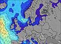 | 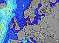 | 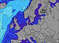 | 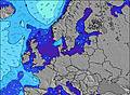 | 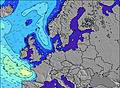 | 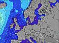 | 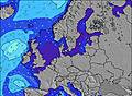 | ||||||||||||||
Wave Height (m) Direction Period (s) | — | E 3 | E 4 | E 4 | E 4 | E 5 | E 4 | WSW 3 | — | SSW 3 | WSW 3 | W 3 | WNW 3 | WNW 4 | NNW 4 | — | — | SE 3 | ESE 3 | — | — |
Wave Graph | |||||||||||||||||||||
0 | 1 | 24 | 10 | 9 | 15 | 1 | 0 | 0 | 0 | 0 | 0 | 0 | 0 | 0 | 0 | 0 | 1 | 1 | 0 | 0 | |
Wind (km/h) | |||||||||||||||||||||
Wind State on-shore cross-onshore cross-shore cross-offshore off-shore glassy | cross-on | on | on | on | cross-on | cross-off | cross-off | off | cross-off | cross-off | off | off | off | off | off | cross-off | cross-off | off | off | off | cross-off |
High Tide | 9:41AM0.01m | 9:53PM0.01m | 11:01AM0.01m | 10:39PM0.01m | 12:26PM0.01m | 11:32PM0.02m | 1:44PM0.02m | 00:30AM0.02m | 2:44PM0.02m | 1:25AM0.03m | 3:29PM0.03m | 2:17AM0.04m | 4:06PM0.03m | 3:09AM0.04m | |||||||
Low Tide | 4:10PM0.00m | 4:18AM-0.00m | 4:54PM0.00m | 5:27AM-0.00m | 5:39PM0.01m | 6:35AM-0.00m | 6:25PM0.01m | 7:37AM0.00m | 7:15PM0.02m | 8:33AM0.01m | 8:05PM0.02m | 9:23AM0.01m | 8:56PM0.02m | ||||||||
5:33 | — | — | 5:35 | — | — | 5:35 | — | — | 5:37 | — | — | 5:39 | — | — | 5:41 | — | — | 5:43 | — | — | |
— | — | 9:16 | — | — | 9:15 | — | — | 9:13 | — | — | 9:10 | — | — | 9:08 | — | — | 9:07 | — | — | 9:05 | |
mm | — | — | — | — | 2 | 7 | — | — | — | — | — | — | — | — | — | — | — | — | — | — | — |
Temp °C | 20 | 22 | 20 | 20 | 25 | 22 | 25 | 25 | 20 | 21 | 21 | 18 | 16 | 19 | 18 | 19 | 24 | 20 | 19 | 20 | 17 |
Feels °C | 18 | 18 | 17 | 18 | 25 | 23 | 21 | 21 | 17 | 16 | 13 | 13 | 11 | 13 | 14 | 16 | 18 | 15 | 13 | 14 | 12 |
Swell 1 Height (m) Direction Period (s) | — | — | — | — | — | E 5 | E 4 | — | — | — | — | — | — | — | NNW 4 | — | — | — | ESE 3 | — | — |
— | — | — | — | — | 15 | 1 | — | — | — | — | — | — | — | 1 | — | — | — | 1 | — | — | |
Swell 2 Height (m) Direction Period (s) | — | — | — | — | — | — | — | — | — | — | — | — | — | — | — | — | — | — | — | — | — |
— | — | — | — | — | — | — | — | — | — | — | — | — | — | — | — | — | — | — | — | — | |
Swell 3 Height (m) Direction Period (s) | — | — | — | — | — | — | — | — | — | — | — | — | — | — | — | — | — | — | — | — | — |
— | — | — | — | — | — | — | — | — | — | — | — | — | — | — | — | — | — | — | — | — | |
Wind waves Height (m) Direction Period (s) | — | E 3 | E 4 | E 4 | E 4 | — | SW 2 | WSW 3 | — | SSW 3 | WSW 3 | W 3 | WNW 3 | WNW 4 | — | — | — | SE 3 | — | — | — |
— | 1 | 24 | 10 | 9 | — | 1 | 3 | — | 1 | 3 | 5 | 4 | 8 | — | — | — | 1 | — | — | — | |
Nearest Offshore or Glassy | |||||||||||||||||||||
Distance (km) | 549 | 935 | 208 | 548 | 651 | 671 | 673 | 730 | 805 | 1202 | 774 | 673 | 493 | 587 | 204 | 655 | 914 | 1225 | 895 | 1008 | 1071 |
Best forecast wave conditions in Ostsee | |||||||||||||||||||||
Best forecast wave conditions in Germany | |||||||||||||||||||||
Header Global | |||||||||||||||||||||
- Map Icons:
 Break
Break Live Wave Height (m)
 Live Wind Speed (km/h)
 Surf Rating (10 Max)
 Ocean Swells (m)
- Wind Speed (km/h)
Latest Updates


FREE! Surf-Forecast.com widget for your website
The surf report / weather widget below is available to embed on third party websites free of charge and provides a summary of our Damp surf forecast. Simply grab the html code snippet that we provide and paste it into your own site. You can choose your preferred language and metric/imperial units for the surf forecast feed to suit users of your site. Click here to get the code.
Information about the Damp Surf forecast
The above surf forecast table for Damp provides essential information for determining whether the surfing conditions will be good over the next 16 days. A general guide to surfing at Damp can be found by selecting the local surf guide option on the grey menu. Our Damp surf forecast is unique since it includes wave energy (power) that defines the real feel of the surf rather than just the height or the period. If you surf the same spot (Damp) regularly then make a mental note of the wave energy from the surf forecast table each time you go. Very soon you may start to choose your surf days based on the wave energy alone combined with our forecast of favourable offshore wind conditions. Our star ratings will help here and of course you will also find the usual wave height and period predictions on our surf forecasts as well as a full break down of the swell components under our advanced users option (to reveal that, click the little Einstein character under the tide times).
Further information to help with frequently asked questions about our surf forecast for Damp may be found under the help tab on the top menu and also by moving your mouse over the question marks on the surf forecast table itself. Please always bear in mind that the forecast is for near-shore open water and local factors at each surf break influence the actual breaking wave height, such as the beach / reef profile, water depths offshore and shelter.
Damp is 12 km (7 miles) from the city of Eckernforde. If you plan a holiday in Ostsee, look for hotels and other accommodation in Eckernforde. Eckernforde has rooms for a wide range of budgets as well as car hire and transport links.
 Nearest