

Surf Forecasts:

Costa Nova surf forecast from 2 Aug 2026:
- Best quality surf: Thursday 6 Aug, 4AM (local time) - 3ft (0.9m), 9s period, NNW swell with cross-offshore winds.
- Most powerful swell: Wednesday 5 Aug, 10PM (local time) - 5.5ft (1.7m), 9s period, NNW swell with 455 kJ wave energy.
- Next surfable swell (1★+): Monday 3 Aug, 1AM (local time) - 2ft (0.6m), 9s period with W swell.
Best Forecast Surf Conditions for Costa Nova this week:
The surf forecast for Costa Nova over the next 16 days: The first swell (rated 1 star or higher) is forecast to arrive on Monday (Aug 03) at 1AM. The primary swell is predicted to be 0.6m and 9s period with a secondary swell of 0.3m and 7s. The wind is predicted to be glassy as the swell arrives.
The most powerful waves expected at Costa Nova in the next 16 days are 1.7m 9s and forecast to arrive on Wednesday (Aug 05) at 10PM. Winds are predicted to be cross-shore at the time the swell arrives. The largest open ocean swell (not directed at the beach) is 0.3m 2s period and expected on Monday (Aug 03) at 10AM.
| Wave Type | Time (WEST) & Date | Wave Height & Period |
|---|---|---|
| Next good surf (1 star+) | 1AM (Mon 3rd Aug) | 2ft (0.6m) 9s |
| Best Surf | 4AM (Thu 6th Aug) | 3ft (0.9m) 9s |
| Most Powerful | 10PM (Wed 5th Aug) | 5.5ft (1.7m) 9s |
Table - best surf conditions forecast for Costa Nova over the next 16 days.
The Lowdown
Alright folks, Rusty here. Let’s get into it. The next couple of weeks are looking pretty bleak for a paddle, to be honest. We’re in for a long stretch of mostly poor conditions, but there are a couple of windows that could be worth a look if you’re patient.
The first week and a half is a real struggle. From Sunday, August 2nd right through to Tuesday, August 12th, the surf is small and the wind is nearly always a problem. The combined swell energy is mostly weak, with a moderate spike on Wednesday the 5th afternoon hitting 367, but it’s blown out by a fresh cross-onshore. There’s a moment on Sunday morning, August 9th, where the wind goes glassy, with a 4ft swell from the NNW, and the energy is moderate at 212. That’s your only real chance in that first stretch, but it’s still a short-period, 8-second swell, so it won’t have much push. The break is Costa Nova, a beach/jetty setup that’s fairly consistent but exposed to the swell. The water temp is around 68°, which is pretty normal for this time of year.
Then we get another gap. Wednesday morning, August 12th, is glassy again with a tiny 2ft from the west, but it’s just surfable, nothing special. The real standout, and honestly the only one worth circling on the calendar, is the week after. Thursday morning, August 13th, has a 5ft swell from the NNW with a glassy surface. The energy is strong at 310 and the winds are light. It’s the best conditions we’ll see for a clean wave.
But hold on, because the big news is the following Monday, August 17th. The swell pumps up to 10ft from the NNW, with a massive combined energy of 1068. The wind is light and cross-shore, and the tide is favorable. That sounds like a dream, but here’s the catch – that’s way too big for Costa Nova. It’s an expert-only situation if you’re crazy enough, and honestly, with that much power and a short 8-second period, it’s going to be a washing machine. For the average surfer, it’s a wave to watch from the sand. The setup looks more interesting for kite surfing than paddle surfing.
So, to sum it up: the best bet for a clean, manageable wave is the morning of Thursday, August 13th. The only other real standout is the massive swell on Monday, August 17th, but that’s for the hardcore experts only. Everything else is a write-off until then.
Rusty.
Short Range ForecastMostly dry. Warm (max 22°C on Tue afternoon, min 17°C on Sun night). Wind will be generally light. | Days 5-7 Weather SummaryMostly dry. Very mild (max 19°C on Wed afternoon, min 16°C on Wed night). Wind will be generally light. | |||||||||||||||||||
Sun 2 | Monday 3 | Tuesday 4 | Wednesday 5 | Thursday 6 | Friday 7 | Saturday 8 | ||||||||||||||
PM | Night | AM | PM | Night | AM | PM | Night | AM | PM | Night | AM | PM | Night | AM | PM | Night | AM | PM | Night | |
Swell Height Map |  |  |  |  | 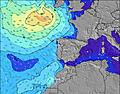 | 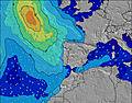 | 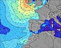 | |||||||||||||
Wave Height (m) Direction Period (s) | W 10 | W 9 | W 9 | W 8 | W 9 | W 9 | W 8 | W 8 | NNW 9 | NNW 10 | NNW 9 | NNW 9 | NNW 9 | NNW 7 | NNW 7 | NNW 7 | NNW 7 | NNW 7 | NNW 8 | NNW 8 |
Wave Graph | ||||||||||||||||||||
68 | 64 | 78 | 205 | 153 | 120 | 89 | 86 | 53 | 301 | 415 | 90 | 280 | 211 | 160 | 183 | 185 | 134 | 88 | 219 | |
Wind (km/h) | ||||||||||||||||||||
Wind State on-shore cross-onshore cross-shore cross-offshore off-shore glassy | cross-on | glassy | cross | cross-on | glassy | cross-on | on | cross | cross-on | cross-on | cross | cross-on | cross-on | cross | cross-on | cross-on | cross-on | cross-on | cross-on | cross |
High Tide | 6:28PM3.10m | 6:48AM2.89m | 7:03PM3.02m | 7:26AM2.81m | 7:44PM2.91m | 8:11AM2.71m | 8:35PM2.77m | 9:12AM2.61m | 9:48PM2.63m | 10:38AM2.56m | 11:25PM2.57m | 12:11PM2.62m | 00:54AM2.63m | |||||||
Low Tide | 00:37AM0.89m | 12:48PM0.97m | 1:17AM0.97m | 1:31PM1.06m | 2:02AM1.08m | 2:21PM1.18m | 2:55AM1.21m | 3:21PM1.29m | 4:00AM1.32m | 4:37PM1.36m | 5:16AM1.37m | 6:01PM1.32m | ||||||||
— | — | 6:33 | — | — | 6:33 | — | — | 6:35 | — | — | 6:35 | — | — | 6:37 | — | — | 6:37 | — | — | |
8:49 | — | — | 8:47 | — | — | 8:46 | — | — | 8:45 | — | — | 8:45 | — | — | 8:44 | — | — | 8:42 | — | |
mm | — | — | — | — | — | — | — | — | — | — | — | — | — | — | — | — | — | — | — | — |
Temp °C | 20 | 19 | 21 | 21 | 20 | 21 | 22 | 20 | 19 | 19 | 18 | 18 | 19 | 18 | 18 | 19 | 18 | 19 | 19 | 18 |
Feels °C | 19 | 20 | 19 | 20 | 22 | 20 | 22 | 21 | 17 | 16 | 17 | 18 | 17 | 18 | 18 | 17 | 18 | 20 | 17 | 17 |
Swell 1 Height (m) Direction Period (s) | W 10 | W 9 | W 9 | W 8 | W 9 | W 9 | W 8 | W 8 | W 8 | W 7 | WNW 10 | NNW 9 | W 10 | NNW 9 | NNW 7 | W 9 | W 9 | NNW 7 | NNW 8 | NNW 8 |
68 | 64 | 78 | 205 | 153 | 120 | 89 | 86 | 44 | 26 | 34 | 90 | 49 | 82 | 160 | 15 | 14 | 134 | 88 | 219 | |
Swell 2 Height (m) Direction Period (s) | NW 5 | NNW 7 | NNW 7 | NNW 8 | NNW 8 | NNW 9 | NW 11 | NW 10 | NNW 9 | WNW 10 | W 7 | W 10 | SW 12 | WNW 10 | NNW 8 | W 6 | S 12 | W 9 | W 9 | W 8 |
11 | 10 | 5 | 6 | 6 | 8 | 20 | 54 | 53 | 34 | 15 | 49 | 5 | 30 | 41 | 2 | 3 | 14 | 14 | 6 | |
Swell 3 Height (m) Direction Period (s) | NNW 7 | NW 4 | W 15 | — | SW 13 | NW 11 | NNW 9 | SW 12 | NW 11 | SW 12 | SW 12 | SW 14 | — | SW 13 | WNW 9 | S 13 | — | W 6 | W 6 | — |
11 | 3 | 4 | — | 7 | 5 | 8 | 6 | 32 | 6 | 6 | 8 | — | 7 | 29 | 3 | — | 3 | 2 | — | |
Wind waves Height (m) Direction Period (s) | NW 5 | — | SSE 2 | — | — | — | — | — | NW 3 | NNW 10 | NNW 9 | NNW 6 | NNW 9 | NNW 7 | — | NNW 7 | NNW 7 | — | NW 6 | — |
11 | — | 1 | — | — | — | — | — | 2 | 301 | 415 | 70 | 280 | 211 | — | 183 | 185 | — | 38 | — | |
Nearest Offshore or Glassy | ||||||||||||||||||||
Distance (km) | 222 | 0 | 5 | 222 | 0 | 8 | 218 | 52 | 118 | 218 | 63 | 118 | 307 | 76 | 76 | 305 | 52 | 52 | 307 | 32 |
Best forecast wave conditions in Beira | ||||||||||||||||||||
Best forecast wave conditions in Portugal | ||||||||||||||||||||
Header Global | ||||||||||||||||||||
- Map Icons:
 Break
Break Live Wave Height (m)
 Live Wind Speed (km/h)
 Surf Rating (10 Max)
 Ocean Swells (m)
- Wind Speed (km/h)
Latest Updates


FREE! Surf-Forecast.com widget for your website
The surf report / weather widget below is available to embed on third party websites free of charge and provides a summary of our Costa Nova surf forecast. Simply grab the html code snippet that we provide and paste it into your own site. You can choose your preferred language and metric/imperial units for the surf forecast feed to suit users of your site. Click here to get the code.
Information about the Costa Nova Surf forecast
The above surf forecast table for Costa Nova provides essential information for determining whether the surfing conditions will be good over the next 16 days. A general guide to surfing at Costa Nova can be found by selecting the local surf guide option on the grey menu. Our Costa Nova surf forecast is unique since it includes wave energy (power) that defines the real feel of the surf rather than just the height or the period. If you surf the same spot (Costa Nova) regularly then make a mental note of the wave energy from the surf forecast table each time you go. Very soon you may start to choose your surf days based on the wave energy alone combined with our forecast of favourable offshore wind conditions. Our star ratings will help here and of course you will also find the usual wave height and period predictions on our surf forecasts as well as a full break down of the swell components under our advanced users option (to reveal that, click the little Einstein character under the tide times).
Further information to help with frequently asked questions about our surf forecast for Costa Nova may be found under the help tab on the top menu and also by moving your mouse over the question marks on the surf forecast table itself. Please always bear in mind that the forecast is for near-shore open water and local factors at each surf break influence the actual breaking wave height, such as the beach / reef profile, water depths offshore and shelter.
Costa Nova is 8 km (5 miles) from the city of Ilhavo. If you plan a holiday in Beira, look for hotels and other accommodation in Ilhavo. Ilhavo has rooms for a wide range of budgets as well as car hire and transport links.
 Nearest