

Surf Forecasts:

| Time (CEST) & Date | Wave Height | Wave Period |
|---|---|---|
| Morning (26 Jul) | - | - |
| Afternoon (26 Jul) | - | - |
| Evening (26 Jul) | 0.5ft (0.1m) | 5s |
Table - waves today at Chalupy. (Swell directed towards the surf break)
Short Range ForecastLight rain (total 7mm), mostly falling on Sun night. Warm (max 20°C on Sun morning, min 15°C on Mon night). Winds increasing (calm on Sun night, strong winds from the W by Mon afternoon). | ||||||||||||||||||||||||
Sunday 26 | Monday 27 | Tuesday 28 | ||||||||||||||||||||||
2 AM | 5 AM | 8 AM | 11 AM | 2 PM | 5 PM | 8 PM | 11 PM | 2 AM | 5 AM | 8 AM | 11 AM | 2 PM | 5 PM | 8 PM | 11 PM | 2 AM | 5 AM | 8 AM | 11 AM | 2 PM | 5 PM | 8 PM | 11 PM | |
Swell Height Map | 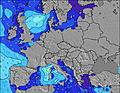 | 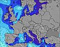 | 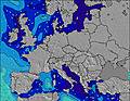 | 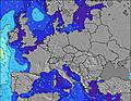 | 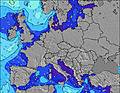 | 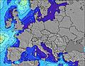 | 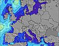 |  | 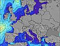 | |||||||||||||||
Wave Height (m) Direction Period (s) | NW 5 | W 6 | SSW 2 | — | — | — | NW 5 | NW 5 | NW 5 | SE 3 | SW 2 | W 3 | NW 4 | WNW 4 | WNW 4 | NNW 6 | NNW 8 | N 5 | N 5 | NW 7 | NW 7 | N 5 | N 5 | N 6 |
Wave Graph | ||||||||||||||||||||||||
1 | 1 | 0 | 0 | 0 | 0 | 1 | 1 | 1 | 0 | 0 | 0 | 0 | 0 | 0 | 6 | 7 | 4 | 5 | 156 | 152 | 5 | 9 | 5 | |
Wind (km/h) | ||||||||||||||||||||||||
Wind State on-shore cross-onshore cross-shore cross-offshore off-shore glassy | cross-off | cross-off | cross-off | cross-off | cross-off | cross-off | glassy | cross-off | cross-off | cross-off | off | off | cross-off | cross-off | cross-off | cross-off | cross-off | cross-off | cross-off | cross-off | cross-off | cross-off | cross-off | cross-off |
High Tide | 11:56PM0.02m | 11:03AM0.02m | 00:27AM0.03m | 11:40AM0.02m | 00:51AM0.03m | 12:14PM0.02m | ||||||||||||||||||
Low Tide | 5:55AM0.01m | 5:35PM0.01m | 6:22AM0.01m | 6:07PM0.00m | 6:48AM0.01m | 6:37PM0.00m | ||||||||||||||||||
4:43 | — | — | — | — | — | — | — | 4:46 | — | — | — | — | — | — | — | 4:47 | — | — | — | — | — | — | — | |
— | — | — | — | — | — | 8:59 | — | — | — | — | — | — | — | 8:57 | — | — | — | — | — | — | — | 8:55 | — | |
mm | — | — | — | — | — | — | — | 4 | 1 | — | 1 | — | 1 | — | — | — | — | — | — | — | — | — | — | — |
Temp °C | 18 | 18 | 19 | 20 | 20 | 19 | 18 | 16 | 16 | 16 | 17 | 18 | 17 | 17 | 17 | 16 | 15 | 15 | 15 | 16 | 17 | 17 | 18 | 17 |
Feels °C | 15 | 15 | 17 | 18 | 18 | 18 | 19 | 14 | 13 | 14 | 14 | 14 | 10 | 9 | 9 | 8 | 8 | 8 | 8 | 8 | 9 | 10 | 12 | 12 |
Swell 1 Height (m) Direction Period (s) | NW 5 | NW 5 | — | — | — | — | — | NW 5 | NW 5 | — | SSE 3 | — | — | — | — | NNW 6 | NNW 8 | N 5 | N 5 | — | — | N 5 | N 5 | N 6 |
1 | 1 | — | — | — | — | — | 1 | 1 | — | 1 | — | — | — | — | 6 | 7 | 4 | 5 | — | — | 5 | 9 | 5 | |
Swell 2 Height (m) Direction Period (s) | — | W 6 | — | — | — | — | — | NW 5 | — | — | — | — | — | — | — | — | — | — | — | — | — | — | — | — |
— | 1 | — | — | — | — | — | 1 | — | — | — | — | — | — | — | — | — | — | — | — | — | — | — | — | |
Swell 3 Height (m) Direction Period (s) | — | — | — | — | — | — | NW 5 | — | — | — | — | — | — | — | — | — | — | — | — | — | — | — | — | — |
— | — | — | — | — | — | 1 | — | — | — | — | — | — | — | — | — | — | — | — | — | — | — | — | — | |
Wind waves Height (m) Direction Period (s) | — | S 2 | SSW 2 | — | — | — | — | — | — | SE 3 | SW 2 | W 3 | NW 4 | WNW 4 | WNW 4 | WNW 4 | NW 4 | WNW 4 | NW 4 | NW 7 | NW 7 | WNW 4 | WNW 4 | WNW 4 |
— | 1 | 1 | — | — | — | — | — | — | 2 | 2 | 5 | 47 | 54 | 48 | 41 | 35 | 25 | 39 | 156 | 152 | 32 | 20 | 13 | |
Nearest Offshore or Glassy | ||||||||||||||||||||||||
Distance (km) | 742 | 742 | 647 | 647 | 671 | 671 | 1295 | 451 | 451 | 451 | 1210 | 1269 | 1210 | 1211 | 1266 | 950 | 1200 | 1201 | 1201 | 1201 | 1201 | 1208 | 904 | 742 |
Best forecast wave conditions in Baltic | ||||||||||||||||||||||||
Best forecast wave conditions in Poland | ||||||||||||||||||||||||
Header Global | ||||||||||||||||||||||||
- Map Icons:
 Break
Break Live Wave Height (m)
 Live Wind Speed (km/h)
 Surf Rating (10 Max)
 Ocean Swells (m)
- Wind Speed (km/h)


FREE! Surf-Forecast.com widget for your website
The surf report / weather widget below is available to embed on third party websites free of charge and provides a summary of our Chalupy surf forecast. Simply grab the html code snippet that we provide and paste it into your own site. You can choose your preferred language and metric/imperial units for the surf forecast feed to suit users of your site. Click here to get the code.
 Nearest