

Surf Forecasts:

Campos at Manzanillo surf forecast from 10 Jul 2026:
- Best quality surf: Friday 10 Jul, 9PM (local time) - 4.5ft (1.3m), 15s period, SSW swell with cross-offshore winds.
- Most powerful swell: Friday 10 Jul, 9PM (local time) - 4.5ft (1.3m), 15s period, SSW swell with 815 kJ wave energy.
- Next surfable swell (1★+): Friday 10 Jul, 9PM (local time) - 4.5ft (1.3m), 15s period with SSW swell.
Best Forecast Surf Conditions for Campos at Manzanillo this week:
The surf forecast for Campos at Manzanillo over the next 16 days: The first swell (rated 1 star or higher) is forecast to arrive on Friday (Jul 10) at 9PM. The primary swell is predicted to be 1.3m and 15s period with a secondary swell of 0.6m and 10s. The wind is predicted to be cross-offshore as the swell arrives.
The most powerful waves expected at Campos at Manzanillo in the next 16 days are 1.3m 15s and forecast to arrive on Friday (Jul 10) at 9PM. Winds are predicted to be cross-offshore at the time the swell arrives. The largest open ocean swell (not directed at the beach) is 0.9m 5s period and expected on Sunday (Jul 12) at 12AM.
| Wave Type | Time (CST) & Date | Wave Height & Period |
|---|---|---|
| Next good surf (1 star+) | 9PM (Fri 10th Jul) | 4.5ft (1.3m) 15s |
| Best Surf | 9PM (Fri 10th Jul) | 4.5ft (1.3m) 15s |
| Most Powerful | 9PM (Fri 10th Jul) | 4.5ft (1.3m) 15s |
Table - best surf conditions forecast for Campos at Manzanillo over the next 16 days.
Alright, let’s get into it. This is Rusty, and I’m looking at the next couple of weeks at Campos at Manzanillo.
First off, the water is sitting at 88°, which is a touch warmer than normal for this time of year – so you can leave the thick rubber at home. The overall pattern is a solid run of fun, manageable swell, with a few standout mornings that are going to be pure magic. The first few days are good, but the real gems are hiding in the second week, so keep an eye on the calendar.
We kick off on Friday, July 10th with a glassy morning. Calm winds, 4ft of SSW groundswell rolling in at a long 15 seconds. The energy is moderate (801), and conditions are going to be perfect for a beginner-friendly wave. The afternoon gets chopped up by a cross-on breeze, so get your session in early.
Saturday, July 11th repeats the formula: another glassy morning, 4ft of SSW swell at 14 seconds, clean as a whistle. The crowds are *sometimes* an issue here, but on a morning like this, it’s worth the company. The afternoons go a bit scratchy, but the mornings are where it’s at.
Sunday, July 12th is a write-off in the afternoon with a risk of thunderstorms and a moderate cross-onshore wind. The morning is cleaner but still a bit textured with a cross-shore breeze.
Monday, July 13th through Tuesday, July 14th are a mixed bag. Monday morning has some cross-shore wind, but Tuesday morning (July 14th) is a beauty – glassy, 3ft of SSW swell, and the energy is still respectable (542). It’s small but clean, perfect for a longboard.
Wednesday, July 15th morning is a gem: glassy, 4ft of SE swell, and the wind is dead calm. This is a sneaky good session.
Now, let’s talk standouts.
Thursday, July 16th morning is a solid call: 5ft of S swell, clean with a cross-off breeze, and moderate energy (475). It’s not huge, but the setup is right.
Saturday, July 18th morning is another one to circle: glassy, 4ft of SSW swell, and the energy is ticking along at 561. The wind is off the land, so it’s going to be a really clean, fun wave.
But the true standout is Monday, July 20th morning. This is a cracker. 4ft of SW groundswell, a long 16-second period, and the energy is strong (1022). The wind is a light cross-off, keeping the face clean. This is excellent surf for experienced surfers – the long period will make the waves peel nicely, but it might section off a bit at the beach, so keep your wits about you. The crowds are a possibility, but this one is worth the paddle.
The second big standout is Thursday, July 23rd morning. 7ft of SW swell, 11-second period, and a glassy start. The energy is very strong (1088). This is a big, powerful wave – only for the experts. If you’re not comfortable on a 6ft+ day, sit this one out. The afternoon gets chopped, so it’s a dawny mission.
Finally, Saturday, July 25th morning is a weird one: only 2ft, but a 21-second period and a clean cross-off wind. The energy is very strong (1236) for such a small height, which means it’s going to be a super consistent, long-lined groundswell. It’s a rare, funky day that could surprise you with shape and push.
There’s a bit of a hole in the middle – Sunday, July 19th and Tuesday, July 22nd are average at best, with rain and choppy winds. But the run from July 20th to the 25th has some real quality.
Keep in mind, the long-period swells (15-21 seconds) are best suited to the points and reefs around here – the beach breaks might get a bit straight. But when it’s glassy, nothing beats it.
Rusty.
Short Range ForecastHeavy rain (total 21mm), heaviest during Sun night. Warm (max 33°C on Fri afternoon, min 25°C on Sun night). Wind will be generally light. | Days 4-6 Weather SummaryHeavy rain (total 23mm), heaviest during Wed night. Warm (max 31°C on Mon afternoon, min 26°C on Mon night). Wind will be generally light. | ||||||||||||||||||||
Friday 10 | Saturday 11 | Sunday 12 | Monday 13 | Tuesday 14 | Wednesday 15 | Thursday 16 | |||||||||||||||
AM | PM | Night | AM | PM | Night | AM | PM | Night | AM | PM | Night | AM | PM | Night | AM | PM | Night | AM | PM | Night | |
Swell Height Map |  |  |  | 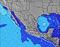 | 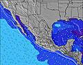 | 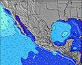 | 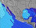 | ||||||||||||||
Wave Height (m) Direction Period (s) | SSW 15 | SSW 15 | SSW 15 | SSW 14 | SSW 15 | SSW 16 | SSW 14 | SSW 14 | SSW 14 | SSW 13 | SSW 13 | SSW 13 | SSW 13 | SW 18 | SSW 12 | SE 10 | SW 16 | SW 16 | S 9 | S 11 | S 9 |
Wave Graph | |||||||||||||||||||||
665 | 674 | 794 | 602 | 746 | 796 | 594 | 594 | 459 | 408 | 336 | 273 | 269 | 375 | 169 | 248 | 310 | 254 | 311 | 396 | 162 | |
Wind (km/h) | |||||||||||||||||||||
Wind State on-shore cross-onshore cross-shore cross-offshore off-shore glassy | glassy | cross-on | cross-off | glassy | cross-on | cross-off | cross | cross-on | glassy | cross | on | glassy | glassy | on | glassy | glassy | on | glassy | cross-off | cross-on | cross |
High Tide | 9:28AM0.69m | 5:47PM0.83m | 9:38AM0.74m | 6:45PM0.91m | 10:01AM0.77m | 7:36PM0.97m | 10:28AM0.78m | 8:23PM1.00m | 10:57AM0.78m | 9:08PM1.00m | 11:26AM0.77m | 9:51PM0.95m | 11:55AM0.75m | 10:32PM0.86m | |||||||
Low Tide | 12:19PM0.66m | 1:59AM-0.01m | 1:18PM0.65m | 2:38AM-0.11m | 2:02PM0.62m | 3:17AM-0.16m | 2:43PM0.58m | 3:54AM-0.16m | 3:23PM0.54m | 4:31AM-0.11m | 4:05PM0.50m | 5:04AM-0.02m | 4:47PM0.48m | ||||||||
6:26 | — | — | 6:26 | — | — | 6:26 | — | — | 6:26 | — | — | 6:26 | — | — | 6:26 | — | — | 6:28 | — | — | |
— | 7:38 | — | — | 7:37 | — | — | 7:37 | — | — | 7:37 | — | — | 7:37 | — | — | 7:37 | — | — | 7:37 | — | |
mm | — | — | — | — | — | — | — | 7 | 14 | — | 3 | 5 | 1 | — | 2 | — | 2 | 10 | — | 3 | 9 |
Temp °C | 32 | 33 | 29 | 32 | 33 | 29 | 32 | 31 | 27 | 30 | 31 | 28 | 30 | 31 | 28 | 31 | 30 | 28 | 30 | 30 | 27 |
Feels °C | 34 | 35 | 32 | 35 | 36 | 33 | 35 | 34 | 31 | 34 | 35 | 34 | 33 | 34 | 34 | 34 | 33 | 33 | 33 | 32 | 31 |
Swell 1 Height (m) Direction Period (s) | SSW 15 | SSW 15 | SSW 15 | SSW 14 | SSW 15 | SSW 16 | SSW 14 | SSW 14 | SSW 14 | SSW 13 | SSW 13 | SSW 13 | SSW 13 | SSW 13 | SSW 12 | SE 10 | SSE 9 | S 8 | S 9 | S 11 | S 9 |
665 | 674 | 794 | 602 | 746 | 796 | 594 | 594 | 459 | 408 | 336 | 273 | 269 | 261 | 169 | 248 | 158 | 234 | 311 | 396 | 162 | |
Swell 2 Height (m) Direction Period (s) | S 11 | S 11 | S 10 | S 10 | S 10 | W 5 | S 9 | S 9 | S 9 | S 9 | SW 19 | SSE 8 | SW 18 | SW 18 | SSE 8 | SW 16 | SW 16 | SW 16 | WSW 16 | SSW 15 | SSW 11 |
63 | 59 | 64 | 50 | 49 | 16 | 59 | 39 | 39 | 38 | 303 | 51 | 252 | 375 | 64 | 214 | 310 | 254 | 99 | 144 | 76 | |
Swell 3 Height (m) Direction Period (s) | SSW 20 | SSW 20 | NW 11 | S 18 | WNW 11 | S 10 | WNW 5 | W 5 | SW 21 | SW 19 | SSE 9 | SW 19 | SSE 8 | SSE 8 | SE 12 | SSW 12 | SSW 12 | S 13 | SW 16 | WSW 15 | S 12 |
37 | 75 | 5 | 158 | 11 | 47 | 9 | 9 | 117 | 184 | 15 | 184 | 21 | 21 | 98 | 101 | 131 | 92 | 65 | 87 | 80 | |
Wind waves Height (m) Direction Period (s) | NW 12 | NW 8 | WNW 4 | WNW 4 | WNW 4 | WNW 5 | — | — | — | — | SSE 5 | — | — | — | — | — | — | — | — | — | — |
36 | 16 | 8 | 9 | 6 | 35 | — | — | — | — | 53 | — | — | — | — | — | — | — | — | — | — | |
Nearest Offshore or Glassy | |||||||||||||||||||||
Distance (km) | 0 | 219 | 0 | 0 | 225 | 0 | 28 | 149 | 0 | 22 | 222 | 0 | 0 | 194 | 0 | 0 | 222 | 0 | 0 | 194 | 149 |
Best forecast wave conditions in Colima | |||||||||||||||||||||
Best forecast wave conditions in Mexico | |||||||||||||||||||||
Header Global | |||||||||||||||||||||
- Map Icons:
 Break
Break Live Wave Height (m)
 Live Wind Speed (km/h)
 Surf Rating (10 Max)
 Ocean Swells (m)
- Wind Speed (km/h)


FREE! Surf-Forecast.com widget for your website
The surf report / weather widget below is available to embed on third party websites free of charge and provides a summary of our Campos at Manzanillo surf forecast. Simply grab the html code snippet that we provide and paste it into your own site. You can choose your preferred language and metric/imperial units for the surf forecast feed to suit users of your site. Click here to get the code.
Information about the Campos at Manzanillo Surf forecast
The above surf forecast table for Campos at Manzanillo provides essential information for determining whether the surfing conditions will be good over the next 16 days. A general guide to surfing at Campos at Manzanillo can be found by selecting the local surf guide option on the grey menu. Our Campos at Manzanillo surf forecast is unique since it includes wave energy (power) that defines the real feel of the surf rather than just the height or the period. If you surf the same spot (Campos at Manzanillo) regularly then make a mental note of the wave energy from the surf forecast table each time you go. Very soon you may start to choose your surf days based on the wave energy alone combined with our forecast of favourable offshore wind conditions. Our star ratings will help here and of course you will also find the usual wave height and period predictions on our surf forecasts as well as a full break down of the swell components under our advanced users option (to reveal that, click the little Einstein character under the tide times).
Further information to help with frequently asked questions about our surf forecast for Campos at Manzanillo may be found under the help tab on the top menu and also by moving your mouse over the question marks on the surf forecast table itself. Please always bear in mind that the forecast is for near-shore open water and local factors at each surf break influence the actual breaking wave height, such as the beach / reef profile, water depths offshore and shelter.
Are you planning a holiday in Colima? If you are looking for accommodation near Campos at Manzanillo, camping, hotels and holiday cottages in Colima, consider staying in Manzanillo which is 5 km (3 miles) away. Other places in and around Colima where you can find information about places to rent, and car hire include Cihuatlan which is 30 km (19 miles) away, Armeria, Tecoman and Villa de Alvarez.
 Nearest