

Surf Forecasts:

Updates in hr min s Forecast update imminent
Short Range ForecastMostly dry. Warm (max 31°C on Sat afternoon, min 21°C on Fri night). Wind will be generally light. | ||||||||||||||||||||||||
Friday 19 | Saturday 20 | Sunday 21 | Mon 22 | |||||||||||||||||||||
5 AM | 8 AM | 11 AM | 2 PM | 5 PM | 8 PM | 11 PM | 2 AM | 5 AM | 8 AM | 11 AM | 2 PM | 5 PM | 8 PM | 11 PM | 2 AM | 5 AM | 8 AM | 11 AM | 2 PM | 5 PM | 8 PM | 11 PM | 2 AM | |
Swell Height Map | 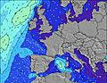 |  |  |  |  |  |  |  |  |  | ||||||||||||||
Wave Height (m) Direction Period (s) | SSE 3 | SSE 3 | S 5 | SE 3 | SSE 4 | SSE 4 | SSE 4 | SSE 3 | SE 6 | SE 6 | SE 6 | SE 6 | SE 4 | SSE 4 | SSE 4 | SSE 4 | SE 6 | SSE 6 | SSE 6 | SSE 6 | SE 4 | SSE 5 | SSE 5 | SSE 4 |
Wave Graph | ||||||||||||||||||||||||
0 | 0 | 0 | 0 | 0 | 0 | 0 | 0 | 0 | 0 | 0 | 12 | 0 | 0 | 0 | 0 | 0 | 0 | 0 | 0 | 0 | 0 | 0 | 0 | |
Wind (km/h) | ||||||||||||||||||||||||
Wind State on-shore cross-onshore cross-shore cross-offshore off-shore glassy | cross-off | cross-off | cross-off | cross-off | cross-off | cross-off | cross-off | off | glassy | glassy | cross | cross | cross-off | cross-off | cross-off | off | cross | glassy | cross | cross | cross | cross-off | glassy | cross |
High Tide | 12:12PM0.33m | 1:37AM0.42m | 1:07PM0.32m | 2:29AM0.41m | 2:18PM0.32m | |||||||||||||||||||
Low Tide | 8:16AM0.28m | 6:57PM0.25m | 9:04AM0.28m | 7:50PM0.26m | 9:50AM0.28m | 8:46PM0.28m | ||||||||||||||||||
6:09 | — | — | — | — | — | — | — | 6:09 | — | — | — | — | — | — | — | 6:09 | — | — | — | — | — | — | 6:09 | |
— | — | — | — | — | 9:27 | — | — | — | — | — | — | — | 9:27 | — | — | — | — | — | — | — | 9:28 | — | 9:28 | |
mm | — | — | — | — | — | — | — | — | — | — | — | — | — | — | — | — | — | — | — | — | — | — | — | — |
Temp °C | 21 | 22 | 26 | 28 | 29 | 27 | 24 | 23 | 21 | 22 | 25 | 29 | 31 | 28 | 25 | 24 | 21 | 22 | 25 | 28 | 31 | 30 | 24 | 22 |
Feels °C | 19 | 21 | 24 | 24 | 25 | 25 | 23 | 23 | 22 | 24 | 25 | 26 | 27 | 26 | 24 | 24 | 21 | 23 | 26 | 27 | 28 | 29 | 25 | 23 |
Swell 1 Height (m) Direction Period (s) | — | — | S 5 | — | — | — | — | SSE 5 | SE 6 | SE 6 | SE 6 | SSE 6 | — | — | — | — | SE 6 | SSE 6 | SSE 6 | — | — | — | SE 5 | SE 4 |
— | — | 1 | — | — | — | — | 3 | 9 | 9 | 9 | 13 | — | — | — | — | 8 | 13 | 13 | — | — | — | 4 | 8 | |
Swell 2 Height (m) Direction Period (s) | — | — | — | — | — | — | — | — | SSE 3 | — | — | — | — | — | — | — | — | — | — | — | — | — | — | — |
— | — | — | — | — | — | — | — | 1 | — | — | — | — | — | — | — | — | — | — | — | — | — | — | — | |
Swell 3 Height (m) Direction Period (s) | — | — | — | — | — | — | — | — | — | — | — | — | — | — | — | — | — | — | — | — | — | — | — | — |
— | — | — | — | — | — | — | — | — | — | — | — | — | — | — | — | — | — | — | — | — | — | — | — | |
Wind waves Height (m) Direction Period (s) | SSE 3 | SSE 3 | — | SE 3 | SSE 4 | SSE 4 | SSE 4 | SSE 3 | — | — | — | SE 6 | SE 4 | SSE 4 | SSE 4 | SSE 4 | S 4 | — | — | SSE 6 | SE 4 | SSE 5 | SSE 5 | SSE 4 |
1 | 1 | — | 4 | 16 | 17 | 11 | 4 | — | — | — | 12 | 20 | 37 | 20 | 11 | 7 | — | — | 22 | 42 | 59 | 24 | 13 | |
Nearest Offshore or Glassy | ||||||||||||||||||||||||
Distance (km) | 396 | 394 | 396 | 485 | 485 | 482 | 394 | 394 | 394 | 394 | 394 | 394 | 394 | 394 | 207 | 207 | 298 | 321 | 394 | 394 | 395 | 430 | 398 | 856 |
Best forecast wave conditions in Languedoc-Roussillon | ||||||||||||||||||||||||
Best forecast wave conditions in France | ||||||||||||||||||||||||
Header Global | ||||||||||||||||||||||||
- Map Icons:
 Break
Break Live Wave Height (m)
 Live Wind Speed (km/h)
 Surf Rating (10 Max)
 Ocean Swells (m)
- Wind Speed (km/h)


FREE! Surf-Forecast.com widget for your website
The surf report / weather widget below is available to embed on third party websites free of charge and provides a summary of our Banyuls surf forecast. Simply grab the html code snippet that we provide and paste it into your own site. You can choose your preferred language and metric/imperial units for the surf forecast feed to suit users of your site. Click here to get the code.
 Nearest