

Surf Forecasts:

How big are the waves at Audreselles today (03 Aug):
- Morning surf: Morning surf (03 Aug, local time) - 0.5ft (0.1m), 8s period with W swell.
- Afternoon surf: Afternoon surf (03 Aug, local time) - 0.5ft (0.1m), 9s period with W swell.
- Evening surf: Evening surf (03 Aug, local time) - 0.5ft (0.1m), 9s period with W swell.
The current surf forecast for Audreselles at 10AM is: 0.1m 10s primary swell from a West direction and 0.1m 8s secondary swell from a West direction (forecast issued at 01:00am August 03). An open ocean swell of 0.4m 5s is not directed at the surf break. The wind direction is predicted to be cross-offshore.
| Time (CEST) & Date | Wave Height | Wave Period |
|---|---|---|
| Morning (03 Aug) | 0.5ft (0.1m) | 8s |
| Afternoon (03 Aug) | 0.5ft (0.1m) | 9s |
| Evening (03 Aug) | 0.5ft (0.1m) | 9s |
Table - waves today at Audreselles. (Swell directed towards the surf break)
Short Range ForecastLight rain (total 3mm), mostly falling on Mon night. Warm (max 25°C on Mon afternoon, min 16°C on Wed night). Winds increasing (light winds from the ESE on Mon night, fresh winds from the WSW by Wed afternoon). | ||||||||||||||||||||||||
Monday 3 | Tuesday 4 | Wednesday 5 | ||||||||||||||||||||||
2 AM | 5 AM | 8 AM | 11 AM | 2 PM | 5 PM | 8 PM | 11 PM | 2 AM | 5 AM | 8 AM | 11 AM | 2 PM | 5 PM | 8 PM | 11 PM | 2 AM | 5 AM | 8 AM | 11 AM | 2 PM | 5 PM | 8 PM | 11 PM | |
Swell Height Map |  | 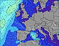 |  |  |  |  |  |  |  | |||||||||||||||
Wave Height (m) Direction Period (s) | W 8 | W 8 | W 8 | W 10 | W 9 | W 9 | W 9 | W 8 | W 8 | W 8 | W 8 | WSW 8 | WSW 4 | WSW 4 | WSW 4 | W 4 | WSW 4 | WSW 4 | WSW 5 | WSW 6 | WSW 6 | WSW 6 | WSW 6 | WSW 6 |
Wave Graph | ||||||||||||||||||||||||
1 | 1 | 1 | 2 | 2 | 2 | 2 | 1 | 5 | 5 | 5 | 13 | 11 | 15 | 11 | 7 | 7 | 25 | 72 | 136 | 184 | 223 | 213 | 182 | |
Wind (km/h) | ||||||||||||||||||||||||
Wind State on-shore cross-onshore cross-shore cross-offshore off-shore glassy | off | off | off | cross-off | cross-off | cross-off | off | cross-off | cross-off | cross | cross-on | on | on | on | on | on | on | on | on | on | on | on | on | on |
High Tide | 3:51AM7.19m | 4:11PM7.18m | 4:31AM7.09m | 4:52PM7.02m | 5:15AM6.86m | 5:39PM6.75m | ||||||||||||||||||
Low Tide | 10:59AM0.56m | 11:17PM0.65m | 11:36AM0.76m | 11:56PM0.87m | 12:15PM1.05m | |||||||||||||||||||
— | 6:20 | — | — | — | — | — | — | — | 6:22 | — | — | — | — | — | — | — | 6:24 | — | — | — | — | — | — | |
— | — | — | — | — | — | 9:36 | — | — | — | — | — | — | — | 9:35 | — | — | — | — | — | — | — | 9:32 | — | |
mm | — | — | — | — | — | — | — | 2 | 1 | — | — | — | — | — | — | — | — | — | — | — | — | — | — | — |
Temp °C | 20 | 19 | 19 | 23 | 25 | 25 | 24 | 22 | 22 | 21 | 20 | 21 | 21 | 21 | 21 | 20 | 19 | 18 | 18 | 18 | 19 | 19 | 18 | 18 |
Feels °C | 17 | 18 | 18 | 22 | 23 | 22 | 21 | 20 | 22 | 21 | 19 | 17 | 18 | 19 | 20 | 18 | 16 | 14 | 13 | 12 | 13 | 13 | 12 | 13 |
Swell 1 Height (m) Direction Period (s) | W 8 | NNE 5 | NNE 5 | NNE 5 | W 9 | W 9 | W 9 | NE 5 | NNE 5 | NNE 5 | NNE 5 | NNE 5 | NNE 6 | NNE 6 | NNE 6 | W 8 | W 8 | NE 6 | NE 6 | N 6 | N 6 | — | — | — |
1 | 25 | 17 | 11 | 2 | 2 | 2 | 6 | 4 | 4 | 2 | 3 | 3 | 3 | 3 | 5 | 4 | 1 | 1 | 1 | 1 | — | — | — | |
Swell 2 Height (m) Direction Period (s) | — | W 8 | W 8 | W 8 | W 8 | — | — | W 8 | W 8 | W 8 | W 8 | — | — | N 6 | W 8 | NNE 6 | NE 6 | — | — | — | — | — | — | — |
— | 1 | 1 | 1 | 1 | — | — | 1 | 5 | 5 | 5 | — | — | 1 | 5 | 3 | 1 | — | — | — | — | — | — | — | |
Swell 3 Height (m) Direction Period (s) | — | — | — | W 10 | — | — | — | N 5 | — | — | — | — | — | — | — | N 6 | — | — | — | — | — | — | — | — |
— | — | — | 2 | — | — | — | 1 | — | — | — | — | — | — | — | 1 | — | — | — | — | — | — | — | — | |
Wind waves Height (m) Direction Period (s) | NE 5 | — | — | — | NNE 5 | NNE 5 | NNE 5 | — | — | — | — | WSW 8 | WSW 4 | WSW 4 | WSW 4 | W 4 | WSW 4 | WSW 4 | WSW 5 | WSW 6 | WSW 6 | WSW 6 | WSW 6 | WSW 6 |
25 | — | — | — | 10 | 15 | 10 | — | — | — | — | 13 | 11 | 15 | 11 | 7 | 7 | 25 | 72 | 136 | 184 | 223 | 213 | 182 | |
Nearest Offshore or Glassy | ||||||||||||||||||||||||
Distance (km) | 410 | 232 | 232 | 294 | 408 | 432 | 472 | 410 | 419 | 503 | 339 | 296 | 339 | 402 | 391 | 340 | 407 | 444 | 444 | 500 | 507 | 741 | 539 | 527 |
Best forecast wave conditions in Nord - Pas de Calais | ||||||||||||||||||||||||
Best forecast wave conditions in France | ||||||||||||||||||||||||
Header Global | ||||||||||||||||||||||||
- Map Icons:
 Break
Break Live Wave Height (m)
 Live Wind Speed (km/h)
 Surf Rating (10 Max)
 Ocean Swells (m)
- Wind Speed (km/h)
Latest Updates


FREE! Surf-Forecast.com widget for your website
The surf report / weather widget below is available to embed on third party websites free of charge and provides a summary of our Audreselles surf forecast. Simply grab the html code snippet that we provide and paste it into your own site. You can choose your preferred language and metric/imperial units for the surf forecast feed to suit users of your site. Click here to get the code.
 Nearest