- Forecast
- Maps
- Live
- Weather State
- Spot Information
Surf Forecasts:
Atins surfForecast / Maranhao / Brazil
Forecast update in hr min s Forecast update imminent
Atins surf forecast is for near shore open water. Breaking waves will often be smaller at less exposed spots.
Today's Atins sea temperature is
29.3° C
(Which is 1.0°C warmer than normal for this time of year)How big are the waves at Atins today?
The current surf forecast for Atins at 10PM is: 0.7m 8s primary swell from a North-northeast direction and 0.9m 5s secondary swell from a East-northeast direction (forecast issued at 02:00pm May 12). The wind direction is predicted to be cross-offshore.
| Time (-03) & Date | Wave Height | Wave Period |
|---|---|---|
| Morning (12 May) | - | - |
| Afternoon (12 May) | 4ft (1.2m) | 8s |
| Evening (12 May) | 2.5ft (0.7m) | 8s |
Table - waves today at Atins. (Swell directed towards the surf break)
Updates in hr min s Forecast update imminent
Short Range ForecastHeavy rain (total 49mm), heaviest during Tue night. Warm (max 28°C on Tue afternoon, min 25°C on Fri morning). Wind will be generally light. | ||||||||||||||||||||||||
Tue 12 | Wednesday 13 | Thursday 14 | Fri 15 | |||||||||||||||||||||
12 PM | 3 PM | 6 PM | 9 PM | 12 AM | 3 AM | 6 AM | 9 AM | 12 PM | 3 PM | 6 PM | 9 PM | 12 AM | 3 AM | 6 AM | 9 AM | 12 PM | 3 PM | 6 PM | 9 PM | 12 AM | 3 AM | 6 AM | 9 AM | |
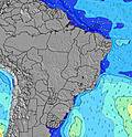
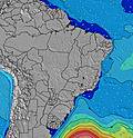
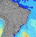
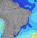
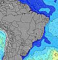
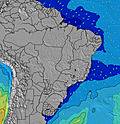
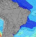
Swell Height Map | ||||||||||||||||||||||||
NNE 8 | NE 8 | NNE 8 | NNE 8 | NNE 8 | NNE 8 | NNE 8 | NNE 8 | NNE 8 | NE 8 | NE 8 | NNE 8 | NE 6 | NE 8 | NNE 8 | ENE 5 | NE 8 | NE 8 | NE 5 | NE 6 | NE 8 | NE 8 | NE 8 | NNE 9 | |
72 | 196 | 70 | 70 | 70 | 68 | 68 | 68 | 68 | 165 | 142 | 67 | 164 | 157 | 50 | 94 | 198 | 216 | 98 | 133 | 239 | 180 | 166 | 154 | |
Wind (km/h) | ||||||||||||||||||||||||
cross-off | cross-off | cross | cross | cross-off | cross-off | cross-off | cross-off | cross-off | cross-off | cross-off | cross-off | cross-off | cross-off | cross-off | cross-off | cross-off | cross-off | cross-off | cross-off | cross-off | cross | cross | cross-off | |
High Tide | 1:14PM2.43m | 1:46AM2.53m | 2:10PM2.59m | 2:34AM2.74m | 3:01PM2.73m | 3:20AM2.92m | ||||||||||||||||||
Low Tide | 7:33PM0.61m | 8:01AM0.57m | 8:22PM0.46m | 8:50AM0.33m | 9:08PM0.33m | |||||||||||||||||||
— | — | — | — | — | 5:47 | — | — | — | — | — | — | — | 5:47 | — | — | — | — | — | — | — | 5:47 | — | — | |
— | 5:46 | — | — | — | — | — | — | — | 5:46 | — | — | — | — | — | — | — | 5:46 | — | — | — | — | — | 5:46 | |
2 | 1 | 1 | 4 | 7 | 2 | — | — | 1 | 1 | 2 | 3 | 3 | 2 | 2 | 4 | 5 | 2 | 1 | 1 | — | — | — | 4 | |
Temp °C | 28 | 28 | 28 | 27 | 27 | 27 | 27 | 28 | 28 | 28 | 27 | 27 | 27 | 26 | 27 | 26 | 27 | 28 | 27 | 27 | 27 | 27 | 27 | 25 |
28 | 29 | 30 | 28 | 28 | 28 | 28 | 29 | 28 | 30 | 29 | 29 | 28 | 27 | 28 | 26 | 27 | 28 | 26 | 27 | 29 | 29 | 30 | 28 | |
Swell 1 Height (m) Direction Period (s) | NNE 8 | NNE 8 | NNE 8 | NNE 8 | NNE 8 | NNE 8 | NNE 8 | NNE 8 | NNE 8 | N 15 | N 15 | NNE 8 | N 16 | N 16 | NNE 8 | NNE 10 | N 14 | N 15 | N 14 | NNE 14 | NNE 13 | NE 8 | NE 8 | NNE 9 |
72 | 115 | 70 | 70 | 70 | 68 | 68 | 68 | 68 | 4 | 4 | 67 | 5 | 5 | 50 | 19 | 16 | 17 | 16 | 19 | 35 | 180 | 166 | 154 | |
Swell 2 Height (m) Direction Period (s) | — | — | — | — | — | — | — | — | N 15 | N 15 | N 15 | N 16 | — | — | NNE 10 | N 15 | — | — | N 15 | — | N 13 | NNE 13 | NNE 13 | NNE 13 |
— | — | — | — | — | — | — | — | 4 | 4 | 4 | 5 | — | — | 18 | 17 | — | — | 17 | — | 32 | 35 | 34 | 34 | |
Swell 3 Height (m) Direction Period (s) | — | — | — | — | — | — | — | — | — | — | — | — | — | — | N 16 | — | — | — | — | — | — | — | — | — |
— | — | — | — | — | — | — | — | — | — | — | — | — | — | 19 | — | — | — | — | — | — | — | — | — | |
Wind waves Height (m) Direction Period (s) | ENE 4 | NE 8 | ENE 5 | ENE 4 | ENE 5 | ENE 5 | ENE 5 | E 5 | ENE 5 | NE 8 | NE 8 | ENE 5 | NE 6 | NE 8 | ENE 5 | ENE 5 | NE 8 | NE 8 | NE 5 | NE 6 | NE 8 | — | — | — |
26 | 196 | 33 | 39 | 35 | 35 | 30 | 42 | 40 | 165 | 142 | 61 | 164 | 157 | 45 | 94 | 198 | 216 | 98 | 133 | 239 | — | — | — | |
Nearest Offshore or Glassy | ||||||||||||||||||||||||
Distance (km) | 2266 | 1993 | 488 | 167 | 859 | 419 | 177 | 1364 | 177 | 177 | 177 | 177 | 177 | 162 | 177 | 177 | 177 | 162 | 177 | 468 | 173 | 419 | 419 | 0 |
Best forecast wave conditions in Maranhão | ||||||||||||||||||||||||
Best forecast wave conditions in Brazil | ||||||||||||||||||||||||
Header Global | ||||||||||||||||||||||||
- Map Icons:
Break
Live Wave Height (m)
Live Wind Speed (km/h)
Surf Rating (10 Max)
Ocean Swells (m)
Wind Speed (km/h)


