

Surf Forecasts:

Weligama surf forecast from 12 Jul 2026:
- Most powerful swell: Thursday 16 Jul, 8AM (local time) - 3.5ft (1.0m), 15s period, SSW swell with 405 kJ wave energy.
Best Forecast Surf Conditions for Weligama this week:
The most powerful waves expected at Weligama in the next 16 days are 1.0m 15s and forecast to arrive on Thursday (Jul 16) at 8AM. Winds are predicted to be cross-shore at the time the swell arrives.
| Wave Type | Time (+0530) & Date | Wave Height & Period |
|---|---|---|
| Next good surf (1 star+) | - | - |
| Best Surf | - | - |
| Most Powerful | 8AM (Thu 16th Jul) | 3.5ft (1.0m) 15s |
Table - best surf conditions forecast for Weligama over the next 16 days.
Alright folks, Rusty here. Let’s have a look at what’s coming up for Weligama.
First off, the next week and a half is a bit of a struggle. We’re looking at a pretty long run of average to poor conditions starting right now. The consistent W wind is blowing cross-shore, which puts a real chop on the surface, and the energy is just not there. From Sunday the 12th right through to the 20th, the surf is mostly marginal at best, with the combined energy sitting between 437 and 893 – that’s weak to moderate. The swell is small, generally under 3 ft, and the period is all over the place, but the wind is the real killer. The water temp is about average for the time of year, nothing wild there.
The first real standout arrives on Monday the 20th of July. We start to see a pulse of energy. The swell jumps to 5 ft in the morning, building to 6 ft by the afternoon, straight out of the S. The period is a solid 17 to 18 seconds, so that’s proper groundswell energy. The combined energy rockets up to 1861 (strong). However, the wind is still cross-shore from the W at 12 mph, so it’s not going to be the cleanest. That 6 ft on the afternoon is getting into the range where it’s a bit much for beginners, but for the advanced crew, that’s the best energy in the window. The 6 ft S swell at 17 seconds will be solid, but the cross-shore wind will stop it being truly epic.
The second real highlight, and probably the best bet for clean waves, comes on Saturday the 25th of July. The morning shows a 3 ft SSW swell with a 18-second period, and the wind turns cross-offshore from the W at 16 mph. That’s the cleanest wind we see in the whole forecast. The combined energy is 1105 (moderate). The afternoon gets even better on the wind front, still cross-off from the WNW at 16 mph, with the same 3 ft SSW swell and a 16-second period. Energy is 1111. This is the pick of the month. It’s the cleanest, most lined-up option. The size is friendly for all abilities, but remember, that long period groundswell can make beach breaks a bit straight. Here at Weligama, a beach and reef setup, it should still offer some nice walls. Crowds are *sometimes* an issue, so expect some company.
The rest of the second week is more of the same cross-shore wind and inconsistent energy. If you’re looking for the best shot, Saturday the 25th is the day to circle on the calendar. It’s a long way out, so keep an eye on it, but it’s the one that’s got me excited.
Rusty, signing off.
Short Range ForecastModerate rain (total 10mm), heaviest on Sun morning. Warm (max 29°C on Mon morning, min 26°C on Tue night). Wind will be generally light. | Days 4-6 Weather SummaryLight rain (total 5mm), mostly falling on Thu night. Warm (max 29°C on Thu morning, min 26°C on Wed night). Wind will be generally light. | ||||||||||||||||||||
Sunday 12 | Monday 13 | Tuesday 14 | Wednesday 15 | Thursday 16 | Friday 17 | Saturday 18 | |||||||||||||||
AM | PM | Night | AM | PM | Night | AM | PM | Night | AM | PM | Night | AM | PM | Night | AM | PM | Night | AM | PM | Night | |
Swell Height Map | 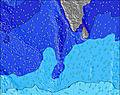 |  | 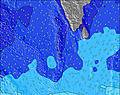 | 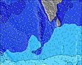 | 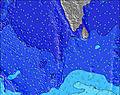 | 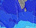 | 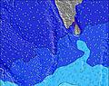 | ||||||||||||||
Wave Height (m) Direction Period (s) | S 12 | S 12 | S 12 | S 12 | S 12 | S 12 | SSW 18 | S 11 | SSW 16 | SSW 15 | SSW 15 | SSW 16 | SSW 14 | SSW 14 | SSW 14 | SSW 14 | SSW 14 | SSW 14 | SSW 14 | SSW 13 | SSW 13 |
Wave Graph | |||||||||||||||||||||
304 | 309 | 294 | 347 | 333 | 396 | 322 | 295 | 366 | 331 | 322 | 382 | 400 | 400 | 400 | 330 | 325 | 285 | 213 | 201 | 198 | |
Wind (km/h) | |||||||||||||||||||||
Wind State on-shore cross-onshore cross-shore cross-offshore off-shore glassy | cross | cross | cross | cross | cross | cross | cross | cross | cross-off | cross | cross-off | cross | cross | cross | cross | cross | cross | cross | cross | cross | cross |
High Tide | 1:04PM0.50m | 1:41AM0.37m | 1:50PM0.53m | 2:24AM0.41m | 2:30PM0.55m | 3:04AM0.45m | 3:06PM0.55m | 3:42AM0.48m | 3:38PM0.54m | 4:18AM0.50m | 4:09PM0.52m | 4:53AM0.50m | 4:38PM0.50m | 5:27AM0.49m | |||||||
Low Tide | 7:51PM0.11m | 7:19AM0.12m | 8:27PM0.07m | 8:09AM0.10m | 9:01PM0.04m | 8:52AM0.08m | 9:32PM0.01m | 9:32AM0.08m | 10:03PM0.00m | 10:09AM0.10m | 10:33PM0.00m | 10:44AM0.12m | 11:02PM0.02m | ||||||||
6:00 | — | — | 6:00 | — | — | 6:00 | — | — | 6:01 | — | — | 6:01 | — | — | 6:01 | — | — | 6:01 | — | — | |
— | 6:27 | — | — | 6:27 | — | — | 6:27 | — | — | 6:27 | — | — | 6:27 | — | — | 6:27 | — | — | 6:27 | — | |
mm | 3 | 4 | 3 | — | — | — | — | — | — | — | — | — | — | — | 1 | — | — | 4 | 2 | 3 | 5 |
Temp °C | 28 | 28 | 27 | 29 | 29 | 27 | 29 | 29 | 27 | 28 | 28 | 26 | 29 | 29 | 27 | 28 | 28 | 27 | 28 | 27 | 26 |
Feels °C | 30 | 28 | 29 | 29 | 29 | 29 | 29 | 29 | 29 | 28 | 29 | 28 | 29 | 29 | 29 | 29 | 27 | 28 | 28 | 27 | 27 |
Swell 1 Height (m) Direction Period (s) | S 12 | S 12 | S 12 | S 12 | S 12 | S 12 | S 11 | S 11 | S 11 | S 11 | S 11 | S 11 | SSW 14 | SSW 14 | SSW 14 | SSW 14 | S 7 | SSW 14 | S 7 | S 8 | S 8 |
304 | 309 | 294 | 347 | 333 | 396 | 295 | 295 | 235 | 231 | 185 | 223 | 400 | 400 | 400 | 330 | 86 | 285 | 77 | 130 | 90 | |
Swell 2 Height (m) Direction Period (s) | W 10 | W 9 | W 9 | W 9 | SSW 19 | SSW 18 | SSW 18 | SSW 16 | SSW 16 | SSW 15 | SSW 15 | SSW 16 | S 10 | S 10 | S 10 | S 10 | SSW 14 | S 8 | SSW 14 | SSW 13 | SSW 13 |
148 | 110 | 81 | 60 | 295 | 352 | 322 | 283 | 366 | 331 | 322 | 382 | 159 | 123 | 92 | 90 | 325 | 54 | 213 | 201 | 198 | |
Swell 3 Height (m) Direction Period (s) | SSE 9 | SSE 9 | SSW 20 | SSW 21 | SE 8 | SE 8 | SE 8 | SSE 13 | ESE 8 | ESE 8 | ESE 9 | E 9 | ESE 9 | WNW 10 | W 10 | W 10 | WNW 10 | W 10 | W 9 | W 9 | W 9 |
8 | 8 | 37 | 251 | 24 | 17 | 10 | 34 | 6 | 6 | 8 | 2 | 7 | 19 | 16 | 18 | 31 | 31 | 43 | 43 | 41 | |
Wind waves Height (m) Direction Period (s) | W 6 | WSW 6 | WSW 6 | WSW 7 | WSW 7 | W 7 | W 7 | WSW 7 | WSW 6 | W 6 | W 6 | W 6 | WSW 6 | WSW 6 | WSW 5 | WSW 6 | W 6 | WSW 6 | W 6 | W 6 | W 6 |
112 | 123 | 144 | 191 | 197 | 134 | 148 | 152 | 119 | 100 | 94 | 63 | 86 | 83 | 62 | 161 | 130 | 121 | 108 | 104 | 82 | |
Nearest Offshore or Glassy | |||||||||||||||||||||
Distance (km) | 190 | 671 | 379 | 190 | 189 | 769 | 190 | 189 | 879 | 190 | 189 | 189 | 190 | 182 | 190 | 190 | 185 | 379 | 795 | 189 | 795 |
Best forecast wave conditions in West Sri Lanka | |||||||||||||||||||||
Best forecast wave conditions in Sri Lanka | |||||||||||||||||||||
Header Global | |||||||||||||||||||||
- Map Icons:
 Break
Break Live Wave Height (m)
 Live Wind Speed (km/h)
 Surf Rating (10 Max)
 Ocean Swells (m)
- Wind Speed (km/h)


FREE! Surf-Forecast.com widget for your website
The surf report / weather widget below is available to embed on third party websites free of charge and provides a summary of our Weligama surf forecast. Simply grab the html code snippet that we provide and paste it into your own site. You can choose your preferred language and metric/imperial units for the surf forecast feed to suit users of your site. Click here to get the code.
Information about the Weligama Surf forecast
The above surf forecast table for Weligama provides essential information for determining whether the surfing conditions will be good over the next 16 days. A general guide to surfing at Weligama can be found by selecting the local surf guide option on the grey menu. Our Weligama surf forecast is unique since it includes wave energy (power) that defines the real feel of the surf rather than just the height or the period. If you surf the same spot (Weligama) regularly then make a mental note of the wave energy from the surf forecast table each time you go. Very soon you may start to choose your surf days based on the wave energy alone combined with our forecast of favourable offshore wind conditions. Our star ratings will help here and of course you will also find the usual wave height and period predictions on our surf forecasts as well as a full break down of the swell components under our advanced users option (to reveal that, click the little Einstein character under the tide times).
Further information to help with frequently asked questions about our surf forecast for Weligama may be found under the help tab on the top menu and also by moving your mouse over the question marks on the surf forecast table itself. Please always bear in mind that the forecast is for near-shore open water and local factors at each surf break influence the actual breaking wave height, such as the beach / reef profile, water depths offshore and shelter.
Weligama is 1 km (1 miles) from the city of Weligama. If you plan a holiday in West Sri Lanka, look for hotels and other accommodation in Weligama. Weligama has rooms for a wide range of budgets as well as car hire and transport links.
 Nearest