

Surf Forecasts:

Pottuvil Point surf forecast from 20 Jul 2026:
- Best quality surf: Tuesday 21 Jul, 5AM (local time) - 5ft (1.6m), 16s period, SSW swell with offshore winds.
- Most powerful swell: Wednesday 22 Jul, 8PM (local time) - 7ft (2.1m), 13s period, SSW swell with 1,408 kJ wave energy.
- Next surfable swell (1★+): Tuesday 21 Jul, 5AM (local time) - 5ft (1.6m), 16s period with SSW swell.
Best Forecast Surf Conditions for Pottuvil Point this week:
The surf forecast for Pottuvil Point over the next 16 days: The first swell (rated 1 star or higher) is forecast to arrive on Tuesday (Jul 21) at 5AM. The primary swell is predicted to be 1.6m and 16s period with a secondary swell of 0.3m and 8s. Another secondary swell of 1.4m and 6s is also forecast. The wind is predicted to be offshore as the swell arrives.
The most powerful waves expected at Pottuvil Point in the next 16 days are 2.1m 13s and forecast to arrive on Wednesday (Jul 22) at 8PM. Winds are predicted to be cross-offshore at the time the swell arrives. The largest open ocean swell (not directed at the beach) is 1.8m 6s period and expected on Thursday (Jul 23) at 5PM.
| Wave Type | Time (+0530) & Date | Wave Height & Period |
|---|---|---|
| Next good surf (1 star+) | 5AM (Tue 21st Jul) | 5ft (1.6m) 16s |
| Best Surf | 5AM (Tue 21st Jul) | 5ft (1.6m) 16s |
| Most Powerful | 8PM (Wed 22nd Jul) | 7ft (2.1m) 13s |
Table - best surf conditions forecast for Pottuvil Point over the next 16 days.
The Lowdown
Alright, let’s get into it. Pottuvil Point is the only game in town for this outlook, and it’s a point break that’s fairly consistent and fairly exposed to the swell. The optimum direction is from the SSE, and we’ve got a lot of that coming through.
First thing to note – the water temperature is about average for the time of year, nothing weird going on there.
The start of the period is a bit of a slow burn. Tuesday and Wednesday the 21st and 22nd of July are pretty average. We’ve got some S swell running, but the winds are cross-offshore and a bit strong, especially on the afternoons. The wave energy is moderate to strong, but conditions are marginal. Not really worth paddling out for the quality on offer.
Thursday and Friday the 23rd and 24th are a write-off. Swell drops right off, wind is up, and the energy just isn’t there. You’ll be sitting on your board doing nothing. Saturday the 25th afternoon picks up a bit with 7ft from the S and strong energy, but the period is short at 10 seconds, and the wind is still cross-off. It’s messy.
Now, Sunday the 26th of July is where things start to look interesting. The morning session has 5ft from the SE, period at 11 seconds, with a light breeze and cross-off wind. The wave energy is moderate. It’s clean and the forecast is very good. Not a standout, but a solid session.
Monday the 27th is similar – morning is clean, 3ft from the SE, light wind, good energy. Tuesday the 28th of July is a real treat: glassy conditions in the morning with 3ft from the SE, period 10 seconds, and energy moderate. It’s clean, glassy, and likely to be a fun morning. The afternoon picks up to 7ft from the SSW but the period drops to 7 seconds – that’s a short period, won’t hold up well on the point, but it’s still a clean wave.
The real standout, the one you’d circle on the calendar, is Thursday the 30th of July. The morning is glassy, dead calm, with 3ft from the SSW and a very long period of 18 seconds. That’s groundswell, and on a point break like Pottuvil, that’s going to line up beautifully. The energy is moderate, but the quality is rated very good. The afternoon is even better: 8ft from the SSW with offshore wind and clean conditions. The period is short (7 seconds), but the energy is strong and the wind is offshore. It’s a serious session for sure.
The 31st of July has a glassy afternoon too – 8ft from the SSW, period 7 seconds, energy strong, and glassy conditions. It’s a big wave, but with that short period it’s going to be a bit fat and dumpy. Still, for the size and the clean wind, it’s worth a look if you’re experienced.
Heading into August, the 1st is a nice morning: 4ft from the SSW, period 16 seconds, glassy conditions, and strong energy. That’s a gorgeous morning for a long, clean wall. The 2nd is also clean in the morning with offshore wind, 4ft from the SSW, period 14 seconds, and good energy. The 3rd of August is a real beauty – glassy calm in the morning, 3ft from the SSW, period 15 seconds, energy strong, and the afternoon is the best of the whole outlook: 3ft from the SSW, period 18 seconds, with offshore wind and excellent conditions for experienced surfers. The energy is very strong. That’s a day to call in sick for.
The 4th of August has a huge 7ft from the SSW, period 18 seconds, and massive energy. The wind is offshore in the afternoon, so it’s clean, but that’s a lot of water moving. Experts only, and it’s going to be a heavy, powerful point break session. The 5th of August winds down with 5ft from the SSW, period 16 seconds, strong energy, but the wind is onshore in the morning, so it’s a bit of a mixed bag.
Overall, the best on offer is the afternoon of the 3rd of August, with that perfect combination of swell size, very long period, offshore wind, and excellent quality. The Thursday the 30th of July is a close second. The rest of the window has plenty of fun, clean waves, but those two are the standouts.
Rusty
Short Range ForecastMostly dry. Warm (max 32°C on Wed morning, min 26°C on Mon night). Winds increasing (light winds from the ENE on Tue morning, fresh winds from the S by Thu afternoon). | Days 5-7 Weather SummaryMostly dry. Warm (max 32°C on Fri morning, min 26°C on Thu night). Winds decreasing (fresh winds from the S on Fri afternoon, light winds from the SSW by Sun morning). | ||||||||||||||||||
Tuesday 21 | Wednesday 22 | Thursday 23 | Friday 24 | Saturday 25 | Sunday 26 | ||||||||||||||
Night | AM | PM | Night | AM | PM | Night | AM | PM | Night | AM | PM | Night | AM | PM | Night | AM | PM | Night | |
Swell Height Map |  | 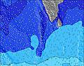 | 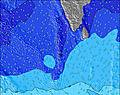 | 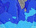 | 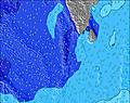 | 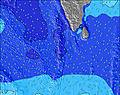 | 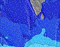 | ||||||||||||
Wave Height (m) Direction Period (s) | S 16 | S 15 | S 14 | S 14 | S 13 | SSW 13 | S 12 | S 12 | SSW 17 | S 11 | SSE 10 | SSW 15 | SSE 10 | SSE 10 | S 10 | SSE 10 | SE 11 | SSW 7 | SE 10 |
Wave Graph | |||||||||||||||||||
1004 | 1005 | 713 | 474 | 427 | 1144 | 235 | 278 | 59 | 178 | 170 | 84 | 200 | 339 | 955 | 367 | 423 | 469 | 226 | |
Wind (km/h) | |||||||||||||||||||
Wind State on-shore cross-onshore cross-shore cross-offshore off-shore glassy | off | on | cross-off | off | cross-off | cross-off | off | cross-off | cross-off | off | cross-off | cross-off | off | cross-off | cross-off | off | cross-off | cross-off | off |
High Tide | 6:49AM0.17m | 6:22AM0.17m | 5:40AM0.17m | 4:52AM0.17m | 4:30AM0.18m | 1:03PM0.15m | 4:27AM0.19m | 1:45PM0.16m | 4:34AM0.19m | ||||||||||
Low Tide | 10:27PM0.06m | 9:42PM0.07m | 8:49PM0.07m | 8:24PM0.06m | 8:29PM0.04m | 10:13AM0.14m | 8:46PM0.03m | 9:50AM0.14m | 9:06PM0.02m | ||||||||||
— | 5:54 | — | — | 5:54 | — | — | 5:54 | — | — | 5:54 | — | — | 5:54 | — | — | 5:54 | — | — | |
— | — | 6:22 | — | — | 6:22 | — | — | 6:22 | — | — | 6:22 | — | — | 6:22 | — | — | 6:22 | — | |
mm | — | — | — | — | — | — | — | — | — | — | — | — | — | — | — | — | — | — | — |
Temp °C | 30 | 31 | 30 | 29 | 32 | 31 | 30 | 32 | 32 | 29 | 32 | 32 | 29 | 32 | 32 | 29 | 32 | 32 | 30 |
Feels °C | 33 | 34 | 32 | 30 | 33 | 31 | 30 | 32 | 31 | 28 | 32 | 31 | 29 | 32 | 31 | 28 | 34 | 33 | 31 |
Swell 1 Height (m) Direction Period (s) | S 16 | S 15 | S 14 | S 14 | S 13 | SE 8 | S 12 | S 12 | SE 8 | S 11 | SSE 10 | SSW 15 | SSE 10 | SSE 10 | SSW 16 | SSE 10 | SE 11 | SE 11 | SE 10 |
1004 | 1005 | 713 | 474 | 427 | 15 | 235 | 278 | 25 | 178 | 170 | 84 | 200 | 339 | 220 | 367 | 423 | 361 | 226 | |
Swell 2 Height (m) Direction Period (s) | S 7 | SE 8 | SE 8 | SE 8 | SSW 5 | S 18 | SE 8 | SE 8 | SSW 17 | SE 9 | SE 9 | S 18 | SSW 14 | SSW 14 | S 18 | SSW 14 | SSW 14 | SSW 18 | SSW 13 |
23 | 10 | 10 | 17 | 25 | 6 | 15 | 17 | 59 | 28 | 39 | 6 | 105 | 71 | 6 | 186 | 236 | 32 | 154 | |
Swell 3 Height (m) Direction Period (s) | SE 8 | SW 16 | SW 16 | SW 15 | SE 8 | — | SW 16 | SSW 16 | SSW 15 | SW 16 | SSW 15 | — | S 18 | SSW 16 | — | S 20 | SW 18 | — | SSW 17 |
16 | 10 | 10 | 8 | 16 | — | 10 | 25 | 23 | 63 | 88 | — | 6 | 86 | — | 7 | 13 | — | 54 | |
Wind waves Height (m) Direction Period (s) | SW 6 | SW 6 | SSW 6 | SSW 6 | SW 6 | SSW 13 | SSW 6 | SSW 5 | S 6 | SSW 6 | SSW 6 | S 6 | SSW 6 | SSW 6 | S 10 | SSW 6 | SSW 6 | SSW 7 | SW 6 |
52 | 80 | 69 | 115 | 72 | 1144 | 123 | 42 | 235 | 96 | 50 | 214 | 111 | 43 | 955 | 136 | 82 | 469 | 147 | |
Nearest Offshore or Glassy | |||||||||||||||||||
Distance (km) | 0 | 7 | 947 | 0 | 0 | 949 | 0 | 949 | 949 | 0 | 949 | 949 | 0 | 661 | 949 | 0 | 0 | 949 | 0 |
Best forecast wave conditions in East Sri Lanka | |||||||||||||||||||
Best forecast wave conditions in Sri Lanka | |||||||||||||||||||
Header Global | |||||||||||||||||||
- Map Icons:
 Break
Break Live Wave Height (m)
 Live Wind Speed (km/h)
 Surf Rating (10 Max)
 Ocean Swells (m)
- Wind Speed (km/h)


FREE! Surf-Forecast.com widget for your website
The surf report / weather widget below is available to embed on third party websites free of charge and provides a summary of our Pottuvil Point surf forecast. Simply grab the html code snippet that we provide and paste it into your own site. You can choose your preferred language and metric/imperial units for the surf forecast feed to suit users of your site. Click here to get the code.
Information about the Pottuvil Point Surf forecast
The above surf forecast table for Pottuvil Point provides essential information for determining whether the surfing conditions will be good over the next 16 days. A general guide to surfing at Pottuvil Point can be found by selecting the local surf guide option on the grey menu. Our Pottuvil Point surf forecast is unique since it includes wave energy (power) that defines the real feel of the surf rather than just the height or the period. If you surf the same spot (Pottuvil Point) regularly then make a mental note of the wave energy from the surf forecast table each time you go. Very soon you may start to choose your surf days based on the wave energy alone combined with our forecast of favourable offshore wind conditions. Our star ratings will help here and of course you will also find the usual wave height and period predictions on our surf forecasts as well as a full break down of the swell components under our advanced users option (to reveal that, click the little Einstein character under the tide times).
Further information to help with frequently asked questions about our surf forecast for Pottuvil Point may be found under the help tab on the top menu and also by moving your mouse over the question marks on the surf forecast table itself. Please always bear in mind that the forecast is for near-shore open water and local factors at each surf break influence the actual breaking wave height, such as the beach / reef profile, water depths offshore and shelter.
Are you planning a holiday in East Sri Lanka? If you are looking for accommodation near Pottuvil Point, camping, hotels and holiday cottages in East Sri Lanka, consider staying in Ampara which is 47 km (29 miles) away. Other places in and around East Sri Lanka where you can find information about places to rent, and car hire include Kalmunai which is 57 km (35 miles) away, Badulla and Batticaloa.
 Nearest