

Surf Forecasts:

Vunaniu surf forecast from 3 Aug 2026:
- Best quality surf: Wednesday 5 Aug, 12AM (local time) - 4ft (1.2m), 19s period, SSW swell with cross-offshore winds.
- Most powerful swell: Monday 3 Aug, 6PM (local time) - 7.5ft (2.3m), 13s period, SSW swell with 1,765 kJ wave energy.
- Next surfable swell (1★+): Wednesday 5 Aug, 12AM (local time) - 4ft (1.2m), 19s period with SSW swell.
Best Forecast Surf Conditions for Vunaniu this week:
The surf forecast for Vunaniu over the next 16 days: The first swell (rated 1 star or higher) is forecast to arrive on Wednesday (Aug 05) at 12AM. The primary swell is predicted to be 1.2m and 19s period with a secondary swell of 1.9m and 11s. The wind is predicted to be cross-offshore as the swell arrives.
The most powerful waves expected at Vunaniu in the next 16 days are 2.3m 13s and forecast to arrive on Monday (Aug 03) at 6PM. Winds are predicted to be cross-onshore at the time the swell arrives. The largest open ocean swell (not directed at the beach) is 0.4m 9s period and expected on Tuesday (Aug 04) at 9PM.
| Wave Type | Time (+12) & Date | Wave Height & Period |
|---|---|---|
| Next good surf (1 star+) | 12AM (Wed 5th Aug) | 4ft (1.2m) 19s |
| Best Surf | 12AM (Wed 5th Aug) | 4ft (1.2m) 19s |
| Most Powerful | 6PM (Mon 3rd Aug) | 7.5ft (2.3m) 13s |
Table - best surf conditions forecast for Vunaniu over the next 16 days.
The Lowdown
G'day, Rusty here. Looks like we’re in for a bit of a slow start at Vunaniu, but there’s some real promise further down the line. This reef break is a bit inconsistent, so you gotta be patient and pick your windows. The water temp is sitting at 77°, which is pretty much spot on for this time of year, nothing unusual there.
The first few days are a write-off, honestly. Monday the 3rd through to Sunday the 9th, the conditions are just not lining up. We’ve got a decent amount of swell in the water, with combined energy readings well into the thousands (1224 to 2248), but the wind is all over the shop – cross, cross-on, and even a strong cross-breeze hitting 25 mph on Friday the 7th. That’s kicking up a messy, lumpy chop, and the wave comment is either “marginal” or “poor.” Not worth paddling out for. The swell is mostly from the SSW, between 3 ft and 10 ft, but the wind is ruining it. On Friday the 7th, with 10 ft of short-period SE swell (8 seconds, 2212 energy) and a strong cross-breeze, it’s honestly looking more like a kite surf session than a paddle surf one.
Now, things start to clean up from Monday the 10th of August. The wind swings to a cross-offshore from the E, and the sea state turns clean. The swell drops a bit, with heights around 5 ft to 7 ft, and period staying short (8 seconds). The combined energy is still moderate (587 to 1150). It’s surfable, but nothing to write home about – the wave comment is still “marginal.” This pattern holds through to Thursday the 13th.
The first real standout comes on Friday the 14th of August. Morning session looks the pick. We’ve got a gentle cross-offshore breeze from the ENE at 9 mph, keeping the surf clean. Swell is 5 ft from the ESE with an 8-second period, and the combined energy is 667. The wave comment says “expect very good surf conditions.” It’s not going to be a monster day, but with the reef handle and clean conditions, it’s a solid option for intermediate surfers. Keep an eye on the crowds, as this spot can get busy.
But the absolute best on offer is on Saturday the 15th of August. The morning has a light breeze from the NE at 6 mph, creating clean conditions. The swell is only 3 ft, but it’s a long-period groundswell from the SSW at 18 seconds, with a combined energy of 1128. That’s a very long period, which will push through with real power and shape, especially on this reef. The wave comment says “excellent surf conditions for experienced surfers.” This is the one to plan for – it’s a standout for quality, even if the wave height is modest. The longer period will mean longer waits between sets, but the waves will be worth it.
Sunday the 16th of August keeps the good vibes going. Morning is glassy – no wind at all – with 5 ft of ESE swell at 10 seconds. The wave comment is “expect very good surf conditions.” Another clean, fun morning for intermediate surfers.
Then Monday the 17th of August morning is also glassy, with 6 ft of ESE swell at 12 seconds. The combined energy is 1182, and the wave comment is again “excellent surf conditions for experienced surfers.” This is a strong, clean, long-period swell that will be firing on the reef. Tuesday the 18th of August morning also offers glassy conditions with 6 ft of ESE swell at 11 seconds, and the wave comment is “excellent.” So, the second week has a run of real quality mornings.
Overall, the first week is a dud, but from the 14th onward, you’ve got some crackers. The 15th of August morning is the true standout – that long-period, clean, excellent surf is a gem. Just remember it’s a bit further out, so the forecast is promising but not locked in yet.
Rusty.
Short Range ForecastLight rain (total 2mm), mostly falling on Mon morning. Warm (max 22°C on Tue morning, min 19°C on Mon night). Winds increasing (light winds from the SE on Mon night, fresh winds from the ESE by Wed night). | Days 4-6 Weather SummaryLight rain (total 3mm), mostly falling on Thu night. Warm (max 22°C on Thu morning, min 20°C on Thu night). Mainly strong winds. | ||||||||||||||||||||
Monday 3 | Tuesday 4 | Wednesday 5 | Thursday 6 | Friday 7 | Saturday 8 | Sunday 9 | |||||||||||||||
AM | PM | Night | AM | PM | Night | AM | PM | Night | AM | PM | Night | AM | PM | Night | AM | PM | Night | AM | PM | Night | |
Swell Height Map | 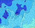 | 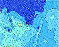 | 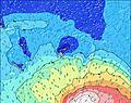 | 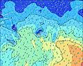 | 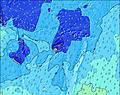 | 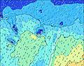 | 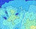 | ||||||||||||||
Wave Height (m) Direction Period (s) | SSW 13 | SSW 13 | SSW 13 | SSW 12 | SSW 11 | SSW 19 | SSW 18 | SSW 17 | SSW 16 | SSW 16 | SSW 15 | SSW 14 | SE 8 | ESE 8 | ESE 8 | ESE 8 | ESE 8 | ESE 8 | ESE 8 | S 18 | SSE 16 |
Wave Graph | |||||||||||||||||||||
888 | 1965 | 1497 | 1369 | 917 | 963 | 1172 | 1120 | 993 | 957 | 711 | 508 | 1441 | 765 | 726 | 614 | 523 | 584 | 338 | 639 | 644 | |
Wind (km/h) | |||||||||||||||||||||
Wind State on-shore cross-onshore cross-shore cross-offshore off-shore glassy | cross-on | cross-on | cross | cross | cross | cross-off | cross | cross | cross | cross | cross | cross | cross | cross | cross-off | cross-off | cross-off | cross-off | cross-off | cross-off | cross-off |
High Tide | 9:21AM1.43m | 9:57PM1.49m | 10:08AM1.37m | 10:40PM1.50m | 11:03AM1.31m | 11:29PM1.50m | 12:06PM1.26m | 00:26AM1.50m | 1:17PM1.25m | 1:29AM1.52m | 2:28PM1.27m | 2:34AM1.56m | 3:36PM1.34m | ||||||||
Low Tide | 3:33PM0.30m | 4:07AM0.42m | 4:14PM0.36m | 4:58AM0.41m | 5:02PM0.42m | 5:57AM0.39m | 5:58PM0.47m | 7:03AM0.35m | 7:03PM0.50m | 8:11AM0.29m | 8:12PM0.49m | 9:16AM0.21m | 9:20PM0.45m | ||||||||
6:35 | — | — | 6:33 | — | — | 6:33 | — | — | 6:33 | — | — | 6:33 | — | — | 6:33 | — | — | 6:31 | — | — | |
— | 5:53 | — | — | 5:53 | — | — | 5:54 | — | — | 5:54 | — | — | 5:54 | — | — | 5:54 | — | — | 5:55 | — | |
mm | 1 | — | — | — | — | — | — | 1 | — | — | — | 2 | — | — | — | — | — | 1 | — | 2 | 2 |
Temp °C | 21 | 21 | 20 | 22 | 22 | 21 | 21 | 21 | 21 | 22 | 22 | 22 | 21 | 21 | 21 | 21 | 22 | 21 | 22 | 22 | 21 |
Feels °C | 20 | 18 | 18 | 19 | 19 | 19 | 18 | 18 | 17 | 17 | 16 | 17 | 14 | 15 | 15 | 15 | 17 | 16 | 18 | 19 | 18 |
Swell 1 Height (m) Direction Period (s) | SSW 13 | SSW 13 | SSW 13 | SSW 12 | SSW 11 | SSE 11 | SSW 18 | SSW 17 | SSW 16 | SSW 16 | SSW 15 | SSW 14 | SSW 14 | SSE 10 | S 10 | S 11 | S 11 | SSE 11 | SSE 11 | S 11 | SSE 16 |
888 | 1965 | 1497 | 1369 | 917 | 813 | 1172 | 1120 | 993 | 957 | 711 | 508 | 373 | 739 | 520 | 371 | 297 | 209 | 303 | 242 | 644 | |
Swell 2 Height (m) Direction Period (s) | SE 12 | SE 12 | SE 13 | SE 12 | S 11 | SSW 19 | SSW 11 | S 12 | S 11 | S 11 | SSE 11 | S 10 | S 16 | SSW 13 | SSW 13 | SSW 13 | SSW 12 | SW 12 | S 19 | S 18 | SSE 12 |
167 | 132 | 156 | 92 | 411 | 963 | 154 | 103 | 64 | 22 | 39 | 50 | 386 | 212 | 149 | 93 | 57 | 35 | 267 | 639 | 140 | |
Swell 3 Height (m) Direction Period (s) | E 7 | SE 14 | SSW 19 | SW 23 | SSW 21 | SW 11 | S 12 | SSW 11 | S 20 | S 14 | S 14 | S 15 | SW 18 | SW 22 | SSW 21 | SSW 20 | SSW 19 | SW 18 | SW 11 | SW 15 | SSW 14 |
4 | 33 | 37 | 134 | 562 | 268 | 80 | 44 | 8 | 33 | 34 | 72 | 12 | 18 | 43 | 37 | 36 | 49 | 32 | 56 | 74 | |
Wind waves Height (m) Direction Period (s) | SSW 6 | — | — | E 7 | E 7 | — | SSE 10 | SSE 7 | SE 7 | SE 8 | SE 8 | ESE 7 | SE 8 | ESE 8 | ESE 8 | ESE 8 | ESE 8 | ESE 8 | ESE 8 | ESE 8 | ESE 8 |
165 | — | — | 4 | 4 | — | 842 | 467 | 558 | 676 | 505 | 430 | 1441 | 765 | 726 | 614 | 523 | 584 | 338 | 326 | 527 | |
Nearest Offshore or Glassy | |||||||||||||||||||||
Distance (km) | 1132 | 264 | 1164 | 84 | 778 | 0 | 844 | 1349 | 1327 | 1311 | 1311 | 1311 | 1311 | 1327 | 73 | 73 | 1293 | 84 | 84 | 73 | 73 |
Best forecast wave conditions in Kadavu Passage | |||||||||||||||||||||
Best forecast wave conditions in Fiji | |||||||||||||||||||||
Header Global | |||||||||||||||||||||
- Map Icons:
 Break
Break Live Wave Height (m)
 Live Wind Speed (km/h)
 Surf Rating (10 Max)
 Ocean Swells (m)
- Wind Speed (km/h)
Latest Updates


FREE! Surf-Forecast.com widget for your website
The surf report / weather widget below is available to embed on third party websites free of charge and provides a summary of our Vunaniu surf forecast. Simply grab the html code snippet that we provide and paste it into your own site. You can choose your preferred language and metric/imperial units for the surf forecast feed to suit users of your site. Click here to get the code.
Information about the Vunaniu Surf forecast
The above surf forecast table for Vunaniu provides essential information for determining whether the surfing conditions will be good over the next 16 days. A general guide to surfing at Vunaniu can be found by selecting the local surf guide option on the grey menu. Our Vunaniu surf forecast is unique since it includes wave energy (power) that defines the real feel of the surf rather than just the height or the period. If you surf the same spot (Vunaniu) regularly then make a mental note of the wave energy from the surf forecast table each time you go. Very soon you may start to choose your surf days based on the wave energy alone combined with our forecast of favourable offshore wind conditions. Our star ratings will help here and of course you will also find the usual wave height and period predictions on our surf forecasts as well as a full break down of the swell components under our advanced users option (to reveal that, click the little Einstein character under the tide times).
Further information to help with frequently asked questions about our surf forecast for Vunaniu may be found under the help tab on the top menu and also by moving your mouse over the question marks on the surf forecast table itself. Please always bear in mind that the forecast is for near-shore open water and local factors at each surf break influence the actual breaking wave height, such as the beach / reef profile, water depths offshore and shelter.
Vunaniu is 61 km (38 miles) from Suva. If you plan a holiday in Kadavu Passage, look for hotels and other accommodation in Suva. Suva has rooms for a wide range of budgets as well as car hire and transport links.
 Nearest