

Surf Forecasts:

Hideaway surf forecast from 3 Aug 2026:
- Most powerful swell: Tuesday 4 Aug, 12AM (local time) - 7ft (2.1m), 13s period, SSW swell with 1,458 kJ wave energy.
Best Forecast Surf Conditions for Hideaway this week:
The most powerful waves expected at Hideaway in the next 16 days are 2.1m 13s and forecast to arrive on Tuesday (Aug 04) at 12AM. Winds are predicted to be cross-shore at the time the swell arrives. The largest open ocean swell (not directed at the beach) is 0.6m 4s period and expected on Saturday (Aug 08) at 12PM.
| Wave Type | Time (+12) & Date | Wave Height & Period |
|---|---|---|
| Next good surf (1 star+) | - | - |
| Best Surf | - | - |
| Most Powerful | 12AM (Tue 4th Aug) | 7ft (2.1m) 13s |
Table - best surf conditions forecast for Hideaway over the next 16 days.
The Lowdown
Alright, this is Rusty, and I’m looking at the outlook for a spot called Hideaway over the next couple of weeks. Honestly, it’s a bit of a mixed bag, and this lineup is a tricky one. Hideaway is a reef break for advanced surfers only, and it’s one of those spots that *rarely breaks*. So when it’s on, it’s a special thing, but there’s going to be a lot of waiting around here.
The first good window doesn’t really kick off until the morning of Monday, August 11th. That’s a solid week away. Before that, we’re looking at a whole lot of cross-shore winds and lumpy, choppy conditions. The energy is there, with the combined swell energy hitting well over 1,000 (in the moderate to strong range on some days), but the wind just ruins it. From Monday the 3rd through to Sunday the 9th, the wind is mostly cross or cross-onshore, and the wave comment is always “marginal” or “poor.” The swell is mostly from the SSW, but the wind is from the ESE, which is the wrong side of the compass for this exposed reef. The water temperature is about 78°, which is pretty normal for this time of year.
The absolute standout is looking like Tuesday morning, August 11th. The wind swings around to a light easterly breeze, making it cross-offshore and clean. The swell is coming from the ESE at 4ft with a period of 9 seconds. That’s not a huge groundswell, but for a rare-breaking reef that needs the right direction, that ESE swell matches the optimum direction from the south-southwest better than the other directions. The combined energy is 666 (moderate), and the forecast is for “very good” conditions. It’s a short window, but if you’re an advanced surfer and you know this reef, that morning is the one to circle. Expect crowds might be around, as it’s “sometimes” busy.
The second worth mentioning is Friday morning, August 14th. The wind is light and from the ENE, making it cross-offshore and clean, with a 4ft swell from the SW and a very long period of 16 seconds. That’s proper groundswell energy, and the combined swell energy is 652 (moderate). The long period will make it powerful and better-shaped at the reef, but it’s a little more than a week out, so keep your fingers crossed.
After that, Saturday morning, August 15th, looks glassy. The report says “glass” wind from the NNW, with a 4ft SW swell at 17 seconds. That’s about as clean as it gets. The energy is 702 (moderate). It’s a promising end to the run, but it’s deep into the second week, so don’t lock it in.
The rest of the period is mostly a write-off. From the 16th onward, the wind turns onshore again, and the swell drops off. There’s a spike on the 18th of August with a 6ft ESE swell, but the wind is cross-onshore and the conditions are described as “poor.”
So, to sum it up: Hideaway is a fickle beast. It’s rarely breaking, and when it is, the wind is often messy. The best bet is Tuesday morning, August 11th, with a clean, cross-offshore breeze and a solid 4ft ESE swell. That’s the one to get excited about. The second nod goes to Friday morning, August 14th, for the long-period groundswell, but it’s a long way off.
Rusty.
Short Range ForecastMostly dry. Warm (max 22°C on Mon afternoon, min 19°C on Mon night). Mainly fresh winds. | Days 5-7 Weather SummarySome drizzle, heaviest during Thu night. Warm (max 23°C on Sat afternoon, min 20°C on Thu night). Mainly fresh winds. | |||||||||||||||||||
Mon 3 | Tuesday 4 | Wednesday 5 | Thursday 6 | Friday 7 | Saturday 8 | Sunday 9 | ||||||||||||||
PM | Night | AM | PM | Night | AM | PM | Night | AM | PM | Night | AM | PM | Night | AM | PM | Night | AM | PM | Night | |
Swell Height Map | 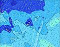 | 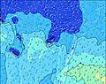 | 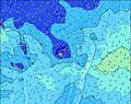 | 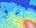 | 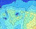 | 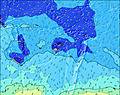 | 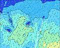 | |||||||||||||
Wave Height (m) Direction Period (s) | SSW 13 | SSW 13 | SSW 12 | SSW 11 | SSW 19 | SSW 18 | SSW 17 | SSW 16 | SSW 16 | SSW 15 | SSW 14 | SSE 10 | SSE 10 | ESE 8 | ESE 8 | ESE 8 | SSE 11 | ESE 9 | S 18 | SSE 16 |
Wave Graph | ||||||||||||||||||||
1309 | 1458 | 1132 | 917 | 973 | 1186 | 1120 | 1122 | 969 | 730 | 515 | 885 | 832 | 783 | 744 | 703 | 205 | 727 | 230 | 350 | |
Wind (km/h) | ||||||||||||||||||||
Wind State on-shore cross-onshore cross-shore cross-offshore off-shore glassy | cross-on | cross | cross | cross | cross | cross | cross | cross | cross | cross | cross | cross | cross | cross | cross-off | cross-off | cross-off | cross-off | cross-off | cross-off |
High Tide | 9:55PM1.50m | 10:06AM1.38m | 10:38PM1.51m | 11:01AM1.32m | 11:28PM1.50m | 12:05PM1.27m | 00:25AM1.51m | 1:16PM1.26m | 1:28AM1.53m | 2:28PM1.28m | 2:33AM1.57m | 3:36PM1.35m | ||||||||
Low Tide | 4:05AM0.43m | 4:13PM0.37m | 4:57AM0.42m | 5:00PM0.43m | 5:56AM0.40m | 5:56PM0.48m | 7:02AM0.36m | 7:02PM0.51m | 8:11AM0.30m | 8:12PM0.51m | 9:16AM0.22m | 9:20PM0.46m | ||||||||
— | — | 6:35 | — | — | 6:35 | — | — | 6:33 | — | — | 6:33 | — | — | 6:33 | — | — | 6:33 | — | — | |
5:54 | — | — | 5:54 | — | — | 5:55 | — | — | 5:55 | — | — | 5:55 | — | — | 5:55 | — | — | 5:57 | — | |
mm | — | — | — | — | — | — | — | — | — | — | 1 | — | — | — | — | — | — | — | — | — |
Temp °C | 22 | 20 | 22 | 22 | 20 | 21 | 21 | 21 | 21 | 22 | 22 | 21 | 22 | 21 | 22 | 23 | 21 | 23 | 23 | 21 |
Feels °C | 20 | 18 | 19 | 19 | 18 | 18 | 18 | 18 | 16 | 17 | 17 | 15 | 17 | 16 | 17 | 18 | 17 | 19 | 19 | 19 |
Swell 1 Height (m) Direction Period (s) | SSW 13 | SSW 13 | SSW 12 | SSW 11 | S 11 | SSE 11 | SSW 17 | SSW 16 | SSW 16 | SSW 15 | SSW 14 | SSW 14 | SSW 13 | SSE 10 | SSE 11 | SSE 9 | SSE 11 | ESE 9 | SSE 11 | SE 9 |
1309 | 1458 | 1132 | 917 | 449 | 452 | 1120 | 1122 | 969 | 730 | 515 | 367 | 209 | 763 | 584 | 387 | 205 | 138 | 156 | 145 | |
Swell 2 Height (m) Direction Period (s) | SSW 7 | SE 13 | SW 23 | S 12 | SSW 11 | SSW 18 | SSW 10 | S 20 | S 11 | SSE 10 | S 15 | S 13 | S 15 | SSW 13 | SSW 13 | SSW 12 | SE 8 | SSE 11 | S 18 | SSE 16 |
121 | 58 | 135 | 276 | 317 | 1186 | 97 | 8 | 61 | 37 | 40 | 86 | 163 | 147 | 93 | 57 | 112 | 194 | 230 | 350 | |
Swell 3 Height (m) Direction Period (s) | SE 12 | SSW 20 | S 16 | SSW 21 | SSW 19 | SSW 11 | SSW 12 | S 20 | S 14 | S 14 | SSE 10 | S 16 | SW 22 | SSW 21 | SSW 20 | SSW 19 | SW 12 | SSE 19 | SW 15 | S 11 |
67 | 37 | 76 | 567 | 973 | 151 | 14 | 8 | 16 | 15 | 21 | 127 | 18 | 44 | 37 | 36 | 36 | 122 | 56 | 114 | |
Wind waves Height (m) Direction Period (s) | — | — | E 7 | ESE 4 | — | SSE 11 | SSE 11 | SSE 11 | SSE 8 | SSE 8 | SE 7 | SSE 10 | SSE 10 | ESE 8 | ESE 8 | ESE 8 | ENE 3 | ESE 9 | ESE 8 | ENE 3 |
— | — | 4 | 15 | — | 778 | 561 | 444 | 292 | 213 | 193 | 885 | 832 | 783 | 744 | 703 | 3 | 727 | 90 | 3 | |
Nearest Offshore or Glassy | ||||||||||||||||||||
Distance (km) | 270 | 1150 | 60 | 1233 | 60 | 1300 | 803 | 1292 | 1307 | 1310 | 1292 | 1308 | 1310 | 49 | 49 | 1274 | 49 | 49 | 49 | 49 |
Best forecast wave conditions in Kadavu Passage | ||||||||||||||||||||
Best forecast wave conditions in Fiji | ||||||||||||||||||||
Header Global | ||||||||||||||||||||
- Map Icons:
 Break
Break Live Wave Height (m)
 Live Wind Speed (km/h)
 Surf Rating (10 Max)
 Ocean Swells (m)
- Wind Speed (km/h)
Latest Updates


FREE! Surf-Forecast.com widget for your website
The surf report / weather widget below is available to embed on third party websites free of charge and provides a summary of our Hideaway surf forecast. Simply grab the html code snippet that we provide and paste it into your own site. You can choose your preferred language and metric/imperial units for the surf forecast feed to suit users of your site. Click here to get the code.
Information about the Hideaway Surf forecast
The above surf forecast table for Hideaway provides essential information for determining whether the surfing conditions will be good over the next 16 days. A general guide to surfing at Hideaway can be found by selecting the local surf guide option on the grey menu. Our Hideaway surf forecast is unique since it includes wave energy (power) that defines the real feel of the surf rather than just the height or the period. If you surf the same spot (Hideaway) regularly then make a mental note of the wave energy from the surf forecast table each time you go. Very soon you may start to choose your surf days based on the wave energy alone combined with our forecast of favourable offshore wind conditions. Our star ratings will help here and of course you will also find the usual wave height and period predictions on our surf forecasts as well as a full break down of the swell components under our advanced users option (to reveal that, click the little Einstein character under the tide times).
Further information to help with frequently asked questions about our surf forecast for Hideaway may be found under the help tab on the top menu and also by moving your mouse over the question marks on the surf forecast table itself. Please always bear in mind that the forecast is for near-shore open water and local factors at each surf break influence the actual breaking wave height, such as the beach / reef profile, water depths offshore and shelter.
Are you planning a holiday in Kadavu Passage? If you are looking for accommodation near Hideaway, camping, hotels and holiday cottages in Kadavu Passage, consider staying in Nandi which is 50 km (31 miles) away. Other places in and around Kadavu Passage where you can find information about places to rent, and car hire include Lautoka which is 68 km (42 miles) away, Suva and Savusavu.
 Nearest