

Surf Forecasts:

Nera Rivermouth surf forecast from 3 Aug 2026:
- Best quality surf: Tuesday 4 Aug, 8PM (local time) - 3ft (0.9m), 17s period, SSW swell with cross-offshore winds.
- Most powerful swell: Tuesday 4 Aug, 2PM (local time) - 3ft (0.9m), 18s period, SSW swell with 531 kJ wave energy.
- Next surfable swell (1★+): Tuesday 4 Aug, 8PM (local time) - 3ft (0.9m), 17s period with SSW swell.
Best Forecast Surf Conditions for Nera Rivermouth this week:
The surf forecast for Nera Rivermouth over the next 16 days: The first swell (rated 1 star or higher) is forecast to arrive on Tuesday (Aug 04) at 8PM. The primary swell is predicted to be 0.9m and 17s period. The wind is predicted to be cross-offshore as the swell arrives.
The most powerful waves expected at Nera Rivermouth in the next 16 days are 0.9m 18s and forecast to arrive on Tuesday (Aug 04) at 2PM. Winds are predicted to be cross-shore at the time the swell arrives. The largest open ocean swell (not directed at the beach) is 2.2m 10s period and expected on Tuesday (Aug 04) at 2AM.
| Wave Type | Time (+11) & Date | Wave Height & Period |
|---|---|---|
| Next good surf (1 star+) | 8PM (Tue 4th Aug) | 3ft (0.9m) 17s |
| Best Surf | 8PM (Tue 4th Aug) | 3ft (0.9m) 17s |
| Most Powerful | 2PM (Tue 4th Aug) | 3ft (0.9m) 18s |
Table - best surf conditions forecast for Nera Rivermouth over the next 16 days.
The Lowdown
Alright, Rusty here. Let me tell you straight up, this is a tough stretch for the Nera Rivermouth. We’re looking at a long, drawn-out period of mostly flat, wind-affected dribble. The first real opportunity to even get wet doesn’t come up until the 4th of August, and honestly, even that is a struggle.
The first couple of days are a write-off. The 3rd of August has a tiny 1.0ft swell with a 19 mph cross-shore wind, making for lumpy, poor conditions.
Tuesday morning, the 4th of August, is the closest thing to a highlight. We get a touch more size, about 3ft of SSW swell, and the wind goes cross-offshore with a clean surface. The combined energy is moderate (402). It’s not pumping, but it’s the cleanest the wave will be for a while. The water temp is sitting at a pretty normal 73°, so nothing weird there.
From there, it’s a slow bleed. The 5th of August has some small, surfable but ordinary 3ft waves with a gentle breeze, but it’s never good. Then we hit a massive dead zone. From the 6th of August all the way through the 12th of August, the swell barely registers, often dropping below 0.7ft and the energy is weak, like 14 or 5. It’s heartbreaking. There’s a bit of a tease on the 8th of August with a light offshore wind, but the swell is just 0.3ft to 0.7ft. On the 9th of August, it goes glassy in the morning, but again, there’s nothing to ride.
We finally get a whisper of life again on the morning of the 13th of August. The swell bumps up to 2ft with a long period of 16 seconds, and the wind is glassy. The combined energy is moderate (209). The conditions are clean, but with that long period, the wave might be a bit too straight for a beach-and-river setup. It’s surfable, but very ordinary.
The last few days of the run, from the 14th to the 18th of August, are a mix of cross-onshore winds and small, choppy swell. The 18th of August sees a return to 3ft swell, but it’s getting smashed by a 16 mph cross-shore, creating a messy cross-chop. That kind of wind and weak, short-period swell on a beach setup is honestly more interesting for a kite surfer than a paddle surfer.
So, to sum it up: if you’re desperate, the Tuesday morning, 4th of August, is your best bet for the cleanest conditions. The 13th of August morning is the only other time the stars align for a glassy session, but it’s tiny. Other than that, it’s a long wait for something that isn’t much. Stay patient.
- Rusty
Short Range ForecastMostly dry. Warm (max 21°C on Mon afternoon, min 18°C on Mon night). Winds decreasing (fresh winds from the SE on Mon afternoon, light winds from the E by Tue night). | Days 5-7 Weather SummaryLight rain (total 2mm), mostly falling on Fri afternoon. Warm (max 24°C on Sat afternoon, min 19°C on Thu night). Wind will be generally light. | |||||||||||||||||||
Mon 3 | Tuesday 4 | Wednesday 5 | Thursday 6 | Friday 7 | Saturday 8 | Sunday 9 | ||||||||||||||
PM | Night | AM | PM | Night | AM | PM | Night | AM | PM | Night | AM | PM | Night | AM | PM | Night | AM | PM | Night | |
Swell Height Map |  | 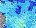 | 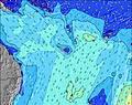 | 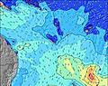 | 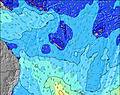 | 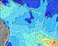 | 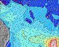 | |||||||||||||
Wave Height (m) Direction Period (s) | SSW 22 | SSW 21 | SSW 19 | SSW 18 | SSW 16 | SSW 16 | SSW 15 | SSW 14 | SSW 13 | SE 7 | SSW 13 | SSW 12 | SSW 12 | SW 18 | SW 11 | SSW 14 | SSW 14 | SW 13 | SSW 10 | SW 9 |
Wave Graph | ||||||||||||||||||||
96 | 378 | 402 | 486 | 390 | 291 | 270 | 165 | 102 | 0 | 32 | 14 | 14 | 12 | 5 | 21 | 18 | 7 | 10 | 25 | |
Wind (km/h) | ||||||||||||||||||||
Wind State on-shore cross-onshore cross-shore cross-offshore off-shore glassy | cross | cross-off | cross-off | cross | cross-off | cross-off | cross-off | cross-off | cross-off | cross-off | cross-off | cross-off | cross-off | off | off | off | off | glassy | cross | cross-off |
High Tide | 9:25PM1.18m | 9:32AM0.96m | 10:02PM1.17m | 10:43AM0.92m | 10:45PM1.16m | 12:05PM0.92m | 11:37PM1.14m | 1:31PM0.95m | 00:36AM1.14m | 2:48PM1.01m | 1:40AM1.16m | 3:51PM1.09m | 2:43AM1.19m | |||||||
Low Tide | 3:44AM0.48m | 3:22PM0.44m | 4:40AM0.43m | 4:11PM0.53m | 5:42AM0.37m | 5:15PM0.62m | 6:48AM0.30m | 6:35PM0.67m | 7:53AM0.21m | 7:56PM0.69m | 8:52AM0.12m | 9:06PM0.66m | ||||||||
— | — | 6:28 | — | — | 6:28 | — | — | 6:28 | — | — | 6:26 | — | — | 6:26 | — | — | 6:26 | — | — | |
5:38 | — | — | 5:38 | — | — | 5:39 | — | — | 5:39 | — | — | 5:39 | — | — | 5:40 | — | — | 5:40 | — | |
mm | — | — | — | — | — | — | — | — | — | — | — | — | 2 | — | — | — | — | — | — | — |
Temp °C | 21 | 19 | 20 | 21 | 19 | 20 | 21 | 20 | 21 | 22 | 20 | 22 | 22 | 20 | 23 | 24 | 21 | 23 | 23 | 21 |
Feels °C | 16 | 15 | 16 | 17 | 17 | 18 | 18 | 19 | 19 | 20 | 18 | 20 | 20 | 18 | 21 | 23 | 21 | 24 | 22 | 21 |
Swell 1 Height (m) Direction Period (s) | S 12 | S 10 | SSE 10 | SSW 18 | SSW 16 | SSW 16 | SSE 8 | SSE 8 | SSE 7 | SE 7 | SE 7 | SE 9 | SE 9 | SE 9 | SE 9 | SE 9 | SE 9 | SE 9 | SE 9 | SW 9 |
1103 | 720 | 200 | 486 | 390 | 291 | 98 | 72 | 30 | 21 | 24 | 65 | 86 | 99 | 39 | 37 | 19 | 12 | 19 | 21 | |
Swell 2 Height (m) Direction Period (s) | SSW 22 | SSW 21 | S 11 | S 10 | SSE 9 | SSE 8 | SSW 15 | SSW 14 | SSW 13 | SSW 13 | S 14 | S 12 | S 12 | S 11 | S 11 | SSW 11 | SSW 14 | SW 13 | SSW 10 | SE 10 |
96 | 378 | 181 | 96 | 106 | 78 | 270 | 165 | 102 | 56 | 64 | 48 | 25 | 22 | 9 | 11 | 18 | 7 | 10 | 26 | |
Swell 3 Height (m) Direction Period (s) | SSE 14 | SE 14 | SSW 19 | S 13 | S 9 | SE 12 | SE 12 | SE 12 | S 18 | S 16 | SSW 13 | SSW 12 | SSW 12 | SW 18 | SW 11 | SSW 14 | S 10 | SW 9 | SSW 8 | SSW 16 |
20 | 8 | 402 | 3 | 40 | 6 | 6 | 6 | 6 | 20 | 32 | 14 | 14 | 12 | 5 | 21 | 8 | 3 | 7 | 25 | |
Wind waves Height (m) Direction Period (s) | SSE 12 | SSE 10 | SE 10 | SSE 10 | — | — | SE 7 | — | SE 7 | SE 7 | — | — | — | — | — | — | — | — | — | — |
1733 | 961 | 524 | 204 | — | — | 285 | — | 63 | 89 | — | — | — | — | — | — | — | — | — | — | |
Nearest Offshore or Glassy | ||||||||||||||||||||
Distance (km) | 1338 | 858 | 858 | 1338 | 0 | 0 | 0 | 0 | 1 | 1 | 1 | 1 | 1 | 1 | 37 | 1 | 4 | 38 | 1291 | 1 |
Best forecast wave conditions in New Caledonia | ||||||||||||||||||||
Best forecast wave conditions in New Caledonia | ||||||||||||||||||||
Header Global | ||||||||||||||||||||
- Map Icons:
 Break
Break Live Wave Height (m)
 Live Wind Speed (km/h)
 Surf Rating (10 Max)
 Ocean Swells (m)
- Wind Speed (km/h)
Latest Updates


FREE! Surf-Forecast.com widget for your website
The surf report / weather widget below is available to embed on third party websites free of charge and provides a summary of our Nera Rivermouth surf forecast. Simply grab the html code snippet that we provide and paste it into your own site. You can choose your preferred language and metric/imperial units for the surf forecast feed to suit users of your site. Click here to get the code.
Information about the Nera Rivermouth Surf forecast
The above surf forecast table for Nera Rivermouth provides essential information for determining whether the surfing conditions will be good over the next 16 days. A general guide to surfing at Nera Rivermouth can be found by selecting the local surf guide option on the grey menu. Our Nera Rivermouth surf forecast is unique since it includes wave energy (power) that defines the real feel of the surf rather than just the height or the period. If you surf the same spot (Nera Rivermouth) regularly then make a mental note of the wave energy from the surf forecast table each time you go. Very soon you may start to choose your surf days based on the wave energy alone combined with our forecast of favourable offshore wind conditions. Our star ratings will help here and of course you will also find the usual wave height and period predictions on our surf forecasts as well as a full break down of the swell components under our advanced users option (to reveal that, click the little Einstein character under the tide times).
Further information to help with frequently asked questions about our surf forecast for Nera Rivermouth may be found under the help tab on the top menu and also by moving your mouse over the question marks on the surf forecast table itself. Please always bear in mind that the forecast is for near-shore open water and local factors at each surf break influence the actual breaking wave height, such as the beach / reef profile, water depths offshore and shelter.
Are you planning a holiday in New Caledonia? If you are looking for accommodation near Nera Rivermouth, camping, hotels and holiday cottages in New Caledonia, consider staying in Poro which is 38 km (24 miles) away. Other places in and around New Caledonia where you can find information about places to rent, and car hire include Kouaoua which is 44 km (27 miles) away and Thio, 78 km (48 miles) away.
 Nearest