

Surf Forecasts:

St Vincent Left surf forecast from 18 Jul 2026:
- Best quality surf: Sunday 19 Jul, 8AM (local time) - 3.5ft (1.1m), 15s period, SSW swell with offshore winds.
- Most powerful swell: Sunday 19 Jul, 8PM (local time) - 6ft (1.8m), 20s period, SSW swell with 2,651 kJ wave energy.
- Next surfable swell (1★+): Sunday 19 Jul, 5AM (local time) - 4ft (1.2m), 15s period with SSW swell.
Best Forecast Surf Conditions for St Vincent Left this week:
The surf forecast for St Vincent Left over the next 16 days: The first swell (rated 1 star or higher) is forecast to arrive on Sunday (Jul 19) at 5AM. The primary swell is predicted to be 1.2m and 15s period with a secondary swell of 0.6m and 16s. The wind is predicted to be offshore as the swell arrives.
The most powerful waves expected at St Vincent Left in the next 16 days are 1.8m 20s and forecast to arrive on Sunday (Jul 19) at 8PM. Winds are predicted to be cross-shore at the time the swell arrives. The largest open ocean swell (not directed at the beach) is 0.7m 8s period and expected on Tuesday (Jul 21) at 5AM.
| Wave Type | Time (+11) & Date | Wave Height & Period |
|---|---|---|
| Next good surf (1 star+) | 5AM (Sun 19th Jul) | 4ft (1.2m) 15s |
| Best Surf | 8AM (Sun 19th Jul) | 3.5ft (1.1m) 15s |
| Most Powerful | 8PM (Sun 19th Jul) | 6ft (1.8m) 20s |
Table - best surf conditions forecast for St Vincent Left over the next 16 days.
The Lowdown
Alright, surfers, Rusty here with the lowdown for Saint-Vincents – specifically St Vincent Left, that advanced reef break. We've got a solid run of SSW groundswell kicking off, but it's a short window of greatness before the wind turns ugly. The first two days are the real deal, so if you're advanced and hungry, get on it.
Sunday July 19 – Morning kicks off with a light offshore NNE breeze at 6 mph, pushing 3.3 ft of SSW swell with a very long 21-second period. That's proper groundswell, and the combined energy of 1456 is solid. The reef will handle that long period beautifully. Afternoon steps it up to 4.9 ft, still from the SSW, 20-second period, with a cross-off wind from the east at 3 mph. Energy jumps to 2382 – still clean and punchy. This is a standout session for experienced surfers. Crowds are possible, but it's worth it.
Monday July 20 – Morning is the absolute gem: glassy calm, zero wind, 4.6 ft of SSW swell at 18 seconds, energy 1310. That's as clean as it gets. The swell direction is practically on the optimum SW, so expect lined-up waves. Afternoon goes onshore with a SSW breeze at 6 mph, making conditions messy. Then from Tuesday through to the end of the week, the wind turns cross-shore or onshore, with speeds up to 25 mph. The swell drops and becomes choppy, poor for surfing. There's a stretch of several days with no real recommendations – Tuesday 21 July through Friday 24 July are mostly write-offs.
Saturday 25 July to Sunday 26 July – Still poor, with cross-onshore winds and lumpy seas. However, on Sunday afternoon the energy picks up again (1833) but the wind is still cross-shore. Not worth it.
Monday 27 July to Tuesday 28 July – Swell builds to 8.2 ft on Monday morning with a 15-second period from the SSW, energy 2782, but the wind is cross-shore at 9–16 mph. That's big for experts only, and the cross-shore chop will make it ugly. The swell is over 8 ft, so only for the experienced. The combined energy is strong, but the wind kills it.
Wednesday 29 July – Afternoon offers a glimmer: ENE cross-off breeze at 6 mph, 3.6 ft SSW swell, 12-second period
Short Range ForecastHeavy rain (total 77mm), heaviest during Sun morning. Warm (max 23°C on Sat night, min 19°C on Sun afternoon). Winds increasing (calm on Mon morning, fresh winds from the SE by Tue afternoon). | Days 5-7 Weather SummaryMostly dry. Warm (max 22°C on Wed morning, min 19°C on Wed night). Winds decreasing (strong winds from the SE on Wed afternoon, calm by Fri morning). | ||||||||||||||||||
Sunday 19 | Monday 20 | Tuesday 21 | Wednesday 22 | Thursday 23 | Friday 24 | ||||||||||||||
Night | AM | PM | Night | AM | PM | Night | AM | PM | Night | AM | PM | Night | AM | PM | Night | AM | PM | Night | |
Swell Height Map |  | 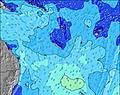 | 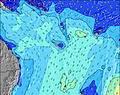 | 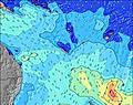 | 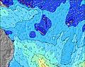 | 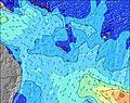 | 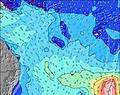 | ||||||||||||
Wave Height (m) Direction Period (s) | SSW 15 | SSW 21 | SSW 20 | SSW 19 | SSW 18 | SSW 17 | SSW 15 | SSW 14 | SSW 13 | SSE 8 | SE 8 | SSW 16 | SSW 16 | SE 7 | SE 7 | SSW 13 | SSW 12 | SSW 13 | SSW 13 |
Wave Graph | |||||||||||||||||||
786 | 863 | 1821 | 2045 | 1178 | 785 | 637 | 521 | 458 | 513 | 517 | 437 | 329 | 203 | 164 | 96 | 205 | 173 | 98 | |
Wind (km/h) | |||||||||||||||||||
Wind State on-shore cross-onshore cross-shore cross-offshore off-shore glassy | off | off | cross-off | cross-off | glassy | on | cross-off | cross | cross | cross | cross | cross | cross | cross | cross-on | cross-off | cross-on | cross-on | cross |
High Tide | 11:11PM1.36m | 11:19AM1.06m | 11:46PM1.28m | 12:12PM1.02m | 00:22AM1.19m | 1:12PM0.98m | 00:59AM1.09m | 2:22PM0.95m | 1:42AM1.00m | 3:44PM0.95m | 2:39AM0.92m | 5:02PM0.99m | 3:52AM0.88m | ||||||
Low Tide | 5:35AM0.31m | 5:18PM0.26m | 6:17AM0.31m | 6:02PM0.39m | 6:59AM0.31m | 6:51PM0.51m | 7:46AM0.32m | 7:51PM0.61m | 8:39AM0.33m | 9:11PM0.68m | 9:40AM0.33m | 10:46PM0.68m | |||||||
— | 6:33 | — | — | 6:33 | — | — | 6:33 | — | — | 6:33 | — | — | 6:33 | — | — | 6:31 | — | — | |
— | — | 5:30 | — | — | 5:30 | — | — | 5:30 | — | — | 5:30 | — | — | 5:31 | — | — | 5:31 | — | |
mm | 38 | 24 | 8 | 7 | — | — | — | — | — | — | — | — | — | — | — | — | — | — | 2 |
Temp °C | 23 | 21 | 20 | 21 | 22 | 22 | 22 | 22 | 22 | 21 | 22 | 22 | 21 | 21 | 22 | 21 | 21 | 21 | 20 |
Feels °C | 26 | 23 | 23 | 23 | 25 | 24 | 24 | 18 | 17 | 18 | 18 | 16 | 16 | 19 | 19 | 19 | 22 | 20 | 16 |
Swell 1 Height (m) Direction Period (s) | SSW 15 | SSW 21 | SSW 20 | SSW 19 | SSW 18 | SSW 17 | SSW 15 | SSW 14 | SSW 13 | SSE 8 | SSE 8 | SSW 16 | SSE 7 | SSE 7 | SE 7 | SSE 6 | SSW 12 | SSW 13 | SSW 13 |
786 | 863 | 1821 | 2045 | 1178 | 785 | 637 | 521 | 458 | 284 | 280 | 437 | 94 | 68 | 49 | 22 | 205 | 173 | 98 | |
Swell 2 Height (m) Direction Period (s) | SE 16 | SSW 14 | SSW 14 | SE 15 | SE 14 | SE 14 | SSE 14 | SE 13 | S 18 | SSW 13 | SSW 17 | SSW 12 | SSW 16 | SSW 12 | SSW 12 | SSW 13 | SSE 11 | SSE 8 | SE 7 |
163 | 400 | 378 | 174 | 102 | 164 | 121 | 61 | 162 | 303 | 505 | 150 | 329 | 109 | 106 | 96 | 12 | 6 | 2 | |
Swell 3 Height (m) Direction Period (s) | SSW 9 | SE 16 | SE 15 | SW 11 | SW 11 | SW 4 | SW 8 | SSW 18 | SE 13 | SSW 16 | SSW 12 | SE 12 | SSW 12 | SSW 15 | SSW 14 | S 11 | SE 8 | SE 11 | SE 11 |
52 | 193 | 183 | 5 | 30 | 5 | 14 | 107 | 61 | 280 | 152 | 23 | 107 | 121 | 70 | 58 | 2 | 5 | 4 | |
Wind waves Height (m) Direction Period (s) | — | — | — | — | — | — | — | SE 5 | SSE 6 | SSE 8 | SE 8 | SSE 8 | — | SE 7 | SE 7 | — | SE 7 | SSE 4 | S 5 |
— | — | — | — | — | — | — | 10 | 49 | 513 | 517 | 237 | — | 203 | 164 | — | 30 | 4 | 29 | |
Nearest Offshore or Glassy | |||||||||||||||||||
Distance (km) | 0 | 0 | 0 | 0 | 0 | 69 | 0 | 1260 | 1281 | 1279 | 1258 | 1260 | 68 | 0 | 800 | 0 | 31 | 1263 | 1258 |
Best forecast wave conditions in New Caledonia | |||||||||||||||||||
Best forecast wave conditions in New Caledonia | |||||||||||||||||||
Header Global | |||||||||||||||||||
- Map Icons:
 Break
Break Live Wave Height (m)
 Live Wind Speed (km/h)
 Surf Rating (10 Max)
 Ocean Swells (m)
- Wind Speed (km/h)


FREE! Surf-Forecast.com widget for your website
The surf report / weather widget below is available to embed on third party websites free of charge and provides a summary of our St Vincent Left surf forecast. Simply grab the html code snippet that we provide and paste it into your own site. You can choose your preferred language and metric/imperial units for the surf forecast feed to suit users of your site. Click here to get the code.
Information about the St Vincent Left Surf forecast
The above surf forecast table for St Vincent Left provides essential information for determining whether the surfing conditions will be good over the next 16 days. A general guide to surfing at St Vincent Left can be found by selecting the local surf guide option on the grey menu. Our St Vincent Left surf forecast is unique since it includes wave energy (power) that defines the real feel of the surf rather than just the height or the period. If you surf the same spot (St Vincent Left) regularly then make a mental note of the wave energy from the surf forecast table each time you go. Very soon you may start to choose your surf days based on the wave energy alone combined with our forecast of favourable offshore wind conditions. Our star ratings will help here and of course you will also find the usual wave height and period predictions on our surf forecasts as well as a full break down of the swell components under our advanced users option (to reveal that, click the little Einstein character under the tide times).
Further information to help with frequently asked questions about our surf forecast for St Vincent Left may be found under the help tab on the top menu and also by moving your mouse over the question marks on the surf forecast table itself. Please always bear in mind that the forecast is for near-shore open water and local factors at each surf break influence the actual breaking wave height, such as the beach / reef profile, water depths offshore and shelter.
Are you planning a holiday in New Caledonia? If you are looking for accommodation near St Vincent Left, camping, hotels and holiday cottages in New Caledonia, consider staying in Dumbea which is 52 km (32 miles) away. Other places in and around New Caledonia where you can find information about places to rent, and car hire include Thio which is 53 km (33 miles) away, Noumea, Mont-Dore and Kouaoua.
 Nearest