

Surf Forecasts:

Desperations surf forecast from 1 Aug 2026:
- Best quality surf: Friday 7 Aug, 6PM (local time) - 7.5ft (2.3m), 10s period, SE swell with cross-offshore winds.
- Most powerful swell: Monday 3 Aug, 6PM (local time) - 8ft (2.4m), 13s period, SSW swell with 1,906 kJ wave energy.
- Next surfable swell (1★+): Wednesday 5 Aug, 12PM (local time) - 4.5ft (1.3m), 17s period with SSW swell.
Best Forecast Surf Conditions for Desperations this week:
The surf forecast for Desperations over the next 16 days: The first swell (rated 1 star or higher) is forecast to arrive on Wednesday (Aug 05) at 12PM. The primary swell is predicted to be 1.3m and 17s period with a secondary swell of 1.3m and 9s. Another secondary swell of 1.9m and 9s is also forecast. The wind is predicted to be glassy as the swell arrives.
The most powerful waves expected at Desperations in the next 16 days are 2.4m 13s and forecast to arrive on Monday (Aug 03) at 6PM. Winds are predicted to be cross-onshore at the time the swell arrives.
| Wave Type | Time (+12) & Date | Wave Height & Period |
|---|---|---|
| Next good surf (1 star+) | 12PM (Wed 5th Aug) | 4.5ft (1.3m) 17s |
| Best Surf | 6PM (Fri 7th Aug) | 7.5ft (2.3m) 10s |
| Most Powerful | 6PM (Mon 3rd Aug) | 8ft (2.4m) 13s |
Table - best surf conditions forecast for Desperations over the next 16 days.
The Lowdown
Alright folks, Rusty here. Let’s break down what’s happening at Desperations.
Honestly, the first few days are a total bust. From Sunday through Tuesday, we’ve got some decent swell building, with wave heights from 3ft to over 7ft, but the wind is a nightmare. It’s blowing cross-on or onshore from the south and southeast, gusting from 12 to 22 mph. That’s making the surface choppy, lumpy, and just plain ugly. The combined swell energy is in the hundreds to low thousands (424 to 2435), but without clean conditions, it’s a waste of time.
The first real window opens up on Wednesday, August 5th. The morning is still a bit cross-shore with a breeze from the ESE at 12 mph and a cross-chop, so it’s marginal. But the afternoon... that’s the jewel. The wind goes absolutely glassy – dead calm. The swell is a solid 4ft from the SSW, and with a very long period of 17 seconds, this is proper groundswell. The combined energy is strong (1464), and for a reef break that faces the SSW, that’s it’s sweet spot. This is the standout. It’s clean, it’s powerful, and the sets will be lined up. This is "excellent surf conditions for experienced surfers" – meaning it’s not for the faint of heart. A 4ft reef wave with that period will be a serious, powerful wave. It’s a fairly consistent break, so you’ll get waves, and that long period will make it bend perfectly around the reef. Just keep in mind, crowds are possible here.
The next bright spot is Friday, August 7th. The morning is still a bit messy with a cross-offshore wind, but the afternoon glass-off is the main event. The wind swings to the NE at a glassy 3 mph, and the swell is 5ft from the SSE, with a period of 13 seconds. The combined energy is very strong (1304), and it’s clean. Another one for the experienced crew, but a beautiful window.
After that, things get a bit more hit-and-miss. Sunday, August 9th, the morning shows some promise with 3ft of swell from the SSE, a very long period of 19 seconds, and a clean cross-offshore breeze from the ENE at 6 mph. The combined energy is moderate (691), and it’s described as "expect very good surf conditions". This is a small-wave groundswell day – perfect for a longboard or a fish, but the sets will be spaced out with that long period. It’s a clean, fun option, but not a powerhouse.
From the 10th of August onward, it’s a tough stretch. The wind is consistently onshore or cross-on from the southeast, and the swell drops off. You’re looking at a long run of poor surf conditions, with wave heights mostly under 4ft and weak to moderate combined swell energy (mostly under 700). The 18th of August shows a pulse of 3ft from the SSW with a very long period of 20 seconds, but the wind is a fresh cross-shore from the SE at 22 mph, so it’ll be lumpy and messy. Not worth paddling for.
So, the bottom line: Your best bet is Wednesday, August 5th in the afternoon. That’s the one. The glass-off and the solid groundswell from the SSW (the direction this spot loves) is your winning ticket. Friday afternoon is also a solid, clean session. The rest of the forecast is mostly a waiting game, with a lot of onshore slop. The water temp is about average for this time of year, so your usual wetsuit will do.
Stay stoked, and I’ll see you in the lineup.
Rusty
Short Range ForecastMostly dry. Warm (max 23°C on Sat night, min 20°C on Mon night). Winds increasing (light winds from the S on Sat night, fresh winds from the SSE by Mon afternoon). | Days 5-7 Weather SummaryMostly dry. Warm (max 23°C on Wed afternoon, min 20°C on Tue night). Winds increasing (calm on Wed afternoon, strong winds from the ESE by Wed night). | ||||||||||||||||||
Sunday 2 | Monday 3 | Tuesday 4 | Wednesday 5 | Thursday 6 | Friday 7 | ||||||||||||||
Night | AM | PM | Night | AM | PM | Night | AM | PM | Night | AM | PM | Night | AM | PM | Night | AM | PM | Night | |
Swell Height Map | 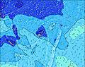 | 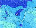 | 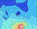 | 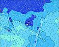 | 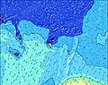 | 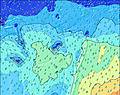 | 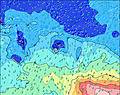 | ||||||||||||
Wave Height (m) Direction Period (s) | SSW 13 | SSW 14 | SSW 14 | SSW 14 | SSW 13 | SSW 13 | SSW 13 | SSW 12 | SSW 11 | SSW 19 | SSW 18 | SSW 17 | SSW 16 | SSW 16 | SSW 15 | SSW 14 | S 13 | SSE 13 | SSE 12 |
Wave Graph | |||||||||||||||||||
229 | 342 | 561 | 731 | 888 | 1820 | 1521 | 986 | 1144 | 983 | 1056 | 986 | 808 | 788 | 632 | 431 | 440 | 653 | 539 | |
Wind (km/h) | |||||||||||||||||||
Wind State on-shore cross-onshore cross-shore cross-offshore off-shore glassy | cross-on | cross-on | on | cross-on | cross-on | cross-on | cross-on | cross-on | cross-on | cross | cross | glassy | cross | cross | cross | cross | cross-off | glassy | cross |
High Tide | 8:25AM1.51m | 9:05PM1.51m | 9:07AM1.45m | 9:44PM1.51m | 9:55AM1.38m | 10:28PM1.51m | 10:51AM1.32m | 11:19PM1.51m | 11:58AM1.27m | 00:18AM1.52m | 1:12PM1.26m | 1:23AM1.54m | |||||||
Low Tide | 2:24AM0.44m | 2:44PM0.26m | 3:07AM0.44m | 3:21PM0.31m | 3:54AM0.44m | 4:02PM0.38m | 4:47AM0.43m | 4:51PM0.44m | 5:49AM0.42m | 5:49PM0.50m | 6:57AM0.38m | 6:56PM0.53m | |||||||
— | 6:37 | — | — | 6:37 | — | — | 6:37 | — | — | 6:35 | — | — | 6:35 | — | — | 6:35 | — | — | |
— | — | 5:57 | — | — | 5:57 | — | — | 5:58 | — | — | 5:58 | — | — | 5:58 | — | — | 5:59 | — | |
mm | — | — | — | — | — | — | — | — | — | — | — | — | — | — | — | — | — | — | — |
Temp °C | 23 | 23 | 23 | 22 | 22 | 21 | 20 | 22 | 22 | 21 | 22 | 23 | 22 | 22 | 23 | 22 | 23 | 23 | 23 |
Feels °C | 23 | 20 | 19 | 19 | 18 | 15 | 15 | 20 | 18 | 18 | 23 | 24 | 18 | 18 | 20 | 17 | 23 | 24 | 22 |
Swell 1 Height (m) Direction Period (s) | SSW 13 | SSW 14 | SSW 14 | SSW 14 | SSW 13 | SSW 13 | SSW 13 | SSW 12 | SSW 11 | S 10 | S 9 | SSW 17 | SSW 16 | SSW 16 | SSW 15 | SSW 14 | S 13 | SSE 13 | SSE 12 |
229 | 342 | 561 | 731 | 888 | 1820 | 1521 | 986 | 1144 | 346 | 293 | 986 | 808 | 788 | 632 | 431 | 440 | 653 | 539 | |
Swell 2 Height (m) Direction Period (s) | SSE 11 | SSE 11 | SSE 12 | SE 12 | SE 12 | SE 14 | SE 14 | SSE 16 | SSW 21 | SSW 11 | SSW 18 | S 12 | SSE 11 | S 11 | SSE 11 | S 15 | SSW 14 | SSW 13 | SSW 13 |
103 | 82 | 93 | 72 | 35 | 52 | 49 | 81 | 567 | 317 | 1056 | 72 | 43 | 59 | 37 | 283 | 307 | 215 | 113 | |
Swell 3 Height (m) Direction Period (s) | SSW 16 | — | S 24 | NW 13 | SW 21 | SSW 20 | SSW 20 | SW 23 | SSW 21 | SSW 19 | SSW 11 | SW 11 | SSW 10 | NNW 12 | S 18 | SSE 10 | NNW 13 | NNW 12 | NNW 12 |
171 | — | 11 | 7 | 18 | 38 | 37 | 135 | 698 | 983 | 149 | 32 | 20 | 15 | 56 | 34 | 16 | 15 | 14 | |
Wind waves Height (m) Direction Period (s) | — | — | S 3 | S 4 | SSW 7 | — | — | — | SSE 4 | ESE 4 | — | SSE 9 | SSE 8 | SSE 8 | SSE 8 | SE 8 | SE 8 | ESE 8 | ESE 9 |
— | — | 5 | 7 | 152 | — | — | — | 26 | 20 | — | 374 | 313 | 162 | 154 | 151 | 107 | 436 | 454 | |
Nearest Offshore or Glassy | |||||||||||||||||||
Distance (km) | 8 | 100 | 927 | 927 | 1217 | 1183 | 8 | 8 | 1340 | 8 | 8 | 0 | 1258 | 1273 | 8 | 1258 | 1273 | 0 | 8 |
Best forecast wave conditions in Mamanucas | |||||||||||||||||||
Best forecast wave conditions in Fiji | |||||||||||||||||||
Header Global | |||||||||||||||||||
- Map Icons:
 Break
Break Live Wave Height (m)
 Live Wind Speed (km/h)
 Surf Rating (10 Max)
 Ocean Swells (m)
- Wind Speed (km/h)
Latest Updates


FREE! Surf-Forecast.com widget for your website
The surf report / weather widget below is available to embed on third party websites free of charge and provides a summary of our Desperations surf forecast. Simply grab the html code snippet that we provide and paste it into your own site. You can choose your preferred language and metric/imperial units for the surf forecast feed to suit users of your site. Click here to get the code.
Information about the Desperations Surf forecast
The above surf forecast table for Desperations provides essential information for determining whether the surfing conditions will be good over the next 16 days. A general guide to surfing at Desperations can be found by selecting the local surf guide option on the grey menu. Our Desperations surf forecast is unique since it includes wave energy (power) that defines the real feel of the surf rather than just the height or the period. If you surf the same spot (Desperations) regularly then make a mental note of the wave energy from the surf forecast table each time you go. Very soon you may start to choose your surf days based on the wave energy alone combined with our forecast of favourable offshore wind conditions. Our star ratings will help here and of course you will also find the usual wave height and period predictions on our surf forecasts as well as a full break down of the swell components under our advanced users option (to reveal that, click the little Einstein character under the tide times).
Further information to help with frequently asked questions about our surf forecast for Desperations may be found under the help tab on the top menu and also by moving your mouse over the question marks on the surf forecast table itself. Please always bear in mind that the forecast is for near-shore open water and local factors at each surf break influence the actual breaking wave height, such as the beach / reef profile, water depths offshore and shelter.
 Nearest