

Surf Forecasts:

Tuckers surf forecast from 3 Aug 2026:
- Best quality surf: Friday 7 Aug, 3AM (local time) - 3ft (0.9m), 7s period, SE swell with cross-offshore winds.
- Most powerful swell: Monday 3 Aug, 12PM (local time) - 4ft (1.2m), 6s period, SE swell with 113 kJ wave energy.
- Next surfable swell (1★+): Friday 7 Aug, 3AM (local time) - 3ft (0.9m), 7s period with SE swell.
Best Forecast Surf Conditions for Tuckers this week:
The surf forecast for Tuckers over the next 16 days: The first swell (rated 1 star or higher) is forecast to arrive on Friday (Aug 07) at 3AM. The primary swell is predicted to be 0.9m and 7s period with a secondary swell of 0.4m and 9s. The wind is predicted to be cross-offshore as the swell arrives.
The most powerful waves expected at Tuckers in the next 16 days are 1.2m 6s and forecast to arrive on Monday (Aug 03) at 12PM. Winds are predicted to be onshore at the time the swell arrives. The largest open ocean swell (not directed at the beach) is 0.5m 5s period and expected on Sunday (Aug 09) at 12PM.
| Wave Type | Time (ADT) & Date | Wave Height & Period |
|---|---|---|
| Next good surf (1 star+) | 3AM (Fri 7th Aug) | 3ft (0.9m) 7s |
| Best Surf | 3AM (Fri 7th Aug) | 3ft (0.9m) 7s |
| Most Powerful | 12PM (Mon 3rd Aug) | 4ft (1.2m) 6s |
Table - best surf conditions forecast for Tuckers over the next 16 days.
The Lowdown
G'day, Rusty here. Look, I've got to be straight with you – the outlook for Tuckers over the next 16 days is a tough one to write. We're looking at a long stretch of flat to tiny, mostly messy surf. The whole first week is a write-off, and honestly, it's not until the very end of the window that we see a flicker of something.
The water temp is sitting at 81°, which is pretty much bang on average for this time of year, so at least a dip won't be a shock.
From Monday the 3rd right through to Saturday the 15th, the swell is tiny. We're talking 1ft to 4ft from the SE, with a short, weak period of 6 to 10 seconds. The combined wave energy is mostly weak, sitting under 100 (94) for most of it, with just a couple of days poking into the low 100s. The wind is a problem too – mostly onshore from the SE and SSE, or cross-shore, which is making for poor, choppy conditions. Even when the wind goes light and glassy on the 10th, the swell is just 1ft. There's nothing to ride.
Then from Sunday the 16th, the wind really picks up. We're seeing fresh to strong breezes from the WSW, cranking up to 25 mph, with a lumpy cross-chop. The swell tries to build a little, hitting 2ft on the 16th with a moderate energy of 152, but it's a messy, windy mess. Not for surfing.
The only real standout, and I'm stretching the term here, is Tuesday the 18th. The morning session shows a bump in size to 5ft from the SW, the biggest of the whole forecast. The period is short, only 6 seconds, so it's windswell, not groundswell, but the combined energy jumps to 191 (moderate). The wind is a cross-offshore from the W at 22 mph, which will keep the surface clean. It's still a bit of a gamble and those strong winds will make it a battle, but for a surfer who's been waiting 16 days, it's the best chance of a wave. Be aware it's a short-period swell, so it won't be the most powerful, but it's the only thing on the board.
Overall, it's a long, flat run. For the locals, a blank spell like this isn't unusual for the area, but it never stays poor for long. Keep an eye on it.
Rusty.
Short Range ForecastLight rain (total 3mm), mostly falling on Mon morning. Warm (max 27°C on Mon morning, min 25°C on Wed night). Wind will be generally light. | Days 4-6 Weather SummaryMostly dry. Warm (max 26°C on Thu morning, min 25°C on Thu morning). Wind will be generally light. | ||||||||||||||||||||
Monday 3 | Tuesday 4 | Wednesday 5 | Thursday 6 | Friday 7 | Saturday 8 | Sunday 9 | |||||||||||||||
AM | PM | Night | AM | PM | Night | AM | PM | Night | AM | PM | Night | AM | PM | Night | AM | PM | Night | AM | PM | Night | |
Swell Height Map | 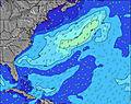 | 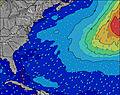 | 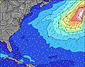 | 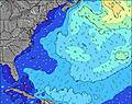 | 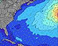 | 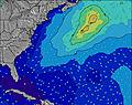 | 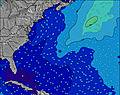 | ||||||||||||||
Wave Height (m) Direction Period (s) | SE 6 | SE 6 | SE 6 | SE 6 | SE 7 | SE 6 | SE 6 | SE 7 | SE 7 | SE 8 | SE 8 | SE 7 | SE 7 | SE 7 | NE 9 | NE 8 | NE 9 | NE 9 | SE 10 | NE 9 | SE 9 |
Wave Graph | |||||||||||||||||||||
91 | 101 | 66 | 70 | 63 | 60 | 60 | 62 | 89 | 113 | 110 | 79 | 51 | 47 | 28 | 25 | 27 | 20 | 14 | 21 | 27 | |
Wind (km/h) | |||||||||||||||||||||
Wind State on-shore cross-onshore cross-shore cross-offshore off-shore glassy | on | on | on | on | on | cross-on | cross-on | cross-on | cross-on | cross | cross | cross | cross-off | cross-off | cross-off | cross-off | cross-off | cross-off | cross-off | cross-off | cross-off |
High Tide | 12:23PM0.83m | 00:37AM0.74m | 1:09PM0.84m | 1:27AM0.70m | 2:03PM0.84m | 2:24AM0.66m | 3:04PM0.85m | 3:29AM0.64m | 4:12PM0.86m | 4:40AM0.64m | 5:22PM0.87m | 5:51AM0.66m | 6:29PM0.90m | ||||||||
Low Tide | 6:44PM0.11m | 6:49AM0.05m | 7:39PM0.13m | 7:35AM0.06m | 8:40PM0.14m | 8:30AM0.07m | 9:48PM0.15m | 9:34AM0.08m | 10:59PM0.13m | 10:43AM0.07m | 00:07AM0.09m | 11:53AM0.04m | 1:08AM0.05m | ||||||||
6:33 | — | — | 6:35 | — | — | 6:35 | — | — | 6:35 | — | — | 6:37 | — | — | 6:37 | — | — | 6:37 | — | — | |
— | 8:14 | — | — | 8:14 | — | — | 8:13 | — | — | 8:12 | — | — | 8:10 | — | — | 8:09 | — | — | 8:08 | — | |
mm | 1 | — | — | — | 1 | 1 | — | — | — | — | — | — | — | — | — | — | — | — | — | — | — |
Temp °C | 27 | 27 | 27 | 27 | 27 | 27 | 26 | 27 | 27 | 26 | 26 | 26 | 25 | 26 | 26 | 25 | 26 | 26 | 25 | 26 | 26 |
Feels °C | 28 | 28 | 29 | 29 | 30 | 29 | 28 | 30 | 30 | 28 | 28 | 28 | 27 | 28 | 28 | 27 | 30 | 29 | 28 | 30 | 29 |
Swell 1 Height (m) Direction Period (s) | WSW 6 | NE 9 | SE 6 | NE 8 | SE 7 | SE 6 | SE 6 | SE 7 | SE 7 | SE 8 | SE 8 | SE 7 | SE 7 | SE 7 | ESE 6 | NE 8 | NE 9 | NE 9 | N 5 | NE 9 | SE 9 |
3 | 3 | 66 | 3 | 63 | 60 | 60 | 62 | 89 | 113 | 110 | 79 | 51 | 47 | 28 | 25 | 27 | 20 | 8 | 21 | 27 | |
Swell 2 Height (m) Direction Period (s) | NE 9 | W 6 | NE 8 | NE 10 | NE 10 | NE 9 | NE 9 | NE 10 | NE 9 | NE 9 | NE 9 | NE 9 | NE 9 | NE 9 | NE 9 | SE 6 | SE 6 | SE 10 | SE 10 | SE 9 | NE 9 |
3 | 2 | 3 | 4 | 15 | 21 | 30 | 34 | 30 | 29 | 29 | 29 | 30 | 29 | 26 | 13 | 8 | 15 | 14 | 21 | 20 | |
Swell 3 Height (m) Direction Period (s) | N 6 | N 5 | W 5 | W 5 | NE 7 | W 7 | W 8 | W 9 | W 7 | W 7 | W 6 | W 6 | WNW 6 | W 6 | SE 11 | SE 9 | SE 9 | SSE 7 | NE 8 | SE 5 | E 12 |
1 | 1 | 1 | 1 | 2 | 4 | 5 | 25 | 17 | 8 | 7 | 3 | 3 | 1 | 5 | 3 | 3 | 4 | 11 | 5 | 3 | |
Wind waves Height (m) Direction Period (s) | SE 6 | SE 6 | — | SE 6 | — | — | — | — | — | — | — | — | — | — | — | N 4 | N 5 | NNW 5 | — | N 5 | N 5 |
91 | 101 | — | 70 | — | — | — | — | — | — | — | — | — | — | — | 3 | 4 | 7 | — | 14 | 13 | |
Nearest Offshore or Glassy | |||||||||||||||||||||
Distance (km) | 1164 | 1164 | 1082 | 1117 | 1144 | 1144 | 1161 | 13 | 1165 | 1216 | 1512 | 14 | 1175 | 1210 | 1162 | 1085 | 1356 | 1161 | 1157 | 1177 | 1506 |
Best forecast wave conditions in Bermuda | |||||||||||||||||||||
Best forecast wave conditions in Bermuda | |||||||||||||||||||||
Header Global | |||||||||||||||||||||
- Map Icons:
 Break
Break Live Wave Height (m)
 Live Wind Speed (km/h)
 Surf Rating (10 Max)
 Ocean Swells (m)
- Wind Speed (km/h)
Latest Updates


FREE! Surf-Forecast.com widget for your website
The surf report / weather widget below is available to embed on third party websites free of charge and provides a summary of our Tuckers surf forecast. Simply grab the html code snippet that we provide and paste it into your own site. You can choose your preferred language and metric/imperial units for the surf forecast feed to suit users of your site. Click here to get the code.
Information about the Tuckers Surf forecast
The above surf forecast table for Tuckers provides essential information for determining whether the surfing conditions will be good over the next 16 days. A general guide to surfing at Tuckers can be found by selecting the local surf guide option on the grey menu. Our Tuckers surf forecast is unique since it includes wave energy (power) that defines the real feel of the surf rather than just the height or the period. If you surf the same spot (Tuckers) regularly then make a mental note of the wave energy from the surf forecast table each time you go. Very soon you may start to choose your surf days based on the wave energy alone combined with our forecast of favourable offshore wind conditions. Our star ratings will help here and of course you will also find the usual wave height and period predictions on our surf forecasts as well as a full break down of the swell components under our advanced users option (to reveal that, click the little Einstein character under the tide times).
Further information to help with frequently asked questions about our surf forecast for Tuckers may be found under the help tab on the top menu and also by moving your mouse over the question marks on the surf forecast table itself. Please always bear in mind that the forecast is for near-shore open water and local factors at each surf break influence the actual breaking wave height, such as the beach / reef profile, water depths offshore and shelter.
Tuckerman's is 3 km (2 miles) from Newport. If you plan a vacation in Rhode Island, look for hotels and other accommodation in Newport. Newport has rooms for a wide range of budgets as well as car hire and transport links.
 Nearest