

Surf Forecasts:

Rivoli Bay surf forecast from 27 Jul 2026:
- Best quality surf: Tuesday 28 Jul, 12AM (local time) - 11ft (3.5m), 10s period, WNW swell with cross-offshore winds.
- Most powerful swell: Wednesday 29 Jul, 6AM (local time) - 23ft (7.0m), 16s period, SW swell with 23,323 kJ wave energy.
- Next surfable swell (1★+): Tuesday 28 Jul, 12AM (local time) - 11ft (3.5m), 10s period with WNW swell.
Best Forecast Surf Conditions for Rivoli Bay this week:
The surf forecast for Rivoli Bay over the next 16 days: The first swell (rated 1 star or higher) is forecast to arrive on Tuesday (Jul 28) at 12AM. The primary swell is predicted to be 3.5m and 10s period with a secondary swell of 3.0m and 11s. The wind is predicted to be cross-offshore as the swell arrives.
The most powerful waves expected at Rivoli Bay in the next 16 days are 7.0m 16s and forecast to arrive on Wednesday (Jul 29) at 6AM. Winds are predicted to be cross-onshore at the time the swell arrives. The largest open ocean swell (not directed at the beach) is 1.1m 5s period and expected on Saturday (Aug 01) at 3PM.
| Wave Type | Time (ACST) & Date | Wave Height & Period |
|---|---|---|
| Next good surf (1 star+) | 12AM (Tue 28th Jul) | 11ft (3.5m) 10s |
| Best Surf | 12AM (Tue 28th Jul) | 11ft (3.5m) 10s |
| Most Powerful | 6AM (Wed 29th Jul) | 23ft (7.0m) 16s |
Table - best surf conditions forecast for Rivoli Bay over the next 16 days.
The Lowdown
Alright folks, Rusty here. Rivoli Bay is the only spot on the table for this 16-day stretch, so we’re locking in on this beach/pier setup. The window opens on the 28th of July, but don’t bother waxing up just yet – we’ve got a rough start. The first few days are a write-off with howling cross-shore winds and messy, blown-out conditions. Swell energy is massive, but it’s all for nothing with the wind. The combined energy is a thumping 4288 on Tuesday morning, but that’s just angry water.
We’re looking at a gap of poor surf until the 30th of July. Thursday morning sees a drop in size to 8ft from the SW, with a period of 13 seconds, but the wind is still cross and the energy is weak (2882). The call is marginal at best.
The real turnaround starts Friday, the 31st of July. That’s my pick for the best of the first week. The morning brings a 6ft SW groundswell with a 12-second period, and the wind swings cross-offshore, leaving the surface clean. The combined energy is a modest 1259, but the quality is there. It’s got that "very good" feel to it. The afternoon cleans up even more with a 6ft, 13-second swell and gentle cross-off winds. This is the sweet spot for intermediate surfers – not too big, not too small.
Saturday, the 1st of August, is a fun one for the crew who can handle a bit more power. We’ve got a 8ft groundswell from the SW, but with a very long period of 17 seconds and clean offshore winds from the N. The water temp is about average for this time of year, so a 3/2mm steamer is plenty. The energy is moderate (3458). The afternoon jumps to 12ft with an 18-second period, which is getting into expert territory, but the wind is cross-off and clean. It’s a standout for the bigger-wave surfers.
Sunday the 2nd and Monday the 3rd of August are a mixed bag. Sunday gets blown out by a fresh cross-onshore wind, but Monday morning is a glassy gem with an 12ft SW swell. That’s a big, clean, glassy morning, but the swell is too big for beginners. The afternoon is also glassy with a 10ft swell. Long-period groundswell (14 seconds) means it’s powerful and better suited for the deeper sandbanks or a reef, but Rivoli is a beach/pier setup, so it might close out a bit. Still, for the experienced, it’s a cracker.
The second week is promising but less certain. Tuesday the 4th of August has a tiny 3ft swell but a very long 23-second period, making it look like a longboard paradise under clean conditions. The energy is moderate (2163). Wednesday the 5th and Thursday the 6th of August are solid options with 7ft to 8ft SW swells, long periods, and clean cross-off winds. The energy stays moderate (2738 to 4185). Friday the 7th of August afternoon is a standout – 7ft, 20-second period, and clean offshore wind. The energy is moderate (4991).
The 8th of August (Saturday) sees a big pulse of 10ft from the SW with a fresh offshore. That’s a big, clean wave for experts only. The 9th of August (Sunday) morning is a lovely 8ft, 15-second swell with glassy conditions, but the afternoon is a washout. Monday the 10th of August is massive – 16ft, 15-second swell with offshore wind. That’s a day for the very brave or the tow crew. The energy is strong (10202). The rest of the window from the 11th of August onwards is completely blown out with near-gale force winds and huge, messy swell.
Overall, the first standout is the morning of Friday, the 31st of July – clean, chest-high, and perfect for a long session. The second standout is the glassy morning of Monday, the 3rd of August – a big, clean, powerful swell for the experienced. Crowds are possible at Rivoli, so get there early for those clean windows.
Rusty.
Short Range ForecastLight rain (total 7mm), mostly falling on Mon night. Very mild (max 14°C on Mon night, min 10°C on Tue afternoon). Winds decreasing (near gales from the WSW on Tue night, light winds from the W by Thu morning). | Days 5-7 Weather SummaryLight rain (total 3mm), mostly falling on Thu night. Very mild (max 12°C on Thu night, min 8°C on Sat morning). Winds increasing (light winds from the W on Thu night, strong winds from the SW by Sat night). | ||||||||||||||||||
Tuesday 28 | Wednesday 29 | Thursday 30 | Friday 31 | Saturday 1 | Sunday 2 | ||||||||||||||
Night | AM | PM | Night | AM | PM | Night | AM | PM | Night | AM | PM | Night | AM | PM | Night | AM | PM | Night | |
Swell Height Map |  | 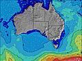 | 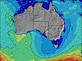 | 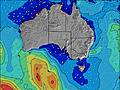 | 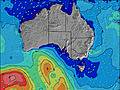 | 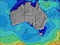 | 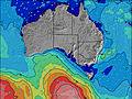 | ||||||||||||
Wave Height (m) Direction Period (s) | WNW 10 | SW 16 | SW 15 | SW 16 | SW 16 | SW 15 | SW 14 | SW 13 | SW 13 | SW 13 | SW 12 | SW 13 | SW 18 | SW 17 | SW 18 | SW 17 | SW 16 | SW 16 | SW 15 |
Wave Graph | |||||||||||||||||||
2013 | 2653 | 8470 | 15658 | 13559 | 7879 | 3845 | 2490 | 1846 | 1285 | 940 | 966 | 811 | 3222 | 6734 | 5673 | 2985 | 4075 | 4054 | |
Wind (km/h) | |||||||||||||||||||
Wind State on-shore cross-onshore cross-shore cross-offshore off-shore glassy | cross-off | cross | cross | cross-on | cross-on | cross-on | cross-on | cross | cross-on | cross-off | cross-off | cross-off | off | off | cross-off | off | cross-on | cross-on | on |
High Tide | 10:55PM0.27m | 12:29PM0.86m | 11:37PM0.32m | 12:51PM0.89m | 00:07AM0.37m | 1:13PM0.91m | 00:37AM0.43m | 1:33PM0.90m | 1:08AM0.49m | 1:52PM0.87m | 1:41AM0.54m | 2:09PM0.82m | 2:14AM0.58m | ||||||
Low Tide | 4:08AM0.17m | 8:21PM0.27m | 5:02AM0.13m | 8:11PM0.27m | 5:43AM0.09m | 8:11PM0.26m | 6:19AM0.08m | 8:17PM0.24m | 6:53AM0.08m | 8:27PM0.21m | 7:26AM0.11m | 8:38PM0.19m | |||||||
— | 7:13 | — | — | 7:11 | — | — | 7:11 | — | — | 7:11 | — | — | 7:09 | — | — | 7:09 | — | — | |
— | — | 5:19 | — | — | 5:20 | — | — | 5:21 | — | — | 5:21 | — | — | 5:22 | — | — | 5:22 | — | |
mm | 2 | 1 | 1 | 3 | — | — | — | — | — | 1 | — | — | — | — | — | 2 | — | — | — |
Temp °C | 14 | 12 | 11 | 12 | 11 | 11 | 11 | 11 | 12 | 12 | 12 | 12 | 12 | 12 | 12 | 12 | 11 | 11 | 12 |
Feels °C | 5 | 3 | -1 | 3 | 2 | 4 | 5 | 6 | 7 | 9 | 9 | 8 | 8 | 5 | 4 | 2 | 2 | 4 | 6 |
Swell 1 Height (m) Direction Period (s) | WSW 11 | SW 16 | — | — | SW 16 | SW 15 | SW 14 | SW 13 | SW 13 | SW 13 | SW 12 | SW 13 | SW 12 | SW 17 | SW 18 | SW 17 | SW 16 | SW 16 | SW 15 |
1922 | 2653 | — | — | 11772 | 7105 | 3845 | 2490 | 1846 | 1285 | 940 | 966 | 811 | 3222 | 6734 | 5673 | 2985 | 4075 | 4054 | |
Swell 2 Height (m) Direction Period (s) | — | W 16 | — | — | — | — | S 11 | S 10 | S 24 | SSW 23 | SW 21 | SW 20 | SW 18 | SW 21 | — | — | — | — | WSW 18 |
— | 260 | — | — | — | — | 695 | 392 | 11 | 51 | 160 | 552 | 808 | 224 | — | — | — | — | 1015 | |
Swell 3 Height (m) Direction Period (s) | — | — | — | — | — | — | — | — | SW 24 | SSW 22 | SW 21 | SSE 8 | SSE 8 | SSE 8 | — | — | — | — | — |
— | — | — | — | — | — | — | — | 22 | 48 | 159 | 38 | 25 | 12 | — | — | — | — | — | |
Wind waves Height (m) Direction Period (s) | WNW 10 | WSW 11 | SW 15 | SW 16 | SW 16 | SW 15 | — | — | — | — | — | — | — | N 4 | NW 5 | NW 6 | W 8 | — | — |
2013 | 1375 | 8470 | 15658 | 13559 | 7879 | — | — | — | — | — | — | — | 9 | 66 | 161 | 405 | — | — | |
Nearest Offshore or Glassy | |||||||||||||||||||
Distance (km) | 247 | 709 | 702 | 366 | 864 | 328 | 173 | 167 | 167 | 0 | 0 | 0 | 0 | 91 | 91 | 247 | 328 | 173 | 43 |
Best forecast wave conditions in South Australia - East Coast | |||||||||||||||||||
Best forecast wave conditions in Australia | |||||||||||||||||||
Header Global | |||||||||||||||||||
- Map Icons:
 Break
Break Live Wave Height (m)
 Live Wind Speed (km/h)
 Surf Rating (10 Max)
 Ocean Swells (m)
- Wind Speed (km/h)


FREE! Surf-Forecast.com widget for your website
The surf report / weather widget below is available to embed on third party websites free of charge and provides a summary of our Rivoli Bay surf forecast. Simply grab the html code snippet that we provide and paste it into your own site. You can choose your preferred language and metric/imperial units for the surf forecast feed to suit users of your site. Click here to get the code.
Information about the Rivoli Bay Surf forecast
The above surf forecast table for Rivoli Bay provides essential information for determining whether the surfing conditions will be good over the next 16 days. A general guide to surfing at Rivoli Bay can be found by selecting the local surf guide option on the grey menu. Our Rivoli Bay surf forecast is unique since it includes wave energy (power) that defines the real feel of the surf rather than just the height or the period. If you surf the same spot (Rivoli Bay) regularly then make a mental note of the wave energy from the surf forecast table each time you go. Very soon you may start to choose your surf days based on the wave energy alone combined with our forecast of favourable offshore wind conditions. Our star ratings will help here and of course you will also find the usual wave height and period predictions on our surf forecasts as well as a full break down of the swell components under our advanced users option (to reveal that, click the little Einstein character under the tide times).
Further information to help with frequently asked questions about our surf forecast for Rivoli Bay may be found under the help tab on the top menu and also by moving your mouse over the question marks on the surf forecast table itself. Please always bear in mind that the forecast is for near-shore open water and local factors at each surf break influence the actual breaking wave height, such as the beach / reef profile, water depths offshore and shelter.
Are you planning a holiday in South Australia - East Coast? If you are looking for accommodation near Rivoli Bay, camping, hotels and holiday cottages in South Australia - East Coast, consider staying in Mount Gambier which is 76 km (47 miles) away. Alternatively, find information about places to stay and car hire in Allendale East which is 84 km (52 miles) away
 Nearest