

Surf Forecasts:

Playa El Yanqui surf forecast from 31 Jul 2026:
- Best quality surf: Sunday 2 Aug, 6PM (local time) - 1.5ft (0.5m), 15s period, SW swell with cross-offshore winds.
- Most powerful swell: Thursday 30 Jul, 9PM (local time) - 3.5ft (1.1m), 14s period, SW swell with 434 kJ wave energy.
- Next surfable swell (1★+): Sunday 2 Aug, 6PM (local time) - 1.5ft (0.5m), 15s period with SW swell.
Best Forecast Surf Conditions for Playa El Yanqui this week:
The surf forecast for Playa El Yanqui over the next 16 days: The first swell (rated 1 star or higher) is forecast to arrive on Sunday (Aug 02) at 6PM. The primary swell is predicted to be 0.5m and 15s period with a secondary swell of 0.6m and 11s. The wind is predicted to be cross-offshore as the swell arrives.
The most powerful waves expected at Playa El Yanqui in the next 16 days are 1.1m 14s and forecast to arrive on Thursday (Jul 30) at 9PM. Winds are predicted to be cross-offshore at the time the swell arrives. The largest open ocean swell (not directed at the beach) is 1.1m 4s period and expected on Saturday (Aug 01) at 6AM.
| Wave Type | Time (CST) & Date | Wave Height & Period |
|---|---|---|
| Next good surf (1 star+) | 6PM (Sun 2nd Aug) | 1.5ft (0.5m) 15s |
| Best Surf | 6PM (Sun 2nd Aug) | 1.5ft (0.5m) 15s |
| Most Powerful | 9PM (Thu 30th Jul) | 3.5ft (1.1m) 14s |
Table - best surf conditions forecast for Playa El Yanqui over the next 16 days.
The Lowdown
Alright, Rusty here. Let’s talk about what’s brewing.
Right now, the outlook for Playa El Yanqui is a proper test of patience. We’ve got a long stretch of very marginal surf ahead, with a few windows that’ll be worth dragging your board out for, but don’t expect any fireworks.
The water temp is sittin’ at a warm 84°, right around average for this time of year, so no surprises there.
The main pattern is solid offshore wind from the ENE, which keeps the face clean, but the swell size is just too small for most of the run. The first real glimmer of something decent shows up on Monday, August 3rd. We’re looking at a southwest swell around 2ft to 3ft, with a period of 13 seconds—decent groundswell energy there. The combined swell energy is moderate, in the 250-260 range. The wind goes light offshore in the afternoon, glassy enough for a fun, clean session. This is the standout window: gentle offshore and clean lines, but don’t expect much power. It’s a beginner-friendly spot, so that size will be just right for longboards and soft-tops.
Before and after that, the story is pretty much the same: small southwest swells, mostly in the 1ft to 2ft range, with persistent fresh to strong offshore winds. The combined energy drops into the 130-180 range on those days, which is weak. From Thursday, July 30th through Saturday, August 2nd, the surf is poor to marginal—scores are zero or one. Then we get that one good day on the 3rd before it falls back into the doldrums again.
From Tuesday, August 5th right through to Wednesday, August 12th, it’s a real struggle. Swell stays tiny, and winds are consistently fresh offshore—often blowing 18 to 25 mph, which makes paddling hard. There’s a period around Friday, August 7th and Saturday, August 8th where the swell period jumps to 15-18 seconds, bringing a long-period groundswell, but the height is still just 2ft to 3ft. The energy reads 344-417, so moderate, but that long period at a beach break means the waves will be fat and straight. Not ideal for paddle surfing, honestly. The strong wind and clean but weak lines make it look better for kiteboarding than a proper surf session.
There is a small uptick again very late in the period—Thursday, August 13th and Friday, August 14th—with a 3ft to 3ft southwest swell and 16-17 second period, combined energy back into the 449-470 range. The wind remains offshore, but again, that long period at a beach break is a caveat—it’ll break straight and be tricky.
So the one true standout is Monday, August 3rd, when the wind goes light and the waves have just enough shape. The rest of the outlook is a waiting game. This spot is *consistent* in terms of always having some wind and swell, but the quality just isn’t there for most of the run. Forecasts can change, but right now, you’ve got a 6-day gap after the 3rd where it’s barely worth a paddle.
Rusty.
Short Range ForecastSome drizzle, heaviest during Thu night. Warm (max 33°C on Thu afternoon, min 26°C on Thu night). Mainly fresh winds. | Days 4-6 Weather SummaryLight rain (total 4mm), mostly falling on Mon night. Warm (max 32°C on Mon afternoon, min 26°C on Sun night). Winds decreasing (fresh winds from the ENE on Sun morning, calm by Mon night). | ||||||||||||||||||||
Thursday 30 | Friday 31 | Saturday 1 | Sunday 2 | Monday 3 | Tuesday 4 | Wednesday 5 | |||||||||||||||
AM | PM | Night | AM | PM | Night | AM | PM | Night | AM | PM | Night | AM | PM | Night | AM | PM | Night | AM | PM | Night | |
Swell Height Map |  |  |  | 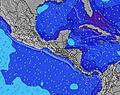 | 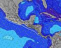 |  | 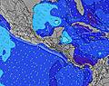 | ||||||||||||||
Wave Height (m) Direction Period (s) | SW 14 | SW 14 | SW 14 | SW 14 | SW 13 | SW 13 | SW 13 | SW 13 | SW 12 | SW 15 | SW 15 | SW 14 | SW 13 | SW 13 | SW 13 | SW 13 | SW 16 | SW 13 | SW 14 | SW 14 | SW 14 |
Wave Graph | |||||||||||||||||||||
459 | 453 | 422 | 304 | 290 | 238 | 193 | 190 | 116 | 112 | 106 | 102 | 215 | 173 | 168 | 101 | 85 | 58 | 54 | 54 | 74 | |
Wind (km/h) | |||||||||||||||||||||
Wind State on-shore cross-onshore cross-shore cross-offshore off-shore glassy | off | cross-off | cross-off | off | off | off | off | cross-off | cross-off | off | cross-off | cross-off | cross-off | off | glassy | off | cross-off | cross-off | off | cross-off | off |
High Tide | 3:21PM2.29m | 3:52AM2.23m | 3:59PM2.31m | 4:28AM2.31m | 4:35PM2.30m | 5:03AM2.36m | 5:12PM2.26m | 5:38AM2.39m | 5:50PM2.21m | 6:15AM2.39m | 6:31PM2.13m | 6:56AM2.38m | 7:17PM2.05m | ||||||||
Low Tide | 9:13AM0.53m | 9:39PM0.31m | 9:52AM0.48m | 10:13PM0.29m | 10:31AM0.45m | 10:46PM0.29m | 11:09AM0.43m | 11:20PM0.32m | 11:48AM0.42m | 11:56PM0.35m | 12:30PM0.43m | 00:35AM0.40m | 1:17PM0.46m | 1:20AM0.46m | |||||||
5:30 | — | — | 5:31 | — | — | 5:31 | — | — | 5:31 | — | — | 5:31 | — | — | 5:31 | — | — | 5:31 | — | — | |
— | 6:07 | — | — | 6:07 | — | — | 6:07 | — | — | 6:07 | — | — | 6:07 | — | — | 6:06 | — | — | 6:06 | — | |
mm | — | — | 1 | — | — | — | — | — | — | — | — | — | — | 1 | 3 | — | — | — | — | — | 1 |
Temp °C | 32 | 33 | 28 | 31 | 31 | 28 | 31 | 32 | 28 | 30 | 30 | 28 | 30 | 32 | 27 | 31 | 32 | 28 | 31 | 32 | 27 |
Feels °C | 29 | 30 | 27 | 30 | 29 | 27 | 28 | 30 | 27 | 29 | 31 | 30 | 32 | 34 | 31 | 30 | 31 | 28 | 30 | 30 | 26 |
Swell 1 Height (m) Direction Period (s) | SW 14 | SW 14 | SW 14 | SW 14 | SW 13 | SW 13 | SW 13 | SW 13 | SW 12 | SW 12 | SSW 11 | S 7 | SW 13 | SW 13 | SW 13 | SSW 8 | SSW 9 | S 8 | S 8 | S 8 | S 8 |
459 | 453 | 422 | 304 | 290 | 238 | 193 | 190 | 116 | 112 | 84 | 39 | 215 | 173 | 168 | 58 | 79 | 51 | 35 | 33 | 33 | |
Swell 2 Height (m) Direction Period (s) | S 7 | S 7 | S 6 | S 6 | S 8 | S 8 | S 8 | SW 16 | SW 16 | SW 15 | SW 15 | SW 12 | S 7 | S 7 | S 7 | SW 13 | SW 16 | SW 13 | SW 12 | SW 12 | SW 14 |
8 | 8 | 7 | 7 | 10 | 10 | 10 | 66 | 65 | 107 | 106 | 68 | 37 | 37 | 35 | 101 | 85 | 58 | 50 | 49 | 74 | |
Swell 3 Height (m) Direction Period (s) | S 10 | W 10 | W 11 | WNW 11 | WNW 12 | WNW 11 | WSW 16 | WNW 11 | WNW 11 | S 11 | SSW 7 | SW 14 | WNW 10 | SW 16 | SW 16 | SW 10 | SW 12 | SW 12 | SW 14 | SW 14 | SW 12 |
7 | 8 | 9 | 23 | 26 | 23 | 27 | 23 | 23 | 39 | 16 | 102 | 9 | 42 | 41 | 15 | 23 | 37 | 54 | 54 | 22 | |
Wind waves Height (m) Direction Period (s) | NE 4 | NE 4 | NE 4 | NE 4 | NE 4 | NE 4 | NE 4 | NE 4 | NE 4 | NE 4 | NE 4 | ENE 3 | NE 3 | — | — | NE 3 | NE 4 | ENE 4 | NE 4 | NE 4 | NE 4 |
28 | 28 | 15 | 17 | 24 | 24 | 36 | 35 | 15 | 28 | 15 | 2 | 2 | — | — | 7 | 26 | 12 | 10 | 22 | 24 | |
Nearest Offshore or Glassy | |||||||||||||||||||||
Distance (km) | 44 | 44 | 44 | 44 | 36 | 36 | 44 | 82 | 44 | 36 | 10 | 10 | 36 | 0 | 0 | 36 | 44 | 4 | 36 | 104 | 82 |
Best forecast wave conditions in Rivas Province | |||||||||||||||||||||
Best forecast wave conditions in Nicaragua | |||||||||||||||||||||
Header Global | |||||||||||||||||||||
- Map Icons:
 Break
Break Live Wave Height (m)
 Live Wind Speed (km/h)
 Surf Rating (10 Max)
 Ocean Swells (m)
- Wind Speed (km/h)
Latest Updates


FREE! Surf-Forecast.com widget for your website
The surf report / weather widget below is available to embed on third party websites free of charge and provides a summary of our Playa El Yanqui surf forecast. Simply grab the html code snippet that we provide and paste it into your own site. You can choose your preferred language and metric/imperial units for the surf forecast feed to suit users of your site. Click here to get the code.
Information about the Playa El Yanqui Surf forecast
The above surf forecast table for Playa El Yanqui provides essential information for determining whether the surfing conditions will be good over the next 16 days. A general guide to surfing at Playa El Yanqui can be found by selecting the local surf guide option on the grey menu. Our Playa El Yanqui surf forecast is unique since it includes wave energy (power) that defines the real feel of the surf rather than just the height or the period. If you surf the same spot (Playa El Yanqui) regularly then make a mental note of the wave energy from the surf forecast table each time you go. Very soon you may start to choose your surf days based on the wave energy alone combined with our forecast of favourable offshore wind conditions. Our star ratings will help here and of course you will also find the usual wave height and period predictions on our surf forecasts as well as a full break down of the swell components under our advanced users option (to reveal that, click the little Einstein character under the tide times).
Further information to help with frequently asked questions about our surf forecast for Playa El Yanqui may be found under the help tab on the top menu and also by moving your mouse over the question marks on the surf forecast table itself. Please always bear in mind that the forecast is for near-shore open water and local factors at each surf break influence the actual breaking wave height, such as the beach / reef profile, water depths offshore and shelter.
Playa El Yanqui is 11 km (7 miles) from San Juan del Sur. If you plan a holiday in Rivas Province, look for hotels and other accommodation in San Juan del Sur. San Juan del Sur has rooms for a wide range of budgets as well as car hire and transport links.
 Nearest