

Surf Forecasts:

Los Pechos surf forecast from 1 Aug 2026:
- Best quality surf: Monday 3 Aug, 12PM (local time) - 2.5ft (0.7m), 13s period, SW swell with offshore winds.
- Most powerful swell: Saturday 8 Aug, 6AM (local time) - 2.5ft (0.7m), 16s period, SW swell with 261 kJ wave energy.
- Next surfable swell (1★+): Monday 3 Aug, 12AM (local time) - 1.5ft (0.5m), 14s period with SW swell.
Best Forecast Surf Conditions for Los Pechos this week:
The surf forecast for Los Pechos over the next 16 days: The first swell (rated 1 star or higher) is forecast to arrive on Monday (Aug 03) at 12AM. The primary swell is predicted to be 0.5m and 14s period with a secondary swell of 0.5m and 12s. The wind is predicted to be cross-offshore as the swell arrives.
The most powerful waves expected at Los Pechos in the next 16 days are 0.7m 16s and forecast to arrive on Saturday (Aug 08) at 6AM. Winds are predicted to be offshore at the time the swell arrives. The largest open ocean swell (not directed at the beach) is 1.3m 5s period and expected on Friday (Aug 07) at 6PM.
| Wave Type | Time (CST) & Date | Wave Height & Period |
|---|---|---|
| Next good surf (1 star+) | 12AM (Mon 3rd Aug) | 1.5ft (0.5m) 14s |
| Best Surf | 12PM (Mon 3rd Aug) | 2.5ft (0.7m) 13s |
| Most Powerful | 6AM (Sat 8th Aug) | 2.5ft (0.7m) 16s |
Table - best surf conditions forecast for Los Pechos over the next 16 days.
The Lowdown
Alright, Rusty here. Let's break down what's happening for the next couple of weeks.
Right off the bat, I'm not going to sugarcoat it – the surf is small and the wind is howling, so there's no real standout session. For the next sixteen days, the only break with any sort of recommendation is Los Pechos, but even then, it's a real grind.
The whole period is dominated by a strong, persistent ENE wind, which is offshore, but it's blowing a fresh to strong breeze, 15 to 25 mph, making it a real battle to paddle out and stay in position. The water temperature is about average for this time of year, so nothing unusual there.
The first few days, starting Saturday, August 1st, the swell is tiny, around 2 ft to 2 ft, with a long period of 12 to 15 seconds from the SW. It's clean, but the swell energy is weak (around 199 to 210 units). It's just not enough to get excited about. The conditions are described as "poor surf" or "marginal," which about sums it up.
We go through a long stretch of similar, small, clean but weak surf. The wind is relentless, and the energy levels stay low, mostly in the 100 to 300 range, until we get to August 7th. Things start to look a bit more interesting from August 7th onward, with the swell energy climbing to 378 (moderate) by the afternoon, and then to 388 on August 8th. The swell is still small, 2 ft, but the period is long, 16 to 18 seconds. That's a proper groundswell, but the problem is the wind. It's a strong offshore breeze, 25 mph, which makes it clean but incredibly hard to paddle into. It's a real test of fitness.
August 9th sees a bit more size, 3 ft, with energy at 314, but still that same strong wind pattern. August 14th brings the highest energy of the whole period, 371 units, with a 2 ft, 19-second period swell. Again, it's clean but the wind is a strong 25 mph offshore. August 15th has the biggest swell of the window, 3 ft, with a 17-second period and energy hitting 561 (moderate). That's the most interesting session, but the wind is still a fresh 22 mph cross-offshore. It's a tough call.
So, looking at the whole picture, if you're a fit, experienced surfer who doesn't mind a battle, August 15th is the best option. The 3 ft, 17-second SW groundswell will have some push, and the energy is the highest we'll see. But for everyone else, the wind is just too strong and the swell too small to make it worth the paddle. This is a spot that needs a break in the wind to really shine, and that's not happening in the next two weeks.
This is Rusty, signing off.
Short Range ForecastMostly dry. Warm (max 32°C on Sat afternoon, min 26°C on Sat night). Mainly fresh winds. | Days 5-7 Weather SummaryLight rain (total 5mm), mostly falling on Mon night. Warm (max 32°C on Tue afternoon, min 26°C on Mon night). Winds increasing (light winds from the ENE on Mon night, fresh winds from the ENE by Thu morning). | ||||||||||||||||||
Saturday 1 | Sunday 2 | Monday 3 | Tuesday 4 | Wednesday 5 | Thursday 6 | ||||||||||||||
Night | AM | PM | Night | AM | PM | Night | AM | PM | Night | AM | PM | Night | AM | PM | Night | AM | PM | Night | |
Swell Height Map |  |  |  |  | 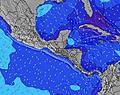 | 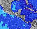 | 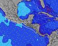 | ||||||||||||
Wave Height (m) Direction Period (s) | SW 13 | SW 13 | SW 13 | SW 12 | SW 12 | SW 15 | SW 14 | SW 13 | SW 13 | SW 13 | SW 13 | SW 14 | SW 13 | SW 12 | SW 15 | SW 15 | SW 14 | SW 14 | SW 13 |
Wave Graph | |||||||||||||||||||
196 | 162 | 164 | 118 | 112 | 104 | 103 | 176 | 173 | 108 | 45 | 49 | 56 | 50 | 54 | 36 | 68 | 116 | 142 | |
Wind (km/h) | |||||||||||||||||||
Wind State on-shore cross-onshore cross-shore cross-offshore off-shore glassy | off | off | cross-off | cross-off | off | off | cross-off | off | cross-off | cross-off | off | cross-off | cross-off | off | cross-off | off | cross-off | off | off |
High Tide | 4:28AM2.31m | 4:35PM2.30m | 5:03AM2.36m | 5:12PM2.26m | 5:38AM2.39m | 5:50PM2.21m | 6:15AM2.39m | 6:31PM2.13m | 6:56AM2.38m | 7:17PM2.05m | 7:44AM2.34m | 8:11PM1.97m | |||||||
Low Tide | 10:13PM0.29m | 10:31AM0.45m | 10:46PM0.29m | 11:09AM0.43m | 11:20PM0.32m | 11:48AM0.42m | 11:56PM0.35m | 12:30PM0.43m | 00:35AM0.40m | 1:17PM0.46m | 1:20AM0.46m | 2:10PM0.50m | 2:13AM0.52m | ||||||
— | 5:31 | — | — | 5:31 | — | — | 5:31 | — | — | 5:31 | — | — | 5:31 | — | — | 5:31 | — | — | |
— | — | 6:07 | — | — | 6:07 | — | — | 6:07 | — | — | 6:06 | — | — | 6:06 | — | — | 6:06 | — | |
mm | — | — | — | — | — | — | — | — | — | 3 | — | — | — | — | — | — | 1 | 1 | 1 |
Temp °C | 28 | 31 | 32 | 28 | 30 | 31 | 28 | 31 | 32 | 27 | 31 | 32 | 28 | 29 | 29 | 27 | 29 | 29 | 26 |
Feels °C | 27 | 29 | 30 | 27 | 28 | 30 | 29 | 31 | 32 | 31 | 30 | 31 | 28 | 29 | 29 | 26 | 27 | 27 | 25 |
Swell 1 Height (m) Direction Period (s) | SW 13 | SW 13 | SW 13 | SW 12 | SW 12 | SW 11 | SW 12 | SW 13 | SW 13 | SW 13 | SSW 8 | SSW 8 | S 8 | S 8 | S 8 | S 8 | SW 14 | SW 14 | SW 13 |
196 | 162 | 164 | 118 | 112 | 63 | 68 | 176 | 173 | 108 | 45 | 47 | 51 | 31 | 33 | 36 | 68 | 116 | 142 | |
Swell 2 Height (m) Direction Period (s) | S 8 | S 8 | SW 16 | SW 16 | SW 15 | SW 15 | SW 14 | S 8 | S 7 | S 7 | SW 13 | SW 14 | SW 13 | SW 12 | SW 12 | SW 15 | S 8 | SSW 7 | S 8 |
10 | 10 | 41 | 66 | 77 | 104 | 103 | 29 | 28 | 26 | 42 | 49 | 56 | 50 | 49 | 33 | 21 | 18 | 19 | |
Swell 3 Height (m) Direction Period (s) | WNW 11 | WSW 17 | S 8 | WNW 11 | S 11 | S 7 | SSW 7 | SW 18 | SSW 17 | SW 9 | SW 12 | SW 11 | SW 12 | SW 14 | SW 15 | SSW 12 | SW 11 | S 11 | SW 18 |
23 | 27 | 5 | 23 | 21 | 8 | 15 | 49 | 28 | 13 | 39 | 18 | 37 | 33 | 54 | 14 | 19 | 21 | 116 | |
Wind waves Height (m) Direction Period (s) | ENE 4 | NE 4 | ENE 4 | ENE 4 | ENE 4 | ENE 4 | ENE 3 | NE 3 | ENE 3 | ENE 3 | ENE 3 | E 4 | ENE 3 | ENE 4 | ENE 4 | NE 4 | NE 4 | NE 4 | ENE 4 |
18 | 24 | 20 | 15 | 28 | 16 | 3 | 9 | 10 | 3 | 10 | 22 | 9 | 11 | 12 | 14 | 10 | 25 | 12 | |
Nearest Offshore or Glassy | |||||||||||||||||||
Distance (km) | 40 | 40 | 32 | 36 | 36 | 32 | 0 | 32 | 32 | 0 | 32 | 36 | 32 | 0 | 32 | 0 | 32 | 159 | 40 |
Best forecast wave conditions in Rivas Province | |||||||||||||||||||
Best forecast wave conditions in Nicaragua | |||||||||||||||||||
Header Global | |||||||||||||||||||
- Map Icons:
 Break
Break Live Wave Height (m)
 Live Wind Speed (km/h)
 Surf Rating (10 Max)
 Ocean Swells (m)
- Wind Speed (km/h)
Latest Updates


FREE! Surf-Forecast.com widget for your website
The surf report / weather widget below is available to embed on third party websites free of charge and provides a summary of our Los Pechos surf forecast. Simply grab the html code snippet that we provide and paste it into your own site. You can choose your preferred language and metric/imperial units for the surf forecast feed to suit users of your site. Click here to get the code.
Information about the Los Pechos Surf forecast
The above surf forecast table for Los Pechos provides essential information for determining whether the surfing conditions will be good over the next 16 days. A general guide to surfing at Los Pechos can be found by selecting the local surf guide option on the grey menu. Our Los Pechos surf forecast is unique since it includes wave energy (power) that defines the real feel of the surf rather than just the height or the period. If you surf the same spot (Los Pechos) regularly then make a mental note of the wave energy from the surf forecast table each time you go. Very soon you may start to choose your surf days based on the wave energy alone combined with our forecast of favourable offshore wind conditions. Our star ratings will help here and of course you will also find the usual wave height and period predictions on our surf forecasts as well as a full break down of the swell components under our advanced users option (to reveal that, click the little Einstein character under the tide times).
Further information to help with frequently asked questions about our surf forecast for Los Pechos may be found under the help tab on the top menu and also by moving your mouse over the question marks on the surf forecast table itself. Please always bear in mind that the forecast is for near-shore open water and local factors at each surf break influence the actual breaking wave height, such as the beach / reef profile, water depths offshore and shelter.
Los Pechos is 15 km (9 miles) from San Juan del Sur. If you plan a holiday in Rivas Province, look for hotels and other accommodation in San Juan del Sur. San Juan del Sur has rooms for a wide range of budgets as well as car hire and transport links.
 Nearest