

Surf Forecasts:

Playa Remonso surf forecast from 25 Jul 2026:
- Best quality surf: Tuesday 28 Jul, 6AM (local time) - 4ft (1.2m), 18s period, SW swell with offshore winds.
- Most powerful swell: Tuesday 28 Jul, 12PM (local time) - 4.5ft (1.3m), 18s period, SW swell with 1,087 kJ wave energy.
- Next surfable swell (1★+): Tuesday 28 Jul, 6AM (local time) - 4ft (1.2m), 18s period with SW swell.
Best Forecast Surf Conditions for Playa Remonso this week:
The surf forecast for Playa Remonso over the next 16 days: The first swell (rated 1 star or higher) is forecast to arrive on Tuesday (Jul 28) at 6AM. The primary swell is predicted to be 1.2m and 18s period with a secondary swell of 0.6m and 13s. The wind is predicted to be offshore as the swell arrives.
The most powerful waves expected at Playa Remonso in the next 16 days are 1.3m 18s and forecast to arrive on Tuesday (Jul 28) at 12PM. Winds are predicted to be cross-offshore at the time the swell arrives. The largest open ocean swell (not directed at the beach) is 0.9m 4s period and expected on Sunday (Jul 26) at 9AM.
| Wave Type | Time (CST) & Date | Wave Height & Period |
|---|---|---|
| Next good surf (1 star+) | 6AM (Tue 28th Jul) | 4ft (1.2m) 18s |
| Best Surf | 6AM (Tue 28th Jul) | 4ft (1.2m) 18s |
| Most Powerful | 12PM (Tue 28th Jul) | 4.5ft (1.3m) 18s |
Table - best surf conditions forecast for Playa Remonso over the next 16 days.
The Lowdown
Alright, Rusty here. Let’s talk about what’s happening at Playa Remonso.
Look, it’s a stretch right now. We’ve got a long run of marginal surf on the cards, but honestly, the whole next 16 days is pretty much a flat spell. The good news is the water is sitting at a warm 84°F, which is pretty much average for this time of year, so at least you won’t need a thick wetsuit.
Saturday the 25th kicks off the whole window, and we’re looking at small 3 ft swell out of the SW with a very long period of 21 seconds. The combined swell energy is weak (641). That period means the waves will have a bit of push, but for a beach setup, it might break a little too straight. The wind is NE at 22 mph, blowing offshore, which keeps the surface clean. For a beginner, these small, clean waves are okay, but it’s not going to get you excited.
By Sunday the 26th, we’re up to 3 ft to 4 ft from the SW, still that long period. The wind stays offshore NE at 19-22 mph, so the morning will be clean. Energy is still moderate (676-783). It’s barely a ripple, but the conditions are tidy.
Moving into Monday the 27th, the swell gets a tiny bit better, maxing out around 4 ft from the SW, with period dropping to 16-18 seconds. The wind is offshore ENE at 16-22 mph. The morning is the pick, with moderate energy (988). It’s the only spot in the whole outlook where the swell and wind come together okay, but even then, the surf commentary is calling it “marginal.”
Tuesday the 28th is where we see the highest combined energy of the whole run at 1097 – that’s still only moderate energy. Swell is 4 ft to 4 ft from the SW, period 17-18 seconds. A 12 mph E wind turns cross-offshore in the afternoon, keeping it clean. But again, the forecast notes it’s still questionable.
From Wednesday the 29th onward, it’s a slow slide downhill. Swell drops from 4 ft down to 1 ft by early August. The wind switches from offshore to cross-offshore, and by around July 31st, the conditions get tagged as “poor.” By August 1st, we’re under 3 ft with cross-offshore winds, and the energy levels fall into the low triple and double digits. From August 2nd right through to August 9th, the swell barely reaches 2 ft, the energy is weak (down to 92), and the waves just aren’t there. The wind stays strong offshore at 22-25 mph on some mornings, which would make paddling a real battle.
The only spot that’s even on the radar is Playa Remonso, and it’s exposed to the SW, which is where the little pulses are coming from. It’s very consistent for a beach break, which is rare for this area, so that’s the one positive note. The best conditions are arguably Tuesday the 28th with the clean afternoon wind and the highest energy of the fortnight, but it’s still not a stand-out session by any stretch.
If you’re a beginner, the tiny 3 ft to 4 ft swells on the weekend are manageable, but with the long period, you’ll be waiting a while between sets. For anyone else, it’s a tough run. The swell just never gets over about 4 ft and the period drops off fast after the first few days. Nothing here is pumping.
Honestly, it’s a blank run for decent surf. The area goes quiet, but with that consistency rating, the forecasts can flip. Hang in there.
- Rusty
Short Range ForecastMostly dry. Warm (max 32°C on Sun afternoon, min 26°C on Sat night). Mainly fresh winds. | Days 4-6 Weather SummaryLight rain (total 5mm), mostly falling on Tue afternoon. Warm (max 32°C on Thu afternoon, min 26°C on Tue night). Mainly fresh winds. | ||||||||||||||||||||
Saturday 25 | Sunday 26 | Monday 27 | Tuesday 28 | Wednesday 29 | Thursday 30 | Friday 31 | |||||||||||||||
AM | PM | Night | AM | PM | Night | AM | PM | Night | AM | PM | Night | AM | PM | Night | AM | PM | Night | AM | PM | Night | |
Swell Height Map |  |  |  | 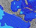 | 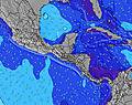 | 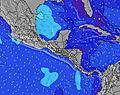 | 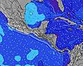 | ||||||||||||||
Wave Height (m) Direction Period (s) | SW 21 | SW 21 | SW 19 | SW 19 | SW 18 | SW 17 | SW 18 | SW 16 | SW 17 | SW 18 | SW 17 | SW 16 | SW 16 | SW 16 | SW 15 | SW 14 | SW 14 | SW 14 | SW 14 | SW 13 | SW 13 |
Wave Graph | |||||||||||||||||||||
543 | 351 | 834 | 614 | 702 | 671 | 921 | 517 | 861 | 871 | 1074 | 737 | 886 | 692 | 623 | 459 | 401 | 322 | 264 | 253 | 196 | |
Wind (km/h) | |||||||||||||||||||||
Wind State on-shore cross-onshore cross-shore cross-offshore off-shore glassy | off | off | off | off | off | cross-off | off | off | cross-off | off | cross-off | cross-off | off | cross-off | cross-off | off | off | cross-off | off | cross-off | cross-off |
High Tide | 11:25AM2.02m | 00:09AM1.76m | 12:22PM2.05m | 1:04AM1.83m | 1:13PM2.11m | 1:52AM1.92m | 1:59PM2.18m | 2:35AM2.03m | 2:41PM2.25m | 3:15AM2.14m | 3:21PM2.29m | 3:52AM2.23m | 3:59PM2.31m | ||||||||
Low Tide | 6:03PM0.66m | 6:04AM0.78m | 6:56PM0.60m | 6:58AM0.73m | 7:43PM0.52m | 7:47AM0.66m | 8:25PM0.43m | 8:31AM0.59m | 9:03PM0.36m | 9:13AM0.53m | 9:39PM0.31m | 9:52AM0.48m | 10:13PM0.29m | ||||||||
5:30 | — | — | 5:30 | — | — | 5:30 | — | — | 5:30 | — | — | 5:30 | — | — | 5:30 | — | — | 5:31 | — | — | |
— | 6:08 | — | — | 6:08 | — | — | 6:08 | — | — | 6:08 | — | — | 6:07 | — | — | 6:07 | — | — | 6:07 | — | |
mm | — | — | — | — | — | — | — | — | — | — | 1 | 2 | — | 1 | 1 | — | — | — | — | 1 | 3 |
Temp °C | 29 | 30 | 27 | 30 | 32 | 28 | 29 | 31 | 28 | 30 | 31 | 27 | 30 | 30 | 28 | 31 | 32 | 28 | 31 | 31 | 27 |
Feels °C | 28 | 29 | 25 | 28 | 30 | 27 | 28 | 30 | 27 | 30 | 31 | 28 | 31 | 30 | 29 | 29 | 30 | 27 | 31 | 31 | 28 |
Swell 1 Height (m) Direction Period (s) | SW 21 | SW 21 | SW 19 | SW 19 | SW 18 | SW 17 | SW 18 | SW 16 | SW 17 | SW 18 | SW 17 | SW 16 | SW 16 | SW 16 | SW 15 | SW 14 | SW 14 | SW 14 | SW 14 | SW 13 | SW 13 |
543 | 351 | 834 | 614 | 702 | 671 | 921 | 517 | 861 | 871 | 1074 | 737 | 886 | 692 | 623 | 459 | 401 | 322 | 264 | 253 | 196 | |
Swell 2 Height (m) Direction Period (s) | SW 8 | SW 8 | SW 12 | SW 11 | S 10 | S 10 | S 10 | SW 20 | SSW 9 | SW 13 | S 9 | SW 12 | SSW 11 | SSW 10 | SSW 10 | S 7 | S 6 | S 6 | S 6 | S 8 | S 7 |
48 | 28 | 83 | 43 | 51 | 50 | 49 | 373 | 29 | 176 | 14 | 93 | 22 | 22 | 19 | 8 | 7 | 7 | 6 | 11 | 10 | |
Swell 3 Height (m) Direction Period (s) | SW 12 | SW 12 | S 11 | SSW 8 | SW 11 | SW 11 | SW 11 | SSW 10 | SW 10 | S 9 | S 11 | SSW 11 | N 4 | S 10 | S 10 | S 10 | W 10 | W 10 | W 9 | W 11 | W 10 |
50 | 49 | 61 | 19 | 30 | 41 | 18 | 31 | 4 | 14 | 9 | 24 | 1 | 8 | 8 | 2 | 8 | 8 | 6 | 9 | 8 | |
Wind waves Height (m) Direction Period (s) | NE 4 | NE 4 | ENE 4 | NE 4 | ENE 4 | ENE 4 | NE 3 | ENE 4 | ENE 3 | ENE 3 | ENE 3 | ENE 3 | ENE 3 | ENE 4 | NE 4 | ENE 4 | ENE 4 | ENE 4 | ENE 4 | ENE 4 | NE 4 |
20 | 14 | 17 | 20 | 16 | 10 | 12 | 11 | 6 | 10 | 7 | 4 | 10 | 14 | 12 | 18 | 21 | 12 | 18 | 23 | 14 | |
Nearest Offshore or Glassy | |||||||||||||||||||||
Distance (km) | 40 | 40 | 40 | 40 | 40 | 40 | 50 | 40 | 40 | 40 | 16 | 40 | 16 | 6 | 16 | 40 | 40 | 40 | 40 | 108 | 50 |
Best forecast wave conditions in Rivas Province | |||||||||||||||||||||
Best forecast wave conditions in Nicaragua | |||||||||||||||||||||
Header Global | |||||||||||||||||||||
- Map Icons:
 Break
Break Live Wave Height (m)
 Live Wind Speed (km/h)
 Surf Rating (10 Max)
 Ocean Swells (m)
- Wind Speed (km/h)


FREE! Surf-Forecast.com widget for your website
The surf report / weather widget below is available to embed on third party websites free of charge and provides a summary of our Playa Remonso surf forecast. Simply grab the html code snippet that we provide and paste it into your own site. You can choose your preferred language and metric/imperial units for the surf forecast feed to suit users of your site. Click here to get the code.
Information about the Playa Remonso Surf forecast
The above surf forecast table for Playa Remonso provides essential information for determining whether the surfing conditions will be good over the next 16 days. A general guide to surfing at Playa Remonso can be found by selecting the local surf guide option on the grey menu. Our Playa Remonso surf forecast is unique since it includes wave energy (power) that defines the real feel of the surf rather than just the height or the period. If you surf the same spot (Playa Remonso) regularly then make a mental note of the wave energy from the surf forecast table each time you go. Very soon you may start to choose your surf days based on the wave energy alone combined with our forecast of favourable offshore wind conditions. Our star ratings will help here and of course you will also find the usual wave height and period predictions on our surf forecasts as well as a full break down of the swell components under our advanced users option (to reveal that, click the little Einstein character under the tide times).
Further information to help with frequently asked questions about our surf forecast for Playa Remonso may be found under the help tab on the top menu and also by moving your mouse over the question marks on the surf forecast table itself. Please always bear in mind that the forecast is for near-shore open water and local factors at each surf break influence the actual breaking wave height, such as the beach / reef profile, water depths offshore and shelter.
Playa Remonso is 5 km (3 miles) from San Juan del Sur. If you plan a holiday in Rivas Province, look for hotels and other accommodation in San Juan del Sur. San Juan del Sur has rooms for a wide range of budgets as well as car hire and transport links.
 Nearest