

Surf Forecasts:

Nusa dua surf forecast from 1 Aug 2026:
- Most powerful swell: Saturday 8 Aug, 2AM (local time) - 8ft (2.5m), 16s period, SSW swell with 3,465 kJ wave energy.
Best Forecast Surf Conditions for Nusa dua this week:
The most powerful waves expected at Nusa dua in the next 16 days are 2.5m 16s and forecast to arrive on Saturday (Aug 08) at 2AM. Winds are predicted to be cross-onshore at the time the swell arrives. The largest open ocean swell (not directed at the beach) is 0.5m 7s period and expected on Sunday (Aug 02) at 8PM.
| Wave Type | Time (WITA) & Date | Wave Height & Period |
|---|---|---|
| Next good surf (1 star+) | - | - |
| Best Surf | - | - |
| Most Powerful | 2AM (Sat 8th Aug) | 8ft (2.5m) 16s |
Table - best surf conditions forecast for Nusa dua over the next 16 days.
The Lowdown
G'day, I'm Rusty, and I'm lookin' at the surf across the next 16 days here at Nusa Dua. It's a bit of a mixed bag, to be honest, but there's a glimmer of something special if you're patient.
The first week or so is a tough one. We've got a solid, consistent SSW groundswell running, with periods well over 15 seconds, which is a beautiful thing for a reef setup like Nusa Dua. The combined energy is moderate to strong, sitting between 1200 and 2000 (moderate wave energy) for most of the early days, but the wind is a total spoiler. It's a persistent cross-onshore breeze from the ESE, and that's just chopping up the face. The water temp is a comfortable 80°, which is right on the money for this time of year, nothing unusual there.
From Saturday, 1st of August through to the end of the second week, it's a slog. The swell stays in the 5ft to 8ft range, but it's almost always blowing cross-onshore or onshore, with wind speeds at 9 to 19 mph. The sets will be there, but they'll be messy and lumpy. On Sunday, 2nd of August, the swell is a clean 6ft, but the 16 mph ESE wind just kills it. This is more of a kite-surfing setup than a clean paddle-surfing one for that whole stretch.
Now, the real standout, the one that's got my heart racing a little, is Tuesday, 11th of August. The morning brings a solid 10ft swell from the SSW, with a very long period of 18 seconds. The combined energy jumps to 5896 (very strong wave energy), which is a significant jump. The wind is a cross-shore SSE breeze at 12 mph, which is a dramatic improvement. This is a big, powerful, clean swell for advanced surfers only. It's too big for anyone but the experienced crew. The afternoon is even better, with the wind dropping to 9 mph, still cross-shore, and the wave energy at 5147 (very strong wave energy). This is the best on offer, a true window of quality. The long period will make it a proper groundswell, which is perfect for a reef like this, but expect long lulls between the sets.
The tail end of the run, from Wednesday, 12th of August onward, sees the swell drop back down, settling into the 4ft to 7ft range. The wind remains a problem, though we do see a few windows with a light breeze. Saturday, 15th of August, has a 7ft swell with a 17-second period, but the cross-onshore wind will keep it from being a classic. Because Nusa Dua is a reef break that's very consistent, I know there's always a chance, but with this wind pattern, you're really waiting for that one day on the 11th.
Rusty out.
Short Range ForecastMostly dry. Warm (max 26°C on Sun afternoon, min 25°C on Sat morning). Wind will be generally light. | Days 4-6 Weather SummarySome drizzle, heaviest during Wed night. Warm (max 26°C on Wed afternoon, min 25°C on Tue morning). Mainly fresh winds. | ||||||||||||||||||||
Saturday 1 | Sunday 2 | Monday 3 | Tuesday 4 | Wednesday 5 | Thursday 6 | Friday 7 | |||||||||||||||
AM | PM | Night | AM | PM | Night | AM | PM | Night | AM | PM | Night | AM | PM | Night | AM | PM | Night | AM | PM | Night | |
Swell Height Map |  |  |  | 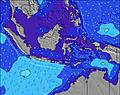 | 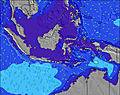 | 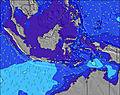 | 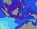 | ||||||||||||||
Wave Height (m) Direction Period (s) | SSW 16 | SSW 18 | SSW 17 | SSW 17 | SSW 16 | SSW 16 | SSW 15 | SSW 15 | SSW 15 | SSW 14 | SSW 14 | SSW 13 | SSW 14 | SSW 15 | SSW 18 | SSW 17 | SSW 16 | SSW 16 | SSW 17 | SSW 16 | SSW 16 |
Wave Graph | |||||||||||||||||||||
962 | 1567 | 1514 | 1945 | 1899 | 1762 | 1220 | 1091 | 1271 | 1187 | 1075 | 817 | 1010 | 1067 | 2268 | 2164 | 1943 | 1474 | 3216 | 3127 | 3465 | |
Wind (km/h) | |||||||||||||||||||||
Wind State on-shore cross-onshore cross-shore cross-offshore off-shore glassy | on | on | on | cross-on | cross-on | on | cross-on | cross-on | cross-on | cross-on | cross-on | cross-on | cross-on | cross-on | cross-on | on | cross-on | on | on | cross-on | cross-on |
High Tide | 11:34AM2.50m | 00:14AM2.32m | 12:05PM2.46m | 00:39AM2.40m | 12:35PM2.36m | 1:05AM2.44m | 1:07PM2.21m | 1:33AM2.44m | 1:42PM2.02m | 2:05AM2.41m | 2:22PM1.78m | 2:44AM2.34m | 3:15PM1.53m | 3:38AM2.23m | |||||||
Low Tide | 5:59PM0.17m | 6:04AM0.56m | 6:23PM0.21m | 6:37AM0.52m | 6:47PM0.28m | 7:12AM0.51m | 7:12PM0.39m | 7:51AM0.54m | 7:39PM0.53m | 8:36AM0.61m | 8:08PM0.69m | 9:36AM0.71m | 8:42PM0.87m | ||||||||
6:33 | — | — | 6:33 | — | — | 6:33 | — | — | 6:31 | — | — | 6:31 | — | — | 6:31 | — | — | 6:31 | — | — | |
— | 6:16 | — | — | 6:16 | — | — | 6:16 | — | — | 6:16 | — | — | 6:16 | — | — | 6:16 | — | — | 6:16 | — | |
mm | — | — | — | — | — | — | — | — | — | — | — | — | — | — | 1 | — | — | — | — | — | — |
Temp °C | 25 | 25 | 25 | 25 | 26 | 26 | 25 | 26 | 25 | 25 | 25 | 25 | 25 | 26 | 25 | 25 | 25 | 25 | 25 | 25 | 25 |
Feels °C | 25 | 25 | 25 | 26 | 26 | 26 | 27 | 27 | 26 | 26 | 26 | 26 | 26 | 27 | 25 | 25 | 24 | 24 | 24 | 24 | 24 |
Swell 1 Height (m) Direction Period (s) | SSW 16 | SSW 18 | SSW 17 | SSW 17 | SSW 16 | SSW 16 | SSW 15 | SSW 15 | SSW 15 | SSW 14 | SSW 14 | SSW 13 | SSW 14 | SSW 15 | SSW 18 | SSW 17 | SSW 16 | SSW 16 | SSW 17 | SSW 16 | SSW 16 |
962 | 1567 | 1514 | 1945 | 1899 | 1762 | 1220 | 1091 | 1271 | 1187 | 1075 | 817 | 1010 | 1067 | 2268 | 2164 | 1943 | 1474 | 3216 | 3127 | 3465 | |
Swell 2 Height (m) Direction Period (s) | SE 6 | SE 6 | SE 6 | SE 6 | ESE 6 | SE 7 | SE 7 | S 18 | SE 7 | SE 7 | SW 16 | SSW 17 | SSW 22 | SSW 20 | — | — | S 21 | SSW 19 | SE 6 | — | — |
45 | 35 | 33 | 33 | 25 | 75 | 60 | 99 | 71 | 54 | 381 | 344 | 156 | 420 | — | — | 81 | 804 | 51 | — | — | |
Swell 3 Height (m) Direction Period (s) | S 20 | NE 7 | NE 7 | NE 7 | — | — | S 19 | SSW 18 | — | SSW 14 | NE 8 | SE 6 | NE 7 | ENE 7 | — | — | — | — | — | — | — |
196 | 8 | 7 | 12 | — | — | 66 | 326 | — | 215 | 10 | 40 | 7 | 4 | — | — | — | — | — | — | — | |
Wind waves Height (m) Direction Period (s) | ESE 6 | — | — | — | ESE 4 | — | — | SE 7 | — | — | SE 7 | — | SE 6 | SE 6 | SE 6 | SE 6 | SE 6 | SE 6 | SE 6 | SE 6 | SE 5 |
80 | — | — | — | 27 | — | — | 102 | — | — | 61 | — | 49 | 45 | 49 | 49 | 76 | 65 | 85 | 66 | 35 | |
Nearest Offshore or Glassy | |||||||||||||||||||||
Distance (km) | 9 | 9 | 9 | 9 | 9 | 9 | 9 | 9 | 9 | 9 | 9 | 9 | 9 | 9 | 27 | 27 | 27 | 13 | 27 | 9 | 27 |
Best forecast wave conditions in The Bukit - Bali | |||||||||||||||||||||
Best forecast wave conditions in Indonesia | |||||||||||||||||||||
Header Global | |||||||||||||||||||||
- Map Icons:
 Break
Break Live Wave Height (m)
 Live Wind Speed (km/h)
 Surf Rating (10 Max)
 Ocean Swells (m)
- Wind Speed (km/h)
Latest Updates


FREE! Surf-Forecast.com widget for your website
The surf report / weather widget below is available to embed on third party websites free of charge and provides a summary of our Nusa dua surf forecast. Simply grab the html code snippet that we provide and paste it into your own site. You can choose your preferred language and metric/imperial units for the surf forecast feed to suit users of your site. Click here to get the code.
Information about the Nusa dua Surf forecast
The above surf forecast table for Nusa dua provides essential information for determining whether the surfing conditions will be good over the next 16 days. A general guide to surfing at Nusa dua can be found by selecting the local surf guide option on the grey menu. Our Nusa dua surf forecast is unique since it includes wave energy (power) that defines the real feel of the surf rather than just the height or the period. If you surf the same spot (Nusa dua) regularly then make a mental note of the wave energy from the surf forecast table each time you go. Very soon you may start to choose your surf days based on the wave energy alone combined with our forecast of favourable offshore wind conditions. Our star ratings will help here and of course you will also find the usual wave height and period predictions on our surf forecasts as well as a full break down of the swell components under our advanced users option (to reveal that, click the little Einstein character under the tide times).
Further information to help with frequently asked questions about our surf forecast for Nusa dua may be found under the help tab on the top menu and also by moving your mouse over the question marks on the surf forecast table itself. Please always bear in mind that the forecast is for near-shore open water and local factors at each surf break influence the actual breaking wave height, such as the beach / reef profile, water depths offshore and shelter.
Nusa dua is 12 km (7 miles) from the city of Kuta. If you plan a holiday in The Bukit - Bali, look for hotels and other accommodation in Kuta. Kuta has rooms for a wide range of budgets as well as car hire and transport links.
 Nearest