

Surf Forecasts:

Non Nuoc surf forecast from 3 Aug 2026:
- Best quality surf: Saturday 8 Aug, 1AM (local time) - 4.5ft (1.3m), 18s period, ENE swell with offshore winds.
- Most powerful swell: Saturday 8 Aug, 1AM (local time) - 4.5ft (1.3m), 18s period, ENE swell with 1,042 kJ wave energy.
- Next surfable swell (1★+): Wednesday 5 Aug, 1AM (local time) - 1ft (0.3m), 17s period with ENE swell.
Best Forecast Surf Conditions for Non Nuoc this week:
The surf forecast for Non Nuoc over the next 16 days: The first swell (rated 1 star or higher) is forecast to arrive on Wednesday (Aug 05) at 1AM. The primary swell is predicted to be 0.3m and 17s period with a secondary swell of 0.1m and 5s. The wind is predicted to be offshore as the swell arrives.
The most powerful waves expected at Non Nuoc in the next 16 days are 1.3m 18s and forecast to arrive on Saturday (Aug 08) at 1AM. Winds are predicted to be offshore at the time the swell arrives. The largest open ocean swell (not directed at the beach) is 0.6m 6s period and expected on Friday (Aug 07) at 1PM.
| Wave Type | Time (+07) & Date | Wave Height & Period |
|---|---|---|
| Next good surf (1 star+) | 1AM (Wed 5th Aug) | 1ft (0.3m) 17s |
| Best Surf | 1AM (Sat 8th Aug) | 4.5ft (1.3m) 18s |
| Most Powerful | 1AM (Sat 8th Aug) | 4.5ft (1.3m) 18s |
Table - best surf conditions forecast for Non Nuoc over the next 16 days.
The Lowdown
Alright, Rusty here. Let’s talk about what’s cooking at Non Nuoc.
The next 16 days are a real mixed bag. We’re looking at a quiet start, then a solid pulse of long-period groundswell right in the middle of the first week, before it all fades back to flatness. The real standout is the combo of swell and clean offshore wind that rolls in around Thursday morning and carries through the weekend.
The first few days are a write-off. Monday and Tuesday are tiny, with wave heights barely a ripple at 0.7ft, and the energy is weak (combined energy between 3 and 34). The water temp is sitting around 86°, which is about normal for this time of year, no drama there.
Things start to turn around Wednesday morning (5 August). The swell edges up to 1ft, and we get a clean offshore wind from the SW. The combined energy jumps to 115 – still small, but it’s a sign of life. Wednesday afternoon, the period stretches out to 17 seconds, and the energy builds to 187. It’s surfable, but you’ll be scratching for a good one.
Now, Thursday morning (6 August) is where it gets real. The swell hits 3ft from the ENE, with a very long 18-second period. The combined energy is a solid 367 – that’s moderate energy, and it’s running clean with light offshore wind from the WSW. The morning is the pick of the day. The afternoon gets a bit messy with a cross-onshore breeze and a risk of thunderstorms, so get out early.
Friday morning (7 August) is the absolute best of the entire outlook. Swell builds to 4ft from the ENE, still that lovely 18-second period, and the wind is offshore from the WSW at 9 mph. The combined energy is 939 – that’s strong wave energy, and the waves are going to have real push and shape. The water is clean, the sets will be well-spaced, and the crowd here can be around sometimes, so if you can, go early. This is the one to circle.
Saturday (8 August) holds on nicely. The swell is still 3ft to 4ft from the ENE, with offshore winds all day. The energy is still high at 628 to 778, so the quality stays excellent. For a beginner, 4ft is fine and manageable, but it’s not a day for learners.
By Sunday (9 August), the swell drops back to 1ft, and the energy falls off to 94. The wind is still offshore, but it’s back to ordinary surf. Then from Monday (10 August) onward, it’s pretty much flat for the rest of the 16-day window. The period drops to 6-7 seconds, the energy is in the teens and twenties, and the wave heights are 0.3ft to 0.7ft. No good surf on offer from the second week at all.
So, bottom line: if you’re looking for waves, your window is from Thursday morning (6 August) through Saturday (8 August). The standout is Friday morning (7 August) – 4ft, 18-second ENE groundswell, clean offshore wind, and strong energy. Go get it.
Rusty.
Short Range ForecastLight rain (total 8mm), mostly falling on Mon afternoon. Warm (max 31°C on Mon morning, min 26°C on Wed afternoon). Wind will be generally light. | Days 4-6 Weather SummarySome drizzle, heaviest during Thu afternoon. Warm (max 31°C on Thu morning, min 26°C on Fri night). Wind will be generally light. | ||||||||||||||||||||
Monday 3 | Tuesday 4 | Wednesday 5 | Thursday 6 | Friday 7 | Saturday 8 | Sunday 9 | |||||||||||||||
AM | PM | Night | AM | PM | Night | AM | PM | Night | AM | PM | Night | AM | PM | Night | AM | PM | Night | AM | PM | Night | |
Swell Height Map | 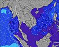 | 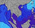 | 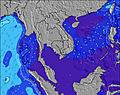 | 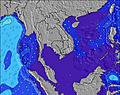 | 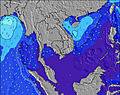 | 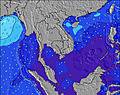 | 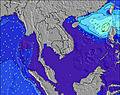 | ||||||||||||||
Wave Height (m) Direction Period (s) | E 4 | E 4 | E 18 | ENE 18 | ENE 17 | ENE 17 | ENE 16 | ENE 17 | ENE 18 | ENE 18 | ENE 18 | ENE 17 | ENE 18 | ENE 18 | ENE 18 | ENE 18 | ENE 17 | ENE 16 | ENE 14 | NE 14 | NW 6 |
Wave Graph | |||||||||||||||||||||
1 | 2 | 6 | 30 | 29 | 55 | 107 | 111 | 243 | 356 | 480 | 576 | 928 | 907 | 1042 | 751 | 615 | 291 | 81 | 48 | 8 | |
Wind (km/h) | |||||||||||||||||||||
Wind State on-shore cross-onshore cross-shore cross-offshore off-shore glassy | glassy | cross-on | cross-off | cross-off | off | off | off | off | off | off | cross-on | off | off | off | off | off | off | off | off | off | off |
High Tide | 12:24PM0.94m | 1:56AM0.87m | 1:16PM0.84m | 2:13AM0.91m | 2:23PM0.74m | 2:36AM0.96m | 4:03PM0.65m | 3:07AM1.01m | 3:52AM1.05m | 4:54AM1.08m | |||||||||||
Low Tide | 7:13PM0.29m | 7:32AM0.53m | 7:33PM0.38m | 8:35AM0.46m | 7:50PM0.48m | 9:48AM0.39m | 7:58PM0.57m | 11:15AM0.31m | 12:45PM0.22m | 2:02PM0.13m | |||||||||||
5:28 | — | — | 5:28 | — | — | 5:28 | — | — | 5:28 | — | — | 5:28 | — | — | 5:28 | — | — | 5:28 | — | — | |
— | 6:16 | — | — | 6:16 | — | — | 6:15 | — | — | 6:15 | — | — | 6:15 | — | — | 6:15 | — | — | 6:14 | — | |
mm | — | 3 | 2 | 1 | — | 1 | — | 1 | — | — | 1 | — | — | — | — | — | — | — | — | — | — |
Temp °C | 31 | 31 | 27 | 29 | 28 | 28 | 31 | 26 | 28 | 31 | 29 | 28 | 29 | 28 | 28 | 28 | 29 | 28 | 30 | 29 | 29 |
Feels °C | 36 | 33 | 31 | 33 | 32 | 30 | 32 | 29 | 30 | 34 | 32 | 32 | 33 | 31 | 31 | 31 | 31 | 29 | 31 | 31 | 30 |
Swell 1 Height (m) Direction Period (s) | E 4 | E 4 | ESE 5 | ESE 4 | ESE 4 | ENE 17 | ENE 16 | ENE 17 | ENE 18 | ENE 18 | ENE 18 | ENE 17 | ENE 18 | ENE 18 | ENE 18 | ENE 18 | ENE 17 | ENE 16 | ENE 14 | NW 6 | NW 6 |
1 | 2 | 4 | 2 | 2 | 55 | 107 | 111 | 243 | 356 | 480 | 576 | 928 | 907 | 1042 | 751 | 615 | 291 | 81 | 11 | 8 | |
Swell 2 Height (m) Direction Period (s) | SE 5 | SE 5 | E 18 | ENE 18 | ENE 17 | SE 5 | E 9 | ENE 20 | E 8 | ENE 7 | ENE 7 | ENE 7 | NE 7 | NE 6 | — | NW 5 | NW 6 | NW 6 | NW 6 | NE 14 | NE 12 |
1 | 1 | 6 | 30 | 29 | 1 | 6 | 75 | 10 | 10 | 20 | 9 | 11 | 6 | — | 4 | 11 | 8 | 11 | 48 | 6 | |
Swell 3 Height (m) Direction Period (s) | E 6 | E 7 | E 9 | E 9 | E 9 | E 9 | E 9 | NW 5 | NNW 5 | NW 5 | SE 6 | E 10 | NW 5 | SE 8 | — | SE 7 | SE 7 | SE 6 | SE 7 | SE 7 | SE 7 |
1 | 1 | 2 | 2 | 2 | 2 | 2 | 1 | 3 | 1 | 10 | 2 | 6 | 16 | — | 23 | 2 | 6 | 2 | 2 | 2 | |
Wind waves Height (m) Direction Period (s) | — | — | — | — | — | — | SW 3 | — | W 5 | WNW 5 | — | — | SSW 6 | SSW 3 | W 5 | — | — | SW 3 | WSW 3 | — | — |
— | — | — | — | — | — | 3 | — | 2 | 2 | — | — | 13 | 4 | 11 | — | — | 2 | 1 | — | — | |
Nearest Offshore or Glassy | |||||||||||||||||||||
Distance (km) | 1358 | 286 | 1405 | 1288 | 286 | 0 | 0 | 0 | 0 | 0 | 286 | 0 | 0 | 0 | 0 | 0 | 0 | 0 | 0 | 0 | 430 |
Best forecast wave conditions in Da Nang | |||||||||||||||||||||
Best forecast wave conditions in Vietnam | |||||||||||||||||||||
Header Global | |||||||||||||||||||||
- Map Icons:
 Break
Break Live Wave Height (m)
 Live Wind Speed (km/h)
 Surf Rating (10 Max)
 Ocean Swells (m)
- Wind Speed (km/h)
Latest Updates


FREE! Surf-Forecast.com widget for your website
The surf report / weather widget below is available to embed on third party websites free of charge and provides a summary of our Non Nuoc surf forecast. Simply grab the html code snippet that we provide and paste it into your own site. You can choose your preferred language and metric/imperial units for the surf forecast feed to suit users of your site. Click here to get the code.
Information about the Non Nuoc Surf forecast
The above surf forecast table for Non Nuoc provides essential information for determining whether the surfing conditions will be good over the next 16 days. A general guide to surfing at Non Nuoc can be found by selecting the local surf guide option on the grey menu. Our Non Nuoc surf forecast is unique since it includes wave energy (power) that defines the real feel of the surf rather than just the height or the period. If you surf the same spot (Non Nuoc) regularly then make a mental note of the wave energy from the surf forecast table each time you go. Very soon you may start to choose your surf days based on the wave energy alone combined with our forecast of favourable offshore wind conditions. Our star ratings will help here and of course you will also find the usual wave height and period predictions on our surf forecasts as well as a full break down of the swell components under our advanced users option (to reveal that, click the little Einstein character under the tide times).
Further information to help with frequently asked questions about our surf forecast for Non Nuoc may be found under the help tab on the top menu and also by moving your mouse over the question marks on the surf forecast table itself. Please always bear in mind that the forecast is for near-shore open water and local factors at each surf break influence the actual breaking wave height, such as the beach / reef profile, water depths offshore and shelter.
Non Nuoc is 4 km (2 miles) from Da Nang. If you plan a holiday in Da Nang, look for hotels and other accommodation in Da Nang. Da Nang has rooms for a wide range of budgets as well as car hire and transport links.
 Nearest