

Surf Forecasts:

Lang Co surf forecast from 12 Jul 2026:
- Best quality surf: Sunday 12 Jul, 4PM (local time) - 3ft (0.9m), 14s period, ENE swell with glassy winds.
- Most powerful swell: Sunday 12 Jul, 1PM (local time) - 3.5ft (1.0m), 14s period, ENE swell with 437 kJ wave energy.
- Next surfable swell (1★+): Sunday 12 Jul, 4PM (local time) - 3ft (0.9m), 14s period with ENE swell.
Best Forecast Surf Conditions for Lang Co this week:
The surf forecast for Lang Co over the next 16 days: The first swell (rated 1 star or higher) is forecast to arrive on Sunday (Jul 12) at 4PM. The primary swell is predicted to be 0.9m and 14s period. The wind is predicted to be glassy as the swell arrives.
The most powerful waves expected at Lang Co in the next 16 days are 1.0m 14s and forecast to arrive on Sunday (Jul 12) at 1PM. Winds are predicted to be cross-onshore at the time the swell arrives. The largest open ocean swell (not directed at the beach) is 0.6m 7s period and expected on Wednesday (Jul 15) at 7PM.
| Wave Type | Time (+07) & Date | Wave Height & Period |
|---|---|---|
| Next good surf (1 star+) | 4PM (Sun 12th Jul) | 3ft (0.9m) 14s |
| Best Surf | 4PM (Sun 12th Jul) | 3ft (0.9m) 14s |
| Most Powerful | 1PM (Sun 12th Jul) | 3.5ft (1.0m) 14s |
Table - best surf conditions forecast for Lang Co over the next 16 days.
Alright folks, Rusty here. Let's have a look at what's on the menu for Lang Co over the next couple of weeks.
Right off the bat, we've got a bit of a tease. The first real action is a punchy little window on Sunday, July 12th. The morning is the standout by a long shot. We're looking at a clean 4ft groundswell rolling in from the ENE with a seriously long 15-second period. That's proper energy with a combined total of 530 (moderate wave energy), and with the wind dead calm and glassy, it's going to be utterly pristine. The water is a balmy 88°, which is a touch warmer than normal for this time of year, so it's going to feel like a bath. This is your best chance to get a wave, and it's right now. The afternoon sees the swell drop a touch to 3ft but stays glassy, though there's a risk of thunderstorms hanging around.
After that glorious Sunday, the forecast goes quiet. Really quiet. We’re looking at a long stretch of tiny, weak waves. From Monday, July 13th, right through to the end of the month, the swell is consistently under 2ft, with periods dropping to 7 seconds or less. The combined energy values are mostly in the single digits (from 3 to 24) – that's weak energy, making for poor surf conditions. The winds are mostly light and variable, sometimes glassy or clean, but there simply isn't any swell to work with. It’s a proper flat spell. For a sandbar break like Lang Co, this is a normal blank run for the area; it just doesn’t tend to stay poor for long, but right now, it's a waiting game.
So, the headline is clear: your only real shot at a decent wave is Sunday morning, July 12th. That's the one. The rest of the 16 days is a write-off for any meaningful surfing.
Rusty.
Short Range ForecastSome drizzle, heaviest during Sun afternoon. Warm (max 32°C on Mon morning, min 28°C on Sun afternoon). Wind will be generally light. | Days 4-6 Weather SummaryMostly dry. Warm (max 34°C on Thu morning, min 28°C on Wed night). Wind will be generally light. | ||||||||||||||||||||
Sunday 12 | Monday 13 | Tuesday 14 | Wednesday 15 | Thursday 16 | Friday 17 | Saturday 18 | |||||||||||||||
AM | PM | Night | AM | PM | Night | AM | PM | Night | AM | PM | Night | AM | PM | Night | AM | PM | Night | AM | PM | Night | |
Swell Height Map |  |  |  |  | 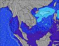 | 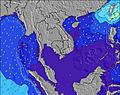 | 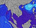 | ||||||||||||||
Wave Height (m) Direction Period (s) | ENE 15 | ENE 14 | ENE 13 | ENE 12 | ENE 12 | ESE 7 | SE 7 | ESE 7 | SE 4 | SE 7 | SE 7 | ESE 4 | SE 7 | ESE 7 | ESE 6 | SE 7 | SE 7 | NW 5 | SE 7 | NW 5 | NW 5 |
Wave Graph | |||||||||||||||||||||
530 | 321 | 114 | 28 | 14 | 4 | 7 | 5 | 5 | 13 | 8 | 2 | 7 | 21 | 3 | 8 | 8 | 4 | 7 | 5 | 7 | |
Wind (km/h) | |||||||||||||||||||||
Wind State on-shore cross-onshore cross-shore cross-offshore off-shore glassy | glassy | glassy | off | cross-on | on | off | cross-on | on | cross-off | glassy | cross-off | cross-off | cross | glassy | cross-off | glassy | glassy | cross-off | glassy | cross-off | off |
High Tide | 10:30PM0.60m | 8:17AM0.87m | 11:18PM0.63m | 9:19AM0.90m | 11:58PM0.65m | 10:18AM0.90m | 00:36AM0.68m | 11:12AM0.88m | 1:12AM0.71m | 12:02PM0.83m | 1:49AM0.73m | 12:51PM0.77m | 2:24AM0.75m | ||||||||
Low Tide | 3:09PM0.05m | 1:52AM0.54m | 4:06PM-0.00m | 3:08AM0.52m | 4:57PM-0.03m | 4:15AM0.50m | 5:43PM-0.03m | 5:16AM0.46m | 6:24PM-0.00m | 6:14AM0.43m | 7:02PM0.04m | 7:11AM0.41m | 7:36PM0.10m | ||||||||
5:22 | — | — | 5:22 | — | — | 5:22 | — | — | 5:22 | — | — | 5:22 | — | — | 5:22 | — | — | 5:24 | — | — | |
— | 6:23 | — | — | 6:23 | — | — | 6:22 | — | — | 6:22 | — | — | 6:22 | — | — | 6:22 | — | — | 6:22 | — | |
mm | — | 1 | — | — | — | — | — | — | — | — | — | — | — | — | — | — | — | — | — | — | — |
Temp °C | 31 | 31 | 29 | 32 | 32 | 29 | 32 | 32 | 29 | 32 | 30 | 29 | 34 | 34 | 30 | 34 | 34 | 30 | 35 | 34 | 30 |
Feels °C | 35 | 37 | 33 | 35 | 36 | 33 | 35 | 36 | 32 | 36 | 33 | 33 | 38 | 38 | 33 | 37 | 37 | 32 | 38 | 36 | 33 |
Swell 1 Height (m) Direction Period (s) | ENE 15 | ENE 14 | ENE 13 | ENE 12 | ENE 12 | ESE 7 | SE 7 | ESE 7 | SE 4 | SE 7 | SE 7 | ESE 4 | SE 7 | NW 4 | ESE 6 | SE 7 | SE 7 | NW 5 | SE 7 | NW 5 | NW 5 |
530 | 321 | 114 | 28 | 14 | 4 | 7 | 5 | 5 | 13 | 8 | 1 | 7 | 1 | 3 | 8 | 8 | 4 | 7 | 5 | 7 | |
Swell 2 Height (m) Direction Period (s) | — | SSE 6 | SE 10 | ENE 8 | ENE 8 | NE 8 | NE 8 | NW 4 | E 10 | NW 4 | NW 4 | SE 6 | — | — | NW 4 | NW 5 | NW 5 | ESE 5 | NW 5 | SE 6 | SE 5 |
— | 8 | 4 | 7 | 6 | 3 | 2 | 1 | 2 | 1 | 1 | 2 | — | — | 1 | 1 | 4 | 2 | 1 | 2 | 1 | |
Swell 3 Height (m) Direction Period (s) | — | — | WNW 4 | SE 7 | NW 4 | E 11 | — | E 10 | — | E 9 | E 9 | NW 4 | NE 7 | E 10 | E 10 | E 10 | E 10 | E 10 | E 10 | E 10 | E 10 |
— | — | 2 | 2 | 1 | 2 | — | 2 | — | 2 | 2 | 1 | 2 | 2 | 2 | 2 | 2 | 2 | 2 | 2 | 2 | |
Wind waves Height (m) Direction Period (s) | S 3 | — | — | — | ESE 7 | — | — | E 3 | — | SSW 3 | — | — | SW 2 | ESE 7 | — | SW 3 | — | — | SW 3 | — | — |
4 | — | — | — | 9 | — | — | 1 | — | 1 | — | — | 1 | 21 | — | 3 | — | — | 2 | — | — | |
Nearest Offshore or Glassy | |||||||||||||||||||||
Distance (km) | 0 | 0 | 0 | 37 | 349 | 276 | 666 | 276 | 1322 | 1341 | 1328 | 1328 | 1406 | 1406 | 924 | 924 | 1406 | 924 | 1775 | 1775 | 312 |
Best forecast wave conditions in Da Nang | |||||||||||||||||||||
Best forecast wave conditions in Vietnam | |||||||||||||||||||||
Header Global | |||||||||||||||||||||
- Map Icons:
 Break
Break Live Wave Height (m)
 Live Wind Speed (km/h)
 Surf Rating (10 Max)
 Ocean Swells (m)
- Wind Speed (km/h)


FREE! Surf-Forecast.com widget for your website
The surf report / weather widget below is available to embed on third party websites free of charge and provides a summary of our Lang Co surf forecast. Simply grab the html code snippet that we provide and paste it into your own site. You can choose your preferred language and metric/imperial units for the surf forecast feed to suit users of your site. Click here to get the code.
Information about the Lang Co Surf forecast
The above surf forecast table for Lang Co provides essential information for determining whether the surfing conditions will be good over the next 16 days. A general guide to surfing at Lang Co can be found by selecting the local surf guide option on the grey menu. Our Lang Co surf forecast is unique since it includes wave energy (power) that defines the real feel of the surf rather than just the height or the period. If you surf the same spot (Lang Co) regularly then make a mental note of the wave energy from the surf forecast table each time you go. Very soon you may start to choose your surf days based on the wave energy alone combined with our forecast of favourable offshore wind conditions. Our star ratings will help here and of course you will also find the usual wave height and period predictions on our surf forecasts as well as a full break down of the swell components under our advanced users option (to reveal that, click the little Einstein character under the tide times).
Further information to help with frequently asked questions about our surf forecast for Lang Co may be found under the help tab on the top menu and also by moving your mouse over the question marks on the surf forecast table itself. Please always bear in mind that the forecast is for near-shore open water and local factors at each surf break influence the actual breaking wave height, such as the beach / reef profile, water depths offshore and shelter.
Lang Co is 28 km (17 miles) from Da Nang. If you plan a holiday in Da Nang, look for hotels and other accommodation in Da Nang. Da Nang has rooms for a wide range of budgets as well as car hire and transport links.
 Nearest