

Surf Forecasts:

How big are the waves at Martinique today (03 Aug):
- Morning surf: Morning surf (03 Aug, local time) - 2.5ft (0.7m), 7s period with SSW swell.
- Afternoon surf: Afternoon surf (03 Aug, local time) - 1.5ft (0.5m), 7s period with SSW swell.
- Evening surf: Evening surf (03 Aug, local time) - 4ft (1.2m), 5s period with S swell.
The current surf forecast for Martinique at 6AM is: 0.8m 8s primary swell from a South-southwest direction and 0.1m 9s secondary swell from a Southeast direction (forecast issued at 02:00am August 03). The wind direction is predicted to be cross-onshore.
| Time (ADT) & Date | Wave Height | Wave Period |
|---|---|---|
| Morning (03 Aug) | 2.5ft (0.7m) | 7s |
| Afternoon (03 Aug) | 1.5ft (0.5m) | 7s |
| Evening (03 Aug) | 4ft (1.2m) | 5s |
Table - waves today at Martinique. (Swell directed towards the surf break)
Short Range ForecastLight rain (total 2mm), mostly falling on Mon night. Warm (max 27°C on Wed morning, min 17°C on Tue morning). Winds decreasing (fresh winds from the SSW on Mon night, light winds from the WNW by Tue night). | ||||||||||||||||||||||||
Monday 3 | Tuesday 4 | Wednesday 5 | ||||||||||||||||||||||
12 AM | 3 AM | 6 AM | 9 AM | 12 PM | 3 PM | 6 PM | 9 PM | 12 AM | 3 AM | 6 AM | 9 AM | 12 PM | 3 PM | 6 PM | 9 PM | 12 AM | 3 AM | 6 AM | 9 AM | 12 PM | 3 PM | 6 PM | 9 PM | |
Swell Height Map | 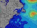 | 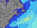 | 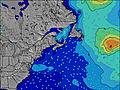 | 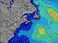 | 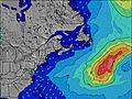 | 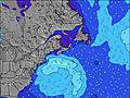 | 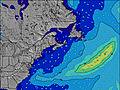 | 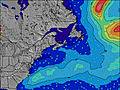 |  | |||||||||||||||
Wave Height (m) Direction Period (s) | SSW 8 | SSW 8 | SSW 8 | SSW 7 | SSW 7 | SSW 7 | S 7 | S 5 | SSW 6 | SSW 6 | SSW 7 | SSW 8 | SSW 8 | SSW 8 | SSW 8 | SSW 8 | E 9 | E 10 | SSW 8 | SSW 8 | SSW 8 | SSW 8 | SSW 8 | SSW 8 |
Wave Graph | ||||||||||||||||||||||||
79 | 60 | 75 | 57 | 43 | 31 | 131 | 73 | 126 | 237 | 603 | 912 | 753 | 620 | 513 | 481 | 7 | 7 | 235 | 184 | 179 | 175 | 171 | 193 | |
Wind (km/h) | ||||||||||||||||||||||||
Wind State on-shore cross-onshore cross-shore cross-offshore off-shore glassy | cross-on | cross-on | cross-on | on | on | cross-on | cross-on | cross-on | cross-on | cross-on | cross-on | cross | cross | cross | cross | cross | cross | cross-off | cross-off | cross-off | cross | cross-on | cross | cross |
High Tide | 11:38PM1.53m | 12:06PM1.60m | 00:22AM1.48m | 12:48PM1.60m | 1:12AM1.43m | 1:35PM1.58m | ||||||||||||||||||
Low Tide | 5:48AM0.24m | 6:19PM0.32m | 6:29AM0.29m | 7:07PM0.32m | 7:14AM0.35m | 8:02PM0.33m | ||||||||||||||||||
— | — | 6:00 | — | — | — | — | — | — | — | 6:01 | — | — | — | — | — | — | — | 6:01 | — | — | — | — | — | |
— | — | — | — | — | — | 8:36 | — | — | — | — | — | — | — | 8:35 | — | — | — | — | — | — | — | 8:32 | — | |
mm | — | — | — | — | — | — | — | — | — | 1 | 1 | — | — | — | — | — | — | — | — | — | — | — | — | — |
Temp °C | 19 | 20 | 20 | 20 | 21 | 21 | 21 | 20 | 20 | 20 | 19 | 17 | 21 | 24 | 26 | 24 | 20 | 20 | 20 | 22 | 27 | 27 | 25 | 23 |
Feels °C | 19 | 21 | 22 | 21 | 21 | 21 | 21 | 20 | 19 | 18 | 15 | 13 | 16 | 19 | 21 | 21 | 16 | 17 | 18 | 20 | 24 | 23 | 21 | 22 |
Swell 1 Height (m) Direction Period (s) | SSW 8 | SSW 8 | SSW 8 | SSW 7 | SSW 7 | SSW 7 | SE 8 | SE 8 | E 11 | E 10 | E 10 | E 10 | E 10 | E 10 | E 9 | E 9 | E 9 | SW 8 | SSW 8 | SSW 8 | E 9 | E 9 | E 9 | E 9 |
79 | 60 | 75 | 57 | 43 | 31 | 3 | 3 | 9 | 8 | 8 | 8 | 7 | 7 | 7 | 7 | 7 | 354 | 235 | 184 | 7 | 6 | 6 | 6 | |
Swell 2 Height (m) Direction Period (s) | E 8 | SE 9 | SE 9 | E 10 | SE 8 | SE 8 | E 9 | E 11 | SE 8 | SE 8 | SE 9 | — | — | SE 9 | SE 9 | — | SE 8 | E 10 | E 10 | E 9 | SE 8 | SE 8 | SE 8 | SE 8 |
4 | 3 | 3 | 7 | 3 | 3 | 2 | 2 | 3 | 3 | 3 | — | — | 3 | 3 | — | 3 | 7 | 7 | 7 | 3 | 3 | 3 | 3 | |
Swell 3 Height (m) Direction Period (s) | SE 9 | E 7 | E 10 | SE 9 | E 9 | SE 6 | E 7 | E 7 | E 7 | — | — | — | — | — | — | — | — | SE 9 | SE 8 | SE 8 | — | — | — | — |
3 | 1 | 2 | 3 | 7 | 2 | 1 | 1 | 1 | — | — | — | — | — | — | — | — | 3 | 3 | 3 | — | — | — | — | |
Wind waves Height (m) Direction Period (s) | SW 4 | SW 4 | — | S 4 | S 4 | S 4 | S 7 | S 5 | SSW 6 | SSW 6 | SSW 7 | SSW 8 | SSW 8 | SSW 8 | SSW 8 | SSW 8 | SW 8 | SW 9 | — | — | SSW 8 | SSW 8 | SSW 8 | SSW 8 |
9 | 9 | — | 7 | 10 | 23 | 131 | 73 | 126 | 237 | 603 | 912 | 753 | 620 | 513 | 481 | 450 | 582 | — | — | 179 | 175 | 171 | 193 | |
Nearest Offshore or Glassy | ||||||||||||||||||||||||
Distance (km) | 1858 | 1858 | 1876 | 2080 | 1201 | 1130 | 1004 | 673 | 634 | 554 | 615 | 631 | 615 | 615 | 615 | 639 | 615 | 14 | 0 | 0 | 732 | 792 | 631 | 306 |
Best forecast wave conditions in Nova Scotia | ||||||||||||||||||||||||
Best forecast wave conditions in Canada | ||||||||||||||||||||||||
Header Global | ||||||||||||||||||||||||
- Map Icons:
 Break
Break Live Wave Height (m)
 Live Wind Speed (km/h)
 Surf Rating (10 Max)
 Ocean Swells (m)
- Wind Speed (km/h)
Latest Updates


FREE! Surf-Forecast.com widget for your website
The surf report / weather widget below is available to embed on third party websites free of charge and provides a summary of our Martinique surf forecast. Simply grab the html code snippet that we provide and paste it into your own site. You can choose your preferred language and metric/imperial units for the surf forecast feed to suit users of your site. Click here to get the code.
 Nearest