

Surf Forecasts:

La Pepita (Mar del Plata) surf forecast from 24 Jul 2026:
- Best quality surf: Wednesday 29 Jul, 6PM (local time) - 5.5ft (1.7m), 11s period, S swell with cross-offshore winds.
- Most powerful swell: Wednesday 29 Jul, 3AM (local time) - 8ft (2.5m), 13s period, SSW swell with 2,071 kJ wave energy.
- Next surfable swell (1★+): Friday 24 Jul, 6PM (local time) - 2ft (0.6m), 14s period with SSE swell.
Best Forecast Surf Conditions for La Pepita (Mar del Plata) this week:
The surf forecast for La Pepita (Mar del Plata) over the next 16 days: The first swell (rated 1 star or higher) is forecast to arrive on Friday (Jul 24) at 6PM. The primary swell is predicted to be 0.6m and 14s period with a secondary swell of 0.5m and 6s. The wind is predicted to be cross-offshore as the swell arrives.
The most powerful waves expected at La Pepita (Mar del Plata) in the next 16 days are 2.5m 13s and forecast to arrive on Wednesday (Jul 29) at 3AM. Winds are predicted to be cross-offshore at the time the swell arrives. The largest open ocean swell (not directed at the beach) is 1.3m 6s period and expected on Tuesday (Jul 28) at 12PM.
| Wave Type | Time (-03) & Date | Wave Height & Period |
|---|---|---|
| Next good surf (1 star+) | 6PM (Fri 24th Jul) | 2ft (0.6m) 14s |
| Best Surf | 6PM (Wed 29th Jul) | 5.5ft (1.7m) 11s |
| Most Powerful | 3AM (Wed 29th Jul) | 8ft (2.5m) 13s |
Table - best surf conditions forecast for La Pepita (Mar del Plata) over the next 16 days.
The Lowdown
G’day, Rusty here, and I’ve gotta be straight with you—this outlook for La Pepita (Mar del Plata) is a bit of a sad story for the next week and a half. We’re lookin’ at a whole lotta nothin’ for days on end, and the few flickers of hope only come in the second week. So, let’s break it down, but don’t expect to be waxing up your board just yet.
From Friday the 24th right through to Monday the 3rd of August, it’s pretty much a write-off. There’s a long, dry gap of over a week where the surf is just poor. The swell is small, the wind is messy, and the energy is weak. On Friday the 24th, we’ve got a tiny 2ft southerly swell with a 12-second period, but a northerly wind at 12 mph is blowin’ cross, making it choppy and uninviting. The combined swell energy is a measly 135 – that’s weak, mate. Saturday and Sunday are no better, with the same small dribble and more cross-wind. It’s just not worth paddlin’ out.
Then on Tuesday the 28th, we get a little glimmer. The morning shows a 3ft SSW swell with a 9-second period, and the wind is off-shore from the west at 9 mph. The water temp is about average for the time of year, nothing wild. The combined energy is 173 – still weak, but the surf is just barely surfable. It’s clean, but the waves are ordinary. That’s the best you’ll see for a while, and it’s not sayin’ much.
The real standout, and the only one worth gettin’ excited about, comes on Sunday the 2nd of August. The morning delivers a 6ft easterly swell with an 8-second period – that’s short-period, so it’ll be a bit straight and dumpy, but the energy is moderate at 539. The wind is off-shore from the SSW at 9 mph, so it’s glassy clean. This is the best wave of the whole forecast, with clean conditions and a decent size that’s still good for intermediates. The break is fairly consistent, but crowds are often a thing here, so expect some company. The swell direction is from the east, which is a good match for the break’s optimum from the ESE, just a bit off. It’s a solid, fun wave, but don’t expect it to hold up into the afternoon when the wind shifts.
After that, Monday the 3rd and Tuesday the 4th are hammered by strong onshore winds from the ENE, blowin’ 19 mph to 34 mph, and the swell is over 6ft but blown out. That’s kite-surfing territory, not paddle surfing. The energy is strong, with values around 700, but the wind is trash.
Towards the end of the run, Wednesday the 5th and Thursday the 6th of August show some promise. The morning of the 6th has a 4ft ESE swell with a 12-second period, light off-shore wind from the NW at 6 mph, and a combined energy of 503. The surf is clean and fun, but it’s not a standout compared to the 2nd. Still, if you missed the Sunday, this is a decent backup.
Overall, if you’re a surfer in Mar del Plata, the 2nd of August is your day. The rest is a long, flat wait. Keep your eyes on the forecasts, but don’t hold your breath.
Rusty.
Short Range ForecastLight rain (total 5mm), mostly falling on Fri afternoon. Very mild (max 14°C on Sat afternoon, min 8°C on Thu night). Mainly fresh winds. | Days 5-7 Weather SummaryLight rain (total 3mm), mostly falling on Mon afternoon. Very mild (max 13°C on Tue morning, min 7°C on Wed morning). Wind will be generally light. | ||||||||||||||||||
Friday 24 | Saturday 25 | Sunday 26 | Monday 27 | Tuesday 28 | Wednesday 29 | ||||||||||||||
Night | AM | PM | Night | AM | PM | Night | AM | PM | Night | AM | PM | Night | AM | PM | Night | AM | PM | Night | |
Swell Height Map |  | 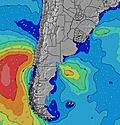 | 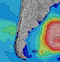 | 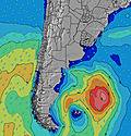 | 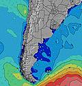 | 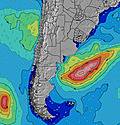 | 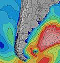 | ||||||||||||
Wave Height (m) Direction Period (s) | S 8 | S 12 | S 14 | S 12 | S 11 | S 11 | SSE 12 | SSE 11 | E 8 | E 7 | S 10 | S 10 | S 9 | SSW 9 | SSW 7 | SSW 9 | S 11 | S 11 | S 11 |
Wave Graph | |||||||||||||||||||
35 | 78 | 148 | 110 | 63 | 37 | 49 | 40 | 29 | 28 | 151 | 154 | 80 | 151 | 212 | 461 | 610 | 607 | 584 | |
Wind (km/h) | |||||||||||||||||||
Wind State on-shore cross-onshore cross-shore cross-offshore off-shore glassy | cross | cross | cross-off | cross-off | cross-off | cross | cross-off | cross-off | cross | cross-on | cross-on | cross | off | off | cross-off | cross-off | cross | cross | glassy |
High Tide | 3:27AM1.11m | 3:43PM1.33m | 4:33AM1.03m | 4:30PM1.38m | 5:34AM0.98m | 5:15PM1.42m | 6:26AM0.96m | 5:58PM1.46m | 7:10AM0.94m | 6:39PM1.51m | 7:45AM0.93m | 7:18PM1.55m | |||||||
Low Tide | 9:46PM0.61m | 9:13AM0.71m | 11:03PM0.58m | 9:38AM0.76m | 00:11AM0.53m | 10:11AM0.79m | 1:05AM0.48m | 10:58AM0.79m | 1:50AM0.44m | 11:56AM0.78m | 2:30AM0.41m | 12:52PM0.75m | |||||||
— | 7:56 | — | — | 7:56 | — | — | 7:56 | — | — | 7:54 | — | — | 7:54 | — | — | 7:52 | — | — | |
— | — | 5:54 | — | — | 5:55 | — | — | 5:57 | — | — | 5:58 | — | — | 5:59 | — | — | 5:59 | — | |
mm | — | 2 | 3 | — | — | — | — | — | — | — | — | 3 | — | — | — | — | — | — | — |
Temp °C | 9 | 9 | 12 | 12 | 12 | 14 | 13 | 10 | 10 | 8 | 10 | 12 | 12 | 13 | 11 | 8 | 8 | 9 | 8 |
Feels °C | 5 | 4 | 9 | 9 | 8 | 11 | 9 | 5 | 6 | 5 | 5 | 9 | 12 | 8 | 5 | 2 | 3 | 4 | 5 |
Swell 1 Height (m) Direction Period (s) | S 8 | S 12 | S 14 | S 12 | S 11 | S 11 | ENE 5 | E 8 | E 8 | S 5 | S 10 | S 10 | S 9 | ENE 8 | ENE 7 | E 8 | S 11 | S 11 | S 11 |
35 | 78 | 148 | 110 | 63 | 37 | 9 | 32 | 29 | 14 | 151 | 154 | 80 | 19 | 11 | 10 | 610 | 607 | 584 | |
Swell 2 Height (m) Direction Period (s) | E 8 | S 8 | ENE 5 | ENE 6 | E 6 | E 8 | SSE 12 | SSE 11 | S 11 | E 7 | ENE 7 | E 8 | ENE 5 | S 12 | S 13 | ENE 7 | E 8 | E 9 | E 8 |
12 | 21 | 25 | 10 | 6 | 21 | 49 | 40 | 20 | 28 | 17 | 10 | 9 | 3 | 3 | 10 | 6 | 6 | 5 | |
Swell 3 Height (m) Direction Period (s) | SSE 13 | E 8 | E 8 | E 9 | E 8 | S 15 | E 8 | S 15 | SSE 14 | S 11 | — | — | E 8 | — | S 12 | — | — | — | NE 6 |
34 | 5 | 6 | 6 | 5 | 4 | 13 | 17 | 20 | 20 | — | — | 10 | — | 3 | — | — | — | 2 | |
Wind waves Height (m) Direction Period (s) | NE 4 | NE 5 | NNW 3 | — | — | N 2 | NNW 3 | SW 5 | SSW 5 | — | NE 4 | NE 5 | NE 5 | SSW 9 | SSW 7 | SSW 9 | — | — | — |
19 | 31 | 1 | — | — | 1 | 3 | 20 | 39 | — | 8 | 17 | 19 | 151 | 212 | 461 | — | — | — | |
Nearest Offshore or Glassy | |||||||||||||||||||
Distance (km) | 12 | 120 | 6 | 0 | 12 | 12 | 6 | 113 | 3 | 12 | 119 | 12 | 0 | 0 | 815 | 1208 | 1181 | 120 | 0 |
Best forecast wave conditions in Provincia de Buenos Aires | |||||||||||||||||||
Best forecast wave conditions in Argentina | |||||||||||||||||||
Header Global | |||||||||||||||||||
- Map Icons:
 Break
Break Live Wave Height (m)
 Live Wind Speed (km/h)
 Surf Rating (10 Max)
 Ocean Swells (m)
- Wind Speed (km/h)


FREE! Surf-Forecast.com widget for your website
The surf report / weather widget below is available to embed on third party websites free of charge and provides a summary of our La Pepita (Mar del Plata) surf forecast. Simply grab the html code snippet that we provide and paste it into your own site. You can choose your preferred language and metric/imperial units for the surf forecast feed to suit users of your site. Click here to get the code.
Information about the La Pepita (Mar del Plata) Surf forecast
The above surf forecast table for La Pepita (Mar del Plata) provides essential information for determining whether the surfing conditions will be good over the next 16 days. A general guide to surfing at La Pepita (Mar del Plata) can be found by selecting the local surf guide option on the grey menu. Our La Pepita (Mar del Plata) surf forecast is unique since it includes wave energy (power) that defines the real feel of the surf rather than just the height or the period. If you surf the same spot (La Pepita (Mar del Plata)) regularly then make a mental note of the wave energy from the surf forecast table each time you go. Very soon you may start to choose your surf days based on the wave energy alone combined with our forecast of favourable offshore wind conditions. Our star ratings will help here and of course you will also find the usual wave height and period predictions on our surf forecasts as well as a full break down of the swell components under our advanced users option (to reveal that, click the little Einstein character under the tide times).
Further information to help with frequently asked questions about our surf forecast for La Pepita (Mar del Plata) may be found under the help tab on the top menu and also by moving your mouse over the question marks on the surf forecast table itself. Please always bear in mind that the forecast is for near-shore open water and local factors at each surf break influence the actual breaking wave height, such as the beach / reef profile, water depths offshore and shelter.
Are you planning a holiday in Provincia de Buenos Aires? If you are looking for accommodation near La Pepita (Mar del Plata), camping, hotels and holiday cottages in Provincia de Buenos Aires, consider staying in Mar del Plata which is 3 km (2 miles) away. Alternatively, find information about places to stay and car hire in Villa Gesell which is 95 km (59 miles) away
 Nearest