

Surf Forecasts:

La Balconada surf forecast from 31 Jul 2026:
- Best quality surf: Saturday 1 Aug, 9AM (local time) - 3.5ft (1.1m), 9s period, E swell with cross-offshore winds.
- Most powerful swell: Saturday 1 Aug, 3AM (local time) - 4.5ft (1.3m), 9s period, E swell with 257 kJ wave energy.
- Next surfable swell (1★+): Saturday 1 Aug, 9AM (local time) - 3.5ft (1.1m), 9s period with E swell.
Best Forecast Surf Conditions for La Balconada this week:
The surf forecast for La Balconada over the next 16 days: The first swell (rated 1 star or higher) is forecast to arrive on Saturday (Aug 01) at 9AM. The primary swell is predicted to be 1.1m and 9s period with a secondary swell of 0.2m and 3s. The wind is predicted to be cross-offshore as the swell arrives.
The most powerful waves expected at La Balconada in the next 16 days are 1.3m 9s and forecast to arrive on Saturday (Aug 01) at 3AM. Winds are predicted to be offshore at the time the swell arrives. The largest open ocean swell (not directed at the beach) is 1.7m 8s period and expected on Friday (Jul 31) at 9PM.
| Wave Type | Time (-03) & Date | Wave Height & Period |
|---|---|---|
| Next good surf (1 star+) | 9AM (Sat 1st Aug) | 3.5ft (1.1m) 9s |
| Best Surf | 9AM (Sat 1st Aug) | 3.5ft (1.1m) 9s |
| Most Powerful | 3AM (Sat 1st Aug) | 4.5ft (1.3m) 9s |
Table - best surf conditions forecast for La Balconada over the next 16 days.
The Lowdown
Alright, Rusty here. Let’s break down what’s coming up for La Balconada over the next couple of weeks.
First off, the early days are pretty quiet. On Friday the 31st of July, we’ve got a weak, short-period swell from the SSE, but it’s only 1ft with a stiff 35 km/h cross-off wind. The water’s about 54°, which is normal for this time of year, but the conditions are just poor. Not worth getting wet for.
The first real chance comes on Saturday the 1st of August. The morning shows a jump to 4ft from the east, period 9 seconds, and the combined swell energy is moderate at 210. The wind is a light 10 km/h cross-off, and the report says “expect good surf conditions.” That’s your best early window. The break is exposed to the south, and the swell is coming from the east—not the ideal south, but with clean conditions and that light breeze, it’ll be fun. La Balconada is an advanced spot that’s fairly consistent, but crowds can show up sometimes.
After that, we hit a long stretch of nothing. From Sunday the 2nd right through to Wednesday the 12th of August, it’s mostly small, weak swell with onshore or cross-shore winds. The energy drops into the low range—mostly under 100, with a few days barely hitting 200. The swell rarely gets above 4ft, and the wind is all wrong. There’s a couple of sessions on the 3rd and 5th that are “surfable but very ordinary,” but nothing to get excited about. It’s a dry run of over a week.
Now, the standout. On Thursday the 13th of August, the morning goes glassy with a 8ft swell from the south, period 10 seconds, and the combined energy is a strong 947. The wind is a dead calm 5 km/h, glassy conditions. That’s a solid groundswell with serious power, but it’s not too big for the advanced crew. The optimum swell direction for La Balconada is south, and this matches perfectly. This is the pick of the whole forecast.
Friday the 14th of August is a different story. The swell jumps to 12ft from the SSE, period 13 seconds, and the energy goes insane—4704 in the morning and 6587 in the afternoon. That’s a very strong, long-period groundswell. The wind is light cross-off and clean, but the forecast says it’s too big for this break. At 12ft to 13ft, that’s expert-only territory, and even then, it might be a beast. This one’s for the big-wave crew only.
Saturday the 15th of August stays oversized—13ft in the morning, dropping to 10ft in the afternoon—with the same long-period SSE swell and strong energy. The wind is howling at 30 km/h cross-off, so it’s clean but massive. Again, too big for this spot.
So, to sum it up: the first week is mostly a dud, with a decent session on Saturday morning the 1st of August. The real gem is Thursday the 13th of August—glassy, 8ft south swell, and clean. After that, it’s all about the big, dangerous stuff for experts only. Check the tides and your courage.
Rusty.
Short Range ForecastHeavy rain (total 33mm), heaviest during Sat morning. Very mild (max 19°C on Fri afternoon, min 8°C on Sun morning). Winds decreasing (fresh winds from the NE on Fri morning, light winds from the SE by Sun morning). | Days 4-6 Weather SummaryMostly dry. Very mild (max 16°C on Mon night, min 10°C on Tue night). Wind will be generally light. | ||||||||||||||||||||
Friday 31 | Saturday 1 | Sunday 2 | Monday 3 | Tuesday 4 | Wednesday 5 | Thursday 6 | |||||||||||||||
AM | PM | Night | AM | PM | Night | AM | PM | Night | AM | PM | Night | AM | PM | Night | AM | PM | Night | AM | PM | Night | |
Swell Height Map |  |  | 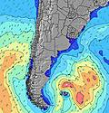 | 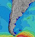 | 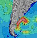 | 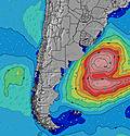 | 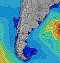 | ||||||||||||||
Wave Height (m) Direction Period (s) | SSE 10 | SSE 9 | E 8 | E 9 | E 10 | E 10 | S 5 | SSE 6 | SSE 13 | SSE 11 | SSE 11 | SSE 10 | SE 10 | SSE 9 | SSE 9 | SSE 9 | SSE 8 | SE 8 | SE 9 | SE 9 | SE 9 |
Wave Graph | |||||||||||||||||||||
32 | 17 | 234 | 203 | 190 | 92 | 21 | 12 | 55 | 180 | 210 | 163 | 98 | 201 | 124 | 86 | 64 | 24 | 29 | 27 | 42 | |
Wind (km/h) | |||||||||||||||||||||
Wind State on-shore cross-onshore cross-shore cross-offshore off-shore glassy | cross-off | cross-off | off | cross-off | cross-on | on | cross-on | cross | cross-off | cross-off | cross-off | on | on | on | glassy | off | cross-off | off | off | cross-off | cross-off |
High Tide | 2:30PM0.25m | 8:31PM0.38m | 9:01AM0.27m | 3:07PM0.24m | 9:15PM0.38m | 3:02AM0.21m | 3:46PM0.22m | 9:59PM0.37m | 3:53AM0.21m | 4:27PM0.20m | 10:46PM0.36m | 4:48AM0.21m | 5:07PM0.18m | 11:34PM0.34m | 5:46AM0.21m | 5:47PM0.15m | 00:26AM0.32m | 6:51AM0.21m | 12:40PM0.43m | 6:24PM0.13m | |
Low Tide | 11:21AM0.13m | 4:53PM0.19m | 00:19AM0.18m | 5:29AM0.08m | 12:09PM0.13m | 00:57AM0.17m | 6:09AM0.09m | 12:59PM0.14m | 6:21PM0.15m | 6:48AM0.11m | 1:54PM0.13m | 7:04PM0.13m | 7:26AM0.13m | 2:52PM0.13m | 7:48PM0.10m | 3:08AM0.14m | 3:58PM0.13m | 8:34PM0.08m | 3:57AM0.13m | 5:12PM0.13m | 9:24PM0.06m |
7:31 | — | — | 7:30 | — | — | 7:28 | — | — | 7:28 | — | — | 7:28 | — | — | 7:26 | — | — | 7:26 | — | — | |
— | 5:53 | — | — | 5:54 | — | — | 5:55 | — | — | 5:55 | — | — | 5:57 | — | — | 5:58 | — | — | 5:59 | — | |
mm | — | — | 10 | 20 | 3 | — | — | — | — | — | — | — | — | — | — | — | — | — | — | — | — |
Temp °C | 16 | 19 | 19 | 16 | 15 | 11 | 10 | 11 | 11 | 14 | 15 | 16 | 12 | 12 | 11 | 13 | 15 | 14 | 14 | 15 | 14 |
Feels °C | 11 | 15 | 16 | 15 | 13 | 7 | 8 | 8 | 9 | 12 | 13 | 17 | 8 | 8 | 9 | 10 | 13 | 13 | 13 | 12 | 11 |
Swell 1 Height (m) Direction Period (s) | SSE 10 | SSE 9 | E 8 | E 9 | E 10 | E 10 | S 5 | E 9 | S 6 | SSE 11 | SSE 11 | SSE 10 | SE 10 | SSE 9 | SSE 9 | SSE 9 | SSE 8 | SE 8 | SE 9 | SE 9 | SE 9 |
32 | 17 | 234 | 203 | 190 | 92 | 21 | 42 | 19 | 180 | 210 | 163 | 98 | 201 | 124 | 86 | 64 | 24 | 29 | 27 | 42 | |
Swell 2 Height (m) Direction Period (s) | S 7 | — | SSE 9 | WSW 3 | S 8 | S 8 | E 10 | SSE 6 | SSE 13 | E 4 | E 5 | ENE 8 | ENE 8 | ENE 8 | ENE 7 | E 7 | E 7 | S 6 | S 8 | S 7 | ENE 4 |
3 | — | 8 | 1 | 1 | 1 | 47 | 10 | 55 | 9 | 13 | 21 | 11 | 11 | 5 | 4 | 4 | 7 | 10 | 4 | 6 | |
Swell 3 Height (m) Direction Period (s) | — | — | — | S 9 | — | — | S 11 | SSW 6 | ENE 9 | ENE 9 | ENE 8 | E 10 | — | S 12 | S 11 | S 10 | ENE 7 | SSE 9 | ENE 7 | ENE 7 | E 7 |
— | — | — | 6 | — | — | 3 | 12 | 26 | 15 | 7 | 2 | — | 3 | 2 | 2 | 5 | 8 | 5 | 5 | 4 | |
Wind waves Height (m) Direction Period (s) | ENE 6 | ENE 7 | NNE 4 | — | SW 2 | SSW 5 | — | — | ENE 3 | — | — | SSW 3 | S 5 | — | — | — | — | NE 3 | NE 2 | NE 4 | NE 4 |
154 | 229 | 28 | — | 1 | 12 | — | — | 4 | — | — | 5 | 43 | — | — | — | — | 4 | 1 | 2 | 15 | |
Nearest Offshore or Glassy | |||||||||||||||||||||
Distance (km) | 595 | 934 | 300 | 0 | 8 | 478 | 489 | 595 | 2 | 0 | 43 | 8 | 311 | 300 | 0 | 0 | 0 | 491 | 50 | 43 | 62 |
Best forecast wave conditions in Uruguay - North | |||||||||||||||||||||
Best forecast wave conditions in Uruguay | |||||||||||||||||||||
Header Global | |||||||||||||||||||||
- Map Icons:
 Break
Break Live Wave Height (m)
 Live Wind Speed (km/h)
 Surf Rating (10 Max)
 Ocean Swells (m)
- Wind Speed (km/h)
Latest Updates


FREE! Surf-Forecast.com widget for your website
The surf report / weather widget below is available to embed on third party websites free of charge and provides a summary of our La Balconada surf forecast. Simply grab the html code snippet that we provide and paste it into your own site. You can choose your preferred language and metric/imperial units for the surf forecast feed to suit users of your site. Click here to get the code.
Information about the La Balconada Surf forecast
The above surf forecast table for La Balconada provides essential information for determining whether the surfing conditions will be good over the next 16 days. A general guide to surfing at La Balconada can be found by selecting the local surf guide option on the grey menu. Our La Balconada surf forecast is unique since it includes wave energy (power) that defines the real feel of the surf rather than just the height or the period. If you surf the same spot (La Balconada) regularly then make a mental note of the wave energy from the surf forecast table each time you go. Very soon you may start to choose your surf days based on the wave energy alone combined with our forecast of favourable offshore wind conditions. Our star ratings will help here and of course you will also find the usual wave height and period predictions on our surf forecasts as well as a full break down of the swell components under our advanced users option (to reveal that, click the little Einstein character under the tide times).
Further information to help with frequently asked questions about our surf forecast for La Balconada may be found under the help tab on the top menu and also by moving your mouse over the question marks on the surf forecast table itself. Please always bear in mind that the forecast is for near-shore open water and local factors at each surf break influence the actual breaking wave height, such as the beach / reef profile, water depths offshore and shelter.
La Balconada is 2 km (1 miles) from La Paloma. If you plan a holiday in Uruguay - North, look for hotels and other accommodation in La Paloma. La Paloma has rooms for a wide range of budgets as well as car hire and transport links.
 Nearest