

Surf Forecasts:

Jaguay surf forecast from 3 Aug 2026:
- Best quality surf: Wednesday 5 Aug, 10PM (local time) - 3ft (0.9m), 12s period, SW swell with glassy winds.
- Most powerful swell: Friday 7 Aug, 4AM (local time) - 3.5ft (1.1m), 15s period, SW swell with 479 kJ wave energy.
- Next surfable swell (1★+): Monday 3 Aug, 7PM (local time) - 1.5ft (0.4m), 12s period with WSW swell.
Best Forecast Surf Conditions for Jaguay this week:
The surf forecast for Jaguay over the next 16 days: The first swell (rated 1 star or higher) is forecast to arrive on Monday (Aug 03) at 7PM. The primary swell is predicted to be 0.6m and 8s period with a secondary swell of 0.4m and 12s. The wind is predicted to be glassy as the swell arrives.
The most powerful waves expected at Jaguay in the next 16 days are 1.1m 15s and forecast to arrive on Friday (Aug 07) at 4AM. Winds are predicted to be cross-shore at the time the swell arrives.
| Wave Type | Time (-05) & Date | Wave Height & Period |
|---|---|---|
| Next good surf (1 star+) | 7PM (Mon 3rd Aug) | 1.5ft (0.4m) 12s |
| Best Surf | 10PM (Wed 5th Aug) | 3ft (0.9m) 12s |
| Most Powerful | 4AM (Fri 7th Aug) | 3.5ft (1.1m) 15s |
Table - best surf conditions forecast for Jaguay over the next 16 days.
The Lowdown
G’day, Rusty here. Let’s talk about what’s happening at Jaguay over the next couple of weeks.
Right off the bat, I’ve gotta be straight with you—there’s nothing here that’s gonna get the heart racing. The first few days are a bit of a write-off, with weak little swells and onshore winds messing with any chance of a decent wave. The water is sitting at 68°, which is much warmer than normal for this time of year, so at least you won’t need a thick wetsuit if you’re desperate for a paddle.
Monday the 3rd and Tuesday the 4th are total duds—poor surf conditions with tiny 2 ft to 3 ft swell coming from the SW, and the wind is blowing right on it. Not worth the drive. Wednesday the 5th through to Friday the 7th, the swell bumps up a little, with heights around 3 ft to 4 ft, but the wind stays cross-on or onshore, and the combined energy only hits moderate numbers (around 313 to 461). The period hangs around 12 to 14 seconds, which means there’s a bit of groundswell in there, but it’s not doing us any favours with the breeze.
The real story is that this stretch keeps on rolling with marginal to poor conditions right through until mid-August. There’s no standout day, no moment where the stars align. The swell direction stays stubbornly SW, which is okay for Jaguay’s exposure, but the wind just won’t play nice. A few mornings like Saturday the 8th and Sunday the 9th have light offshore wind, but the swell drops back to 2 ft to 2 ft, so it’s tiny and weak.
If I had to pick the *least* worst time, it’d be Thursday the 7th morning—4 ft of SW swell with a 14-second period, light offshore wind from the W, and the combined energy is decent at 461 (moderate). But even then, it’s still only rated as marginal. For beginners, that’s probably fine—it’s small enough and clean enough to mess around on a foamie.
After that, the second week looks flat and uninspiring. Swell sizes hover around 1 ft to 3 ft, and the wind keeps switching between cross-on and onshore. The long period swells from the WSW around the 13th and 14th (up to 19 seconds) are promising in theory, but with such small heights, they’ll be weak and slow. Not worth getting excited about.
Bottom line: there’s no real standout session here. It’s a quiet, mediocre run for Jaguay. If you’re desperate, keep an eye on the 7th morning, but don’t expect much. The forecast can always change, but right now, this is a tough one to sell.
Stay frothy,
Rusty
Short Range ForecastMostly dry. Warm (max 21°C on Wed morning, min 18°C on Mon afternoon). Wind will be generally light. | Days 4-6 Weather SummaryMostly dry. Warm (max 20°C on Thu morning, min 17°C on Thu night). Wind will be generally light. | ||||||||||||||||||||
Monday 3 | Tuesday 4 | Wednesday 5 | Thursday 6 | Friday 7 | Saturday 8 | Sunday 9 | |||||||||||||||
AM | PM | Night | AM | PM | Night | AM | PM | Night | AM | PM | Night | AM | PM | Night | AM | PM | Night | AM | PM | Night | |
Swell Height Map | 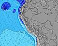 | 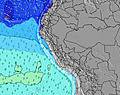 | 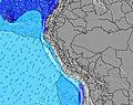 | 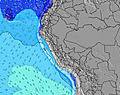 | 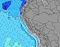 | 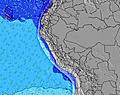 | 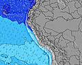 | ||||||||||||||
Wave Height (m) Direction Period (s) | SW 12 | SW 12 | WSW 13 | SW 12 | SW 12 | SW 13 | SW 13 | SW 12 | SW 12 | SW 12 | SW 13 | SW 13 | SW 14 | SW 14 | SW 13 | SW 13 | SW 13 | SW 12 | SW 11 | SW 15 | SW 20 |
Wave Graph | |||||||||||||||||||||
74 | 72 | 106 | 175 | 291 | 273 | 273 | 256 | 236 | 240 | 277 | 273 | 459 | 293 | 246 | 134 | 161 | 112 | 99 | 104 | 97 | |
Wind (km/h) | |||||||||||||||||||||
Wind State on-shore cross-onshore cross-shore cross-offshore off-shore glassy | on | on | cross | on | on | cross | cross-on | cross-on | glassy | cross-on | on | cross | on | cross-on | cross | on | on | cross | on | on | cross |
High Tide | 9:53PM0.59m | 9:29AM0.73m | 10:51PM0.63m | 10:03AM0.65m | 00:00AM0.67m | 10:49AM0.58m | 1:16AM0.72m | 11:55AM0.52m | 2:30AM0.79m | 1:23PM0.47m | 3:34AM0.87m | 2:50PM0.47m | |||||||||
Low Tide | 3:46PM0.22m | 3:12AM0.34m | 4:17PM0.20m | 4:17AM0.40m | 4:55PM0.18m | 5:53AM0.44m | 5:46PM0.17m | 7:54AM0.43m | 6:50PM0.14m | 9:27AM0.38m | 7:59PM0.11m | 10:30AM0.32m | 9:04PM0.07m | ||||||||
6:24 | — | — | 6:24 | — | — | 6:24 | — | — | 6:22 | — | — | 6:22 | — | — | 6:22 | — | — | 6:22 | — | — | |
— | 5:57 | — | — | 5:57 | — | — | 5:58 | — | — | 5:58 | — | — | 5:58 | — | — | 5:58 | — | — | 5:58 | — | |
mm | — | — | — | — | — | — | — | — | — | — | — | — | — | — | — | — | — | — | — | — | — |
Temp °C | 20 | 20 | 18 | 20 | 20 | 18 | 21 | 20 | 18 | 20 | 19 | 17 | 20 | 20 | 18 | 20 | 19 | 18 | 20 | 20 | 18 |
Feels °C | 19 | 20 | 19 | 20 | 20 | 19 | 21 | 20 | 19 | 20 | 19 | 18 | 19 | 19 | 17 | 19 | 18 | 18 | 19 | 20 | 18 |
Swell 1 Height (m) Direction Period (s) | SW 9 | SW 8 | SSW 8 | SW 12 | SW 12 | SW 13 | SW 13 | SW 12 | SW 12 | SW 12 | SW 13 | SW 13 | SW 14 | SW 14 | SW 13 | SW 13 | SW 13 | SW 12 | SW 11 | SW 10 | SSW 9 |
64 | 55 | 45 | 175 | 291 | 273 | 273 | 256 | 236 | 240 | 277 | 273 | 459 | 293 | 246 | 134 | 161 | 112 | 99 | 89 | 58 | |
Swell 2 Height (m) Direction Period (s) | SW 12 | SW 12 | WSW 13 | SW 8 | W 20 | SW 21 | WSW 20 | WSW 19 | SW 18 | WSW 17 | WSW 16 | WSW 16 | W 10 | SSW 8 | W 20 | SSW 8 | WSW 17 | SW 16 | SW 15 | SW 15 | SW 14 |
74 | 72 | 106 | 29 | 8 | 17 | 38 | 74 | 81 | 197 | 173 | 169 | 2 | 45 | 7 | 25 | 29 | 66 | 56 | 104 | 91 | |
Swell 3 Height (m) Direction Period (s) | — | W 11 | W 11 | W 13 | W 12 | W 12 | W 11 | W 11 | W 11 | W 10 | W 10 | W 10 | — | W 10 | W 11 | SW 18 | W 11 | W 23 | WSW 21 | WSW 21 | SW 20 |
— | 2 | 2 | 3 | 3 | 3 | 2 | 2 | 2 | 2 | 2 | 2 | — | 2 | 2 | 12 | 2 | 11 | 45 | 44 | 97 | |
Wind waves Height (m) Direction Period (s) | — | — | — | — | — | — | — | — | — | — | — | — | — | — | — | — | — | — | — | — | — |
— | — | — | — | — | — | — | — | — | — | — | — | — | — | — | — | — | — | — | — | — | |
Nearest Offshore or Glassy | |||||||||||||||||||||
Distance (km) | 96 | 96 | 33 | 63 | 96 | 63 | 63 | 96 | 0 | 96 | 96 | 33 | 8 | 96 | 64 | 63 | 96 | 96 | 96 | 96 | 96 |
Best forecast wave conditions in Lima | |||||||||||||||||||||
Best forecast wave conditions in Peru | |||||||||||||||||||||
Header Global | |||||||||||||||||||||
- Map Icons:
 Break
Break Live Wave Height (m)
 Live Wind Speed (km/h)
 Surf Rating (10 Max)
 Ocean Swells (m)
- Wind Speed (km/h)
Latest Updates


FREE! Surf-Forecast.com widget for your website
The surf report / weather widget below is available to embed on third party websites free of charge and provides a summary of our Jaguay surf forecast. Simply grab the html code snippet that we provide and paste it into your own site. You can choose your preferred language and metric/imperial units for the surf forecast feed to suit users of your site. Click here to get the code.
Information about the Jaguay Surf forecast
The above surf forecast table for Jaguay provides essential information for determining whether the surfing conditions will be good over the next 16 days. A general guide to surfing at Jaguay can be found by selecting the local surf guide option on the grey menu. Our Jaguay surf forecast is unique since it includes wave energy (power) that defines the real feel of the surf rather than just the height or the period. If you surf the same spot (Jaguay) regularly then make a mental note of the wave energy from the surf forecast table each time you go. Very soon you may start to choose your surf days based on the wave energy alone combined with our forecast of favourable offshore wind conditions. Our star ratings will help here and of course you will also find the usual wave height and period predictions on our surf forecasts as well as a full break down of the swell components under our advanced users option (to reveal that, click the little Einstein character under the tide times).
Further information to help with frequently asked questions about our surf forecast for Jaguay may be found under the help tab on the top menu and also by moving your mouse over the question marks on the surf forecast table itself. Please always bear in mind that the forecast is for near-shore open water and local factors at each surf break influence the actual breaking wave height, such as the beach / reef profile, water depths offshore and shelter.
Jaguay is 18 km (11 miles) from Chincha Alta. If you plan a holiday in Lima, look for hotels and other accommodation in Chincha Alta. Chincha Alta has rooms for a wide range of budgets as well as car hire and transport links.
 Nearest