

Surf Forecasts:

KM-200 - Totoritas surf forecast from 1 Aug 2026:
- Best quality surf: Thursday 6 Aug, 10PM (local time) - 3ft (0.9m), 13s period, SW swell with glassy winds.
- Most powerful swell: Friday 7 Aug, 4AM (local time) - 3.5ft (1.0m), 14s period, SW swell with 407 kJ wave energy.
- Next surfable swell (1★+): Saturday 1 Aug, 7AM (local time) - 2ft (0.6m), 11s period with SW swell.
Best Forecast Surf Conditions for KM-200 - Totoritas this week:
The surf forecast for KM-200 - Totoritas over the next 16 days: The first swell (rated 1 star or higher) is forecast to arrive on Saturday (Aug 01) at 7AM. The primary swell is predicted to be 0.6m and 11s period with a secondary swell of 0.6m and 8s. The wind is predicted to be glassy as the swell arrives.
The most powerful waves expected at KM-200 - Totoritas in the next 16 days are 1.0m 14s and forecast to arrive on Friday (Aug 07) at 4AM. Winds are predicted to be glassy at the time the swell arrives.
| Wave Type | Time (-05) & Date | Wave Height & Period |
|---|---|---|
| Next good surf (1 star+) | 7AM (Sat 1st Aug) | 2ft (0.6m) 11s |
| Best Surf | 10PM (Thu 6th Aug) | 3ft (0.9m) 13s |
| Most Powerful | 4AM (Fri 7th Aug) | 3.5ft (1.0m) 14s |
Table - best surf conditions forecast for KM-200 - Totoritas over the next 16 days.
The Lowdown
Alright, let’s break down the 16-day window for Totoritas, a point break that is exposed to the south-west swell. This spot is a fairly consistent intermediate wave, but it’s a persistent offender for tricky conditions. The water temperature is about average for this time of year, nothing unusual.
The first week is a real struggle. There’s really no good surf on offer at all through the first 13 days, with a long stretch of poor surf conditions and mostly onshore or cross-onshore winds. The surf is tiny, from 1 ft to 3 ft, and the wave energy is mostly weak to moderate, with the combined energy hanging around 140 to 448 (moderate). The swell direction is consistently from the SW, which is the optimum for this spot, but the wind is constantly killing it. The only bright spots are some glassy conditions on Sunday morning August 2nd and Monday morning August 3rd, but the swell is only 1 ft and 2 ft respectively, and the water is flat. You’d be catching little knee-high slop. The period is between 11 and 14 seconds, which is a decent groundswell, but there’s just not enough size.
After a long, dry run, things finally look promising on the 14th of August. Friday morning the 14th is the standout. The wind is glassy and light from the S at 3 mph, which is perfect for a point break. The swell is 2 ft from the WSW, with a very long period of 17 seconds. That’s proper groundswell energy, and the combined energy is 225 (moderate). The guidance says “expect good surf conditions” and that’s exactly what you want to hear. It’s small, but for a point break, that long-period glassy south-west swell will produce clean, rippable waves. The afternoon is more marginal with onshore wind, so hit the morning session. Crowds are possible at Totoritas, but with dawn patrol you’ll be sweet.
The rest of the 16-day outlook after that is back to poor conditions, with dropping swell and onshore winds. The periods stay long, but the size is too small to get excited about.
So, bottom line: the first 13 days are a washout. Keep your board in the bag. Set your alarm for the 14th of August, dawn patrol at Totoritas. That’s your one and only shot.
Rusty
Short Range ForecastMostly dry. Warm (max 21°C on Sat morning, min 18°C on Fri night). Wind will be generally light. | Days 4-6 Weather SummaryMostly dry. Warm (max 21°C on Tue morning, min 18°C on Wed night). Wind will be generally light. | ||||||||||||||||||||
Saturday 1 | Sunday 2 | Monday 3 | Tuesday 4 | Wednesday 5 | Thursday 6 | Friday 7 | |||||||||||||||
AM | PM | Night | AM | PM | Night | AM | PM | Night | AM | PM | Night | AM | PM | Night | AM | PM | Night | AM | PM | Night | |
Swell Height Map |  |  |  |  |  |  | 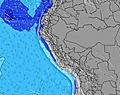 | ||||||||||||||
Wave Height (m) Direction Period (s) | SW 11 | SW 11 | SW 10 | SW 10 | WSW 13 | WSW 13 | SW 12 | SW 12 | WSW 12 | SW 12 | SW 12 | SW 13 | SW 13 | SW 12 | SW 12 | SW 12 | SW 13 | SW 13 | SW 14 | SW 14 | SW 13 |
Wave Graph | |||||||||||||||||||||
121 | 162 | 124 | 73 | 101 | 114 | 74 | 73 | 104 | 149 | 252 | 277 | 273 | 252 | 236 | 205 | 273 | 241 | 407 | 336 | 208 | |
Wind (km/h) | |||||||||||||||||||||
Wind State on-shore cross-onshore cross-shore cross-offshore off-shore glassy | on | cross-on | cross-off | glassy | on | cross | glassy | on | cross | on | on | cross | cross-on | on | cross-on | on | on | glassy | on | on | glassy |
High Tide | 8:10AM0.88m | 8:16PM0.54m | 8:35AM0.84m | 9:02PM0.57m | 9:00AM0.79m | 9:53PM0.59m | 9:29AM0.73m | 10:51PM0.63m | 10:03AM0.65m | 00:00AM0.67m | 10:49AM0.58m | 1:16AM0.72m | 11:55AM0.52m | 2:30AM0.79m | |||||||
Low Tide | 2:54PM0.25m | 1:45AM0.22m | 3:20PM0.23m | 2:24AM0.28m | 3:46PM0.22m | 3:12AM0.34m | 4:17PM0.20m | 4:17AM0.40m | 4:55PM0.18m | 5:53AM0.44m | 5:46PM0.17m | 7:54AM0.43m | 6:50PM0.14m | ||||||||
6:24 | — | — | 6:24 | — | — | 6:24 | — | — | 6:24 | — | — | 6:24 | — | — | 6:22 | — | — | 6:22 | — | — | |
— | 5:57 | — | — | 5:57 | — | — | 5:57 | — | — | 5:57 | — | — | 5:57 | — | — | 5:57 | — | — | 5:58 | — | |
mm | — | — | — | — | — | — | — | — | — | — | — | — | — | — | — | — | — | — | — | — | — |
Temp °C | 21 | 20 | 19 | 21 | 20 | 19 | 21 | 20 | 19 | 21 | 20 | 19 | 21 | 20 | 19 | 20 | 20 | 19 | 21 | 19 | 19 |
Feels °C | 21 | 20 | 20 | 20 | 20 | 20 | 20 | 20 | 21 | 22 | 20 | 21 | 21 | 20 | 20 | 20 | 20 | 21 | 20 | 19 | 20 |
Swell 1 Height (m) Direction Period (s) | SW 11 | SW 11 | SW 10 | SW 10 | SW 10 | SW 9 | SW 9 | SW 8 | SSW 8 | SW 12 | SW 12 | SW 13 | SW 13 | SW 12 | SW 12 | SW 12 | SW 13 | SW 13 | SW 14 | SW 14 | SW 13 |
121 | 162 | 124 | 63 | 47 | 65 | 64 | 57 | 47 | 149 | 252 | 277 | 273 | 252 | 236 | 205 | 273 | 241 | 407 | 336 | 208 | |
Swell 2 Height (m) Direction Period (s) | SSW 8 | WSW 15 | WSW 15 | WSW 14 | WSW 13 | WSW 13 | SW 12 | SW 12 | WSW 12 | SSW 8 | W 20 | SW 21 | WSW 20 | WSW 19 | SW 18 | WSW 17 | WSW 16 | WSW 16 | W 10 | W 10 | W 19 |
26 | 45 | 84 | 73 | 101 | 114 | 74 | 73 | 104 | 25 | 8 | 17 | 38 | 74 | 81 | 197 | 173 | 164 | 2 | 2 | 7 | |
Swell 3 Height (m) Direction Period (s) | WSW 16 | — | — | SSW 7 | — | — | W 11 | W 11 | W 11 | W 13 | W 12 | W 12 | W 11 | W 11 | W 11 | W 10 | W 10 | W 10 | — | — | W 11 |
51 | — | — | 21 | — | — | 2 | 2 | 2 | 3 | 3 | 3 | 2 | 2 | 2 | 2 | 2 | 2 | — | — | 2 | |
Wind waves Height (m) Direction Period (s) | — | — | — | — | SSW 7 | — | — | — | — | — | — | — | — | — | — | — | — | — | — | — | — |
— | — | — | — | 21 | — | — | — | — | — | — | — | — | — | — | — | — | — | — | — | — | |
Nearest Offshore or Glassy | |||||||||||||||||||||
Distance (km) | 59 | 105 | 0 | 0 | 105 | 60 | 0 | 105 | 42 | 105 | 105 | 42 | 57 | 105 | 105 | 105 | 105 | 0 | 105 | 105 | 0 |
Best forecast wave conditions in Ica | |||||||||||||||||||||
Best forecast wave conditions in Peru | |||||||||||||||||||||
Header Global | |||||||||||||||||||||
- Map Icons:
 Break
Break Live Wave Height (m)
 Live Wind Speed (km/h)
 Surf Rating (10 Max)
 Ocean Swells (m)
- Wind Speed (km/h)
Latest Updates


FREE! Surf-Forecast.com widget for your website
The surf report / weather widget below is available to embed on third party websites free of charge and provides a summary of our KM-200 - Totoritas surf forecast. Simply grab the html code snippet that we provide and paste it into your own site. You can choose your preferred language and metric/imperial units for the surf forecast feed to suit users of your site. Click here to get the code.
Information about the KM-200 - Totoritas Surf forecast
The above surf forecast table for KM-200 - Totoritas provides essential information for determining whether the surfing conditions will be good over the next 16 days. A general guide to surfing at KM-200 - Totoritas can be found by selecting the local surf guide option on the grey menu. Our KM-200 - Totoritas surf forecast is unique since it includes wave energy (power) that defines the real feel of the surf rather than just the height or the period. If you surf the same spot (KM-200 - Totoritas) regularly then make a mental note of the wave energy from the surf forecast table each time you go. Very soon you may start to choose your surf days based on the wave energy alone combined with our forecast of favourable offshore wind conditions. Our star ratings will help here and of course you will also find the usual wave height and period predictions on our surf forecasts as well as a full break down of the swell components under our advanced users option (to reveal that, click the little Einstein character under the tide times).
Further information to help with frequently asked questions about our surf forecast for KM-200 - Totoritas may be found under the help tab on the top menu and also by moving your mouse over the question marks on the surf forecast table itself. Please always bear in mind that the forecast is for near-shore open water and local factors at each surf break influence the actual breaking wave height, such as the beach / reef profile, water depths offshore and shelter.
KM-200 - Totoritas is 10 km (6 miles) from Chincha Alta. If you plan a holiday in Ica, look for hotels and other accommodation in Chincha Alta. Chincha Alta has rooms for a wide range of budgets as well as car hire and transport links.
 Nearest