

Surf Forecasts:

San Gallan surf forecast from 2 Aug 2026:
- Most powerful swell: Saturday 8 Aug, 4PM (local time) - 6.5ft (2.0m), 9s period, S swell with 582 kJ wave energy.
Best Forecast Surf Conditions for San Gallan this week:
The most powerful waves expected at San Gallan in the next 16 days are 2.0m 9s and forecast to arrive on Saturday (Aug 08) at 4PM. Winds are predicted to be onshore at the time the swell arrives. The largest open ocean swell (not directed at the beach) is 1.6m 16s period and expected on Thursday (Aug 06) at 7PM.
| Wave Type | Time (-05) & Date | Wave Height & Period |
|---|---|---|
| Next good surf (1 star+) | - | - |
| Best Surf | - | - |
| Most Powerful | 4PM (Sat 8th Aug) | 6.5ft (2.0m) 9s |
Table - best surf conditions forecast for San Gallan over the next 16 days.
The Lowdown
Well, folks, Rusty here. Let’s look at what’s on the menu for the next couple of weeks. We’ve got one spot in the mix: San Gallan, a reef break that’s steep and advanced. I’m seeing a long stretch of tough conditions ahead, so let’s get real about it.
The first surf recommendation doesn’t pop up until Sunday, August 16th, and even then it’s just a hint of something. Before that, we’re looking at a solid 14-day gap with no real surf on offer. From Sunday, August 2nd, right through to Saturday, August 15th, it’s all poor surf conditions—strong onshore winds, short-period junk, and messy energy. The winds are mostly from the SSE or S, blowing onshore for this exposed S-facing reef, and that’s a killer. The swell is short-period, mostly 6 to 8 seconds, which is weak and choppy. The combined energy is weak to moderate early on, with values like 269, 263, and 385, but it’s not enough to save the day. The water temperature anomaly is about average for this time of year, so no surprises there.
The only standout, if you can call it that, is on Sunday, August 16th, the morning. There’s a marginal surf forecast, scoring a 1 out of 10, with a 6 ft swell from the S at 7 seconds, and the wind is SSE at 9 mph, still onshore but lighter. The combined energy is moderate at 554, but it’s still a short-period swell, so expect choppy, weak waves. This is a reef break, so it might hold a bit of shape, but with onshore wind and short period, it’s really only for the dedicated locals who know the lineup. Crowds are rare here, so you’ll have it quiet, but the quality is poor. For most, this is a skip.
The later part of the second week, from August 9th onward, shows some bigger swell—like 7 ft to 7 ft from the S and SSW, with periods up to 16 seconds on August 10th afternoon. That’s a very long period groundswell, which could be powerful, but every single session still has poor surf conditions due to the strong onshore winds. The combined energy hits strong to very strong, like 1158 and 2149, but the wind is still blowing 19 to 25 mph onshore. That’s more kite-surfing territory than paddle surfing for this beach-and-reef setup. Not worth the paddle out if you want clean waves.
So, the bottom line: you’ve got a long, dry spell until August 16th, and even then it’s just marginal. Keep an eye on the forecasts, but honestly, it’s a tough run for San Gallan right now.
Rusty.
Short Range ForecastMostly dry. Very mild (max 18°C on Sat night, min 17°C on Sat night). Mainly fresh winds. | Days 4-6 Weather SummaryMostly dry. Very mild (max 18°C on Wed morning, min 16°C on Thu night). Winds increasing (light winds from the SSE on Wed morning, strong winds from the S by Fri morning). | ||||||||||||||||||||
Sunday 2 | Monday 3 | Tuesday 4 | Wednesday 5 | Thursday 6 | Friday 7 | Saturday 8 | |||||||||||||||
AM | PM | Night | AM | PM | Night | AM | PM | Night | AM | PM | Night | AM | PM | Night | AM | PM | Night | AM | PM | Night | |
Swell Height Map |  |  | 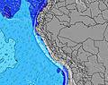 | 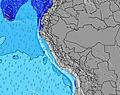 | 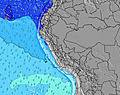 | 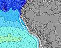 | 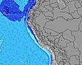 | ||||||||||||||
Wave Height (m) Direction Period (s) | S 7 | S 7 | S 7 | SSW 12 | S 7 | S 7 | S 7 | S 8 | S 7 | S 7 | S 8 | S 8 | S 8 | S 8 | S 8 | S 6 | S 7 | S 8 | S 8 | S 9 | S 9 |
Wave Graph | |||||||||||||||||||||
269 | 242 | 210 | 218 | 257 | 254 | 243 | 249 | 143 | 127 | 111 | 100 | 130 | 103 | 148 | 157 | 247 | 368 | 505 | 582 | 582 | |
Wind (km/h) | |||||||||||||||||||||
Wind State on-shore cross-onshore cross-shore cross-offshore off-shore glassy | on | on | on | on | on | on | on | on | on | on | cross-on | on | on | on | on | on | on | cross-on | on | on | on |
High Tide | 8:40AM0.83m | 9:09PM0.55m | 9:05AM0.77m | 10:00PM0.58m | 9:34AM0.71m | 10:59PM0.62m | 10:08AM0.64m | 00:07AM0.66m | 10:54AM0.56m | 1:22AM0.71m | 12:00PM0.50m | 2:34AM0.78m | 1:27PM0.46m | 3:38AM0.86m | |||||||
Low Tide | 3:26PM0.23m | 2:29AM0.28m | 3:53PM0.21m | 3:18AM0.34m | 4:23PM0.19m | 4:25AM0.40m | 5:01PM0.18m | 6:03AM0.43m | 5:51PM0.16m | 8:03AM0.42m | 6:53PM0.14m | 9:35AM0.37m | 8:01PM0.10m | ||||||||
6:26 | — | — | 6:26 | — | — | 6:24 | — | — | 6:24 | — | — | 6:24 | — | — | 6:24 | — | — | 6:24 | — | — | |
— | 5:57 | — | — | 5:57 | — | — | 5:58 | — | — | 5:58 | — | — | 5:58 | — | — | 5:58 | — | — | 5:58 | — | |
mm | — | — | — | — | — | — | — | — | — | — | — | — | — | — | — | — | — | — | — | — | — |
Temp °C | 18 | 18 | 17 | 18 | 18 | 17 | 18 | 18 | 17 | 18 | 18 | 17 | 17 | 17 | 17 | 17 | 18 | 17 | 18 | 17 | 17 |
Feels °C | 14 | 14 | 13 | 15 | 14 | 14 | 16 | 15 | 15 | 17 | 16 | 15 | 14 | 13 | 13 | 12 | 12 | 13 | 13 | 11 | 12 |
Swell 1 Height (m) Direction Period (s) | SW 14 | SW 10 | WSW 13 | SSW 12 | SSW 11 | SW 13 | SW 12 | SW 12 | SW 12 | SW 13 | SW 12 | SW 12 | SW 12 | SW 13 | SW 16 | SW 14 | SW 14 | SW 13 | S 8 | SW 12 | SW 12 |
218 | 94 | 114 | 218 | 135 | 176 | 398 | 494 | 555 | 504 | 481 | 450 | 361 | 480 | 1140 | 825 | 659 | 392 | 505 | 240 | 169 | |
Swell 2 Height (m) Direction Period (s) | SW 10 | SW 13 | SSW 12 | SW 13 | WSW 12 | SSW 12 | SSW 12 | SW 20 | S 7 | S 7 | S 8 | SW 18 | SW 17 | SW 16 | NW 10 | NW 10 | NW 12 | NW 11 | SW 13 | SW 17 | SW 16 |
94 | 178 | 138 | 130 | 98 | 147 | 26 | 15 | 143 | 127 | 111 | 304 | 465 | 567 | 4 | 4 | 5 | 5 | 315 | 45 | 91 | |
Swell 3 Height (m) Direction Period (s) | W 12 | SSW 14 | SW 9 | NW 11 | SSW 15 | WSW 12 | NW 13 | NW 12 | SW 21 | SW 19 | SW 19 | S 11 | NW 10 | NW 10 | — | W 12 | W 12 | — | WSW 18 | NW 10 | SW 24 |
3 | 21 | 55 | 5 | 22 | 56 | 7 | 6 | 17 | 93 | 183 | 20 | 4 | 4 | — | 3 | 3 | — | 31 | 4 | 22 | |
Wind waves Height (m) Direction Period (s) | S 7 | S 7 | S 7 | S 7 | S 7 | S 7 | S 7 | S 8 | — | — | — | S 8 | S 8 | S 8 | S 8 | S 6 | S 7 | S 8 | — | S 9 | S 9 |
269 | 242 | 210 | 167 | 257 | 254 | 243 | 249 | — | — | — | 100 | 130 | 103 | 148 | 157 | 247 | 368 | — | 582 | 582 | |
Nearest Offshore or Glassy | |||||||||||||||||||||
Distance (km) | 55 | 139 | 55 | 139 | 139 | 10 | 139 | 139 | 10 | 11 | 139 | 55 | 139 | 139 | 55 | 139 | 139 | 110 | 81 | 139 | 55 |
Best forecast wave conditions in Ica | |||||||||||||||||||||
Best forecast wave conditions in Peru | |||||||||||||||||||||
Header Global | |||||||||||||||||||||
- Map Icons:
 Break
Break Live Wave Height (m)
 Live Wind Speed (km/h)
 Surf Rating (10 Max)
 Ocean Swells (m)
- Wind Speed (km/h)
Latest Updates


FREE! Surf-Forecast.com widget for your website
The surf report / weather widget below is available to embed on third party websites free of charge and provides a summary of our San Gallan surf forecast. Simply grab the html code snippet that we provide and paste it into your own site. You can choose your preferred language and metric/imperial units for the surf forecast feed to suit users of your site. Click here to get the code.
Information about the San Gallan Surf forecast
The above surf forecast table for San Gallan provides essential information for determining whether the surfing conditions will be good over the next 16 days. A general guide to surfing at San Gallan can be found by selecting the local surf guide option on the grey menu. Our San Gallan surf forecast is unique since it includes wave energy (power) that defines the real feel of the surf rather than just the height or the period. If you surf the same spot (San Gallan) regularly then make a mental note of the wave energy from the surf forecast table each time you go. Very soon you may start to choose your surf days based on the wave energy alone combined with our forecast of favourable offshore wind conditions. Our star ratings will help here and of course you will also find the usual wave height and period predictions on our surf forecasts as well as a full break down of the swell components under our advanced users option (to reveal that, click the little Einstein character under the tide times).
Further information to help with frequently asked questions about our surf forecast for San Gallan may be found under the help tab on the top menu and also by moving your mouse over the question marks on the surf forecast table itself. Please always bear in mind that the forecast is for near-shore open water and local factors at each surf break influence the actual breaking wave height, such as the beach / reef profile, water depths offshore and shelter.
San Gallan is 30 km (19 miles) from Pisco. If you plan a holiday in Ica, look for hotels and other accommodation in Pisco. Pisco has rooms for a wide range of budgets as well as car hire and transport links.
 Nearest