

Surf Forecasts:

How big are the waves at Ipitanga today (29 Jun):
- Afternoon surf: Afternoon surf (29 Jun, local time) - 5.5ft (1.7m), 8s period with ESE swell.
- Evening surf: Evening surf (29 Jun, local time) - 5ft (1.6m), 8s period with ESE swell.
The current surf forecast for Ipitanga at 7PM is: 1.6m 8s primary swell from a East-southeast direction and 0.4m 15s secondary swell from a South-southeast direction (forecast issued at 02:00pm June 29). The wind direction is predicted to be onshore.
| Time (-03) & Date | Wave Height | Wave Period |
|---|---|---|
| Morning (29 Jun) | - | - |
| Afternoon (29 Jun) | 5.5ft (1.7m) | 8s |
| Evening (29 Jun) | 5ft (1.6m) | 8s |
Table - waves today at Ipitanga. (Swell directed towards the surf break)
Updates in hr min s Forecast update imminent
Short Range ForecastModerate rain (total 12mm), heaviest on Tue night. Warm (max 26°C on Mon afternoon, min 24°C on Tue night). Wind will be generally light. | ||||||||||||||||||||||||
Mon 29 | Tuesday 30 | Wednesday 1 | Thu 2 | |||||||||||||||||||||
12 PM | 3 PM | 6 PM | 9 PM | 12 AM | 3 AM | 6 AM | 9 AM | 12 PM | 3 PM | 6 PM | 9 PM | 12 AM | 3 AM | 6 AM | 9 AM | 12 PM | 3 PM | 6 PM | 9 PM | 12 AM | 3 AM | 6 AM | 9 AM | |
Swell Height Map |  |  |  |  |  |  |  |  |  | 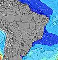 | ||||||||||||||
Wave Height (m) Direction Period (s) | ESE 8 | ESE 8 | ESE 8 | ESE 8 | ESE 8 | E 8 | ESE 9 | ESE 9 | ESE 9 | ESE 9 | ESE 9 | ESE 9 | ESE 9 | ESE 9 | ESE 9 | ESE 9 | ESE 9 | ESE 9 | ESE 9 | ESE 9 | ESE 9 | ESE 9 | ESE 9 | ESE 9 |
Wave Graph | ||||||||||||||||||||||||
434 | 389 | 376 | 376 | 422 | 422 | 394 | 505 | 477 | 530 | 463 | 463 | 463 | 413 | 427 | 530 | 505 | 547 | 586 | 617 | 677 | 741 | 724 | 660 | |
Wind (km/h) | ||||||||||||||||||||||||
Wind State on-shore cross-onshore cross-shore cross-offshore off-shore glassy | cross-on | cross-on | on | on | on | on | cross-on | cross-on | on | on | on | on | on | on | on | cross-on | cross-on | on | cross-on | on | on | on | on | on |
High Tide | 1:39PM2.66m | 1:52AM2.72m | 2:19PM2.52m | 2:34AM2.58m | 3:07PM2.36m | 3:27AM2.44m | ||||||||||||||||||
Low Tide | 7:42PM0.25m | 8:07AM0.20m | 8:21PM0.40m | 8:50AM0.38m | 9:06PM0.57m | |||||||||||||||||||
— | — | — | — | — | 5:54 | — | — | — | — | — | — | — | 5:54 | — | — | — | — | — | — | — | 5:54 | — | — | |
— | 5:16 | — | — | — | — | — | — | — | 5:17 | — | — | — | — | — | — | — | 5:17 | — | — | — | — | — | 5:17 | |
mm | — | — | — | — | — | — | — | — | — | — | — | — | — | — | 2 | 1 | 1 | 2 | 2 | 1 | 2 | 1 | — | — |
Temp °C | 26 | 26 | 26 | 25 | 25 | 25 | 25 | 25 | 26 | 26 | 25 | 25 | 25 | 25 | 24 | 25 | 25 | 25 | 25 | 24 | 25 | 25 | 25 | 25 |
Feels °C | 25 | 25 | 26 | 25 | 25 | 25 | 24 | 24 | 26 | 26 | 24 | 23 | 25 | 25 | 25 | 25 | 25 | 25 | 25 | 24 | 24 | 24 | 24 | 24 |
Swell 1 Height (m) Direction Period (s) | ESE 8 | ESE 8 | ESE 8 | ESE 8 | ESE 8 | E 8 | ESE 9 | E 8 | ESE 9 | ESE 9 | ESE 9 | ESE 9 | ESE 9 | ESE 9 | ESE 9 | ESE 9 | ESE 9 | ESE 9 | ESE 9 | ESE 9 | S 12 | S 12 | ESE 9 | ESE 9 |
434 | 389 | 376 | 376 | 422 | 422 | 394 | 351 | 477 | 530 | 463 | 463 | 463 | 413 | 427 | 530 | 505 | 547 | 586 | 617 | 77 | 76 | 724 | 660 | |
Swell 2 Height (m) Direction Period (s) | SSE 16 | SSE 16 | SSE 15 | SSE 14 | SSE 14 | S 14 | S 13 | SE 9 | S 13 | S 13 | S 16 | SSE 15 | SSE 15 | S 14 | S 13 | S 13 | S 13 | S 13 | S 13 | S 12 | — | — | SSE 12 | SSE 12 |
84 | 81 | 73 | 70 | 69 | 62 | 55 | 86 | 54 | 53 | 122 | 72 | 71 | 103 | 92 | 90 | 90 | 125 | 81 | 77 | — | — | 83 | 82 | |
Swell 3 Height (m) Direction Period (s) | — | S 12 | — | — | S 18 | SSE 18 | SSE 17 | S 13 | SSE 16 | SSE 16 | SSE 15 | S 12 | S 12 | — | — | — | — | — | — | — | — | — | — | — |
— | 26 | — | — | 6 | 30 | 30 | 54 | 51 | 50 | 45 | 25 | 25 | — | — | — | — | — | — | — | — | — | — | — | |
Wind waves Height (m) Direction Period (s) | — | — | — | — | — | — | — | ESE 9 | — | — | — | — | — | — | — | — | — | — | — | — | ESE 9 | ESE 9 | — | — |
— | — | — | — | — | — | — | 505 | — | — | — | — | — | — | — | — | — | — | — | — | 677 | 741 | — | — | |
Nearest Offshore or Glassy | ||||||||||||||||||||||||
Distance (km) | 763 | 763 | 763 | 763 | 189 | 174 | 166 | 166 | 763 | 763 | 763 | 205 | 205 | 166 | 675 | 763 | 763 | 763 | 763 | 675 | 675 | 675 | 675 | 237 |
Best forecast wave conditions in Bahia - Norte | ||||||||||||||||||||||||
Best forecast wave conditions in Brazil | ||||||||||||||||||||||||
Header Global | ||||||||||||||||||||||||
- Map Icons:
 Break
Break Live Wave Height (m)
 Live Wind Speed (km/h)
 Surf Rating (10 Max)
 Ocean Swells (m)
- Wind Speed (km/h)


FREE! Surf-Forecast.com widget for your website
The surf report / weather widget below is available to embed on third party websites free of charge and provides a summary of our Ipitanga surf forecast. Simply grab the html code snippet that we provide and paste it into your own site. You can choose your preferred language and metric/imperial units for the surf forecast feed to suit users of your site. Click here to get the code.
 Nearest